Download presentation
Presentation is loading. Please wait.

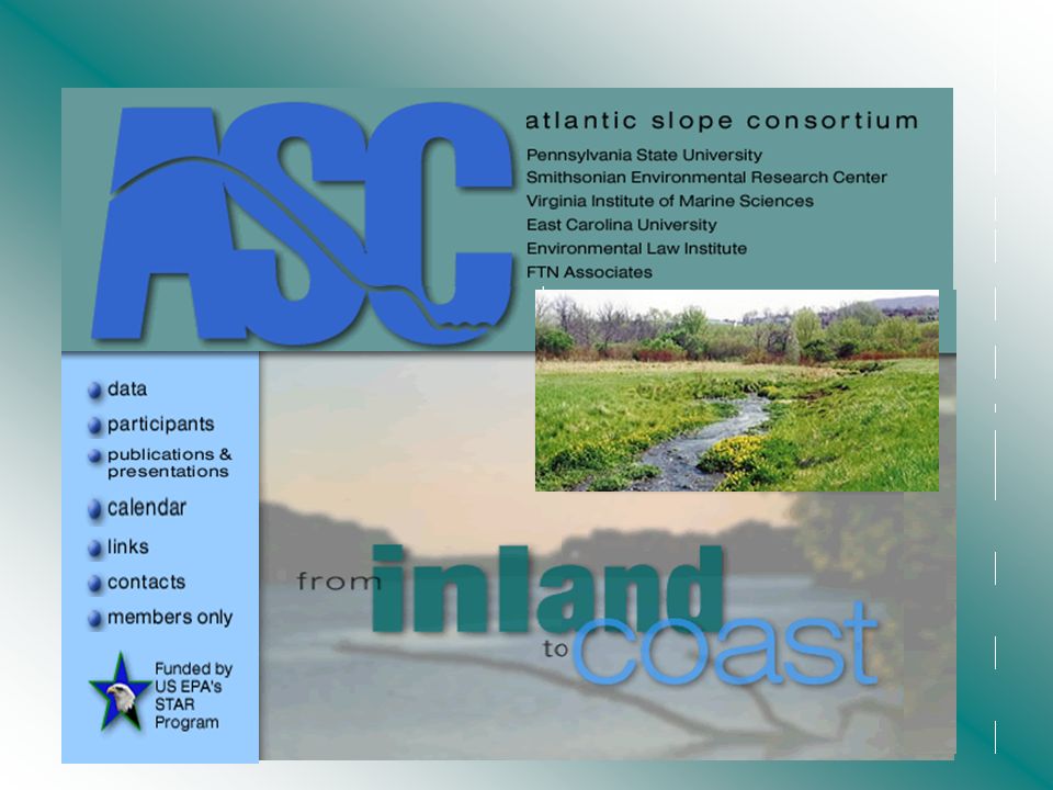
2
Spatial Datasets of the ASC Region 2000 Census asc_cens us.zip Census tract boundaries (geography only) from the US Bureau of Census (2000 Census). Metadata available. Metadata ASC States asc_state s.zip State boundaries for the ASC study area Metadata available. Metadata Digital Elevation models ascdems. zip 3-arc-second DEMs at the 1:250,000- scale. Resolution: approx. 100 m. Metadata available. Metadata

4
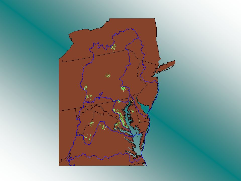
Susquehanna Delaware Potomac Pamlico Abermarle Neuse Patuxent-W. & E. Shores James-York-Rappahannock

6
Pennsylvania Spatial Data Access

7
A Clearinghouse for Pennsylvania’s Spatial Data

8
Pennsylvania Geospatial Information Council Pennsylvania Department of Environmental Protection Penn State University A Collaborative Effort

9
What is the PASDA Team? GIS Uses -Education -Facilities planning -Economic development -Emergency management -Natural resources management -Etc… Data Partners -Documentation -Mapping -Data Collection PASDA Staff -Archiving -Availability -Management Distribution Via the Web -Retrieval by user

10
Data Cataloging Data Access Data Usage What does PASDA do?

11
Planar Distance Units:meters Geodetic Model: Horizontal Datum Name:North American Datum of 1927 Ellipsoid Name:Clarke 1866 Planar Distance Units:meters Geodetic Model: Horizontal Datum Name:North American Datum of 1927 Ellipsoid Name:Clarke 1866 Title:USEPA/OW River Reach File 3 (RF3) Alpha for CONUS, Hawaii, Puerto Rico, and the U.S. Virgin Islands PASDA: Data Cataloging

12
ERRI penndot -Partner data collected and organized -Metadata created

13
Time Period of Content: Time Period Information: Single Date/Time: Calendar Date:1994 Currentness Reference:publication date Status: Progress:Complete Maintenance and Update Frequency:None planned Spatial Domain: Bounding Coordinates: West Bounding Coordinate:-74.739 East Bounding Coordinate:-73.652 North Bounding Coordinate:45.156 South Bounding Coordinate:44.496 Keywords: Theme: Theme Keyword Thesaurus:None Theme Keyword:RF3 alpha Hydrography River Reach streams stream network rivers hydrography ArcInfo navigation drainage Place: Place Keyword Thesaurus:Geographic Names Information System Place Keyword:New York NY New York English-Salmon Access Constraints:none Use Constraints:none Point of Contact: Contact Information: Contact Organization Primary: Contact Organization:U.S. Environmental Protection Agency Contact Person:Dan Parker Contact Address: Address Type:mailing and physical address Address:401 M Street SW (4503F) City:Washington State or Province:DC Postal Code:20460 Country:United States Contact Voice Telephone:1-800-424-9067 Data Set Credit:McKay, Lucinda; Sue Hanson; Robert Horn; Richard Dulaney; Alan Cahoon; Mark Olsen; and Thomas Dewald, 1994. The U.S. EPA Reach File Version 3.0 Alpha Release (RF3-Alpha) Technical Reference. U.S. Environmental Protection Agency, Washington, DC PASDA: Data Cataloging- knowing what it is Originator:U.S. Environmental Protection Agency/Office of Water/OST Basins Title:USEPA/OW River Reach File 3 (RF3) Alpha for CONUS, Hawaii, Puerto Rico, and the U.S. Virgin Islands Spatial Domain: Bounding Coordinates: West Bounding Coordinate:-74.739 East Bounding Coordinate:-73.652 Spatial Domain: Bounding Coordinates: West Bounding Coordinate:-74.739 East Bounding Coordinate:-73.652 Calendar Date:1994 Indirect Spatial Reference:English- Salmon - New York Direct Spatial Reference Method:Vector Description: Abstract :The U.S. Environmental Protection Agency's (EPA) Reach Files are a series of hydrographic databases of the surface waters of the continental United States … Description: Abstract :The U.S. Environmental Protection Agency's (EPA) Reach Files are a series of hydrographic databases of the surface waters of the continental United States … Planar Distance Units:meters Geodetic Model: Horizontal Datum Name:North American Datum of 1927 Ellipsoid Name:Clarke 1866 Planar Distance Units:meters Geodetic Model: Horizontal Datum Name:North American Datum of 1927 Ellipsoid Name:Clarke 1866 Metadata Info about the data
 City:Washington State or Province:DC Postal Code:20460 Country:United States Contact Voice Telephone: Data Set Credit:McKay, Lucinda; Sue Hanson; Robert Horn; Richard Dulaney; Alan Cahoon; Mark Olsen; and Thomas Dewald, The U.S. EPA Reach File Version 3.0 Alpha Release (RF3-Alpha) Technical Reference. U.S. Environmental Protection Agency, Washington, DC PASDA: Data Cataloging- knowing what it is Originator:U.S. Environmental Protection Agency/Office of Water/OST Basins Title:USEPA/OW River Reach File 3 (RF3) Alpha for CONUS, Hawaii, Puerto Rico, and the U.S. Virgin Islands Spatial Domain: Bounding Coordinates: West Bounding Coordinate: East Bounding Coordinate: Spatial Domain: Bounding Coordinates: West Bounding Coordinate: East Bounding Coordinate: Calendar Date:1994 Indirect Spatial Reference:English- Salmon - New York Direct Spatial Reference Method:Vector Description: Abstract :The U.S. Environmental Protection Agency s (EPA) Reach Files are a series of hydrographic databases of the surface waters of the continental United States … Description: Abstract :The U.S. Environmental Protection Agency s (EPA) Reach Files are a series of hydrographic databases of the surface waters of the continental United States … Planar Distance Units:meters Geodetic Model: Horizontal Datum Name:North American Datum of 1927 Ellipsoid Name:Clarke 1866 Planar Distance Units:meters Geodetic Model: Horizontal Datum Name:North American Datum of 1927 Ellipsoid Name:Clarke 1866 Metadata Info about the data.")
14
Title:USEPA/OW River Reach File 3 (RF3) Alpha for CONUS, Hawaii, Puerto Rico, and the U.S. Virgin Islands Planar Distance Units:meters Geodetic Model: Horizontal Datum Name:North American Datum of 1927 Ellipsoid Name:Clarke 1866 Planar Distance Units:meters Geodetic Model: Horizontal Datum Name:North American Datum of 1927 Ellipsoid Name:Clarke 1866

15
organized into a retrievable format on the PASDA web page for analysis. Time Period of Content: Time Period Information: Single Date/Time: Calendar Date:1994 Currentness Reference:publication date Status: Progress:Complete Maintenance and Update Frequency:None planned Spatial Domain: Bounding Coordinates: West Bounding Coordinate:-74.739 East Bounding Coordinate:-73.652 North Bounding Coordinate:45.156 South Bounding Coordinate:44.496 Keywords: Theme: Theme Keyword Thesaurus:None Theme Keyword:RF3 alpha Hydrography River Reach streams stream network rivers hydrography ArcInfo navigation drainage Place: Place Keyword Thesaurus:Geographic Names Information System Place Keyword:New York NY New York English-Salmon Access Constraints:none Use Constraints:none Point of Contact: Contact Information: Contact Organization Primary: Contact Organization:U.S. Environmental Protection Agency Contact Person:Dan Parker Contact Address: Address Type:mailing and physical address Address:401 M Street SW (4503F) City:Washington State or Province:DC Postal Code:20460 Country:United States Contact Voice Telephone:1-800-424-9067 Data Set Credit:McKay, Lucinda; Sue Hanson; Robert Horn; Richard Dulaney; Alan Cahoon; Mark Olsen; and Thomas Dewald, 1994. The U.S. EPA Reach File Version 3.0 Alpha Release (RF3-Alpha) Technical Reference. U.S. Environmental Protection Agency, Washington, DC http://www.pasda.psu.edu PASDA: Finding What is Out There
 City:Washington State or Province:DC Postal Code:20460 Country:United States Contact Voice Telephone: Data Set Credit:McKay, Lucinda; Sue Hanson; Robert Horn; Richard Dulaney; Alan Cahoon; Mark Olsen; and Thomas Dewald, The U.S. EPA Reach File Version 3.0 Alpha Release (RF3-Alpha) Technical Reference. U.S. Environmental Protection Agency, Washington, DC PASDA: Finding What is Out There.")
16
35 75 190 230 150 200 438 8 3 73 783 334 43322005641 59031504332 52142305903 7551905214 190 564 150 200 190 230 150 200 521 1 433 564 521 590 433 564 4 1 14332 25903 35214 35903 24332 45214 15641 opElev.Well PASDA: Data Access

17
Partner files Downloaded Via the Internet Onto your GIS PASDA: Fast and Convenient Data Access

18
Easy access Centralized location No expense ftp format Zipped for quick download Easy access Centralized location No expense ftp format Zipped for quick download PASDA: The Clearinghouse Advantage PASDA: The Clearinghouse Advantage

19
PASDA: Data Usage Partner data analysis examples

20
PEOPLE SOFTWARE HARDWARE DATA MAPS ERRI DATA PARTNERS

Similar presentations


>")


 is composed of twelve regions. Each regional planning council is a public organization.>")


 as.>")


>")
