Download presentation
Presentation is loading. Please wait.

1
Political Geography n Location n Capital Cities n Boundaries

2
Relative Location n Landlocked States are disadvantaged for access to ocean and resources. Some have land corridors to ocean. Eg. Democratic Rep of Congo n Strategic Location of resources in Iraq/Kuwait.

3
Capital Cities n Seat of government. Often centre of finances, education, health services. n Symbol of national pride. Palestinians say only Jerusalem could be the capital of a Palestinian state. n New capitals can open territory eg. Brasilia

4
Boundaries n Natural Boundaries- based on natural features like rivers and mountains. Difficult to determine the height of land or the middle of the river for boundaries. n Geometric Boundaries- based on lines of latitudes or longitude of arcs of circles eg. Saskatchewan u Antecedent were laid down before most of the cultural landscape. u Subsequent were laid down after most settlement patterns were developed.

5
Geometric Boundaries of Antarctica n Disputed mountain (natural boundary)-
-")
6
Antecedent Boundary n Antecedent Boundary. The 49th parallel of latitude was used for most of the western US/Canada boundary. Transportation links developed around the boundary.

7
Subsequent Boundaries n Consequent Boundaries-drawn to account for cultural patterns eg. Eire/N Ireland n Superimposed Boundaries- boundaries disregard cultural patterns eg. African states vs tribal boundaries (right) n Consequent Boundaries - drawn according to the cultural patterns present eg. Eire/N. Ireland
 n Consequent Boundaries - drawn according to the cultural patterns present eg. Eire/N. Ireland.")
8
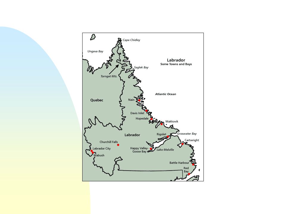
Labrador Boundary n Canada u Coast of Labrador belonged to Nf. u One mile from water u wanted interior for resources u Privy Council in 1927 n Newfoundland u Coast was watershed divide u Previous use of “coast” - HBCo u Previous definitions of coast in Africa u decision in NF favour

10
Maritime Boundaries n Increased importance in c.20. n Islands especially crucial (St. Pierre et Miquelon increases France’s maritime boundary) n United Nations Convention on the Law of the Sea (UNCLOS) widely accepted by 1990. n Still disputes of ownership and boundary baselines all over world.
 n United Nations Convention on the Law of the Sea (UNCLOS) widely accepted by n Still disputes of ownership and boundary baselines all over world..")
11
Maritime Boundaries

12
n Territorial Sea- up to 12 nm, exclusive fishing rights n Contiguous Zone-24nm immigration and sanitation controls n Exclusive Economic Zone EEZ-200nm. Economic advantage for all resources n High Seas-all states of world. Resources are common heritage

13
Mexican-US border tries to curtail illegal immigration

14
Canberra, the capital of Australia. A city planned as the centre of federal government

15
Natural boundaries can pose problems of demarcation….Chile/Argentina

16
Geometric boundary called Four Corners:Utah/Arizona/Colorado/ New Mexico

17
Ministates claim 200-mile nautical limit. Gain considerable control of oceans

18
Azerbaijan has an exclave separated by Armenia.

19
n Nagorno-Karabakh is 80% Armenian within Azerbaijan. n Armenians are Christians/Azers are Shiite Muslims n Stalin awarded N-K to Azerbaijan n Nationalism became stronger n In Gorbachev’s perestroika N-K lobbied for a 16km corridor to Armenia n Azerbaijan tightened grips on N-K n Guerilla war ever since

Similar presentations