Download presentation
Presentation is loading. Please wait.

1
Copyright 2005SIEP B.V.Shell Exploration & ProductionEPT-EIP0 Shell Exploration & Production 1 End user requirements (2) – some examples Alaska summer operations Paul Verlaan
 – some examples Alaska summer operations Paul Verlaan")
2
Assess Select Design Construct Operations Phases of a project

3
Assess Select Design Construct Operations Phases of a project 1. Preliminary area description historical data on ice type and ice concentration at one location (offshore structure) or along a certain route (shipping, pipeline)
 or along a certain route (shipping, pipeline).")
4
Assess Select Design Construct Operations Phases of a project 2. drilling ice type, ice thickness, ice drift, floe size data around drilling rig continuous data around one location 3. seismic operations ice edge avoid small floes of ice cover a wide area once per day

5
Assess Select Design Construct Operations Phases of a project Geotechnical, surveys ice edge cover a wide area once per day

6
Assess Select Design Construct Operations Phases of a project Local and global ice loads historical data on ice type, ice drift, floe size data historical data on ice thickness, keel depth, sail height, consolidated layer thickness mechanical properties of ice full-scale ice load data ice-structure interaction data

7
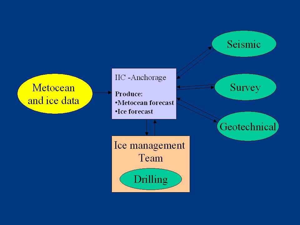
Assess Select Design Construct + install Operations Phases of a project Installation of structures, pipelines ice edge cover a wide area once per day

8
Assess Select Design Construct Operations Phases of a project 1. Marine transportation of oil and gas ice concentration, ice type, ice thickness, ice pressure cover a wide area once per day 2. Evacuation, oil spill response, platform operations ice type, ice thickness, ice pressure, ice drift continuous data around one location

9
Assess Select Design Construct Operations Phases of a project 3. Supply vessels ice concentration, ice type, ice thickness, ice pressure data cover a wide area once per day

10
Limitations of present ice data 1.Limited temporal resolution Operations around one location (drilling, EER, OSR) 2.Limited insight in ice-thickness parameters Design Navigation
 2.Limited insight in ice-thickness parameters Design Navigation")
11
Alaska summer/autumn operations (June –December 2007)
")
12
Alaska summer 2007 operations

13
Two drill rigs + 2 ice breakers + 2 anchor handlers + 2 supply vessels Seismic vessel + 2 support vessels Geotechnical barge + anchor handler Survey vessel + support vessels Oil spill response vessels Kulluk Frontier discovery

15
Sources of satellite data: 1.SAR data from RADARSAT-1 satellite (June – December 2007) 31 images from Beaufort (100 x 100 km) 23 images from Chukchi (100 x 100 km) 187 images from Beaufort- Chukchi (450 x 450 km) 2.NOAA - AVHRR data 3.MODIS data from TERRA / AQUA 4.Passive microwave data
 31 images from Beaufort (100 x 100 km) 23 images from Chukchi (100 x 100 km) 187 images from Beaufort- Chukchi (450 x 450 km) 2.NOAA - AVHRR data 3.MODIS data from TERRA / AQUA 4.Passive microwave data")
17
Additional sources of data 1.Ice observations from icebreakers and drilling rigs 2.Continuous ice drift and ice draft data collected at three locations near Sivulliq 3.Enhanced marine radar images from drilling rigs and icebreakers

Similar presentations


 Will an ice reduced Arctic become more productive and what are the consequences of this to other components of the system? – Is.>")


