Download presentation
Presentation is loading. Please wait.

1
Contour Lines

2
Contour Lines are lines on a map that join points of equal elevation above sea level
5 Rules of Contour Lines Contour lines never cross The closer the lines the steeper the slope The farther apart the lines are the gentler the slope Rivers run against contour elevation Hash marks show depression

3
Contour lines trace the elevation of the terrain surface at regularly-spaced intervals.
Drawing contour lines is a way to represent a terrain surface with a sample of elevations. Instead of measuring and depicting elevation at every point, you measure only along lines at which a series of imaginary horizontal planes slice through the terrain surface. The more imaginary planes, the more contours, and the more detail is captured.

4
Contour lines representing the same terrain as in the first figure, but in plan view. (Raisz, 1948).
.")
5
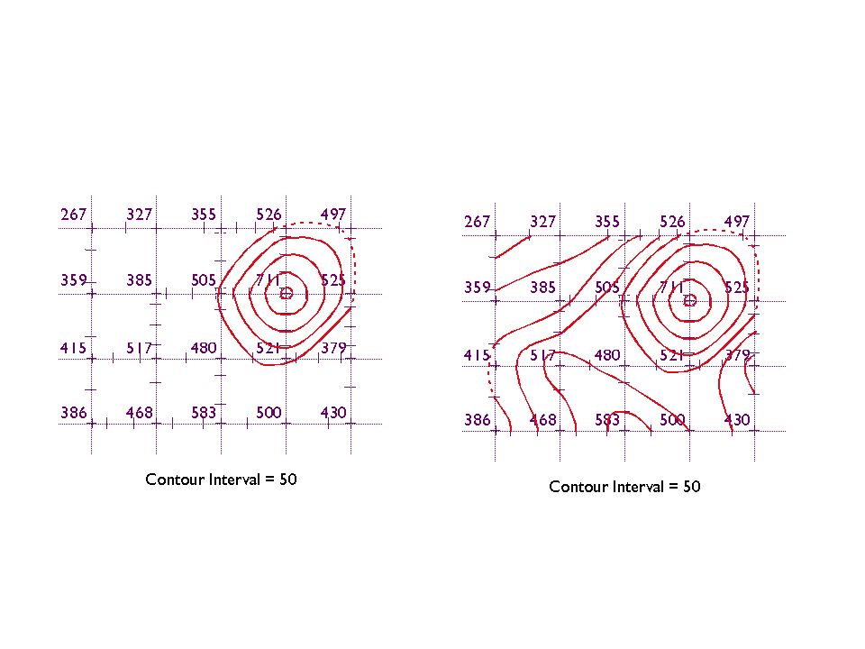
A collection of spot elevations.

Similar presentations


>")


 shows elevation of various points on the Earth’s surface.>")


