Download presentation
Presentation is loading. Please wait.

1
UNDERSTANDING WORLD MAPS

2
NAMES ◦ North America ◦ South America ◦ Europe ◦ Africa ◦ Asia ◦ Australia ◦ Antarctica ◦ Pacific Ocean ◦ North Atlantic Ocean ◦ South Atlantic Ocean ◦ Southern Ocean ◦ Indian Ocean ◦ Arctic Ocean 1 2 3 4 5 6 7 A B C D E F

3
Oceans and Continents ◦ There are ____ continents on earth. ◦ They are: North America, South America, Europe, Asia, Africa, Australia and Antarctica. 7 There are ___ oceans. 6 They are: Pacific Ocean, North Atlantic Ocean, South Atlantic Ocean, Indian Ocean, Southern Ocean and Arctic Ocean.

4
SO, other than continents and oceans, what other geographical features can be observed on a world map?

5
Great Sandy Desert Sahara Desert Gobi Desert Arabian Desert

6
Rocky Mountains Andes Mountains Himalayas

7
TROPICAL ZONE TEMPERATE ZONE ARCTIC ZONE

9
READING WORLD MAPS

11
FINDING SOMETHING ON THE WORLD MAP https://www.youtube.com/watch?v=lUMlmRzkuuY

12
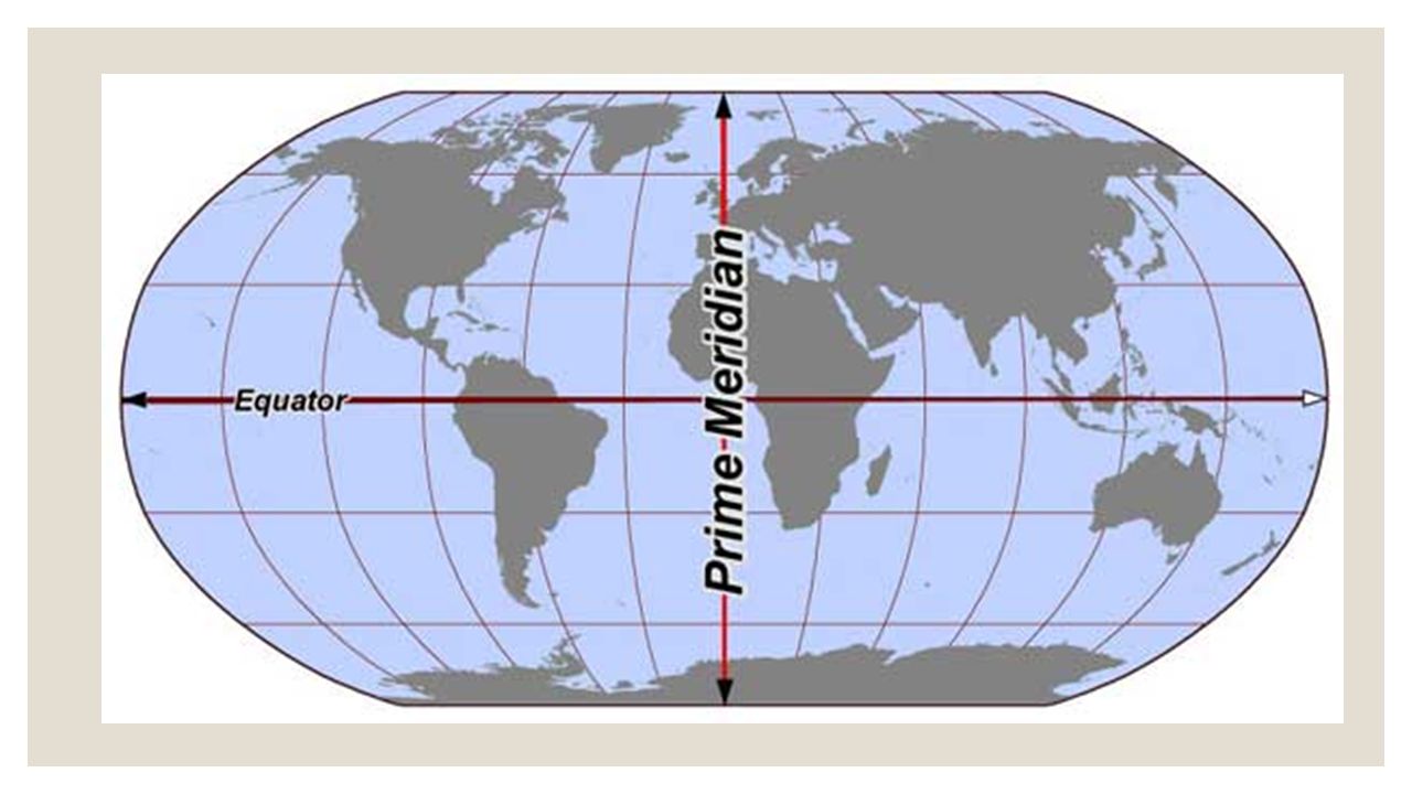
Finding Location (Atlas) ◦ Latitudes and longitudes are imaginary lines which cannot be seen on the actual surface of the Earth ◦ Expressed as degrees of a circle measured from the centre of the Earth ◦ Measured in degrees(°), minutes(‘) and seconds(“) ◦ 1° = 60’ ◦ 1’ = 60” ◦ Latitude is always read before longitude. (North/South then East/West). ◦ Eg. Singapore is located at 1°17’N 103°51’E
. ◦ Eg. Singapore is located at 1°17’N 103°51’E.")
13
Latitude (parallels) ◦ Imaginary horizontal lines running in an east-west direction around the world ◦ Numbered from 0 to 90°N and 90°S
 ◦ Imaginary horizontal lines running in an east-west direction around the world ◦ Numbered from 0 to 90°N and 90°S")
14
Longitudes (Meridians) ◦ Imaginary lines that run in a north- south direction from North Pole to South Pole ◦ Numbered from 0° at Greenwich to 180°E and 180°W ◦ Longitude 180°E and 180°W are the same line.
 ◦ Imaginary lines that run in a north- south direction from North Pole to South Pole ◦ Numbered from 0° at Greenwich to 180°E and 180°W ◦ Longitude 180°E and 180°W are the same line.")
15
Use of Latitude and Longitude 30°N 10°E Clue: (N/S, E/W)
")
16
EXERCISE: Locations on a world map ◦ Exercise 1 – Chapter 2, page 37 of Geography Skills book.

Similar presentations


 Today’s Agenda: Warm – Up>")


