Download presentation
Presentation is loading. Please wait.

1
Air Masses and Fronts

2
What changes do you feel in the weather right before a thunderstorm? Skies get dark Gets windy Gets colder

3
Recipe for a storm Compare the skies between a thunderstorm and a tornado. Do you see any similarities? Do you see any differences?

4
Thunderstorms

5
Tornadoes

6
Can air move around?

7
Air Mass animation http://www.classzone.com/books/earth_scien ce/terc/content/visualizations/es2001/es2001 page01.cfm?chapter_no=visualization http://www.classzone.com/books/earth_scien ce/terc/content/visualizations/es2001/es2001 page01.cfm?chapter_no=visualization All around the earth, large masses of air move around and constantly change the weather. They are named based on where they are coming FROM.

8
What type of weather would the following air masses bring?

9
What do the following terms mean? Continental – Land Maritime – Water Polar – cold Tropical – warm

10
Copy the following slides on page 14 of your Interactive Notebook If it is in YELLOW, you are to copy it in your notebook. Title the page “Air Masses Descriptions”

11
There are four types of air masses. Air masses are named based on where they are coming FROM

12
Continental Polar Cold, dry air mass that forms over central and northern Canada and Alaska

13
Continental Tropical Hot, dry air masses that form over Southwest and northern Mexico

14
Maritime Polar Cool, humid air masses that form over the icy cold North Pacific and North Atlantic oceans.

15
Maritime Tropical Warm, humid air masses that form over tropical oceans such as the Gulf of Mexico

16
Classifying Air Masses Wet (Maritime) Dry (Continental) Warm (Tropical) Maritime TropicalContinental Tropical Cold (Polar) Maritime PolarContinental Polar
 Dry (Continental) Warm (Tropical) Maritime TropicalContinental Tropical Cold (Polar) Maritime PolarContinental Polar")
17
Write on page 13: Fronts Activity Listen to the instructions Do activity

18
On page 13 of your Interactive Notebook, answer the questions below. The water represents air. Knowing this, explain how you think air behaves when air of different temperature meet. Write your answer in complete sentences. Using the color pencils, draw what you made and label.

19
Fronts (Copy on page 13) A boundary created when two air masses meet. Fronts are named for the air mass that is moving.

20
In the activity that we just did… Where is the “front”?

23
Fronts animation http://www.classzone.com/books/earth_scien ce/terc/content/visualizations/es2002/es2002 page01.cfm?chapter_no=visualization http://www.classzone.com/books/earth_scien ce/terc/content/visualizations/es2002/es2002 page01.cfm?chapter_no=visualization

24
Fill in the “Weather Fronts” chart as you follow along the next few slides.

25
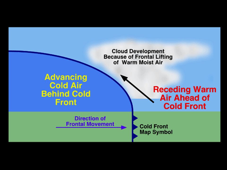
Cold Front Cold dense air moves in and pushes warm air out of the way Cold fronts move very quickly and bring short periods of rain/thunderstorms Lower temperatures are behind the front SYMBOL – the direction of the “arrows” points towards the direction the front is MOVING

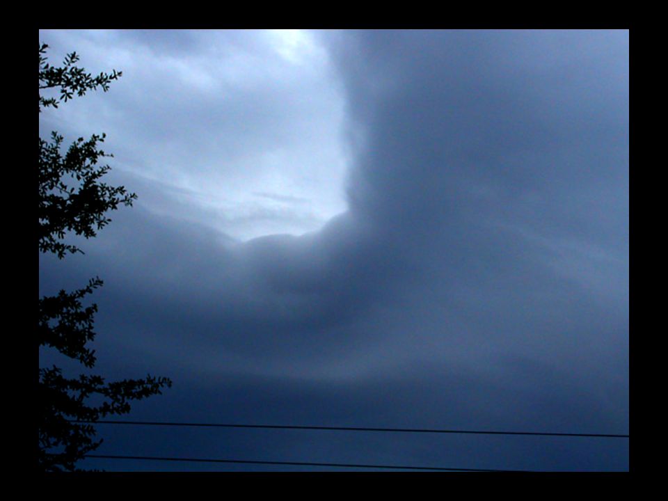
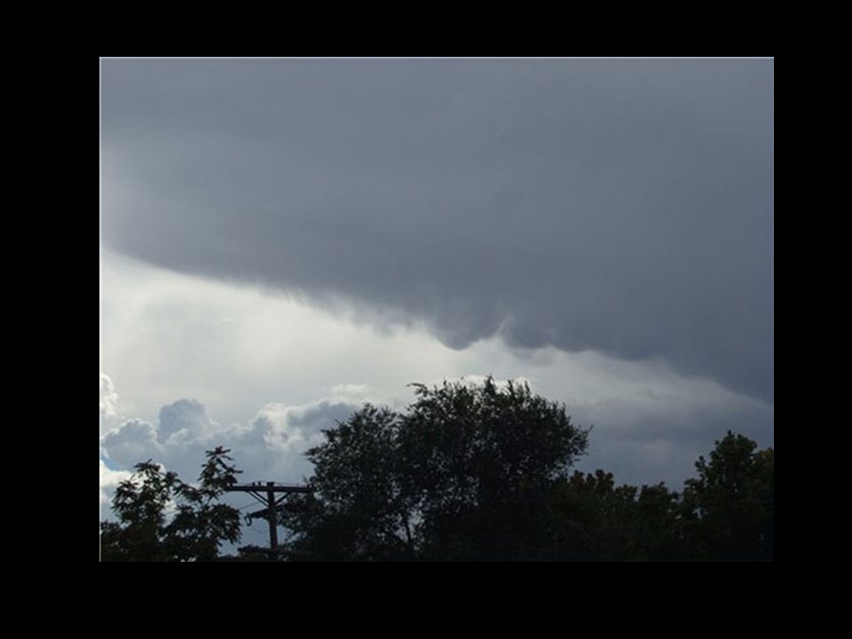
27
A cold front

28
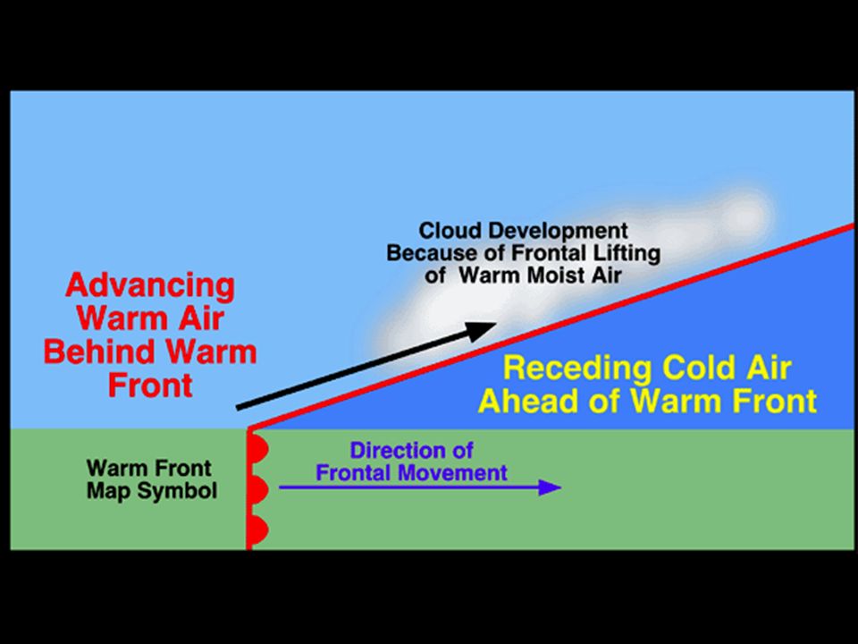
Warm Front Warm air moves up the cold front as it slowly displaces and overtakes the cold air Warm fronts move slowly, and bring many days of steady precipitation Higher temperatures are behind the front SYMBOL – direction of “half-moons” is the direction the front is moving

30
Warm front

31
Animations http://www.classzone.com/books/earth_scien ce/terc/content/visualizations/es2002/es2002 page01.cfm?chapter_no=visualization http://www.classzone.com/books/earth_scien ce/terc/content/visualizations/es2002/es2002 page01.cfm?chapter_no=visualization Cold front Links to cold front videos

32
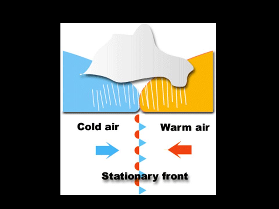
Stationary front Created when cold and warm masses meet but neither one has enough force to move the other out of the way. The water vapor in the warm air condenses into rain, fog, snow, clouds. Can bring many days of precipitation

34
Links Stationary front videos

35
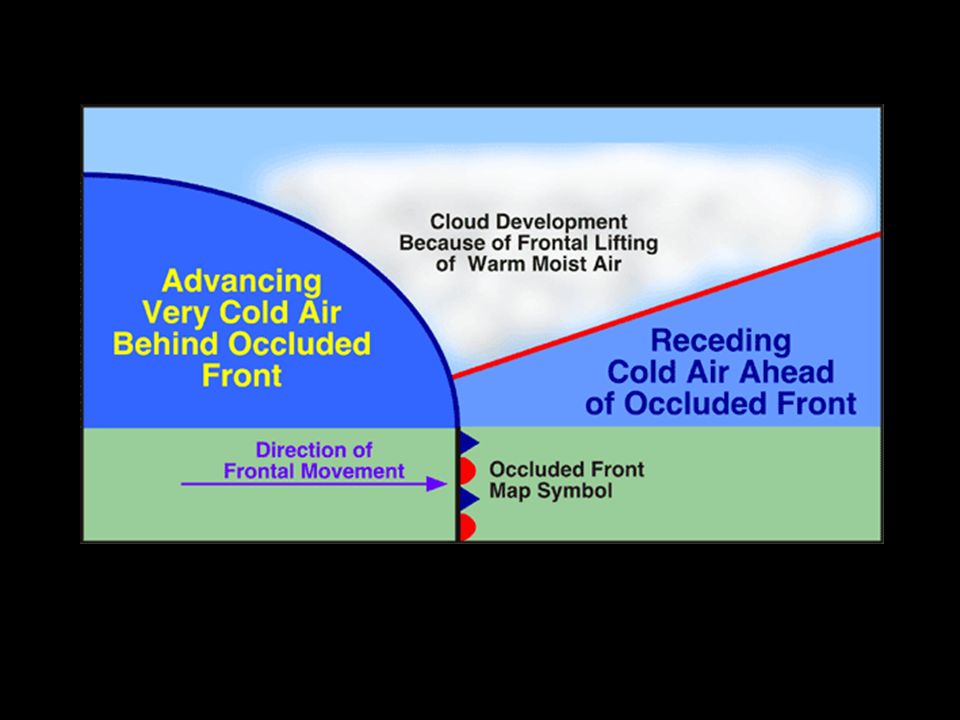
Occluded front Is created when a warm air mass is caught between two cooler air masses. The two denser cooler air masses cut off the warm air mass from the ground. As the warm air mass cools, it may turn cloudy, rainy or snowy.

37
Watch video clip of a weather report. http://www.youtube.com/watch?v=HQrB37Y Qo9Y start at 2:10 http://www.youtube.com/watch?v=HQrB37Y Qo9Y http://www.youtube.com/watch?v=OdcCMn5 sbzM&feature=relatedstart at 1:30 http://www.youtube.com/watch?v=OdcCMn5 sbzM&feature=related http://www.youtube.com/watch?v=nS1nwfRU aaU&feature=relatedstart at :30 http://www.youtube.com/watch?v=nS1nwfRU aaU&feature=related

38
Do a weather report

40
Use the graphic organizers and your interactive notebook to complete your homework.

Similar presentations