Download presentation
Presentation is loading. Please wait.

1
GIS-based River Habitat Mapping in the Obed Wild and Scenic River Paul Ayers, University of Tennessee Use kayak-mounted underwater videomapping system Develop river habitat maps at OBRI from: –Barnett Bridge to Nemo (Clear Creek/Obed/Emory) Other underwater videomapping projects with NPS
 Other underwater videomapping projects with NPS")
2
GPS-Instrumented Kayak Acquires Georeferenced above and below water video and depth sonar

3
Geo-referenced Image Recording Media- Mapper Audio output (GPS output) Audio Input (GPS input) Rear Front GPS Video input Splash Cam DVD Recorder GPS NMEA Data (ASCII)
 Audio Input (GPS input) Rear Front GPS Video input Splash Cam DVD Recorder GPS NMEA Data (ASCII)")
4
Georeferenced Underwater Image

5
Using underwater lasers to determine depth and scale (dot spacing is 7.75 inches) 1.5 to 2.5 ft < 1.5 ft
 1.5 to 2.5 ft < 1.5 ft")
6
Kayaking Clear Creek

7
Riffle Run Pool River Characteristics

8
Full Extent: River Characteristics Clear Creek (Lily to Canoe Hole)
")
9
Substrate Classification

10
Full Extent: Substrate Determinations Clear Creek (Lily to Canoe Hole)
")
11
Endangered Species Habitat Maps Spotfin Chub Dusktail Darter Cumberland Elktoe Cumberland Bean Cumberlandian Combshell Tan Riffleshell Littlewing Pearlymussel

12
Ideal Habitat: Spotfin Chub (Erimonax Monachus) River Characteristic: Run Depth: <1.5 ft Substrate: Bedrock/fines & Boulder
 River Characteristic: Run Depth: <1.5 ft Substrate: Bedrock/fines & Boulder")
13
Other Projects: BISO River Habitat Mapping (Canoe and Kayak) Endangered Mussel Habitat
 Endangered Mussel Habitat")
14
Canoeing with Drop-down Camera

15
Cumberland Bean

16
Optimal Habitat Map

17
T&E Species Habitat Mapping Duskytail Darter (endangered) Smoky Madtom (endangered) Yellowfin Madtom (threatened) Spotfin Chub (threatened)
 Smoky Madtom (endangered) Yellowfin Madtom (threatened) Spotfin Chub (threatened)")
18
Biscayne NP (BISC) Motorized Reel Underwater Video Coral Reef Mapping and Monitoring
 Motorized Reel Underwater Video Coral Reef Mapping and Monitoring")
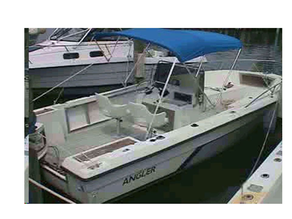
20
GPS Receiver Console Depth Sensor Boat and Equipment Underwater Camera and Sensors

21
Benthic Habitats

23
Sturgeon Habitat Mapping - TN

24
That’s Enough Thanks! Questions? Lunch? Projects?

Similar presentations