Download presentation
Presentation is loading. Please wait.

1
Andrew McLean Kelvin Barraclough Gisborne Secondary College

2
What is GPS? 24 + satellites

3
What is GPS? 24 + satellites Several ground stations

4
What is GPS? 24 + satellites Several ground stations GPS receiver

5
Satellites Altitude ≈ 20200 km

6
Satellites Altitude ≈ 20200 km Period 12 hours

7
Satellites Altitude ≈ 20200 km Period 12 hours At least 4 visible everywhere

8
Satellites Altitude ≈ 20200 km Period 12 hours At least 4 visible everywhere Solar powered, ≈ 50 W transmitter

9
Satellites Altitude ≈ 20200 km Period 12 hours At least 4 visible everywhere Solar powered, ≈ 50 W transmitter Transmit on 1575.42 MHz

10
Satellites Altitude ≈ 20200 km Period 12 hours At least 4 visible everywhere Solar powered, ≈ 50 W transmitter Transmit on 1575.42 MHz Fitted with atomic clocks

11
Satellites Altitude ≈ 20200 km Period 12 hours At least 4 visible everywhere Solar powered, ≈ 50 W transmitter Transmit on 1575.42 MHz Fitted with atomic clocks Lifespan ≈ 10 years

12
Ground Stations I master station, four remote

13
Ground Stations I master station, four remote Monitor satellites and send back accurate orbital and time data

14
The Signal The “almanac”. Approximate position of all satellites, transmitted and stored in the GPS.

15
The Signal The “almanac”. Approximate position of all satellites, transmitted and stored in the GPS. The “ephemeris”. Accurate data of individual satellite position.

16
The Signal The “almanac”. Approximate position of all satellites, transmitted and stored in the GPS. The “ephemeris”. Accurate data of individual satellite position. The “pseudo random code”. Effectively, an accurate time signal

17
The Signal The “almanac”. Approximate position of all satellites, transmitted and stored in the GPS. The “ephemeris”. Accurate data of individual satellite position. The “pseudo random code”. Effectively, an accurate time signal Turned off while satellite orbit is adjusted

18
Satellite positions 27400 km 20200 km

19
Signal times 0.091 s 0.067 s

20
Establishing position

22
If receiver had a good enough clock – Two satellites – somewhere on a circle

23
Establishing position If receiver had a good enough clock – Two satellites – somewhere on a circle 3 rd satellite – cuts this circle twice, but usually one solution is obvious

24
Establishing position If receiver had a good enough clock – Two satellites – somewhere on a circle 3 rd satellite – cuts this circle twice, but usually one solution is obvious 4 th satellite – removes ambiguity

25
Establishing position With a small, cheap clock -

26
Establishing position With a small, cheap clock – 3 satellites give 2D fix

27
Establishing position With a small, cheap clock – 3 satellites give 2D fix 4 satellites give 3D fix

28
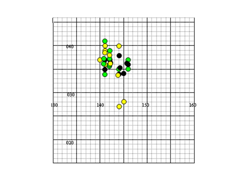
Accuracy Given clear view of sky typically 5 – 10 m

31
Receivers Aren’t equal

32
Receivers Aren’t equal Need “good view” of sky

33
Possible information Position

34
Possible information Position Distance travelled

35
Possible information Position Distance travelled Speed

36
Possible information Position Distance travelled Speed Direction

37
Possible information Position Distance travelled Speed Direction Altitude

38
Gathering data – “low tech”

42
Gathering data – “hi tech” Almost all GPS receivers can be connected to a computer to transfer data

43
Suitable software (1) “OziExplorer”
 OziExplorer")
44
Suitable software (1) “OziExplorer” $130
 OziExplorer $130")
45
Suitable software (1) “OziExplorer” $130 Uses raster mapping
 OziExplorer $130 Uses raster mapping")
46
Suitable software (1) “OziExplorer” $130 Uses raster mapping Suitable for all brands of GPS
 OziExplorer $130 Uses raster mapping Suitable for all brands of GPS")
47
Suitable software (1) “OziExplorer” $130 Uses raster mapping Suitable for all brands of GPS Transferring data from Ozi is awkward
 OziExplorer $130 Uses raster mapping Suitable for all brands of GPS Transferring data from Ozi is awkward")
48
Suitable software (2) Garmin “Mapsource”
 Garmin Mapsource")
49
Suitable software (2) Garmin “Mapsource” Free with Garmin GPS
 Garmin Mapsource Free with Garmin GPS")
50
Suitable software (2) Garmin “Mapsource” Free with Garmin GPS Uses Vector mapping
 Garmin Mapsource Free with Garmin GPS Uses Vector mapping")
51
Suitable software (2) Garmin “Mapsource” Free with Garmin GPS Uses Vector mapping Allows easy transfer of data to other programs (eg Excel)
 Garmin Mapsource Free with Garmin GPS Uses Vector mapping Allows easy transfer of data to other programs (eg Excel)")
54
Some possibilities Real aircraft - loop the loop Model aircraft Racing cars, dragsters, motorbikes Skydivers, bungee jumpers Yacht racing Theme park rides Relative motion on moving ship

55
Cost? Cheap GPS ≈ $100 Garmin GPS Map 60 CSx ≈ $470 OziExplorer $130 Oztopo maps for Garmin (all of Australia) $229
 $229.")
Similar presentations


 Math 437/837 CISC490/850.>")
 for Precision Farming>")


 HOW DOES GPS WORK??>")


. NAVSTAR Global Positioning System (GPS) Globally.>")
>")


 P.JANANI(110051101051) R.JANOFER FERHANA(110051101052) KADIRIMANGALAM JAHNAVI(110051101055)>")
