Download presentation
Presentation is loading. Please wait.

1
Civics/Geography

2
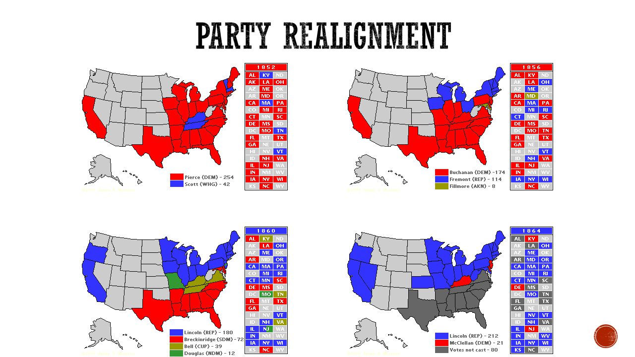
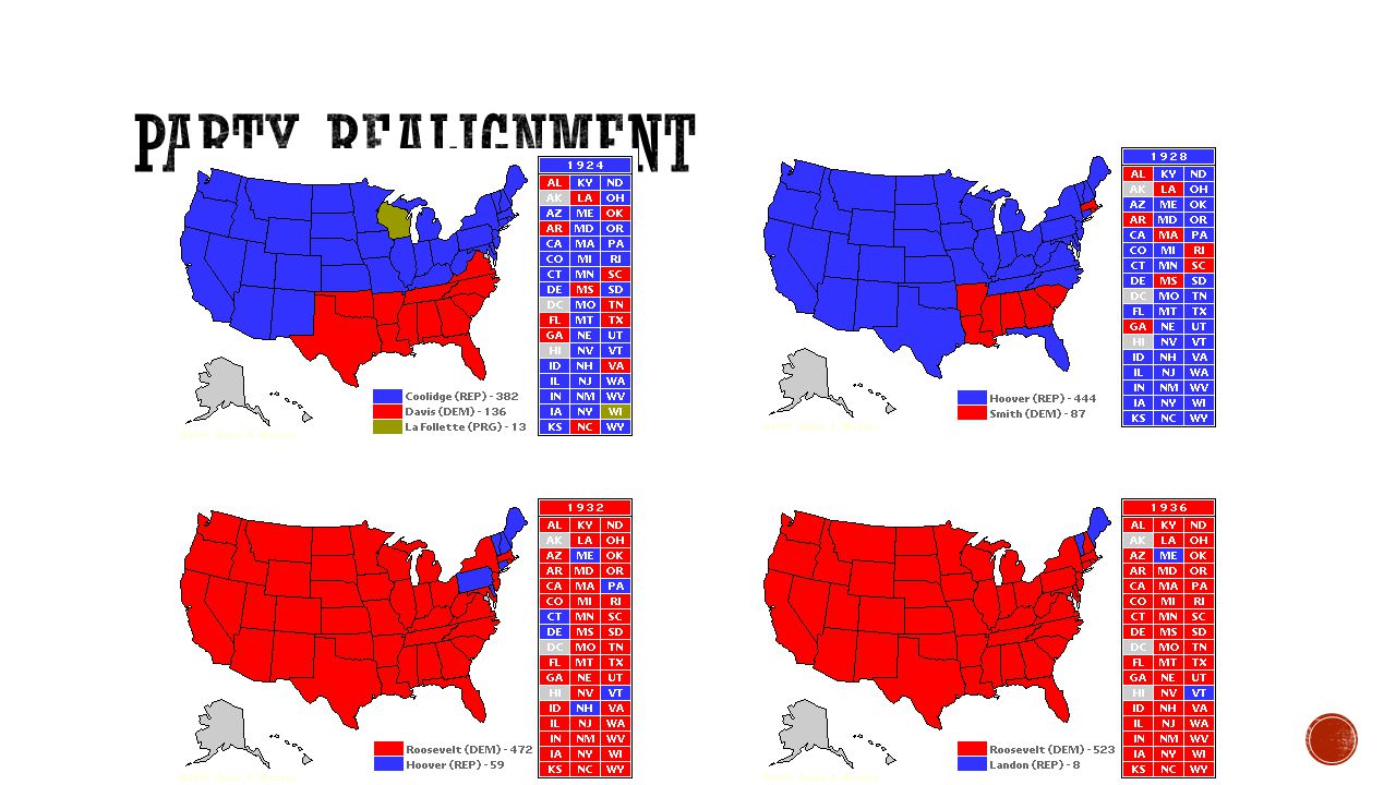
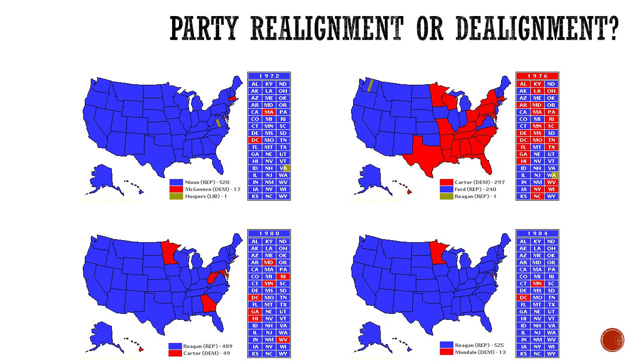
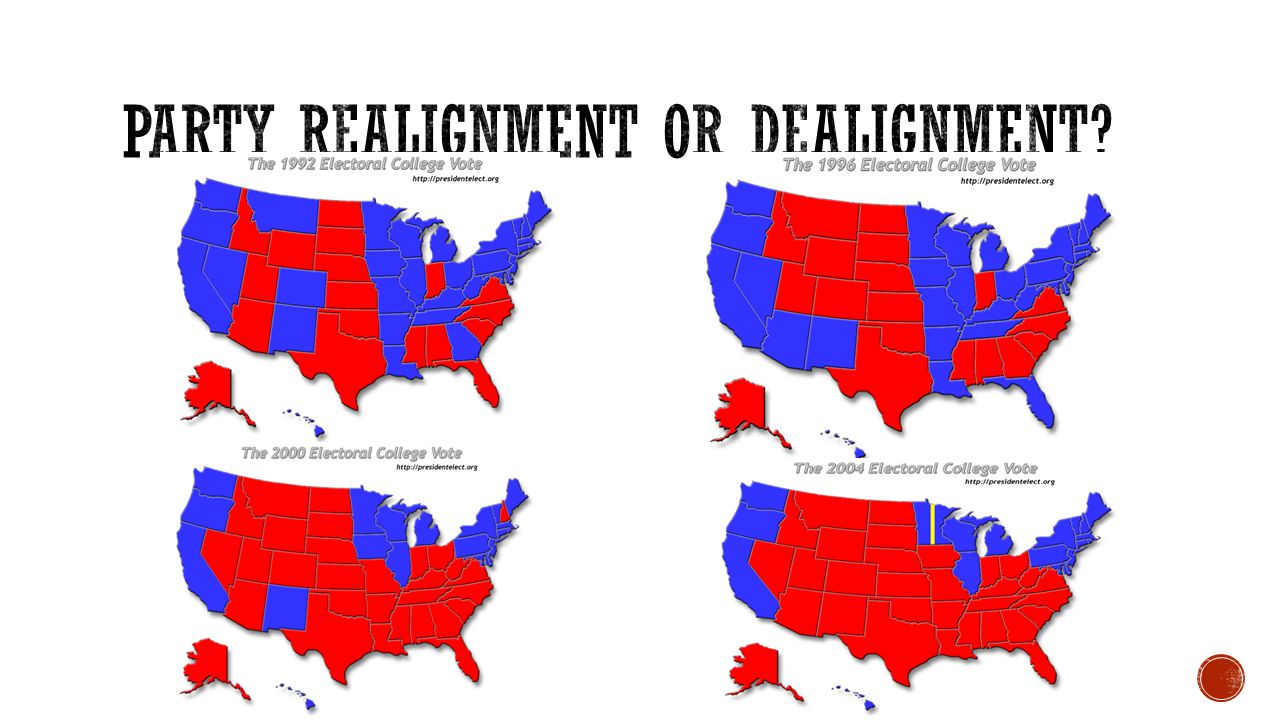
Notes: On both maps, the red states indicate Republican votes and the blue states indicate votes for Democrats. 1.What vocabulary do you need to know in order to understand the maps? 2.What is the purpose of the maps? 3.What information do the maps provide? 4. Identify at least two patterns on the maps. (Which blocks of states changed or stayed the same?) 5. Explain why the patterns exist? 6. How has political party representation changed regionally over time? 1908
 5. Explain why the patterns exist. 6. How has political party representation changed regionally over time")
3
Each state has a number of electors equal to the number of Senators and Representatives that state has Based on population Protects the power of small states Smallest states (and Washington DC) have 3 (2 Senators and one Representative) Largest state (California) has 55 Electors are selected by the state legislatures Some states can split their electors Electors are often guided by, but not bound by, the popular vote A candidate MUST HAVE A Majority to win (270 out of 538)
 have 3 (2 Senators and one Representative) Largest state (California) has 55 Electors are selected by the state legislatures Some states can split their electors Electors are often guided by, but not bound by, the popular vote A candidate MUST HAVE A Majority to win (270 out of 538)")
4
Provide a label for candidates Organize the legislative branch Organize opposition Help voters make semi-informed choices Create policy options

5
Party Realignment When groups of voters leave one party for the other party Happens in “critical elections” Party dealignment Occurs when people leave political parties and identify as independents Characterizes the second half of the twentieth century Party Change is often a reaction to national events Expansion War Economic Crisis Wave of immigration

6
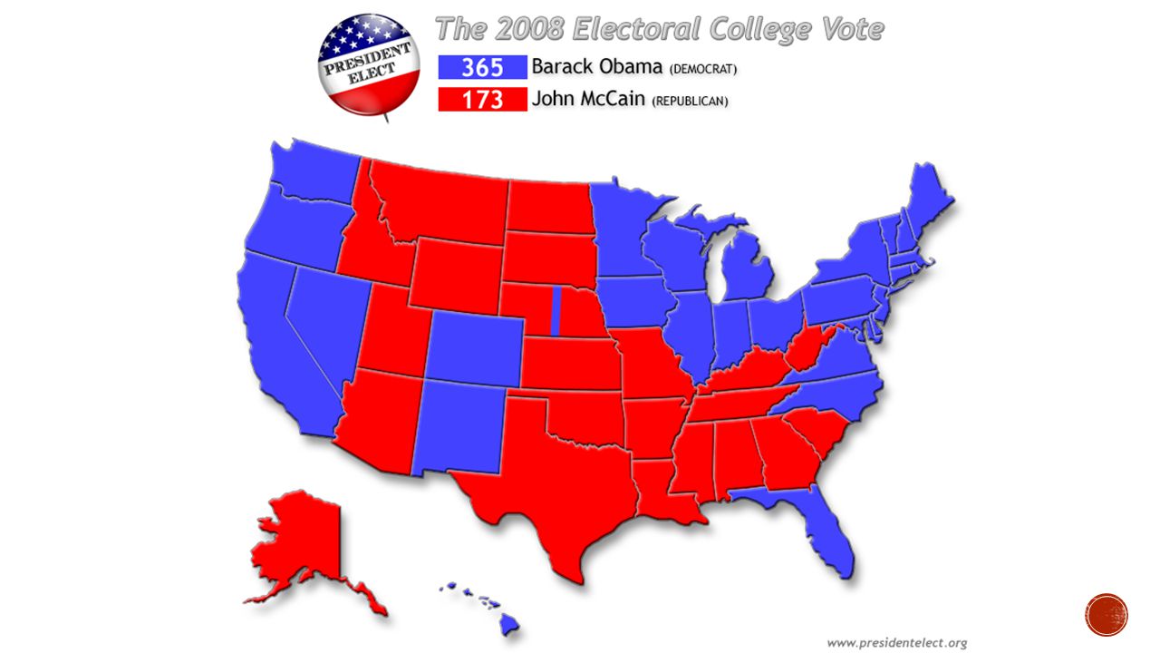
Electoral Maps Realignment 1860 Realignment 1932 2008 Map Tea Party role in Party Change Tea Party Articles Questions

12
How the States Got Their Shapes Season 2 Episode 1 Answer Identify three characteristics of Red States Identify three characteristics of Blue States

13
http://www.270towin.com/ http://www.270towin.com/ Projected Swing States Arizona (11) Colorado (9) Iowa (6) Wisconsin (10) Ohio (18) Pennsylvania (20) New Hampshire (4) Virginia (13) North Carolina (15) Georgia (15) Florida (29)
 Colorado (9) Iowa (6) Wisconsin (10) Ohio (18) Pennsylvania (20) New Hampshire (4) Virginia (13) North Carolina (15) Georgia (15) Florida (29)")
14
1. Which groups of voters will be important in 2016? Why? 2. Which party do you expect will be successful in 2016? Why? 3. How have regional loyalties to the Republican Party changed over time? Why? 4. How have regional loyalties to the Democratic Party changed over time? Why?

Similar presentations


 A.Background B.Who? C.Controversy & Compromise.>")


