Download presentation
Presentation is loading. Please wait.

1
Let’s explore the continent of Africa!

2
World Map - Africa

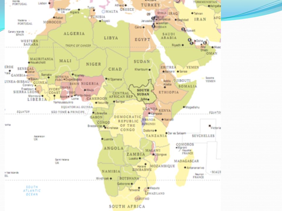
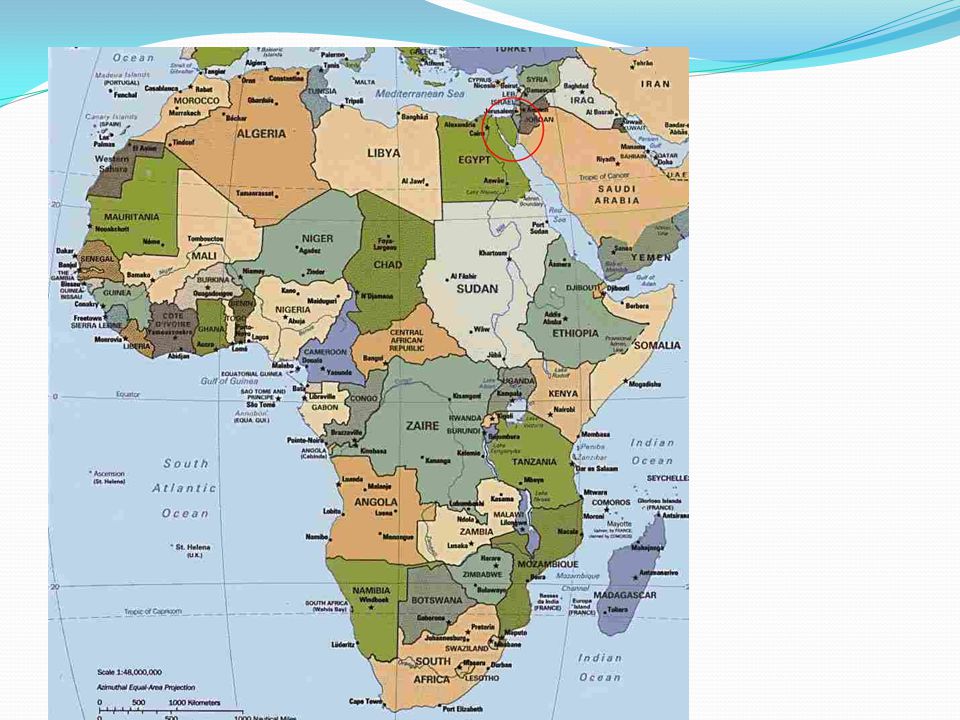
3
Africa – Close -up Map

4
Africa – Outline Map Name the Island to the south east of Africa?

5
Africa – Outline Map Madagascar

6
Political Map of Africa

7
How many countries are there in Africa?
Quiz: How many countries are there in Africa?

8
Answer: 54 countries

9
List the continents by size
Quiz: List the continents by size

10
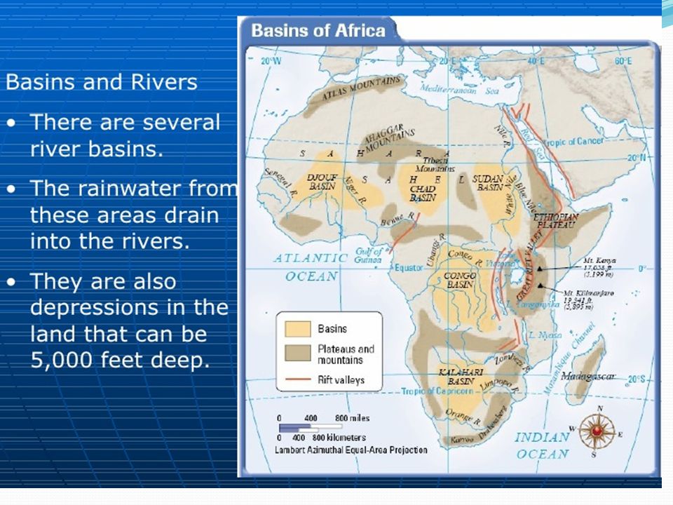
Answer: Asia Africa North America South America Antarctica Europe
Australia

11
List the continents by population
Quiz: List the continents by population

12
Answer: Asia Africa Europe North America South America Australia
Antarctica

13
Overview Africa , the world’s second largest continent by area and population, is comprised of 54 countries.

14
What is Africa’s newest nation?
Overview What is Africa’s newest nation?

15
Overview Africa’s newest nation is South Sudan, which gained independence on July 9, 2011.

17
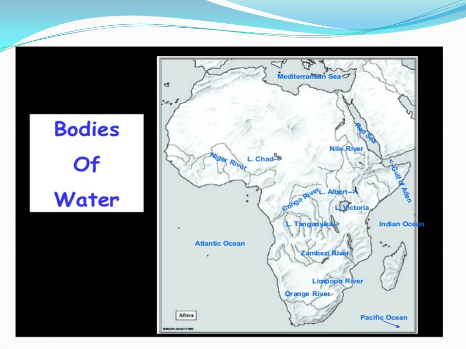
Name the water bodies that border Africa?
Overview Name the water bodies that border Africa?

18
Overview Borders North – Mediterranean Sea
Northeast – Suez Canal and Red Sea along the Sinai Peninsula Southeast - Indian Ocean West – Atlantic Ocean

21
Overview What is a plateau?

22
Overview It is a flat area of high ground.

23
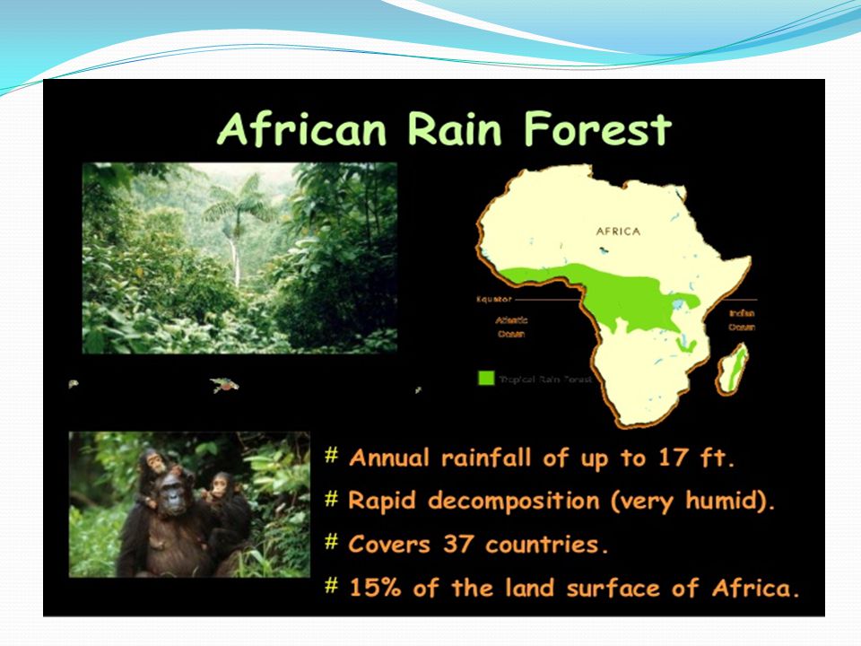
Physical Features Equator bisects the continent into two nearly equal halves, creating an equatorial climate across most of the continent.

24
Physical Map

25
Physical Features Geographic features include Coastal Plains, the Atlas Mountains, the Ethiopian Highlands. The Sahara desert , the third largest in the world covers most of North Africa. In south, the Kalahari desert has similar conditions. The Atlas Mountains traverse northwestern Africa through Morocco, Algeria and Tunisia.

27
Physical Features Which is the third largest desert in the world?

28
Physical Features The Sahara desert , the third largest in the world covers most of North Africa. In south, the Kalahari desert has similar conditions. The Atlas Mountains traverse northwestern Africa through Morocco, Algeria and Tunisia.

29
Physical Features What are the first two largest deserts in the world?

30
Physical Features 1. Antarctic Polar desert 2. Arctic Polar desert

31
Physical Features The two largest deserts on Earth are in the polar areas. The Antarctic Polar Desert covers the continent of Antarctica and has a size of about 5.5 million square miles.

32
Physical Features The second-largest desert is the Arctic Polar Desert. It extends over parts of Alaska, Canada, Greenland, Iceland, Norway, Sweden, Finland and Russia. It has a surface area of about 5.4 million square miles.

34
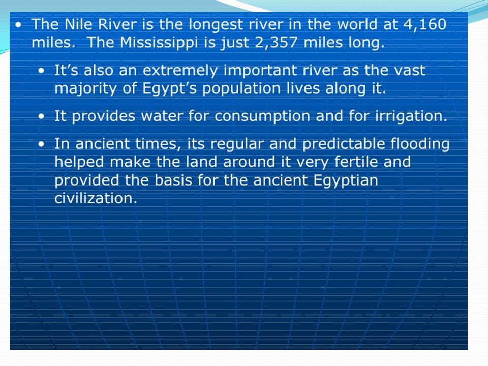
Physical Features What is the longest river in the world?

36
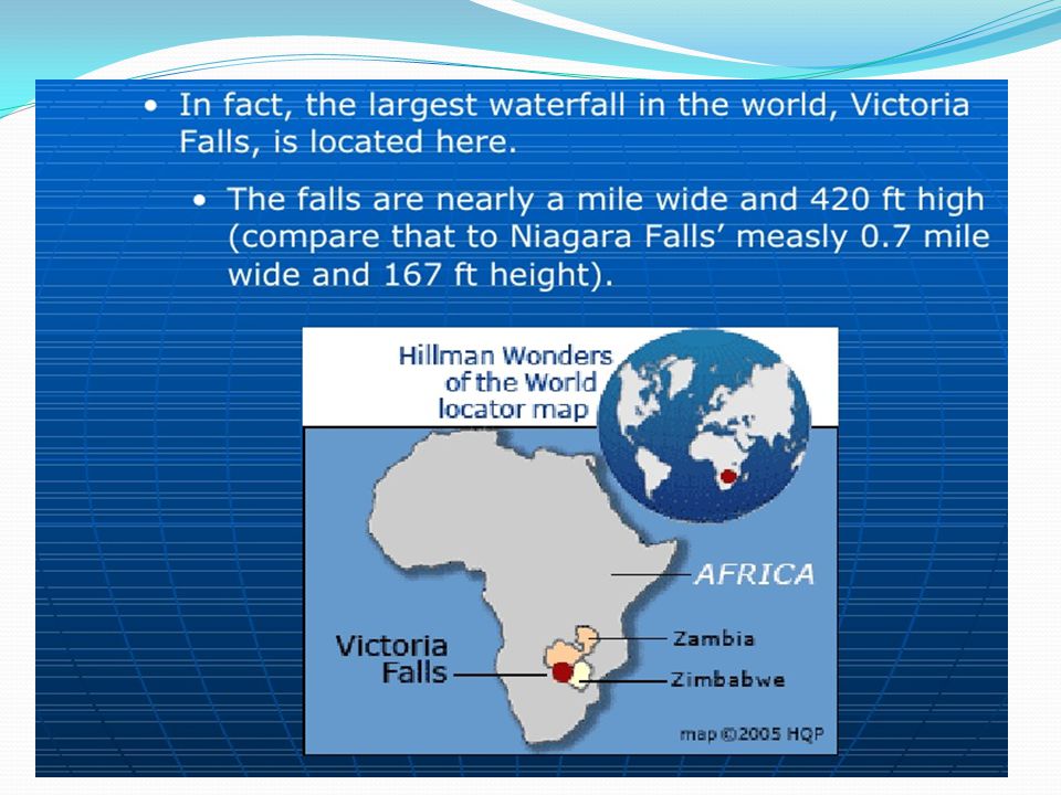
Physical Features What is the largest waterfall in the world?

38
Physical Features

39
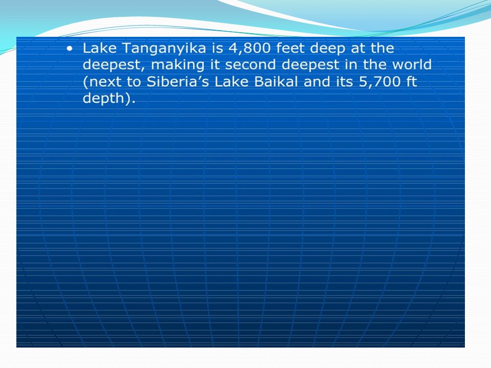
Physical Features What is the second deepest lake in the world?

41
Physical Features

42
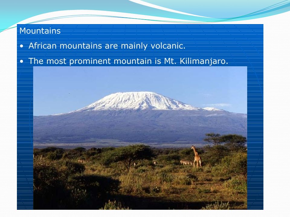
Physical Features What is the tallest mountain in Africa?

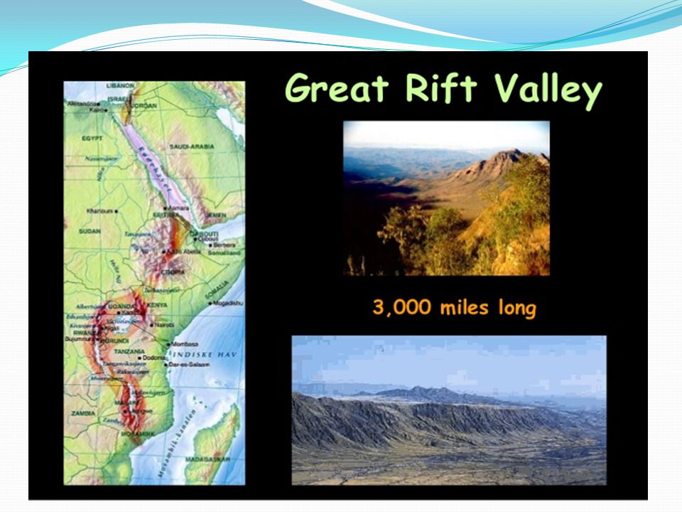
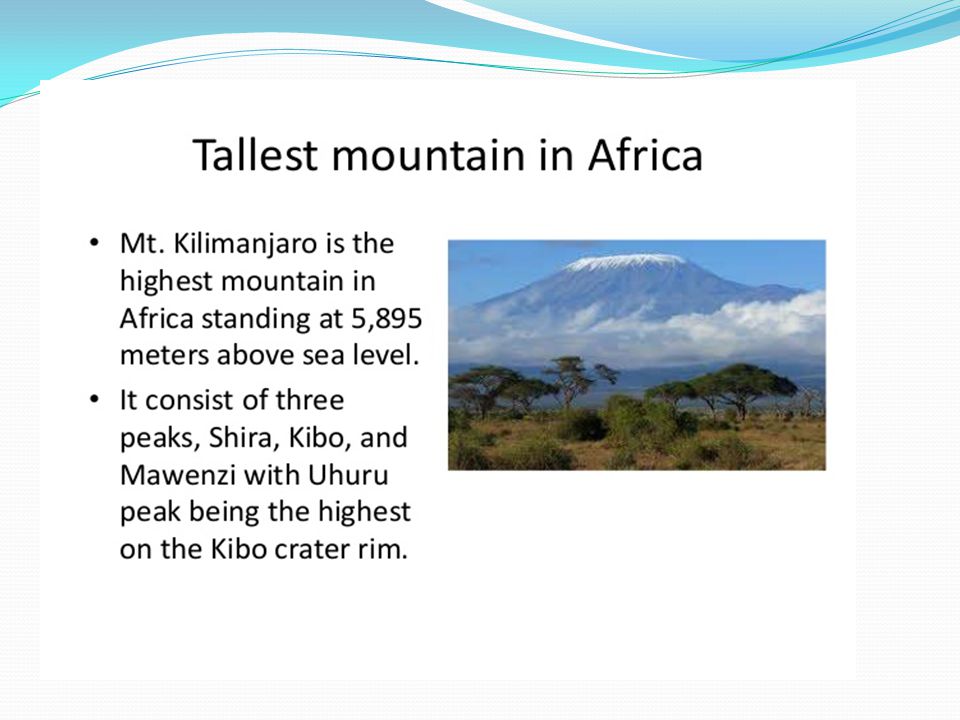
59
Countries of Africa

60
A look at some countries
Egypt South Africa Guinea Ethiopia DRC

61
Ethiopia

62
Africa – Close -up Map

63
Map of Ethiopia

64
Continued Borders – Sudan to west, Somalia and Djibouti to East, Kenya to South, Eritrea to NorthEast. Exports – Coffee, Qat, Gold, Leather products

65
Ethiopia Facts Land Area – 432,310 sq. mi Population - 93,815,992 Capital and Largest City – Addis Ababa Languages – Amharic, Tigrigna, Orominga, Guaragigna, Somali, Arabic, English Ethnicity - Oromo 40%, Amhara and Tigrean 32 % Religion – Islam, Ethiopian orthodox Currency – Birr.

66
South Africa

67
Africa – Close -up Map

68
Map of South Africa

69
South Africa Facts Area – 471,008 sq. mi Population – 48,375,645
Administrative capital – Pretoria Legislative Capital and Largest city – Cape Town Judicial Capital – Bloemfontein Other large cities – Johannesburg, Ekurhuleni, Durban Currency – Rand Languages – IsiZulu, isiXhosa, Afrikaans, English Exports – Gold, Diamond, platinum and other metals

70
Guinea Population - 11.75 million Capital – Conakry
Official Language – French

71
Africa – Close -up Map

72
Guinea Facts Borders – Guinea-Bissau, Senegal, Mali, Cote’ d”Ivoire, Liberia, Sierra Leone. Physical features include Coastal plain, Mountanious Region, savanna interior and aforest area in the guinea highlands. Highest Peak – Mount Nimba. Currency – Guinean Franc Ethnicity – Peuhl 40%, Malinke 30 %, Soussou 20% and other. Religion – Islam 85%,Christian 8 % Exports – Bauxite, Alumina, Gold, Diamonds, Coffee and Fish.

73
Democratic Republic Of Congo
Population - 60,764,000 Capital – Kinhasa Area – 2,344,855 Sq.Km Language – French, Lingaia, Kingwana, Kikongo, Tshiluba Religion – Roman Catholic, Protestant, Muslim Currency – Congolese franc

74
Africa – Close -up Map

75
Continued Old name – Republic of Zaire
Borders – Republic of Congo and the Atlantic Ocean to the west, Zambia to the southeast, Tanzania, Burundi, Rwanda and Uganda to the east, Angola to the southwest, Sudan to the northeast and the Central African Republic to the north Largest Ethnic Group – Bantu Exports – Cobalt, Coffee, Copper and Diamonds

76
Map of DRC

77
Thank you

Similar presentations