Download presentation
Presentation is loading. Please wait.

6
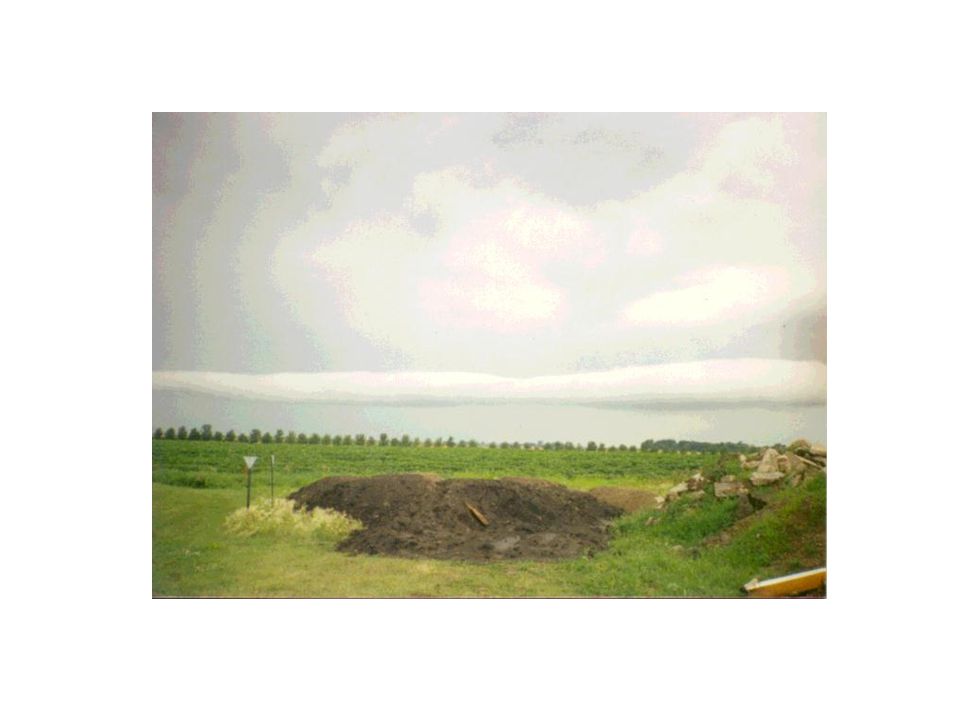
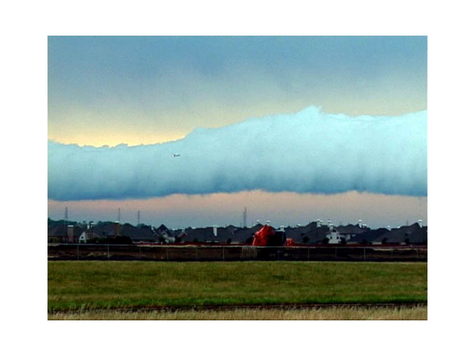
Roll or Arcus Cloud

11
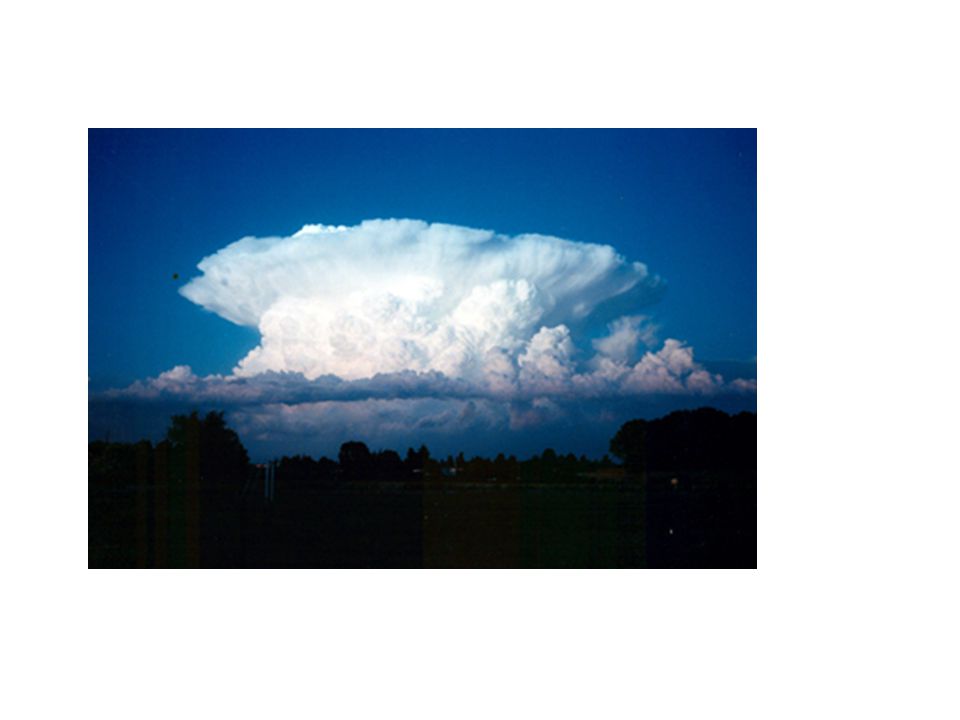
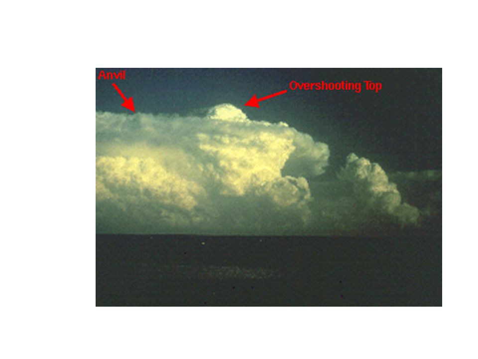
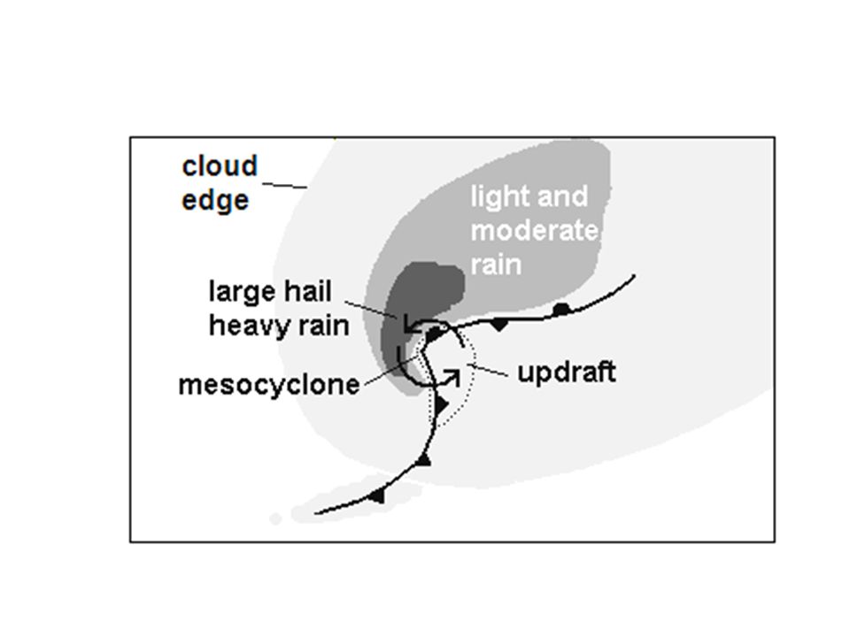
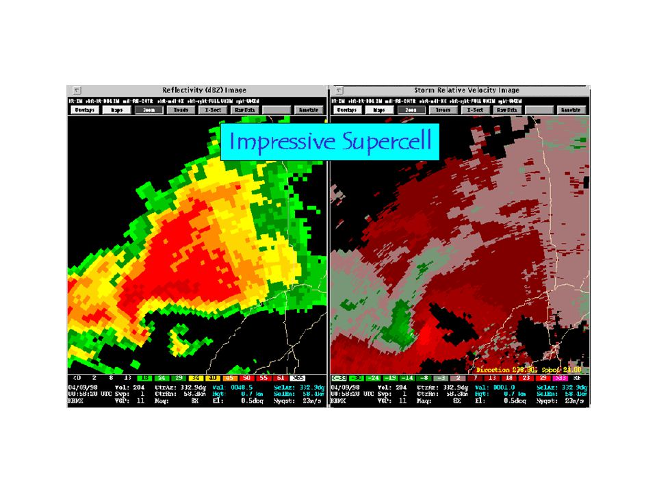
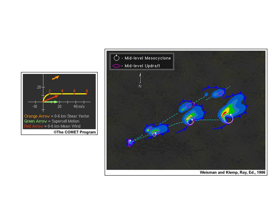
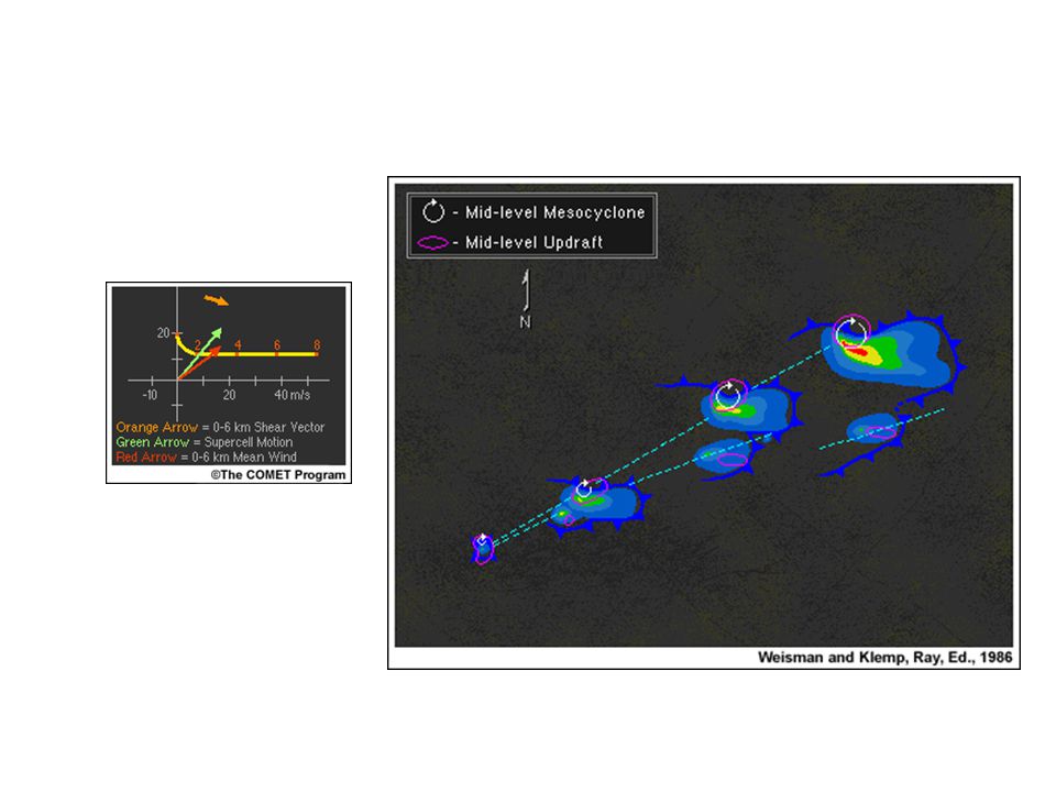
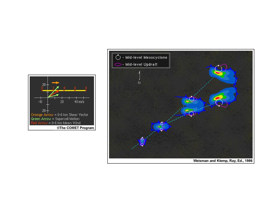
Supercell Thunderstorms

28
Storm split 1 Storm split Storm split 3 Storm Split 2

29
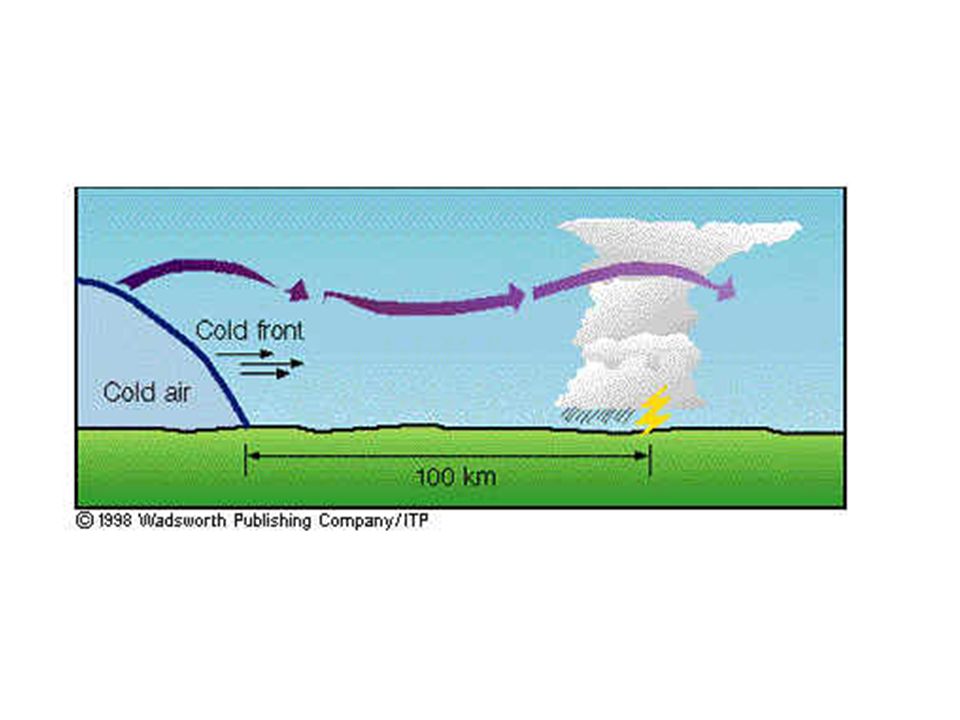
Squall Lines

37
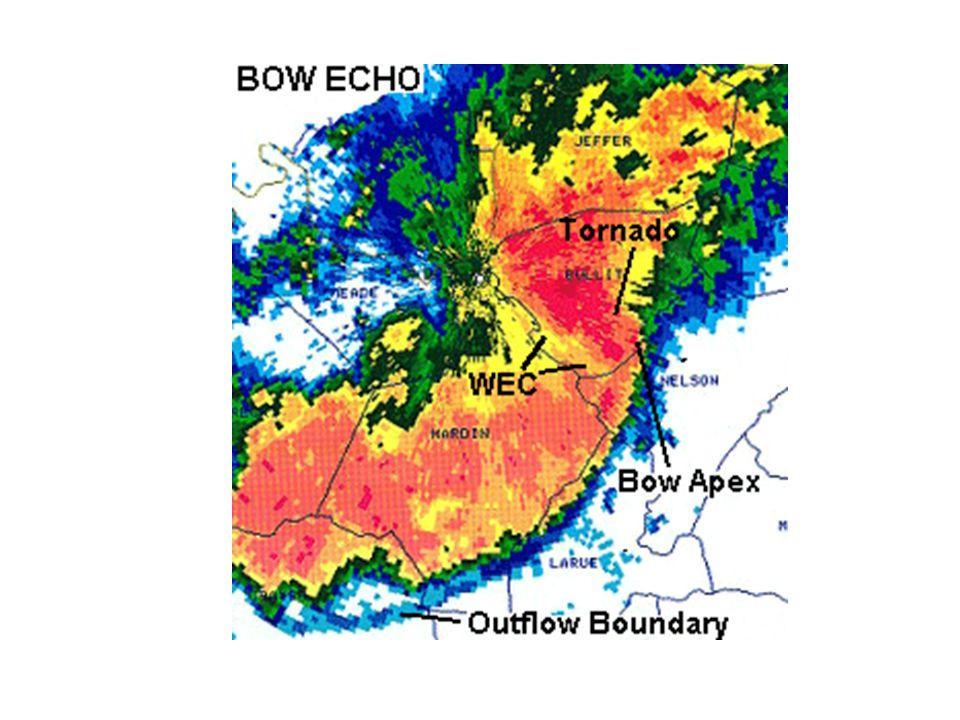
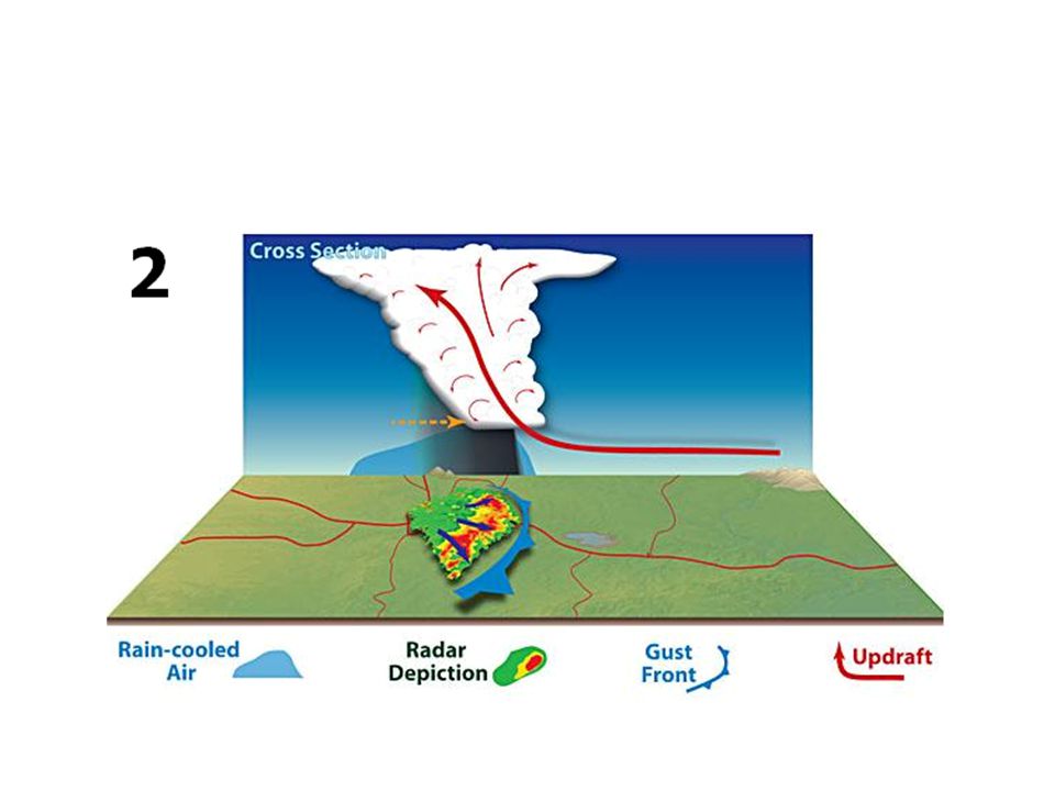
Bow Echoes and Derechos

41
DC Derecho: June 10, 2013

42
Often Associated with Strong Straight Line Winds Known as “Derechos” These straight-line winds may exceed 100 miles per hour, reaching 130 miles per hour in past eventshttp://www.youtube.com/watch?v=E GJmOeDEBtwhttp://www.youtube.com/watch?v=E GJmOeDEBtw Great Derecho Website: http://www.spc.noaa.gov/misc/AbtDerechos/d erechofacts.htm

48
Climatology (Events over 1980- 2001

49
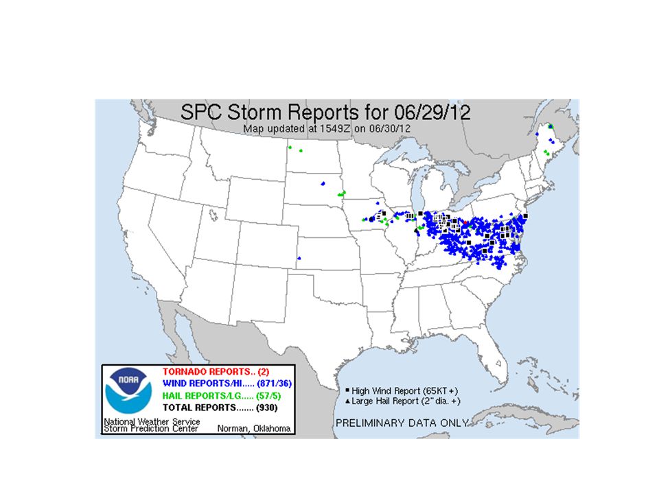
Major Derecho on June 2012

51
June 2012 Derecho Wind gusts increased substantially, peaking as high as 91 mph (147 km/h) in Fort Wayne, Indiana Extremely hot and highly unstable atmosphere with CAPE values in excess of 5,000 J/kg. Temperatures on the south side of a stationary front were in excess of 100F.

52
Derecho Prediction Warm season derechos in the Northern Hemisphere form in west to northwesterly flow at mid levels with moderate to high levels of instability (CAPE). Derechos form within environments of low- level warm air advection and significant low-level moisture

53
Numerical Simulation of Convection High resolution simulates cable of explicitly resolving convection have been run in research mode. It appears that such numerical model can provide great insights into the conditions necessary for convection and how varying environments influence convective evolution.

54
METED Convective Storm Matrix http://www.meted.ucar.edu/convectn/csmatr ix/http://www.meted.ucar.edu/convectn/csmatr ix/ Allows you to experiment with instability and shear and view how the storms evolve.

55
High Resolution Numerical Prediction of Convection

56
Explicit Convective Prediction Requires high resolution (4km or less grid spacing) Requires high-resolution analysis of current situation, using radar, surface observations and all other assets. NCAR (WRF model) and CAPS (Oklahoma, ARPS model) are two leading efforts.
 and CAPS (Oklahoma, ARPS model) are two leading efforts..")
57
Bow Echo and Mesoscale Convective Vortex Experiment (BAMEX) Using the WRF Model Goal: Study the lifecycles of mesoscale convective vortices and bow echoes in and around the St. Louis MO area 10 km WRF forecast domain 4 km WRF forecast domain Field program conducted 20 May – 6 July 2003

58
Real-time WRF 4 km BAMEX Forecast Composite NEXRAD RadarReflectivity forecast Initialized 00 UTC 9 June 03

59
Real-time WRF 4 km BAMEX Forecast Composite NEXRAD Radar 4 km BAMEX forecast 36 h Reflectivity 4 km BAMEX forecast 12 h Reflectivity Valid 6/10/03 12Z

60
Real-time WRF 4 km BAMEX Forecast Initialized 00 UTC 10 June 03 Reflectivity forecastComposite NEXRAD Radar

61
Real-time 12 h WRF Reflectivity Forecast Composite NEXRAD Radar 4 km BAMEX forecast Valid 6/10/03 12Z 10 km BAMEX forecast 22 km CONUS forecast

62
Composite NEXRAD RadarReflectivity forecast Real-time WRF 4 km BAMEX Forecast Initialized 00 UTC 30 May 03

63
Real-time WRF 4 km BAMEX Forecast Composite NEXRAD Radar23 h Reflectivity Forecast Line of Supercells Valid 5/30/03 23Z

64
Realtime WRF 4 km BAMEX Forecast Composite NEXRAD Radar30 h Reflectivity Forecast Squall line 6” hail 00Z Valid 6/23/03 06Z

65
Realtime WRF 4 km BAMEX Forecast Composite NEXRAD RadarReflectivity Forecast 12 h 24 h Squall line PersistsDissipates Initialized 5/24/03 00Z

66
Preliminary BAMEX Forecast Verification (Done, Davis, and Weisman) Mode for corresponding convective systems For Convective Mode 2 or 3 Cases Observed YesNo Cases Predicted 6125 1621 Yes No Probability of detection (POD) = 79% False alarm rate (FAR) = 29%
 Mode for corresponding convective systems For Convective Mode 2 or 3 Cases Observed YesNo Cases Predicted Yes No Probability of detection (POD) = 79% False alarm rate (FAR) = 29%")
67
A High-Resolution Modeling Study of the 24 May 2002 Dryline Case during IHOP (Xue and Martin 2006a,b MWR) Goal: Understand exactly WHEN, WHERE, HOW convection is initiated
 Goal: Understand exactly WHEN, WHERE, HOW convection is initiated")
68
Time and Location of Initiation (Loop time: 17UTC – 22 UTC)
")
69
Surface analysis + satellite images From Wakimoto et al. (2006 MWR). 1900 2000 2200 2100
")
70
20:02UTC

71
19:32UTC

72
20:32UTC

73
21:02UTC

74
21:32UTC

75
22:02UTC

76
22:58UTC

77
23:58UTC

78
18 UTC May 24, 2002 I.C. 3 km / 1km grid

79
Model Configurations ARPS model with full physics, including ice microphysics + soil model + PBL and TKE-SGS turbulence 1200 UTC 1800 UTC 0006 UTC 1km 3km CI ~ 2000UTC 0000 UTC ADAS

80
Surface analysis plus obs at 18 Z

81
t=3h, 2100 UTC sfc. winds, qv, and composite reflectivity

82
t=4h, 2200 UTC

83
t=5h, 2300 UTC

84
Animation of 1 km forecast

85
t=3h, 2100 UTC

86
t=2h t=2h 15min t=2h 30min t=2h 45min A A A B B B C C C B A 2000 UTC 2015 UTC 2030 UTC 2045 UTC

87
Bottom Line High resolution NWP can often predict the mode of the convection correctly, even a day ahead (supercell, bow echo, scattered convection). Skill in predicting the magnitude and location of convection fades out quickly after only a few hours. Predictability is lengthened when there is strong, large scale forcing (e.g,. front or dry line)
.")
88
The Future of Convective Forecasting Clearly, there is substantial uncertainty that must be considered. A major requirement is for there to be large convection-resolving ensembles run operationally (25-100 members), with varying initializations and physics. Need for better initializations to describe the detailed 3D configuration of the lower atmosphere (using all assets: commuter aircraft, mesosnets, satellite data, etc.)
, with varying initializations and physics. Need for better initializations to describe the detailed 3D configuration of the lower atmosphere (using all assets: commuter aircraft, mesosnets, satellite data, etc.).")
89
http://www.spc.noaa.gov/exper/sseo/
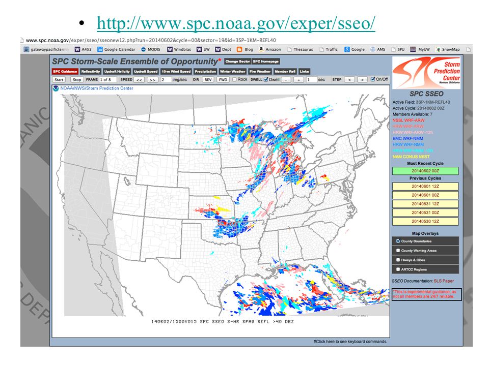
90
Storm Prediction Center Ensemble of Opportunity Based on 7 high-resolution deterministic forecasts run by a variety of groups.

91
Another Major Advancing Tool: High Resolution Rapid Refresh: Particularly for Next Few Hours.

92
The U.S Storm Prediction Center

93
Storm Prediction Center Main U.S. entity responsible for severe weather forecasting. Coordinates between NWS forecast offices, who also important players for their areas.

94
Forecasting of Convection Summary The big challenge is to predict the environment in which convection will develop. Parameters such as vertical instability (CAPE), wind shear and helicity, low-level thermal and moisture structures, CIN, etc. These can change rapidly with large mesoscale variations.
, wind shear and helicity, low-level thermal and moisture structures, CIN, etc. These can change rapidly with large mesoscale variations..")
95
Major Ingredients for General Convection Convective or conditional instability –Lifting turns convectively unstable sounding to a conditionally unstable sounding –Negative LI –High CAPE –Low LFC –CAPE is more useful than LI Moist layer near the surface –Generally Td > 53F needed. An initiator –Source of upward motion (front, dry line, sea breeze front) Low or moderate CIN
 Low or moderate CIN.")
Similar presentations


 Chris Davis (NCAR ESSL/MMM and RAL) Stan Trier (NCAR ESSL/MMM) Boulder, Colorado 60-h Radar Composite Animation (00.>")


 Real-Time High-Resolution Forecast Using Bluesky Wei Wang May 19, 2005 CISL User.>")


