Download presentation
Presentation is loading. Please wait.

1
Nigeria Hydrological Study of Nigeria GIS Term Project November 22, 2005 Presented by Kehinde S Oshodi

2
Outline of Presentation Objective Geographical Location & Background Problem Statement Arc Hydro Framework Hydrological Analysis Future Work Acknowledgements

3
Objective Develop a geodatabase to store information that can be utilized for the analysis and modeling of the hydrology of Nigeria.

4
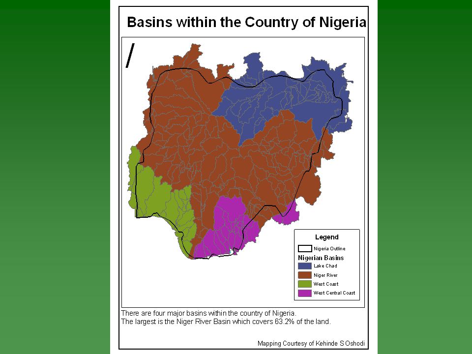
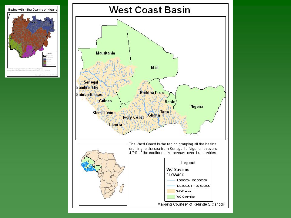
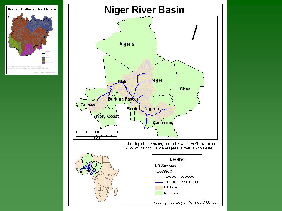
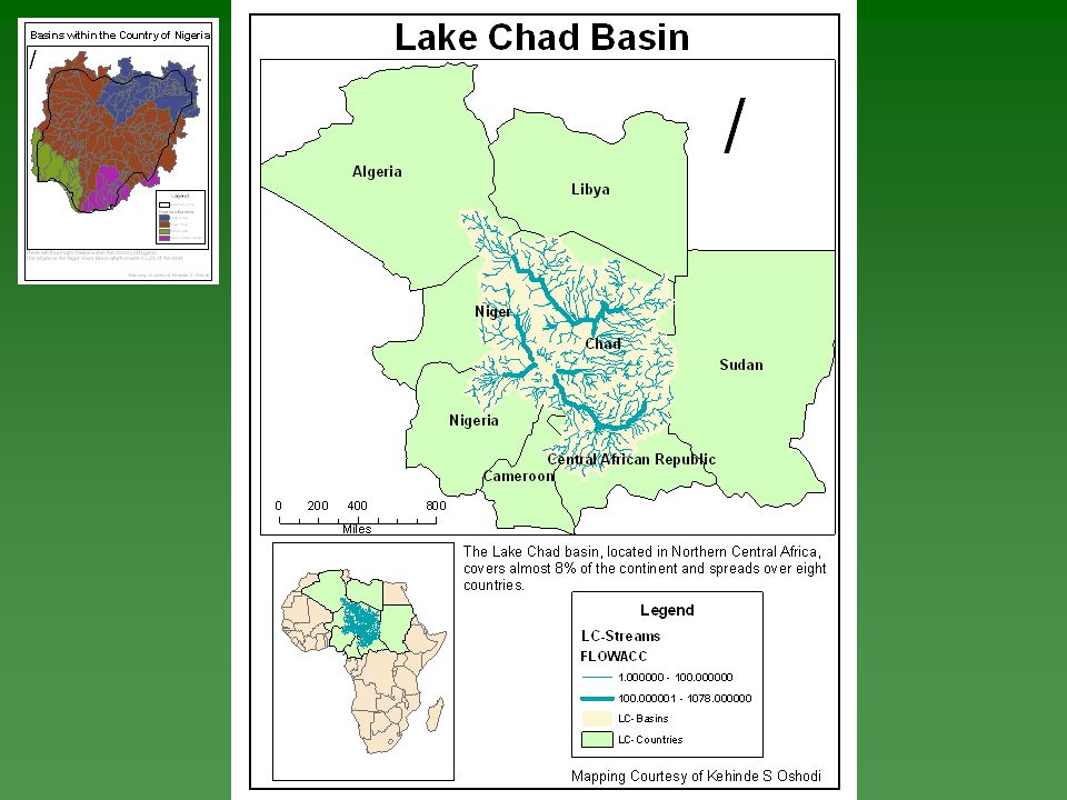
Geographical Location & Background Located in Western Africa Area 923,768 km 2 –1.4% Water –98.6% Land Land Use Population Hydraulic Description

10
Problems Water Quality Availability of Water Transboundary Issues Photo Courtesy of World Health Organization Photo Courtesy of BBC NEWS UK edition Photo Courtesy of Lake Chad Basin Commission Photo Courtesy of Niger Basin Authority

11
Solution Develop Nigeria Geodatabase for Hydrological Studies

12
Hydrological Analysis Analysis of Average Monthly Rainfall and Temperature from 1960 - 19901960 - 1990 Water Balance of Nigeria

13
Future Work Completed –Arc Hydro Geodatabase Further Work to be Done –Correct Coordinates and Upload remaining weather stations –Create Arc Hydro Framework –Complete Analysis –Finish Report

14
Acknowledgements Dr Maidment Ernest To Carlos Pintos Constance Danner Daniela Ortiz Aisha Otori

15
Questions

16
Take Home Message Created geodatabase to store information, analysis and model hydrology of Nigeria associate with real time.

Similar presentations


 Implementation at SFWMD Jim Cameron South Florida Water Management District.>")


>")
 January 18, 2006 Learning Objectives:>")


 V World Water Forum.>")


