Download presentation
Presentation is loading. Please wait.

1
How do we measure and forecast the weather?

2
Radar images can detect areas of rainfall and how heavy it is. RAINFALL

3
The heaviest rainfall is shown in red, green, yellow with blue being the lightest. RAINFALL

4
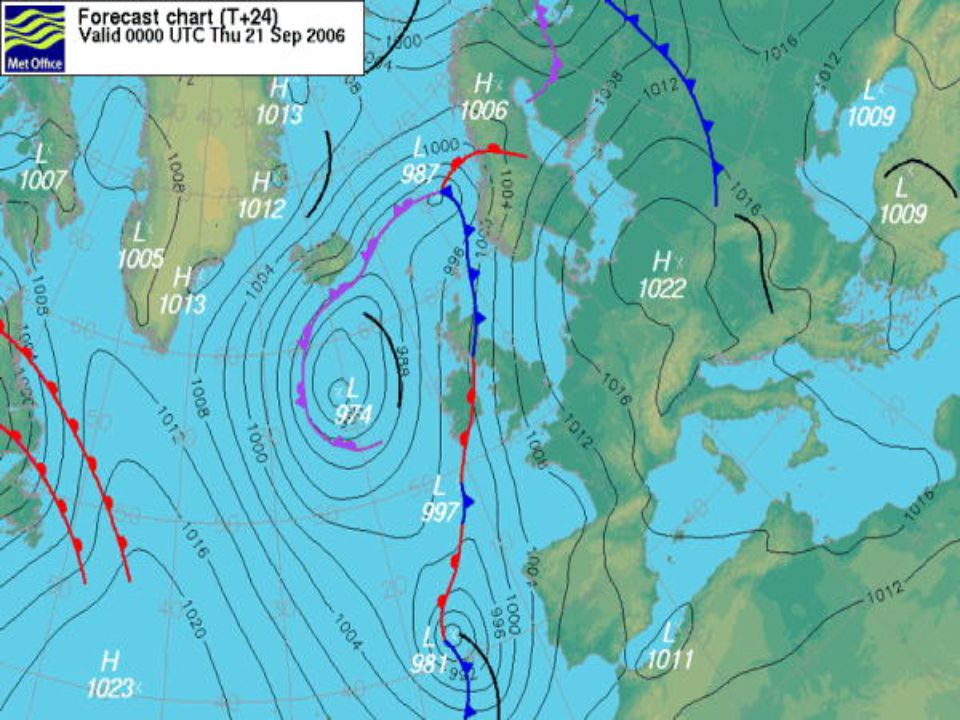
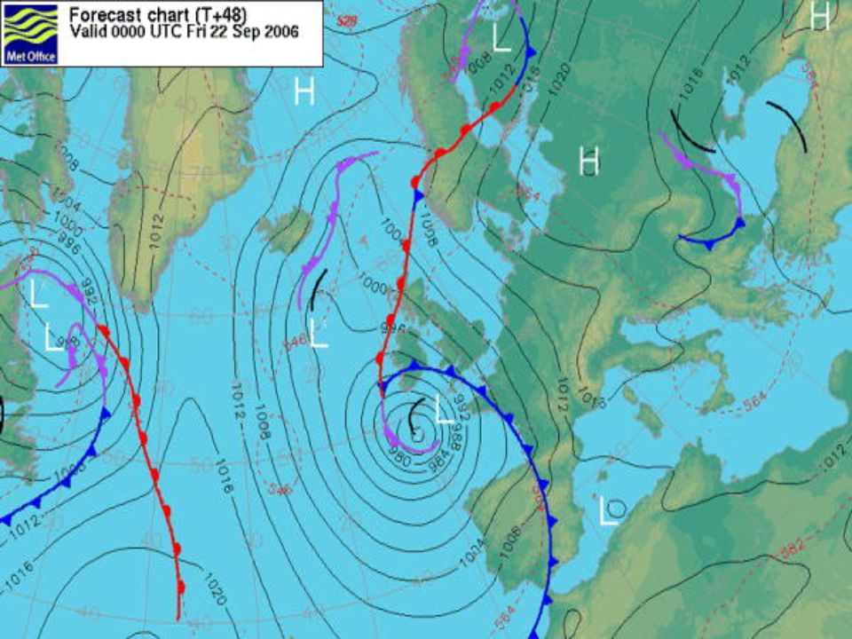
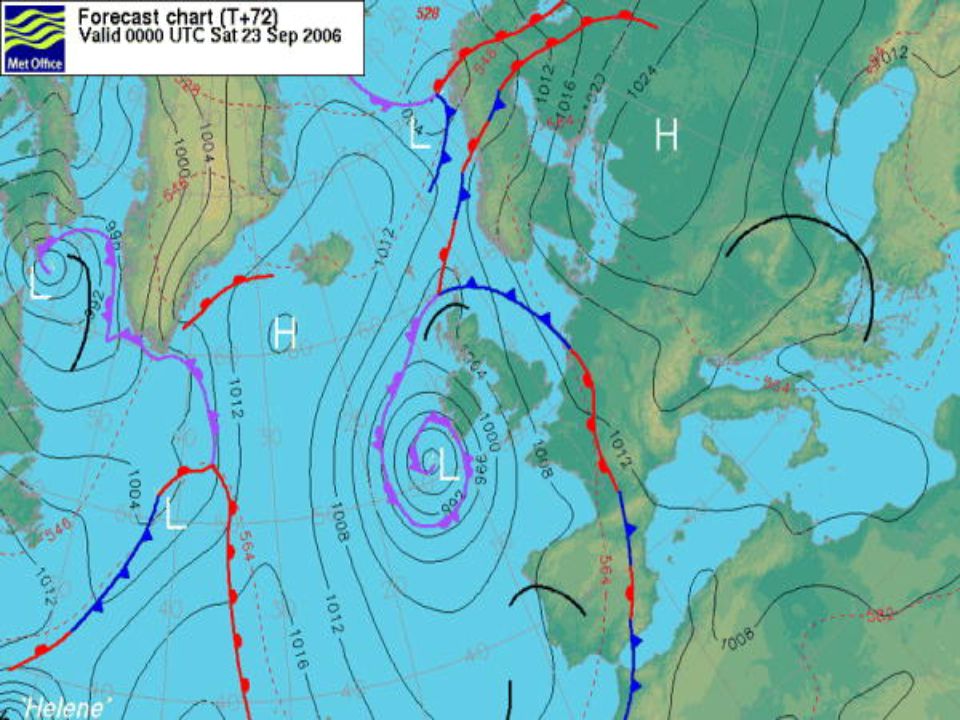
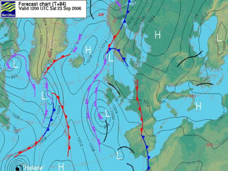
AIR PRESSURE Warm Front Isobars Wind blows from high to low pressure

5
WIND DIRECTION AND STRENGTH Moderate south easterly winds bringing warm, dry air

6
TEMPERATURE

7
WEATHER SUMMARY

8
A B C D E

9
Ridge of High Pressure Trough of Low Pressure Warm Front Cold Front Occluded Front

18
These images come from geostationary satellites. They record visible light from the sun reflected back to the satellite by cloud tops and land and sea surfaces. They are equivalent to a black and white photograph from space. However, visible pictures can only be made during daylight hours. Satellite Imagery

19
The infrared image shows the invisible infrared radiation emitted directly by cloud tops and land or ocean surfaces. The warmer an object is, the more intensely it emits radiation, thus allowing us to determine its temperature. Cooler temperatures show as lighter tones and warmer as darker. Lighter areas of cloud show where the cloud tops are cooler and therefore where weather features like fronts and shower clouds are. The advantage of infrared images is that they can be recorded 24 hours a day. Infra Red Imagery

Similar presentations


 The visible channel of the satellite measures light using the same wavelengths.>")

 Weather Satellite Interpretation 1. Visible satellite images are coded from black to white according to the amount of reflected.>")


>")


