Download presentation
Presentation is loading. Please wait.

1
Geography of the Himalaya Region
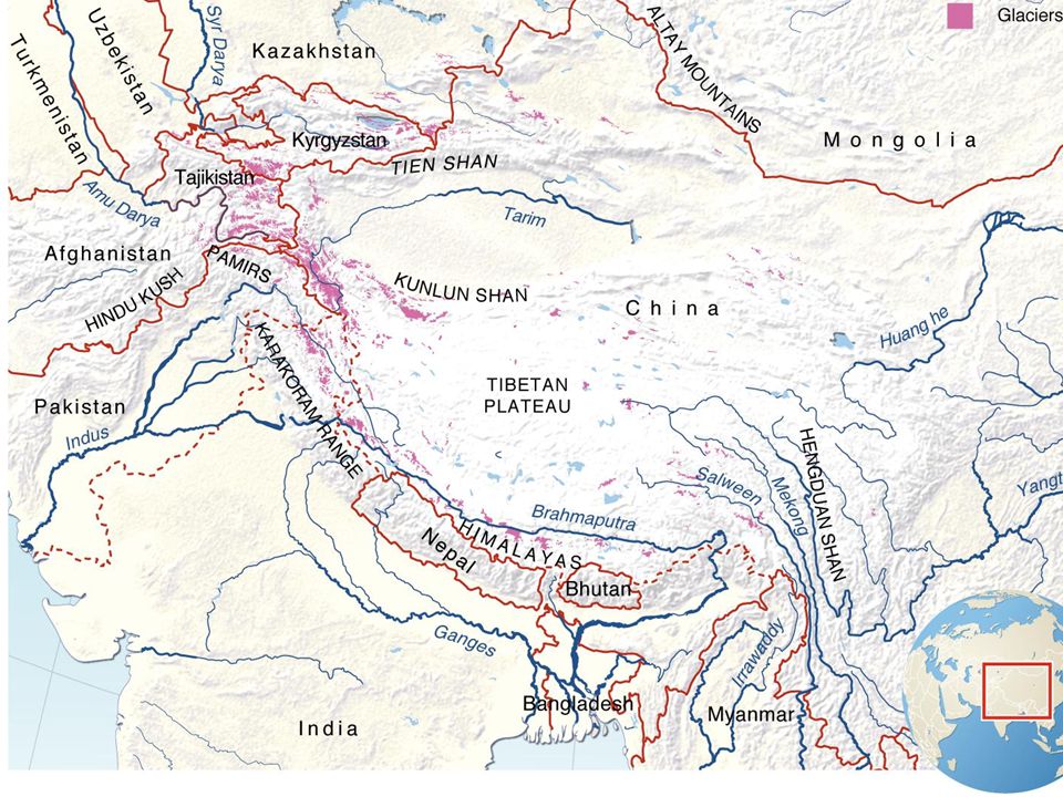
Using the map on the next slide, identify which countries include the Himalayas, and which major rivers have their source there.

3
Tibet July 28, 2011 Note: the provinces to the north and east of the Tibetan Autonomous Region also have populations of ethnic Tibetans.

4
Tibet Autonomous Region in relation to China & other countries
July 28, 2011

5
Map Activities Make a key and color each Himalayan country a different color. Which countries border Tibet to the south? Which country is Tibet a part of (unwillingly)? Which is further east, Nepal or Bhutan? Which country lies between Afghanistan & India? How many entities end in –stan? (Stan means Place or home of)
 Which is further east, Nepal or Bhutan Which country lies between Afghanistan & India How many entities end in –stan (Stan means Place or home of)")
6
Point out the predominantly Muslim countries that are partly in the Himalayas (hint: they all have the same last four letters) Point out the predominantly Hindu countries that are all or partly in the Himalayas. Point out the predominantly Buddhist countries.

7
Answers to previous slide:
Pakistan, Afghanistan, etc. are Muslim India and Nepal are Hindu Tibet, Burma and northern Nepal are Buddhist

8
Billions of people get their water from rivers that start in the Himalayas. What will be the impact of the Himalayan glaciers melting due to global warming?

9
Languages in the Himalayas
India – Indo-Aryan languages, such as Hindi, related to European languages Nepal – 50% Nepali, which is related to Hindi, and Tibeto-Burman languages along the north side, near Tibet. Tibet & Burma – Tibeto-Burman languages

Similar presentations