Download presentation
Presentation is loading. Please wait.

1
Rivers and Groundwater

2
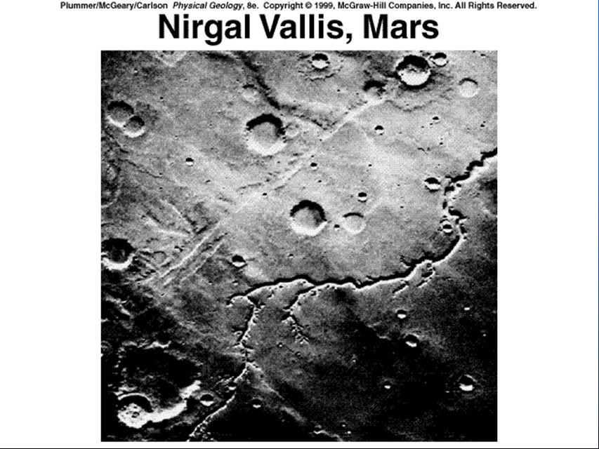
SURFICIAL PROCESSES n Erosion, Transportation, Deposition on the Earth’s Surface n Landscapes created and destroyed n Involves atmosphere, water, gravity n Agents: –Mass wasting (gravity), Running water (streams), glaciers (ice), wind, water waves, ground water
, Running water (streams), glaciers (ice), wind, water waves, ground water")
3
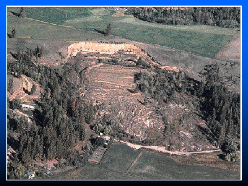
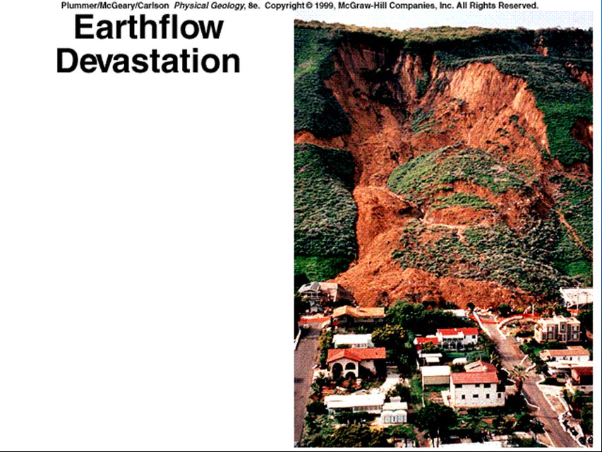
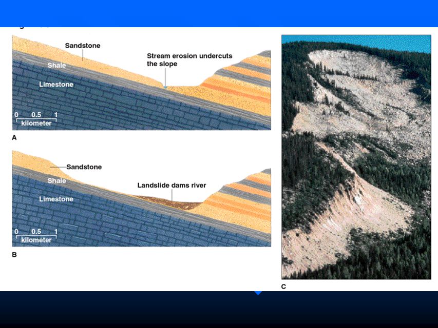
MASS WASTING n Masses of debris (mud, sand, gravel) or bedrock moving downhill n Landslides and slower movements n Driven by GRAVITY
 or bedrock moving downhill n Landslides and slower movements n Driven by GRAVITY")
6
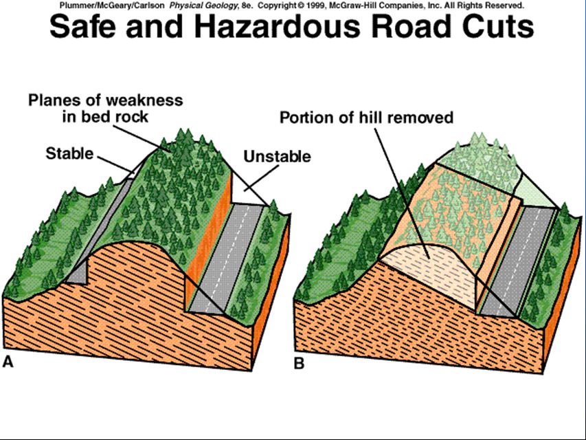
Controlling Factors n Slope angle- gentle vs steep n Local relief- low vs high n Thickness of debris over bedrock- slight vs great n Planes of weakness ( in bedrock) –bedding planes; foliation; joints –planes at right angle to slope vs parallel to slope most dangerous
 –bedding planes; foliation; joints –planes at right angle to slope vs parallel to slope most dangerous")
12
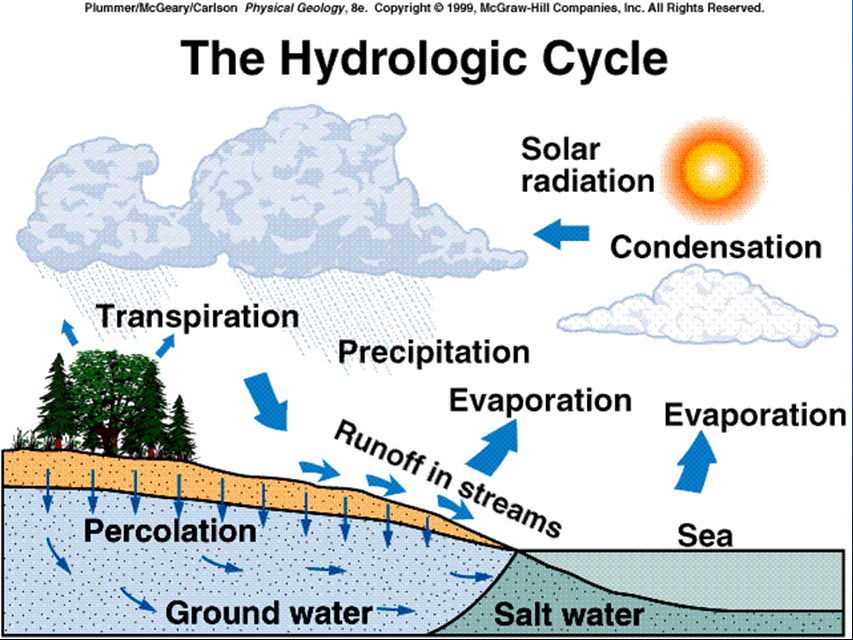
The Hydrologic Cycle n n Powered by the Sun n n Evaporation primarily from tropical oceans n n Evapotranspiration- from surface water & plants n n Condensation- clouds n n Precipitation n n Runoff- from the land n n Infiltration/Percolation into soil and rocks

13
Water Reservoirs n Oceans- 97% n Ice caps and Glaciers- 2.15% n Groundwater- 0.62% n Lakes- 0.017% n Soil Moisture- 0.005% n Streams- 0.0001% n Atmosphere- 0.001%

17
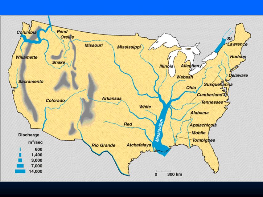
Drainage Basins n n Tributary n n Divide

20
Drainage Patterns n n Dendritic n n Radial n n Rectangular n n Trellis

22
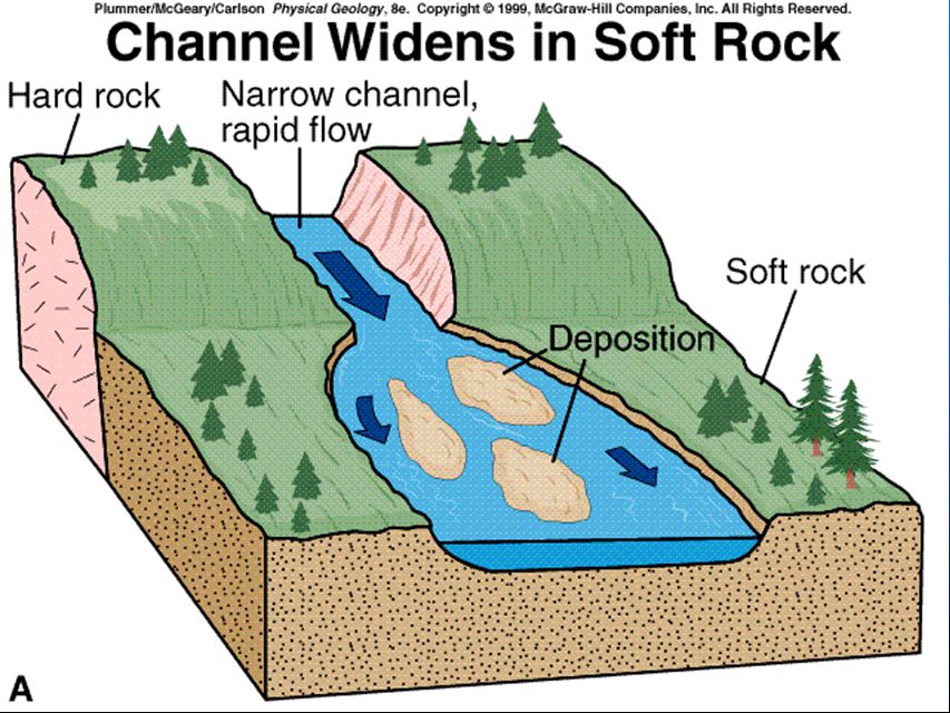
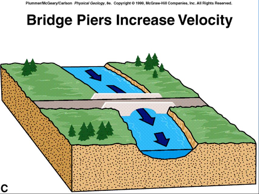
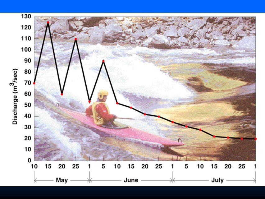
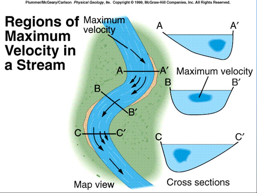
Factors Affecting Stream Erosion and Deposition n n Velocity n n Gradient n n Channel Shape and Roughness n n Discharge

26
Factors Affecting Stream Erosion and Deposition n n Velocity n n Gradient n n Channel Shape and Roughness n n Discharge

31
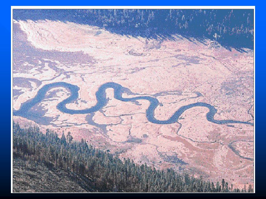
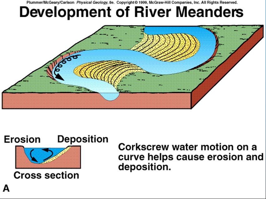
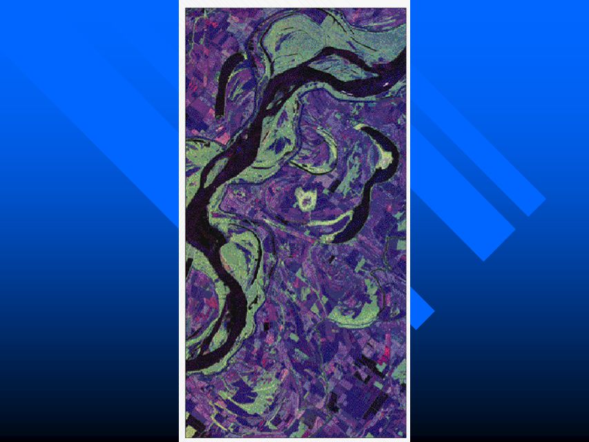
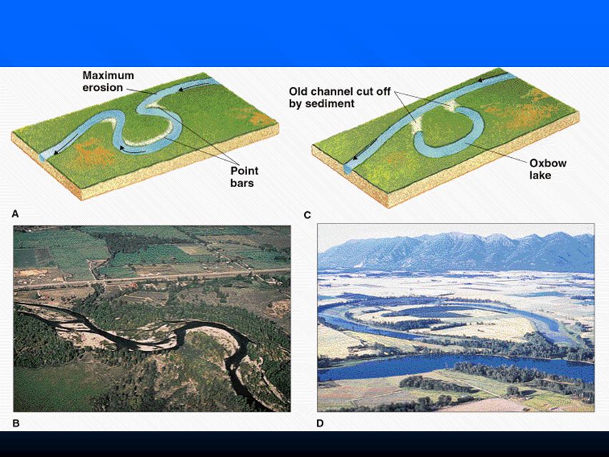
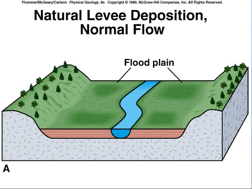
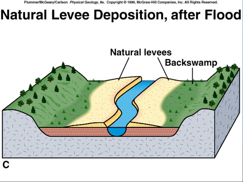
Meandering Streams and Point Bars n n Meanders n n Point Bar n n Meander Cutoff – – Oxbow Lake n n Flood Plains – – Natural Levees

35
Meandering Streams and Point Bars n n Meanders n n Point Bar n n Meander Cutoff – – Oxbow Lake n n Flood Plains – – Natural Levees

37
Meandering Streams and Point Bars n n Meanders n n Point Bar n n Meander Cutoff – – Oxbow Lake n n Flood Plains – – Natural Levees

40
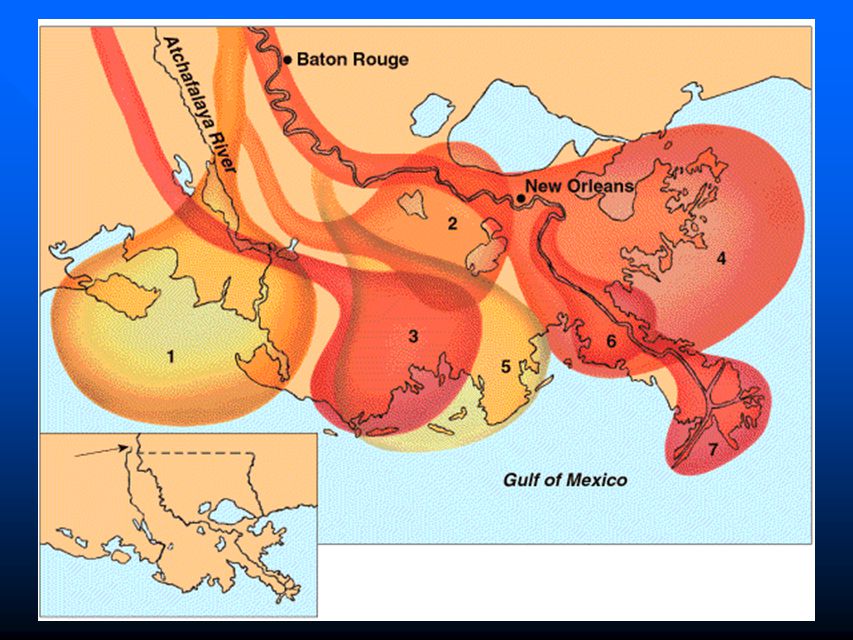
DELTAS

42
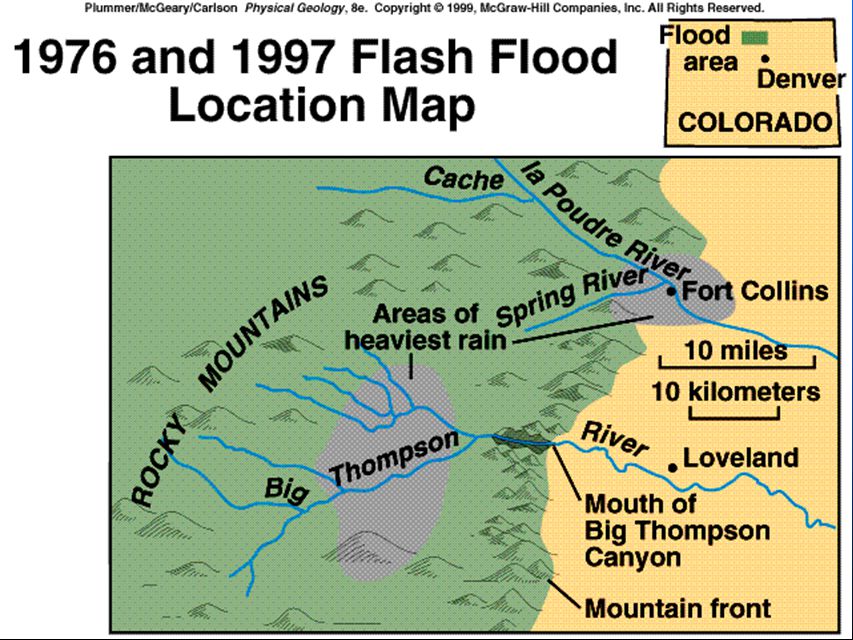
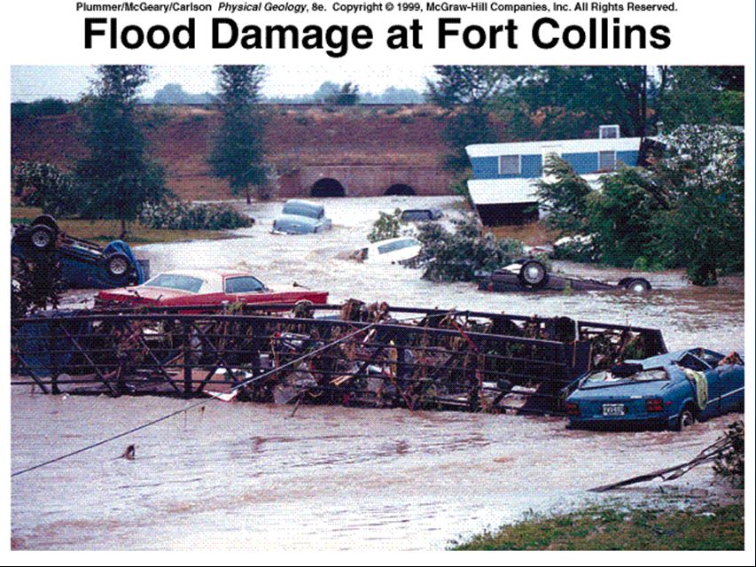
Flooding n n Flooding n n Urban Flooding n n Flash Floods n n Controlling Floods n n The Great Flood of 1993

48
Flooding n n Controlling Floods n n The Great Flood of 1993

50
The Great Flood of 1993 n Excessive rain in upper midwest n 6.6 million acres in 9 states flooded n Discharge exceeded 100-year discharges on many rivers –At St. Louis Mississippi Q=1,000,000 cfs –River Stage 20 ft above flood stage n 38 deaths n $17 billion in losses

51
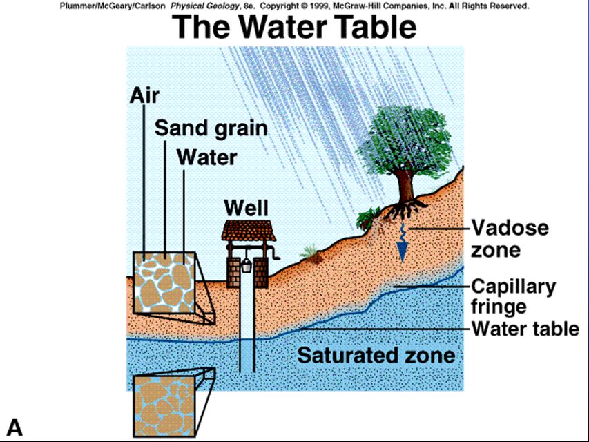
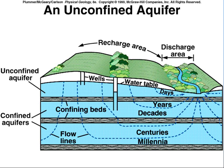
Groundwater n What happens to precipitation once it reaches the ground –infiltration –percolation n Water filling pore space, cracks & crevices in rocks- Porosity n Aquifer- Geologic unit that can store, transmit and yield appreciable amounts of water

53
Porosity and Permeability n Porosity – % of rock or sediment that is open (void spaces) – ability to hold water n Permeability- ability to transmit water
 – ability to hold water n Permeability- ability to transmit water")
55
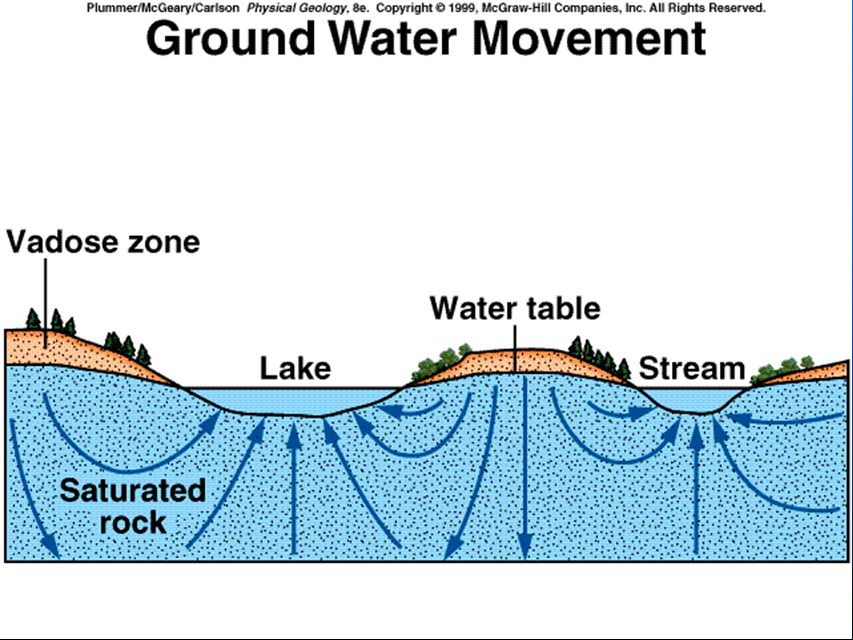
Movement of ground water n Moves in response to differences in water pressure & elevation n Velocity influenced by – Slope of water table – Permeability

57
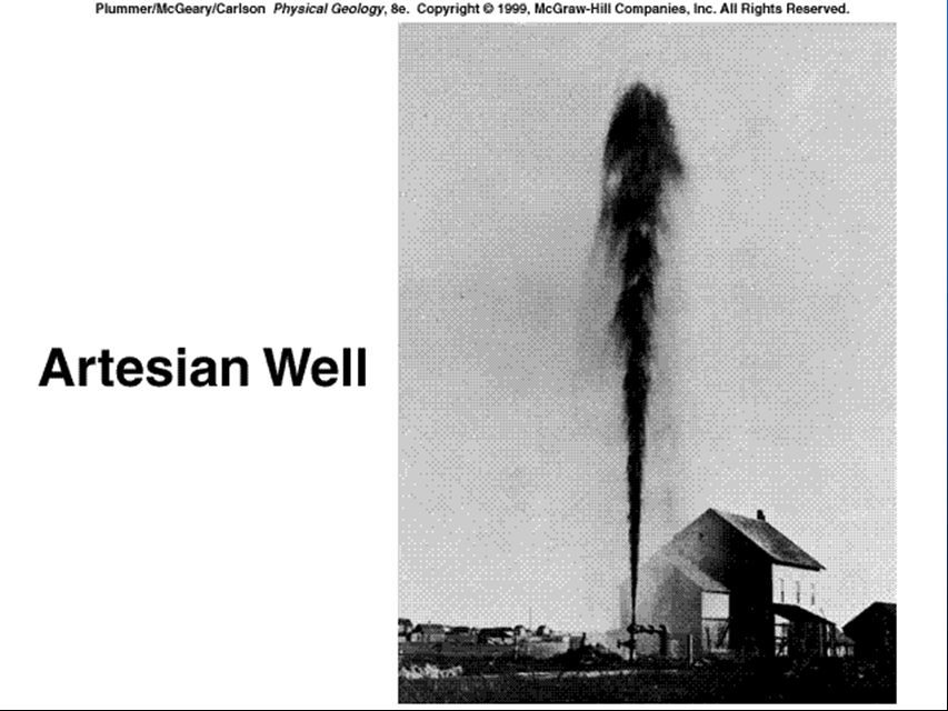
Aquifers n Geologic unit that can store, transmit and yield appreciable amounts of water n Highly permeable & saturated with water – Good aquifers n Aquitards- impermeable n Unconfined aquifer –open to atmosphere n Confined aquifer –under pressure –artesian- flows w/o being pumped

60
Wells n Penetrate aquifer within the saturated zone n Water table rises and falls during seasons – Recharge n Cone of depression – Drawdown n Artesian well- no need to pump – Artesian aquifer

62
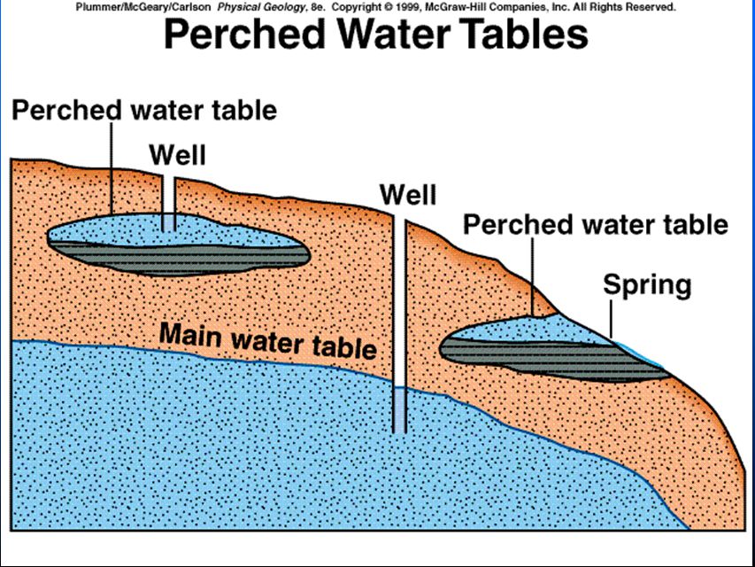
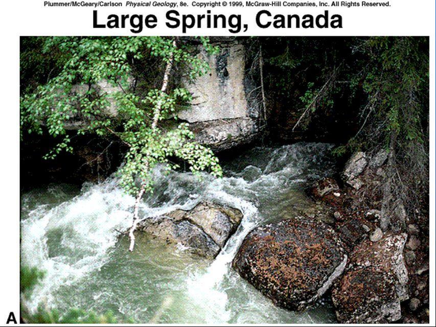
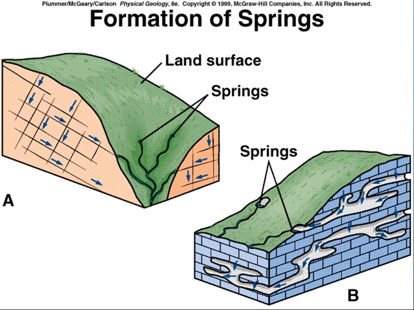
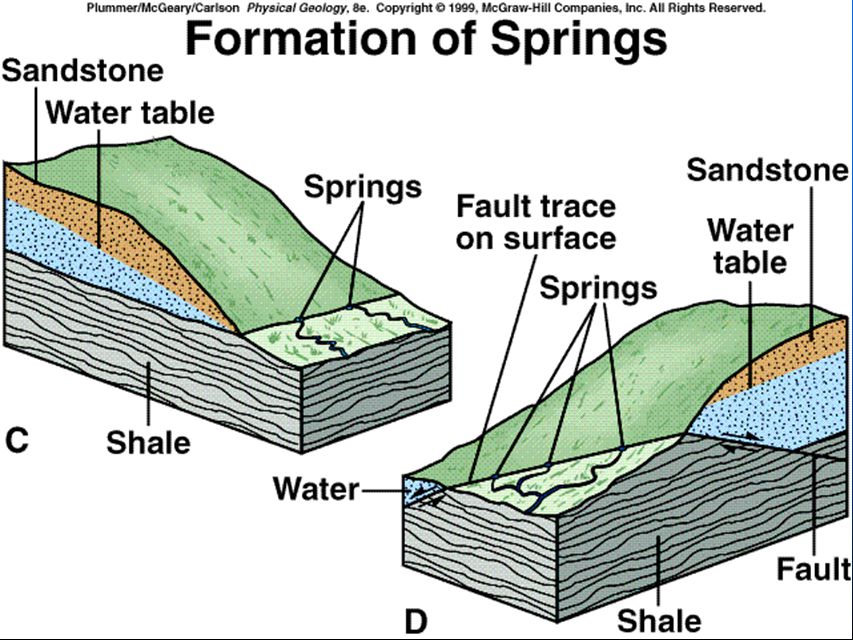
Springs and Streams n Spring –Water table intersecting hillside n Gaining stream= Effluent Stream n Losing stream= Influent Stream

68
Springs and Streams n Spring –Water table intersecting hillside n Gaining stream= Effluent Stream n Losing stream= Influent Stream WT

69
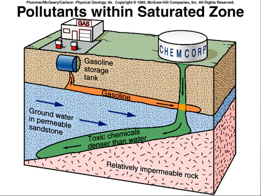
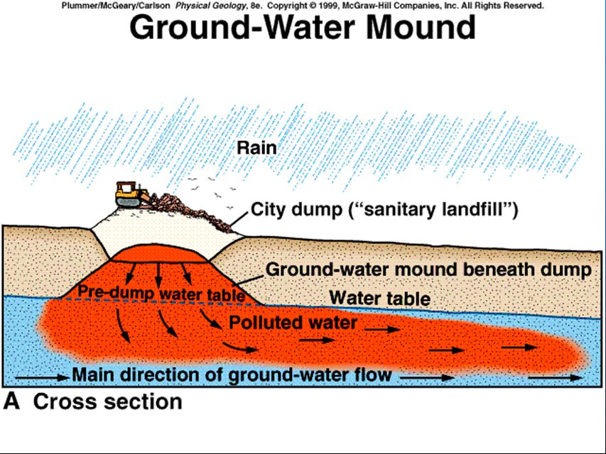
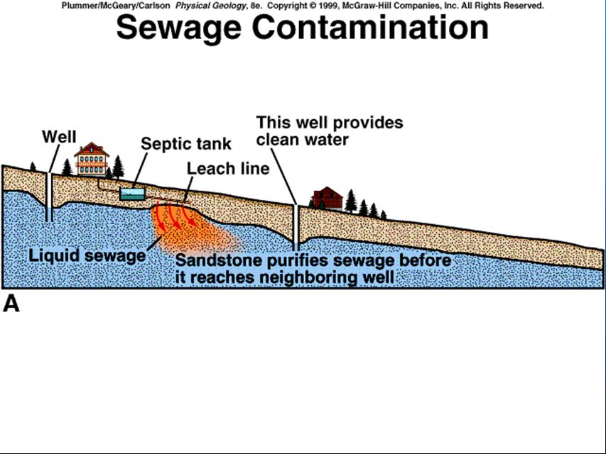
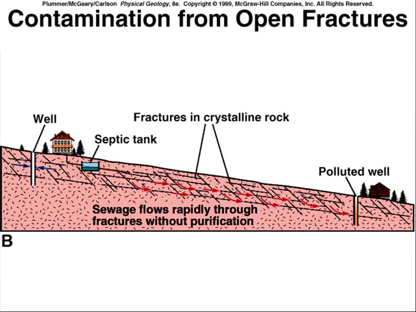
Pollution of Ground Water n Pollutants –Chemicals »Gasoline » Pesticides & herbicides » Fertilizers » Heavy metals – Bacteria, viruses, parasites- Sewage – Acid mine drainage – Radioactive waste – Natural pollution

76
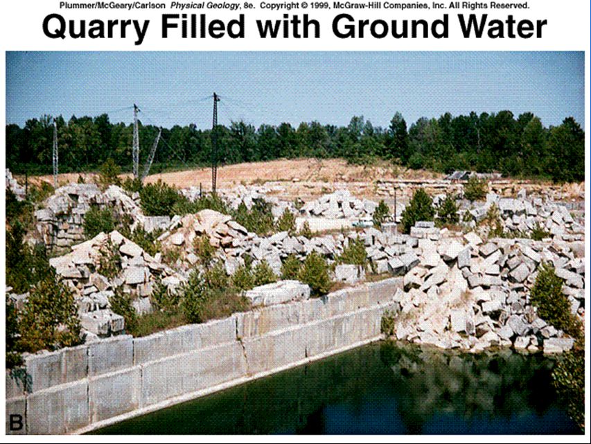
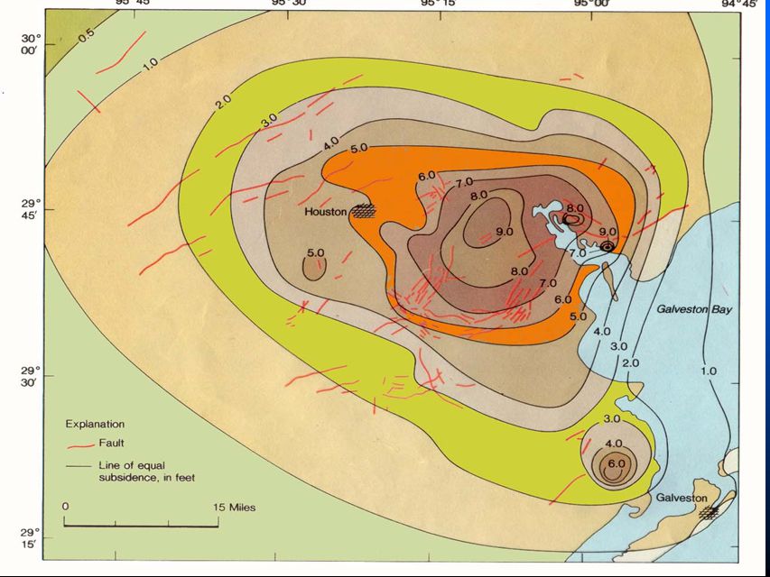
Balancing Withdrawal & Discharge n Overpumping results in: – Falling water table – Ground subsidence n Artificial recharge

77
Subsidence of land caused by extraction of groundwater in the San Juaquin Valley, CA The land sank 9m or 30 ft in 52 years

79
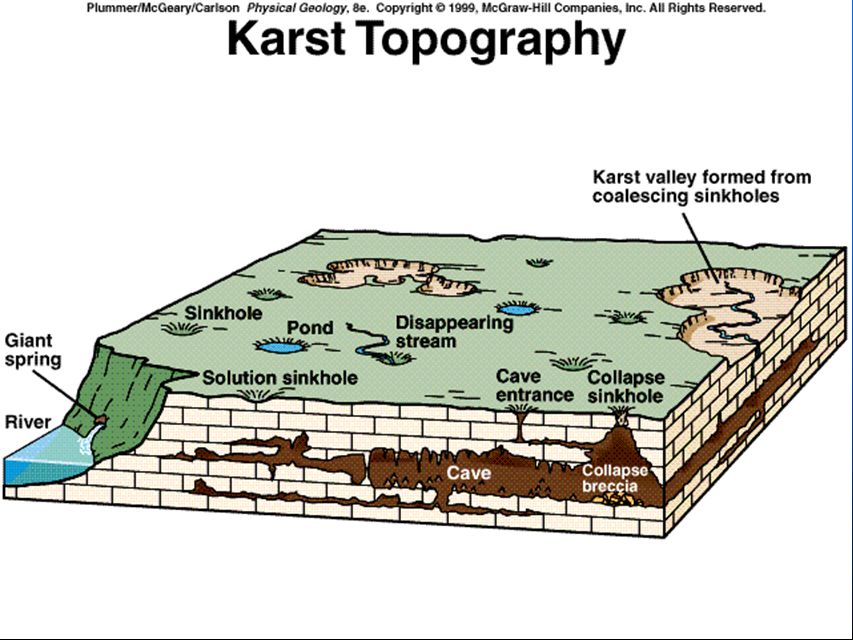
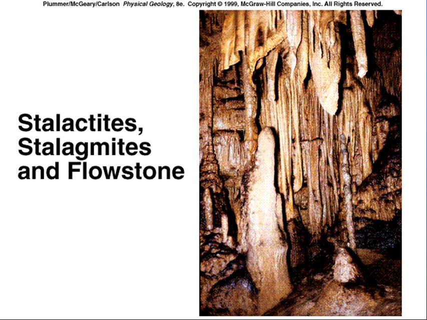
Effects of Groundwater Action n Karst topography -Caves – Rock usually limestone – Dissolves by weakly acidic water n rainwater pH 5.5 and carbonic acid from humus – Dripstone- Speleothem » stalagtite » stalagmite – Flowstone –Sinkholes

84
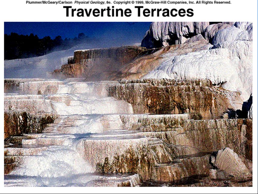
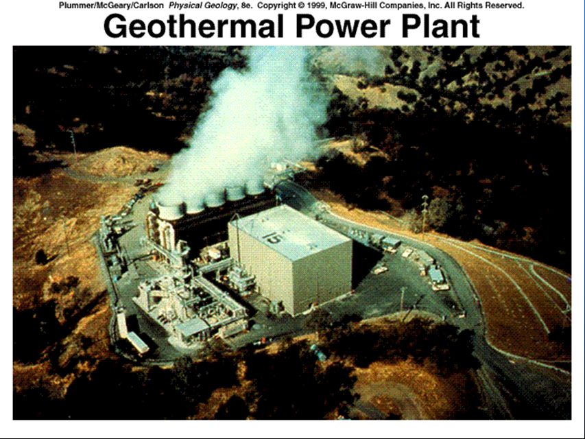
Hot Water Underground n Hot springs – Near magma or cooling igneous rocks – Deep-circulating groundwater or n Geyser n Precipitation of dissolved ions – Travertine- calcite – Sinter- silica n Mudpot n Geothermal Energy

87
Hot Water Underground n Hot springs – Near magma or cooling igneous rocks – Deep-circulating groundwater or n Geyser n Precipitation of dissolved ions – Travertine- calcite – Sinter- silica n Mudpot n Geothermal Energy

Similar presentations


 – 97 % –Freshwater trapped in.>")


