Download presentation
Presentation is loading. Please wait.

1
Unmanned Aircraft Systems Research in California State Parks California Natural Resources Agency – GIS Day 2014 Sacramento, November 13

2
In brief: UAS research in California State Parks focuses on safety, accuracy, and efficiency of UAS operations Land surveys, Facilities Management, and Resource Monitoring Programs are early adopters at CA Parks Priority sites are ‘approvable’ relatively remote areas, controlled access, diversity of terrain elevations and cover types. Re: COA: Dot every i and cross every t about the site, the aircraft, and the mission. And have lots of patience…

4
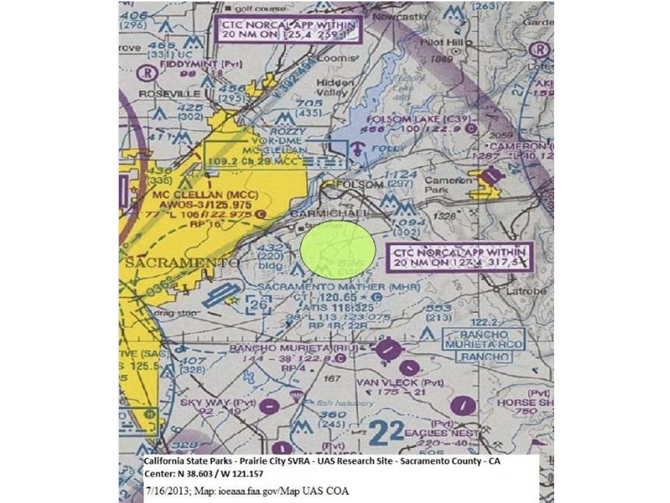
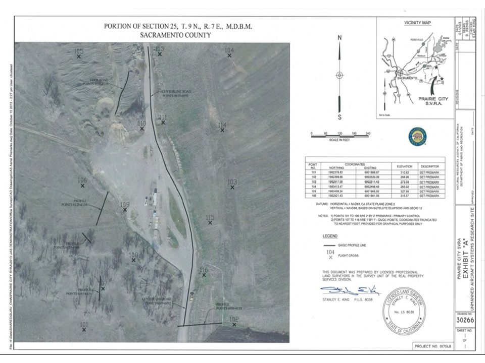
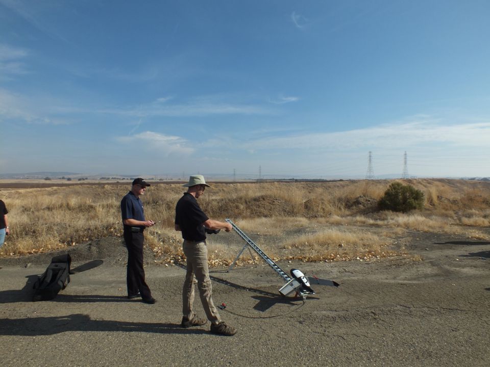
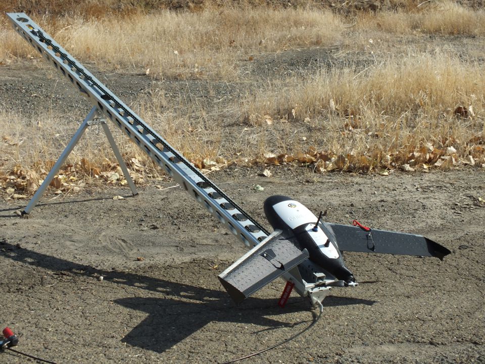
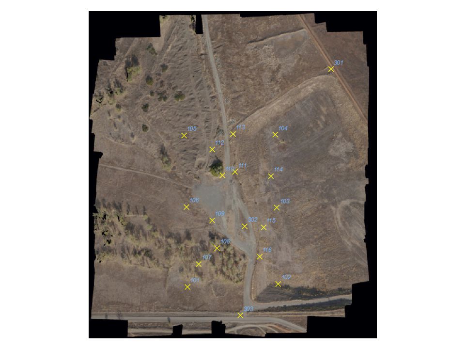
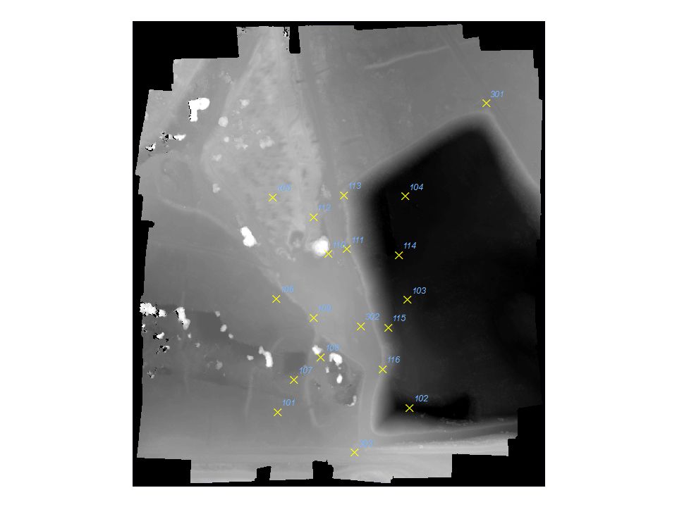
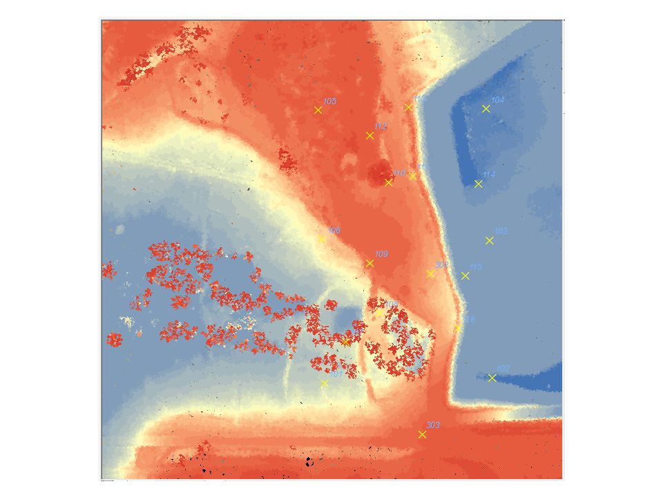
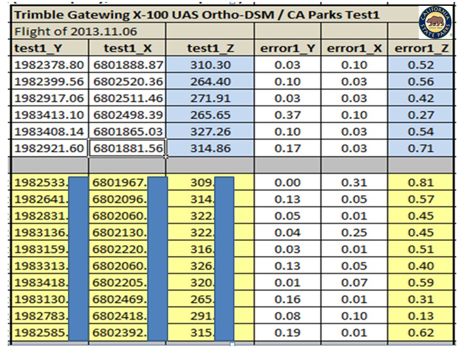
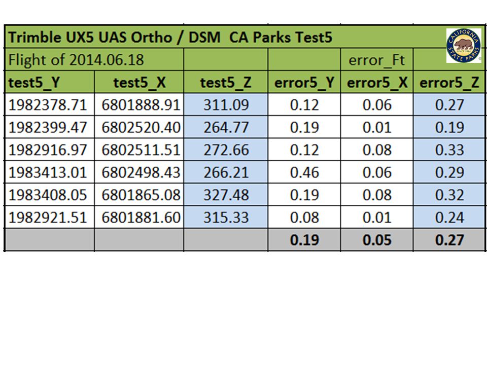
Time Line Start: CA State Park Director’s Action Request, Fall, 2012 Winter, 2013: California State Attorney General letter (1) to FAA verifying Parks as a State Agency; State Parks Chief Counsel letter (2) affirmed to FAA no UAS for commercial purposes—CA Parks now eligible to apply for a COA. Trimble Navigation agreed to a no-cost demo. The Prairie City Chief Ranger allowed use of a closed area of the Park (under gravel mine rehabilitation) for the critical Range Approval. July, 2013: A complete Land Survey of Prairie City site by CA State Parks Surveys 16 photo targets over a 60-acre area; Prairie City SVRA, Rancho Cordova, CA October, 2013: CalTrans – Towill Helicopter LiDAR collect November, 2013: California Surveying & Drafting Supplies, Inc coordinated post- processing facilities and provided carpool transportation and amenities for some 36 people. Trimble Gatewing X-100 flight was a textbook success: 15 minutes airtime, 60 acres, 150+ images; 4 hours post; better than 1-ft xyz accuracy orthophoto and DSM. June 2014: Trimble UX-5, textbook replica of November flight. Camera resolution upgraded, accuracy gains, faster production (aircraft power upgrade) & post speed.
 for the critical Range Approval. July, 2013: A complete Land Survey of Prairie City site by CA State Parks Surveys 16 photo targets over a 60-acre area; Prairie City SVRA, Rancho Cordova, CA October, 2013: CalTrans – Towill Helicopter LiDAR collect November, 2013: California Surveying & Drafting Supplies, Inc coordinated post- processing facilities and provided carpool transportation and amenities for some 36 people. Trimble Gatewing X-100 flight was a textbook success: 15 minutes airtime, 60 acres, 150+ images; 4 hours post; better than 1-ft xyz accuracy orthophoto and DSM. June 2014: Trimble UX-5, textbook replica of November flight. Camera resolution upgraded, accuracy gains, faster production (aircraft power upgrade) & post speed..")
5
Folsom Lake Downton Sacramento

17
Take Home Points UAS research in California State Parks Safety Accuracy Efficiency And have lots of patience

18
Thank you Acknowledgments CA State Parks, Park Operations, Land Surveys, FAA COA Review Teams, Trimble Navigation, California Surveying & Drafting Supplies Inc, CalTrans Photogrammetry, Towill Inc, and Prairie City SVRA Park Rangers. Author Paul Veisze Geographic Information Officer California State Parks Paul.Veisze@parks.ca.gov 916-949-3327

Similar presentations


>")


 mapping provided for the United States International Boundary and Water Commission (USIBWC) – established.>")


