Download presentation
Presentation is loading. Please wait.

1
Traveling Peru

2
Peru Map and Trip Itinerary Machu Picchu

3
Old man playing guitar in a restaurant at Paracas beach, Pisco

4
“El Candelabro”, ancient giant drawing (geogliph) near Paracas, Pisco
 near Paracas, Pisco")
5
Penguins colony on Ballestas Island, Paracas National Reserve, Pisco

6
Wild life on Ballestas Island, Paracas National Reserve, Pisco

7
Sea lions laying in the sun on Ballestas Island, Paracas National Reserve, Pisco

8
Huacachina Oasis, Ica

9
Preparing for sandboarding on the desert dunes near Huacachina Oasis, Ica

10
“Freestyle” sandboarding on the desert dunes near Huacachina Oasis, Ica

11
Desert dunes landscape near Huacachina Oasis, Ica

12
Dune buggy after extreme desert dune ride near Huacachina Oasis, Ica

13
“The Astronaut” geogliph, Nazca Lines Area, Nazca

14
“The Hummingbird” geogliph, Nazca Lines Area, Nazca

15
Secondary street in Cuzco, the Inca Empire Capital (elevation 3,200 meters)
")
16
Plaza del Armas, Cuzco

17
Women handcrafting in open market, Pisac, Sacred Valley

18
Group of girls in open market, Pisac, Sacred Valley

19
Little girl looking for her mother, Pisac, Sacred Valley

20
Machu Picchu, the lost Inca citadel, one of the most beautiful and enigmatic ancient sites in the world

21
Terraces for agriculture at Machu Picchu

22
Machu Picchu and Urubamba river canyon

23
Walking pigs in Ollaytantambo, Sacred Valley

24
Group of men in Ollaytantambo, Sacred Valley

25
Traditional dressed woman, Ollaytantambo village, Sacred Valley

26
Sunrise on Lake Titicaca, Puno (elevation 3,820 meters)
")
27
Floating islands (Uros) community, Lake Titicaca
 community, Lake Titicaca")
28
Family preparing cookies for tourists on floating island Chumi, Lake Titicaca

29
Woman selling handicrafts on floating island Chumi, Lake Titicaca

30
Traditional boat made of tortora reed, near floating island Chumi, Lake Titicaca

31
Woman handcrafting, Amantani Island, Lake Titicaca

32
Afternoon landscape, Amantani Island, Lake Titicaca

33
Woman selling handicrafts on the path to Amantani Island summit

34
Sunset on Amantani Island, Lake Titicaca

35
View of Amantani Island from Taquile Island, Lake Titicaca

36
Woman handcrafting on Taquile Island, Lake Titicaca

37
Woman selling handicrafts on a street in Arequipa

38
Wild animals (Vicunas) in Peruvian “Pampa” (elevation 4,200m), near Arequipa
 in Peruvian Pampa (elevation 4,200m), near Arequipa")
39
View of “El Misti” volcano, a 5,900 meters summit

40
Girl with “baby” alpaca in the Peruvian pampa

41
Small handicrafts market in pampa

42
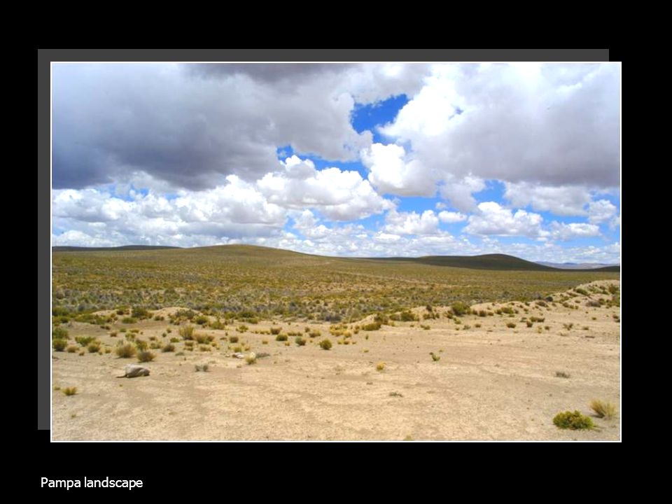
Pampa landscape

44
Highest viewpoint (4,910 meters elevation) on the way to Chivay village, Colca Valley
 on the way to Chivay village, Colca Valley")
45
Traditional dance at the evening tourist party in Chivay village, Colca Valley, Arequipa area

46
Road to Canyon del Colca

47
Inca terraces along Colca river, still fully used for agriculture

48
Inca terraces along Colca river

49
“Condor viewpoint”, Canyon del Colca, one of the deepest canyons in the world

50
“Condor viewpoint”, Canyon del Colca

52
Little girl asking for candies, Colca Valley

53
Little girl selling handicrafts, Colca Valley

54
Abandoned restaurant in the desert, on the way to Chilean border

55
“Candelabro” giant cactus, north of Atacama Desert, Chile

56
Wild Vicunas in Parque Nacional Lauca, Chile

57
Lago Chungara, one of the highest lakes in the world at 4,500 meters, Parque Nacional Lauca, Chile

58
Lago Chungara and volcano Paranicota, Parque Nacional Lauca, Chile

59
Some facts… Total days spent on the continent: 20 Total money spent (excluding the air ticket, including gifts for home): 950 USD Traveled approx. 4,000 km by bus, taxi and train Main source of information: Lonely Planet guide Temperature range during the trip: 2 to 40 degrees Celsius Average cost of accommodation: 5 USD per person/night Average cost of a meal: 2.5 USD per person Average taxi ride: 0.8 USD

60
And some experiences… Most impressive place: Machu Picchu ruins (despite its popularity and high cost) Most breathtaking place: Canyon del Colca Most peaceful place: Amantani and Taquile islands, Lake Titicaca Funniest happening: laying in the bed up to 11 AM in the middle of the desert, thinking it is heavily raining outside – because of the “rain like” noise of a damaged toilet Most extreme adventure: riding the desert huge sand dunes with speeds of up to 120km/h, on 40 degrees sand slopes, in a dune buggy (like a roller-coaster without rails) Most expensive: getting to Machu Picchu ruins (about 110 USD for transportation and entrance only) Highest elevation reached: 4,910 meters above sea level Best value for money: Lake Titicaca tour (2 days, including: meals, 6 hours boat trip, 3 spots visited, accommodation in villagers’ houses, traditional party, bi-lingual guiding, all for only 15 USD) Most unusual experience: policemen discreetly watching our back for thieves in Lima, for about 2 hours, just because we were tourists carrying expensive cameras.
 Most breathtaking place: Canyon del Colca Most peaceful place: Amantani and Taquile islands, Lake Titicaca Funniest happening: laying in the bed up to 11 AM in the middle of the desert, thinking it is heavily raining outside – because of the rain like noise of a damaged toilet Most extreme adventure: riding the desert huge sand dunes with speeds of up to 120km/h, on 40 degrees sand slopes, in a dune buggy (like a roller-coaster without rails) Most expensive: getting to Machu Picchu ruins (about 110 USD for transportation and entrance only) Highest elevation reached: 4,910 meters above sea level Best value for money: Lake Titicaca tour (2 days, including: meals, 6 hours boat trip, 3 spots visited, accommodation in villagers’ houses, traditional party, bi-lingual guiding, all for only 15 USD) Most unusual experience: policemen discreetly watching our back for thieves in Lima, for about 2 hours, just because we were tourists carrying expensive cameras.")
61
All pictures in this presentation are copyright protected. Usage of any of these pictures in any commercial material without the author’s permission is strictly prohibited. Thank you! © 2005 Tibi Dima Image enhancement: Leão Pelado Leão Pelado

Similar presentations


 What is “Math”? What.>")


, Quechua (official), Aymara, many minor Amazonian languages, English.>")

