Download presentation
Presentation is loading. Please wait.

7
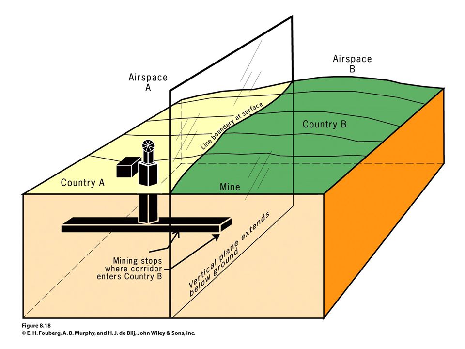
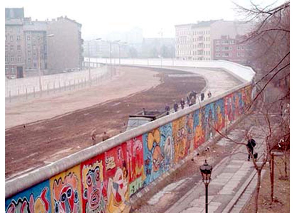
geometric boundary

9
physical-political boundary

10
Friedrich Ratzel German School: lebensraum

11
Germany starts WWII

12
Sir Halford Mackinder’s Heartland Theory

25
Nichols Spyman’s Rimland Theory

26
Cooperation vs…

27
Unilateralism: Vietnam
United States 58,220 dead; 303,644 wounded South Korea 5,099 dead; 10,962 wounded; 4 missing Australia 500 dead; 3,129 wounded Thailand 351 dead;1,358 wounded New Zealand 37 dead; 187 wounded Philippines 9 dead

28
1. Compact States: Efficient
In a compact state, the distance from the center to any boundary does not vary significantly. The ideal theoretical compact state would be shaped like a circle, with the capital at the center and the shortest possible boundaries to defend. Examples: Burundi, Kenya, Rwanda, and Uganda

29
2. Prorupted States: Access or Disruption
An otherwise compact state with a large projecting extension is a prorupted state. Proruptions are created for 2 reasons: Access to a resource such as water They can also separate two states that otherwise would share a boundary.

30
3. Elongated States: Potential Isolation
There are a handful of elongated states, or states with a long and narrow shape. Elongated states may suffer from poor internal communications. Other examples are Italy, Gambia, Malawi

31
4. Fragmented States: Problematic
A fragmented state includes several discontinuous pieces of territory. 2 kinds: those areas separated by water, and those separated by an intervening state.

32
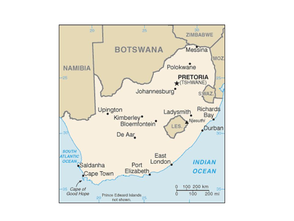
5. Perforated States: South Africa
A state that completely surrounds another is a perforated state.

33
1. Compact States: Efficient
In a compact state, the distance from the center to any boundary does not vary significantly. The ideal theoretical compact state would be shaped like a circle, with the capital at the center and the shortest possible boundaries to defend. Examples: Burundi, Kenya, Rwanda, and Uganda

34
Compact State - Rwanda

35
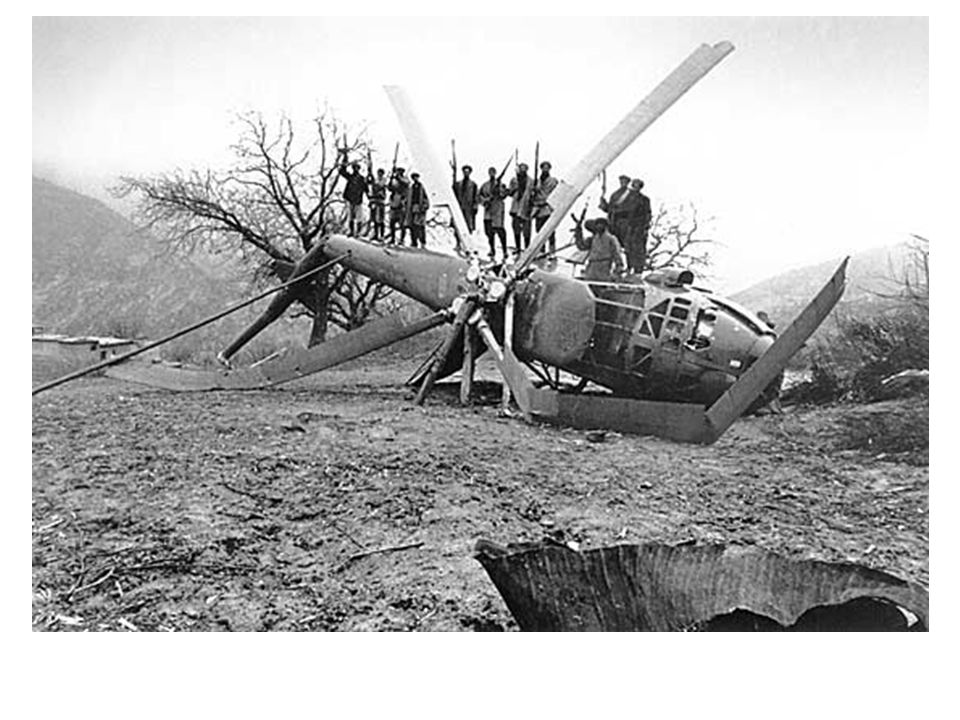
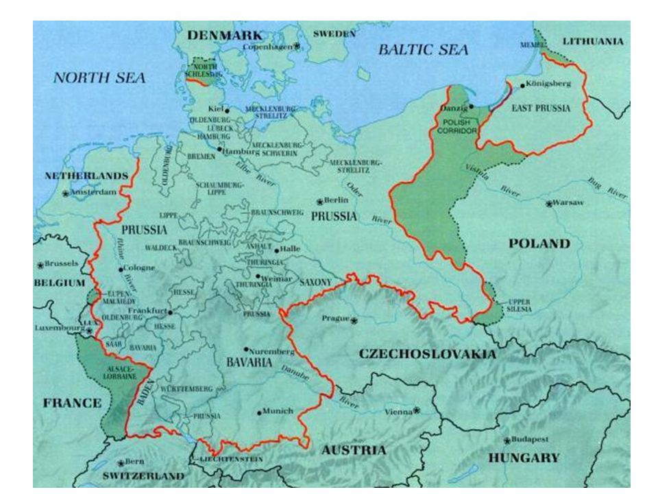
2. Prorupted States: Access or Disruption
An otherwise compact state with a large projecting extension is a prorupted state. Proruptions are created for 2 reasons: Access to a resource such as water They can also separate two states that otherwise would share a boundary.

36
When the British ruled the otherwise compact state of Afghanistan, they created a long, narrow proruption to the east that was to prevent Russia from sharing a border with Pakistan.

37
3. Elongated States: Potential Isolation
There are a handful of elongated states, or states with a long and narrow shape. Elongated states may suffer from poor internal communications. Other examples are Italy, Gambia, Malawi

39
4. Fragmented States: Problematic
A fragmented state includes several discontinuous pieces of territory. 2 kinds: those areas separated by water, and those separated by an intervening state.

41
The most extreme example is Indonesia, made up of 13,677 islands.

42
5. Perforated States: South Africa
A state that completely surrounds another is a perforated state. The one good example is South Africa which completely surrounds the state of Lesotho. Lesotho must depend entirely on South Africa for the import and export of goods.

44
Fragmented States The most extreme example is Indonesia, made up of 13,677 islands. The fragmentation hinders communications makes integration of of people living on remote islands nearly impossible. A difficult type of fragmentation occurs if the 2 pieces of territory are separated by another state. Imagine the difficulty of communicating between Alaska and the lower 48 if Canada were not a friendly neighbor. The division of Angola into two pieces by Congo’s proruption creates a fragmented state. Russia is fragmented by other independent states. Kalingrad is along the Baltic Sea.

45
Fragmented States An unusual case of fragmentation is in India on a tiny strip of land called Tin Bigha. The Tin Bigha corridor measures only 600 feet by 300 feet. It fragments Dhagram and Angarpota from the rest of Bangladesh. The problem is a legacy of the British who divided the region according to religion with Hindu enclaves to India and Muslim enclaves to Bangladesh. India agreed to lease the Tin Bigha corridor to Bangladesh. This created another fragmentation - Cooch Behar from the rest of India.

Similar presentations


>")
 cultural landscape b) ethnic landscape c) religious.>")

