Download presentation
Presentation is loading. Please wait.

1
Leading manufacturer of hydrographic survey equipment and systems
INNERSPACE TECHNOLOGY, INC. Marine Division of Tel Instrument ISO 9001:2000 Registered Carlstadt, NJ Leading manufacturer of hydrographic survey equipment and systems

2
Innerspace - Products and Services
Manufacturing Survey Depth Sounders Collection Software Data RF Telemetry Tide Gauge Velocity Profiler Custom Products Survey Ready Boats Long Range RF Telemetry Turbidity Monitoring Systems Services System Integration Training Equipment Servicing & Repair Sales and Rental Authorized Agent for: Hypack Products Trimble Navigation

3
Model 455 Survey Sounder Features Light Weight Ideal for Small Boats
Easily Integrated Survey Grade Hypack Compatible Daylight Readable Display Ultra Shallow Water

4
Model 455 Survey Sounder Technical Features
Single frequency high resolution sounder. Windows CE USB Ports (2) Ethernet RS232 Printer Port Charts- PCX & Thermal printing Color LCD Display
 Ethernet. RS232. Printer Port. Charts- PCX & Thermal printing. Color LCD Display.")
5
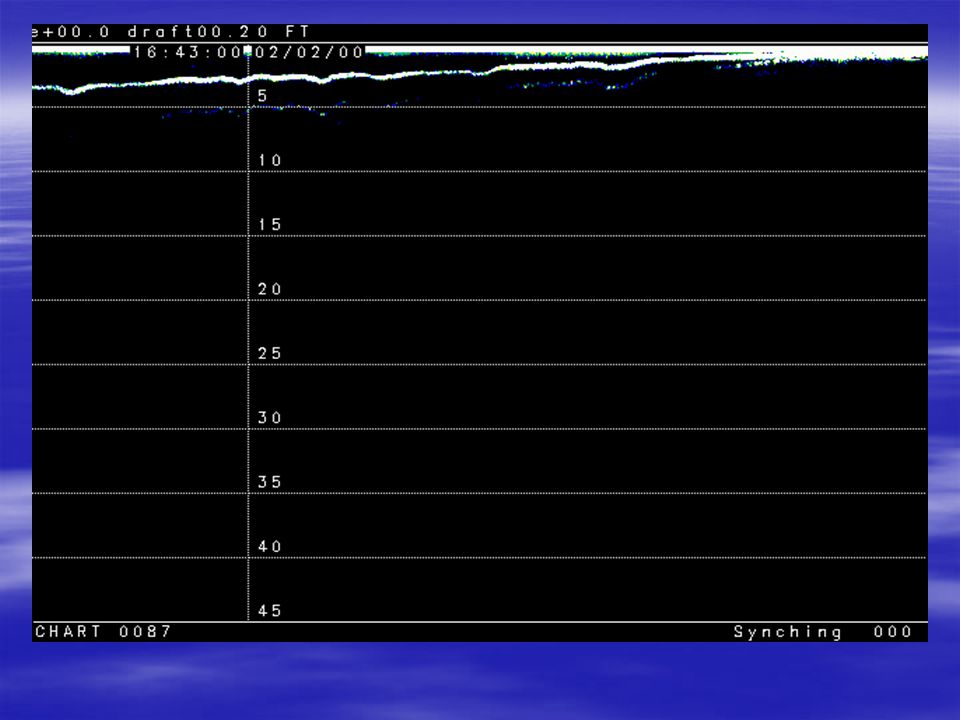
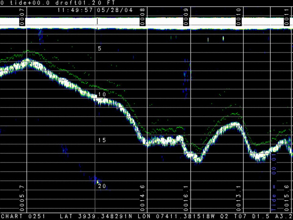
455 Chart Recordings Mixed Charts
Tracking Gate with Fix Marks Tracking Slope; Latitude & Longitude Printed on Chart Auto Ranging Digitizing Below Mid-water Anomaly Shallow Water Records (3)
")
11
Shallow Water Records Following records demonstrate the shallow water capabilities of the 455 Survey Sounder

14
Model 456 Dual Frequency Survey Sounder
Features Light Weight Ideal for Large or Small Boats Narrow Beam Available Easily Integrated Survey Grade Hypack Compatible Daylight Readable Display Shallow Water

15
Model 456 Dual Frequency Survey Sounder
Technical Features Dual frequency high resolution sounder. Windows CE USB Ports (2) Ethernet RS232 Printer Port Charts- PCX & Thermal printing Color LCD Display
 Ethernet. RS232. Printer Port. Charts- PCX & Thermal printing. Color LCD Display.")
16
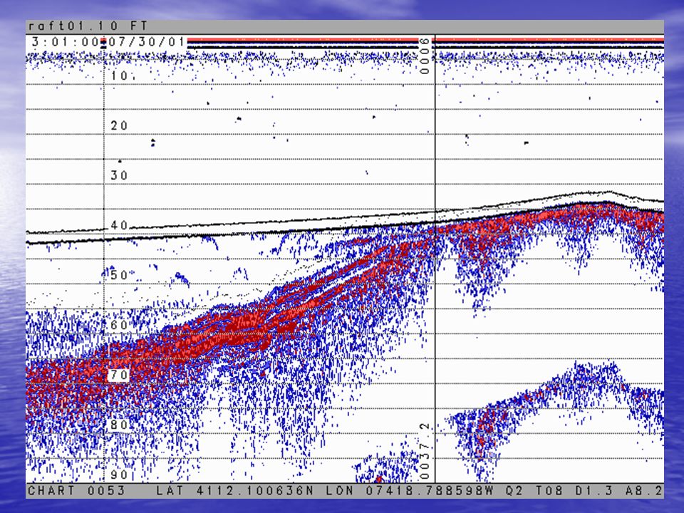
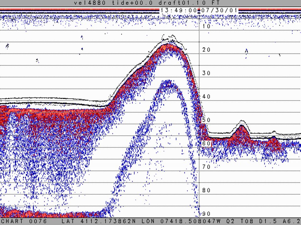
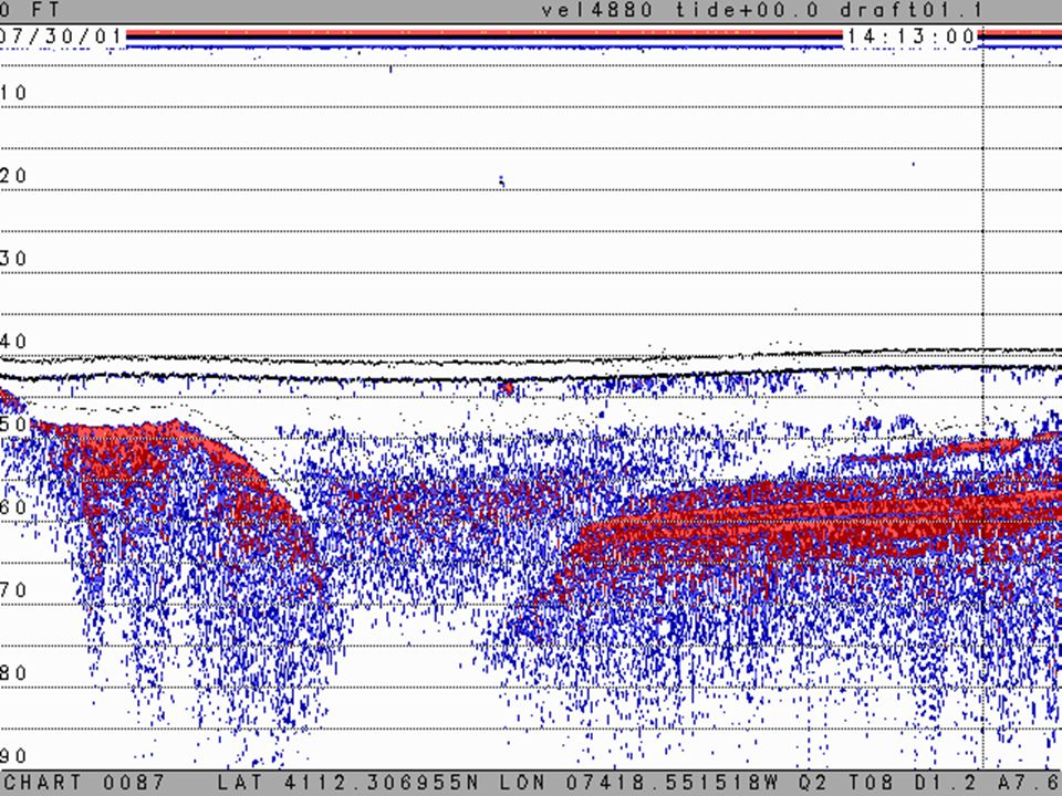
456 Annotated Chart Recordings Greenwood Lake- Shore to Shore (next 6 charts)
")
17
Chart 26

18
Chart 27

19
Chart 28

20
Tracking gate indicator - please note that the color of the tracking gate indicator has been changed to green for enhanced presentation - see other 456 recordings on this CD Chart 29
![]()
21
Chart 30

22
Chart 31

23
Model 456 USACE- Philadelphia Dist. Demo Delaware River

25
456 Chart Recordings (mixed records)
")
30
Model 120 Telemetering Tide Gauge
Features Integrated or Standalone Telemetering Local or Remote Viewing Onboard Microprocessor controls sampling, averaging, data transmission and power control Data may entered real-time into Innerspace sounders or Hypack survey software Self-contained packaging

31
120 Tide Gauge Console

34
453A Telemetery

35
Model 453A Radio Modem Features RS232 interface
User configured for baud rate and parity Baud- 4,800, 9,600 or 19,200 10-14VDC operation Internal battery and external 12VDC power input Mobile, Base omni-direction and directional antennas are available Power on, Status and Charge LEDs

36
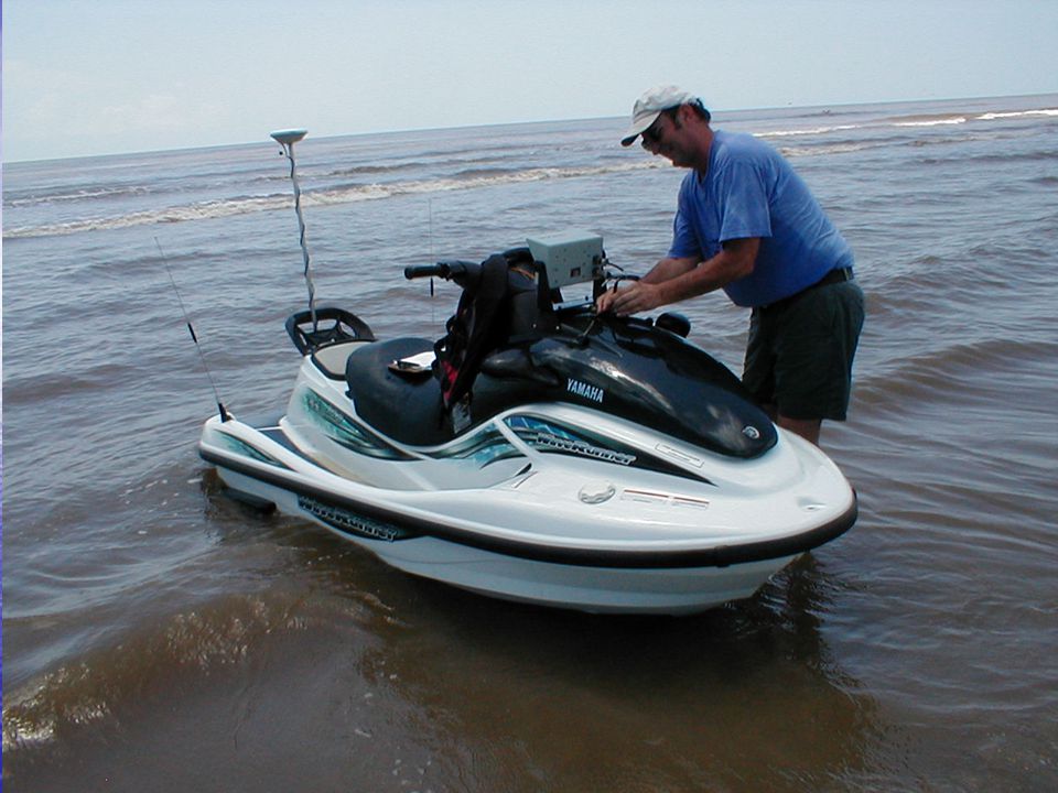
PWSS Personal Watercraft Survey System
Features Highly Mobile Surf zone / shallow water operation Environmentally sensitive surveys All electronics installed internally Commercial and Military Applications Equipment DGPS or RTK Innerspace 455 Survey Sounder Datalog With Guidance data collection software Heave, Pitch & Roll Sensor Innerspace 453A Radio Modem Innerspace Model 603 Helmsman Display

38
PWSS Slides

41
Typical Survey Applications
Waterways channel maintenance, nautical chart production and dredging - all navigable waterways; rivers, estuaries, lakes, reservoirs and coastal areas. Includes dredging activities Marine construction- - new harbors and ports, bridges, tunnels, pipelines, etc. Marine geophysical surveys - offshore oil exploration, pipeline routes, mineral prospecting, oil rig site surveys Port administration - monitoring harbor shipping lanes, mooring areas and berths Marine environmental impact studies Power plants - underwater power line surveys and hydroelectric dam site monitoring Reservoir siltation and water volume surveys – water resources management GIS Bridge scour monitoring surveys Oceanographic research Dredge disposal verification Aquatic habitat surveys

Similar presentations


 Full Windows/XP Graphical Workstation.>")

 University of Hawaii Wave, OTEC Southeast National.>")


 to Ports Dr Mike Osborne OceanWise Ltd 1.>")


 is a.>")