Download presentation
Presentation is loading. Please wait.

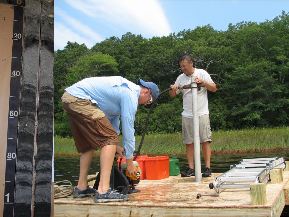
1
Freshwater Subaqueous Soil Survey Investigations and Applications Mark H. Stolt Jonathan Bakken Natural Resources Science University of Rhode Island

2
Thank you RI-NRCS Jim Turenne Maggie Payne CT-NRCS Donald Parizek Debbie Surabian Marisa Theve National NRCS Soil Survey Division RI-AES

3
This year marks the 20 th anniversary of George’s paper briefly articulating the concept of subaqueous soils

4
In the second edition of Soil Taxonomy the definition of soil was changed to accommodate subaqueous soils This was done as resource scientists began to recognize the importance of these shallow-water soil resources for their habitats, structure, and associated ecosystem functions.

5
Vermont

6
2010 National Subaqueous Soil Workshop

7
WHY DIDN’T WE STOP MAPPING SOILS AND MAKING INTERPRETATIONS AT THE LAND-WATER INTERFACE?

9
Why Map Freshwater Subaqueous Soils? There is a growing need for a tool to manage shallow aquatic systems and resources at an ecosystem scale Environments need to be managed in ensure long-term sustainability Growing difficulties in managing elevated nutrient levels (N & P) and the trophic state of lakes Abundance of issues related to sediment accumulation including contaminants such as metals, herbicides, and pesticides) Explosion in the population of invasive species
 and the trophic state of lakes Abundance of issues related to sediment accumulation including contaminants such as metals, herbicides, and pesticides) Explosion in the population of invasive species.")
10
Technical Soil Services Sedimentation rates and volume of sediment for pond restoration Engineering calculations for water volume in ponds Geotechnical data for engineering docks, etc Contaminant levels Floodplain restoration Cultural resources needs Bathymetry Data for dam removal and fish ladders Carbon accounting

11
Project Objectives Characterize the most common freshwater soil types Calculate carbon pools Develop relationships between soils and invasive species distribution Estimate C sequestration rates

12
Project Goals Develop recommendations for additional taxa in Soil Taxonomy for freshwater SAS Develop additional methods, procedures, or standards for mapping freshwater SAS Answer the question: Are impounded freshwater SAS different than natural lake SAS?

13
My goal today is to tell you a little bit about the things that we learned in this study.

14
Bowdish Smith & Sayles Belleville Wordens Tucker Watchaug Impounded Natural

15
Bathymetry Data collected with a Garmin fathometer (fish- finder; about $500) Essentially drive back and forth across the water body in a cross-hatched pattern; X, Y, Z points are collected every 10 seconds Data set to NAVD88 No worry about lake level variations or tidal corrections Use software to create maps
 Essentially drive back and forth across the water body in a cross-hatched pattern; X, Y, Z points are collected every 10 seconds Data set to NAVD88 No worry about lake level variations or tidal corrections Use software to create maps")
16
Delineate soil-landscape units Lake Bed Shoreline Cove Deep Water Shoal

17
Run GPR transects Can also use underwater video along transect to look for surface stones or surface patterns indicative of different soils, and/or to support GPR images

18
GPR in towed raft

19
GPR on ice

20
Layers of organic material Water 1 organicsMineral soils 6 Thin organics Surface stones Boulders

21
Ground-truth GPR Investigate soils Build soil-landscape models Understand map unit composition and purity

24
Summary of Family Classifications Family Classification Number of Pedons Loamy, dysic, mesic (Terric) Sapric Frasiwassists***7 Sandy, dysic, mesic (Terric) Sapric Frasiwassists***2 Sandy, Mixed, mesic Histic Humaquept2 Sandy, mixed, mesic, Typic Humaquepts6 Sandy over Loamy, mixed, mesic Typic Humaquepts1 Coarse-loamy, mesic Typic Humaquepts1 Coarse-loamy over sandy-skeletal, mesic Typic Humaquepts2 Coarse-loamy, Mixed, mesic Typic Frasiwassents14 Coarse-loamy, Mixed, mesic Fluventic Frasiwassent4 Dysic, mesic, Sapric Frasiwassists25 Mixed, mesic Psammentic Frasiwassents9 Siliceous, mesic Psammentic Frasiwassents3 Coarse-loamy, Mixed, mesic Thapto-histic Frasiwassents2 Sandy, Mixed, mesic, Fluvaquentic Humaquept2 Coarse-loamy, Mixed, mesic Fluvaquentic Humaquept1 81 *Any additional pedons were classified to the subgroup level **All mineralogy classes (i.e. mixed or siliceous) were assumed ***The Terric designation is currently being proposed as an addition to Soil Taxonomy
 were assumed ***The Terric designation is currently being proposed as an addition to Soil Taxonomy.")
25
Five New Series (OSDs are available on- line) Burlingame Wickford Aquapaug Shannock Tuckertown Map unit purity was generally >85%
 Burlingame Wickford Aquapaug Shannock Tuckertown Map unit purity was generally >85%")
27
Aquapaug (Psammentic Frasiwassent) Shannock (Typic Humaquept) Burlingame (Aeric Frasiwassent) Tuckertown muck (Sapric Frasiwassist) Wickford muck (Sapric (Terric) Frasiwassist)
 Shannock (Typic Humaquept) Burlingame (Aeric Frasiwassent) Tuckertown muck (Sapric Frasiwassist) Wickford muck (Sapric (Terric) Frasiwassist)")
28
Frasiwassist Subgroups –Sapric Frassiwassists: >130 cm of SOM dominated by sapric SOM –Terric Sapric Frasiwassists: <130 cm of SOM dominated by sapric SOM Terric is a proposed change to Soil Taxonomy

29
Histic Frasiwassepts Umbric Frasiwassepts Proposed SAS Inceptisols

30
Histic Frasiwassents Umbric Frasiwassents Proposed SAS Entisols

31
Method FibricHemicSapric Field 0382 Lab Determination of soil organic soil (SOM) type. Field is based on visual rubbed fiber content. Lab is based on “standard lab rubbed fiber approach” and sodium-pyrophosphate color..

32
Method FibricHemicSapric Field 0381 Lab 84928 Determination of soil organic soil (SOM) type. Field is based on visual rubbed fiber content. Lab is based on “standard lab rubbed fiber approach” and sodium-pyrophosphate color..

33
Invasive Species Eurasian WatermilfoilWater Chestnut Curly-Leafed Pondweed Fanwort Variable Leaf Watermilfoil

34
Invasive plants were abundant in the impounded sites and essentially absent in natural ponds Variable milfoil and fanwort were the predominant species

35
P-value by Extraction Method Variable TestedPorewater NaHCO ₃ NaOHTotal P P (0-5 cm) vs. occurrence of N0.97080.32330.99030.5430 P (5-10 cm) vs. occurrence of N0.50210.98940.90450.9198 P (0-5 cm) vs. occurrence of Non0.07500.29440.10540.1074 P (5-10 cm) vs. occurrence of Non0.06240.04840.12450.0673 P (0-5 cm) vs. occurrence of E0.10950.98620.86260.9529 P (5-10 cm) vs. occurrence of E0.07340.27260.09990.0899 P (0-5 cm) vs. occurrence of M0.99370.96990.03550.1918 P (5-10 cm) vs. occurrence of M0.20270.51230.89050.6642 P (0-5 cm) vs. occurrence of E and M0.10290.99410.17330.3995 P (5-10 cm) vs. occurrence of E and M0.01190.12860.08220.0485 N = Native species present only (n = 11) Non = No Vegetation (n = 9) E = Exotic species only (Fanwort or Variable Milfoil) (n = 24) M = Mixture of native species and exotics (n = 6) E and M = Exotic species present (Fanwort or Variable Milfoil), possibly with native vegetation (n = 30) Logistic regression analysis of the effect of extractable P (by depth) on the type or presence of vegetation. Cells highlighted in dark gray displayed significant results (alpha < 0.05).
 vs. occurrence of N P (0-5 cm) vs. occurrence of Non P (5-10 cm) vs. occurrence of Non P (0-5 cm) vs. occurrence of E P (5-10 cm) vs. occurrence of E P (0-5 cm) vs. occurrence of M P (5-10 cm) vs. occurrence of M P (0-5 cm) vs. occurrence of E and M P (5-10 cm) vs. occurrence of E and M N = Native species present only (n = 11) Non = No Vegetation (n = 9) E = Exotic species only (Fanwort or Variable Milfoil) (n = 24) M = Mixture of native species and exotics (n = 6) E and M = Exotic species present (Fanwort or Variable Milfoil), possibly with native vegetation (n = 30) Logistic regression analysis of the effect of extractable P (by depth) on the type or presence of vegetation. Cells highlighted in dark gray displayed significant results (alpha < 0.05)..")
36
Logistic regression probability plot The output c-value = 0.714 This signifies a fairly strong relationship ‘c’ can range from 0.5 to 1, where 0.5 corresponds to the model randomly predicting the response, and a value of 1.0 corresponds to the model perfectly discerning the response

37
Soil Organic Carbon Pools

39
Soil TypeSoil Classificationn Mean SOC (Mg/ha-1) Excessively Drained UplandsTypic Udipsamments20110 Well Drained UplandsTypic Udipsamments29136 Poorly Drained Palustrine WetlandsAeric Endoaquepts20187 Poorly and Very Poorly Drained Riparian Wetlands Typic Humaquepts29246 Very Poorly Drained Palustrine WetlandsTypic Haplosaprists30586 Estuarine Subaqueous Fluventic Psammowassents 947 Estuarine SubaqueousSulfic Psammowassents557 Estuarine SubaqueousTypic Fluviwassents5109 Estuarine SubaqueousHaplic Sulfiwassents10123 Estuarine SubaqueousFluventic Sulfiwassents5196 Freshwater Subaqueous Psammentic Frasiwassents 556 Freshwater SubaqueousAeric Frasiwassents7161 Freshwater SubaqueousTypic Humaquepts10204 Freshwater SubaqueousSapric Frasiwassists16388 Freshwater Subaqueous Sapric (Terric) Frasiwassists 8427
 Excessively Drained UplandsTypic Udipsamments20110 Well Drained UplandsTypic Udipsamments29136 Poorly Drained Palustrine WetlandsAeric Endoaquepts20187 Poorly and Very Poorly Drained Riparian Wetlands Typic Humaquepts29246 Very Poorly Drained Palustrine WetlandsTypic Haplosaprists30586 Estuarine Subaqueous Fluventic Psammowassents 947 Estuarine SubaqueousSulfic Psammowassents557 Estuarine SubaqueousTypic Fluviwassents5109 Estuarine SubaqueousHaplic Sulfiwassents10123 Estuarine SubaqueousFluventic Sulfiwassents5196 Freshwater Subaqueous Psammentic Frasiwassents 556 Freshwater SubaqueousAeric Frasiwassents7161 Freshwater SubaqueousTypic Humaquepts10204 Freshwater SubaqueousSapric Frasiwassists16388 Freshwater Subaqueous Sapric (Terric) Frasiwassists 8427")
40
ppm lead or arsenic 100 years ago Establishing timeframe to estimate C-sequestration

41
Freshwater SOC sequestration WaterbodySampling ID Depth to background levels of Pb and As Sequestration Rate (Mg C haˉ¹ yrˉ¹) Belleville Pond2011RI009018231.43 Belleville Pond2011RI009021352.57 Belleville Pond2011RI009022200.95 S&S Reservoir2011RI007003300.95 S&S Reservoir2011RI007005301.60 S&S Reservoir2011RI007007301.59 Tucker Pond2011RI009041300.51 Tucker Pond2011RI009044151.21 Tucker Pond2011RI009045251.29 Worden Pond2011RI009003250.80 Worden Pond2011RI009013232.08 Worden Pond2011RI009014451.60 Watchaug Pond2011RI00902650.02 Watchaug Pond2011RI00902930.01 Watchaug Pond2011RI00903250.01
 Belleville Pond2011RI Belleville Pond2011RI Belleville Pond2011RI S&S Reservoir2011RI S&S Reservoir2011RI S&S Reservoir2011RI Tucker Pond2011RI Tucker Pond2011RI Tucker Pond2011RI Worden Pond2011RI Worden Pond2011RI Worden Pond2011RI Watchaug Pond2011RI Watchaug Pond2011RI Watchaug Pond2011RI")
42
Average SOC sequestration Rates SAS in Impounded Systems: 1.57 Mg/ha/year SAS in Natural Lakes: 0.84 Mg/ha/year Forests in New England 0.84 Mg/ha/year

43
Project Goals Develop recommendations for additional taxa in Soil Taxonomy for freshwater SAS Develop additional methods, procedures, or standards for mapping freshwater SAS Answer the question: Are impounded freshwater SAS different than natural lake SAS?

44
Project Goals Develop recommendations for additional taxa in Soil Taxonomy for freshwater SAS Develop additional methods, procedures, or standards for mapping freshwater SAS Answer the question: Are impounded freshwater SAS and different than natural lake SAS? Five new series were established for SAS in lakes and reservoirs in New England. New taxa need to be developed that recognize “Terric “ subgroups of Frasiwassists New taxa need to be developed for SAS that have histic or umbric epipedons. Do we need subaqueous Inceptisols or should we restrict them to the Histisol and Entisol orders?

45
Project Goals Develop recommendations for additional taxa in Soil Taxonomy for freshwater SAS Develop additional methods, procedures, or standards for mapping freshwater SAS Answer the question: Are impounded freshwater SAS and different than natural lake SAS? The methods and procedures developed for mapping and characterizing estuarine subaqueous soils apply to freshwater SAS No special sample handling or analysis is required If you can drive a small boat and operate a GPS, you can make a bathymetric map GPR is a great tool that can be used in freshwater SAS that cannot be used in estuarine systems Don’t be afraid to map freshwater SAS!!!

46
Project Goals Develop recommendations for additional taxa in Soil Taxonomy for freshwater SAS Develop additional methods, procedures, or standards for mapping freshwater SAS Answer the question: Are impounded freshwater SAS and different than natural lake SAS? Essentially all of the invasive plants occurred in the impounded systems Carbon pools were significantly higher in the impounded sites Average SOC sequestration rates were about twice of that in the natural lakes Subaqueous landscape units and soil types differed in their distribution, but in general the same could be found in both types of lakes or ponds

47
The application of soil classification for use and management was recognized in the new Coastal and Marine Ecological Classification Standard (CMECS; NOAA, 2012). This national classification system was developed over the last decade by NOAA through assistance from over 100 coastal and marine habitat experts, who represented agencies of federal, state and local governments, academia, non- governmental organizations, and industry. Although CMECS uses Folk (1954) as it standard classification system for the substrate component: the authors of CMECS gave the nod to soil classification as the best approach to classify substrates for use and management purposes: Soil Classification and the Coastal and Marine Ecological Classification Standard (CMECS)
 as it standard classification system for the substrate component: the authors of CMECS gave the nod to soil classification as the best approach to classify substrates for use and management purposes: Soil Classification and the Coastal and Marine Ecological Classification Standard (CMECS).")
48
“In contrast (to Folk), the Soil Geographic Data Standard, FGDC-STD-006 (FGDC 1997) and Keys to Soil Taxonomy (Soil Survey Staff 2010) together provide more detailed classification options for classifying soils with many hundreds of descriptors that have been used in soil science for decades. Users should consider these sources and approaches when classifying substrate in these areas. It is recommended that a soils approach be used if a more detailed classification is needed for interpreting use and management of shallow water substrates.” Soil Classification and the Coastal and Marine Ecological Classification Standard (CMECS)
.")
49
Thanks for your attention!

Similar presentations