Download presentation
Presentation is loading. Please wait.

1
U.S. National Grid Maps Randy Knippel Dakota County

3
GIS For Emergency Management Analysis Planning Damage Assessment ResourceDeployment

4
Maps!

13
Red River Floods

17
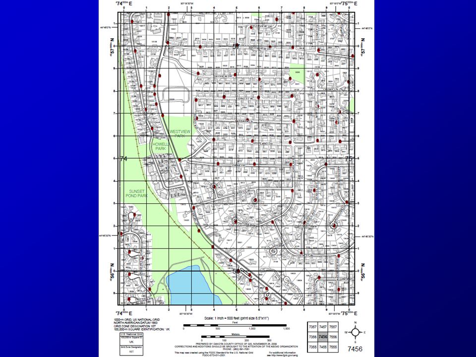
Map VK75 7456

18
741565 Map 7456

19
Romer Scale

20
741565 7456

21
Exercise Find 3309 Dana Dr., Burnsville, MNFind 3309 Dana Dr., Burnsville, MN –745 564

24
Exercise Brush fire in Neill Park along pathBrush fire in Neill Park along path –Where is the nearest fire hydrant? –755 560

27
Benefits of Standard Maps Consistency across jurisdictionsConsistency across jurisdictions –Mutual aid, National Guard, FEMA –Public / NGO’s / volunteers Integration in emergency response training and exercisesIntegration in emergency response training and exercises Quicker GIS responseQuicker GIS response Reduced costsReduced costs –Share templates, software, techniques

28
Cities With USNG Map Books Brooklyn CenterBrooklyn Center Golden ValleyGolden Valley Eden PrairieEden Prairie Maple GroveMaple Grove MinnetonkaMinnetonka PlymouthPlymouth RamseyRamsey Oak GroveOak Grove RichfieldRichfield HutchinsonHutchinson EdinaEdina Apple ValleyApple Valley BurnsvilleBurnsville EaganEagan FarmingtonFarmington HastingsHastings Inver Grove HeightsInver Grove Heights LakevilleLakeville Mendota HeightsMendota Heights RosemountRosemount South St. PaulSouth St. Paul West St. PaulWest St. Paul

Similar presentations


>")


 7440 University Ave NE. Fridley, MN 55432 *Maximum mailing volume is 6 pieces of rolling stock or 2 pallets.>")