Download presentation
Presentation is loading. Please wait.

1
Mapping South Asian dry dipterocarp forest using dual-season satellite imagery. Hugh Stimson, Melissa Songer & Peter Leimgruber 2nd Smithsonian Geographic Information Systems Conference February 11, 2005 National Zoological Park National Zoological Park Conservation & Research Center Conservation & Research Center Conservation GIS Lab Conservation GIS Lab

2
Dry Dipterocarp Forest Indaing High Indaing Low Indaing South East and South Asia South East and South Asia Highly seasonal Highly seasonal Regular burning Regular burning Occurs near humans Occurs near humans

3
Dry Dipterocarp Forest Indaing Elds Deer Cervus eldi thamin Leopard Panthera pardus Bateng Bos javanicus also Asian Hare, Barking Deer, others also Asian Hare, Barking Deer, others

4
Cervus eldi thamin Cervus eldi thamin Dry Dipterocarp Forest preferred habitat Dry Dipterocarp Forest preferred habitat Gone from most of former range Gone from most of former range Habitat loss most significant threat Habitat loss most significant threat Resident of CRC Resident of CRC Dry Dipterocarp Forest Indaing

5
Indaing Agricultural replacement Agricultural replacement Timber and non-timber extraction Timber and non-timber extraction

6
Sensing and Mapping Chatthin National Park December 2000 ASTER image Chatthin National Park March 2000 ASTER image

7
Sensing and Mapping November 2001 Landsat image March 2000 Landsat image

8
Sensing and Mapping `

9
-- Protected Areas Systems Review of the Indo-Malayan Realm Asian Bureau for Conservation

10
Dual-Season Sensing November 2001 image – wet season March 2000 image – dry season

11
Dual-Season Sensing April 7 2003 MODIS image – dry season November 1 2003 MODIS image – wet season Moderate-Resolution Imaging Spectroradiometer (MODIS) NASA operated NASA operated 1-2 day temporal resolution 1-2 day temporal resolution 36 discrete bands 36 discrete bands 250, 500, or 1000m pixels 250, 500, or 1000m pixels 2300km swath 2300km swath several pre-processed products several pre-processed products freely available freely available
 NASA operated NASA operated 1-2 day temporal resolution 1-2 day temporal resolution 36 discrete bands 36 discrete bands 250, 500, or 1000m pixels 250, 500, or 1000m pixels 2300km swath 2300km swath several pre-processed products several pre-processed products freely available freely available")
12
Dual-Season Sensing

13
NDVI 880-660 880+660 Normalized Differential Vegetation Index (NDVI)
")
14
Dual-Season Sensing April 7 2003 MODIS image – dry season November 1 2003 MODIS image – wet season Moderate-Resolution Imaging Spectroradiometer (MODIS) NASA operated NASA operated 1-2 day temporal resolution 1-2 day temporal resolution 36 discrete bands 36 discrete bands 250, 500, or 1000m pixels 250, 500, or 1000m pixels 2300km swath 2300km swath several pre-processed products several pre-processed products freely available freely available
 NASA operated NASA operated 1-2 day temporal resolution 1-2 day temporal resolution 36 discrete bands 36 discrete bands 250, 500, or 1000m pixels 250, 500, or 1000m pixels 2300km swath 2300km swath several pre-processed products several pre-processed products freely available freely available")
15
Dual-Season Sensing April 7 2003 MODIS image – dry season November 1 2003 MODIS image – wet season Moderate-Resolution Imaging Spectroradiometer (MODIS) NASA operated NASA operated 1-2 day temporal resolution 1-2 day temporal resolution 36 discrete bands 36 discrete bands 250, 500, or 1000m pixels 250, 500, or 1000m pixels 2300km swath 2300km swath several pre-processed products several pre-processed products freely available freely available Raw data for classification.
 NASA operated NASA operated 1-2 day temporal resolution 1-2 day temporal resolution 36 discrete bands 36 discrete bands 250, 500, or 1000m pixels 250, 500, or 1000m pixels 2300km swath 2300km swath several pre-processed products several pre-processed products freely available freely available Raw data for classification.")
16
Dual-Season Sensing Advanced Spaceborne Thermal and Emmission and Reflection Radiometer (ASTER) NASA and Japanese Ministry of Economy Trade and Industry operated NASA and Japanese Ministry of Economy Trade and Industry operated 14 discrete bands 14 discrete bands 15, 30, or 90m pixels 15, 30, or 90m pixels 60km swath 60km swath March 7 2002 ASTER image – dry season November 24 2001 ASTER image – wet season
 NASA and Japanese Ministry of Economy Trade and Industry operated NASA and Japanese Ministry of Economy Trade and Industry operated 14 discrete bands 14 discrete bands 15, 30, or 90m pixels 15, 30, or 90m pixels 60km swath 60km swath March ASTER image – dry season November ASTER image – wet season")
17
Dual-Season Sensing Advanced Spaceborne Thermal and Emmission and Reflection Radiometer (ASTER) NASA and Japanese Ministry of Economy Trade and Industry operated NASA and Japanese Ministry of Economy Trade and Industry operated 14 discrete bands 14 discrete bands 15, 30, or 90m pixels 15, 30, or 90m pixels 60km swath 60km swath March 7 2002 ASTER image – dry season November 24 2001 ASTER image – wet season Imagery for training classifactation.
 NASA and Japanese Ministry of Economy Trade and Industry operated NASA and Japanese Ministry of Economy Trade and Industry operated 14 discrete bands 14 discrete bands 15, 30, or 90m pixels 15, 30, or 90m pixels 60km swath 60km swath March ASTER image – dry season November ASTER image – wet season Imagery for training classifactation.")
18
Dual-Season Sensing

20
Dual-Season Analysis

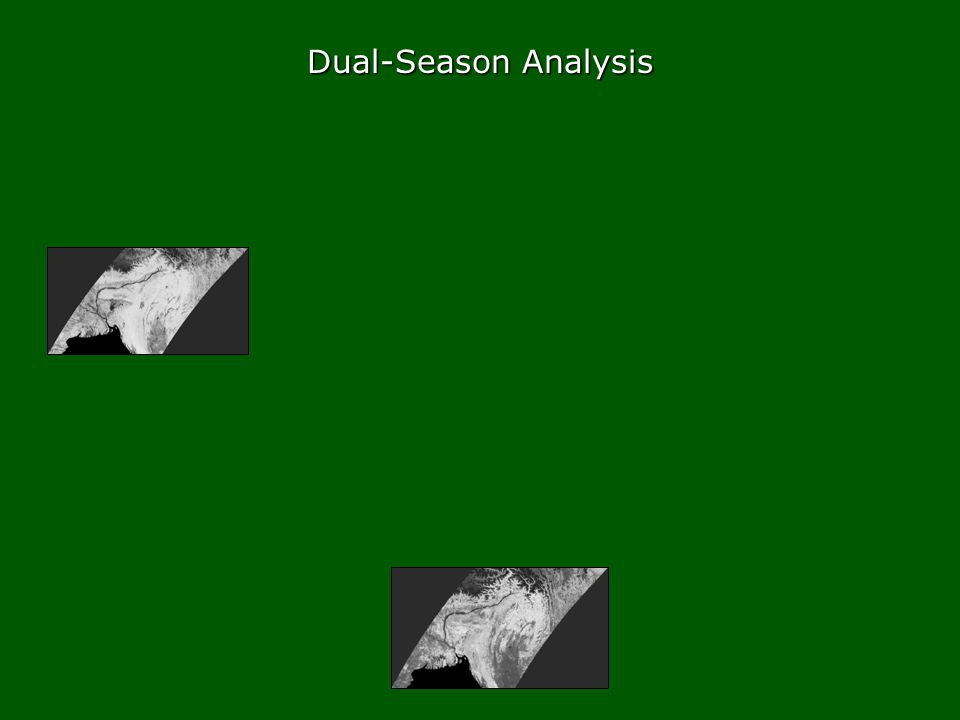
21
April 7 2003 MODIS image – dry season November 1 2003 MODIS image – wet season Dual-Season Analysis

23
wet season NDVI drydryseasonseasonNDVINDVIdrydryseasonseasonNDVINDVI Dual-Season Analysis

24
wet season NDVI drydryseasonseasonNDVINDVIdrydryseasonseasonNDVINDVI Dual-Season Analysis

25
wet season NDVI drydryseasonseasonNDVINDVIdrydryseasonseasonNDVINDVI Dual-Season Analysis

26
wet season NDVI drydryseasonseasonNDVINDVIdrydryseasonseasonNDVINDVI Dual-Season Analysis

27
wet season NDVI drydryseasonseasonNDVINDVIdrydryseasonseasonNDVINDVI Dual-Season Analysis

28
Results Results of supervised classification.

29
Results

30
Results

31
Results

32
Remaining to do: Develop a landscape-level accuracy assessment approach. Develop a landscape-level accuracy assessment approach. Try including a digital elevation layer in the classification model. Try including a digital elevation layer in the classification model. Results

33
Thanks: Thomas Mueller, Dan Kelly, Jamie Robertson, Kevin Koy National Zoological Park National Zoological Park Conservation & Research Center Conservation & Research Center Conservation GIS Lab Conservation GIS Lab

34
Landscape Validation

Similar presentations


 10. 06. 2006 – CEOS/WGCV-25 meeting.>")

 Gilbert Warren Cole (University.>")


 AND MOD15A2 (LAI / fAPAR) PRODUCTS FOR THE CERRADO REGION.>")


 derived from the Visible Infrared Imaging Radiometer Suite (VIIRS) sensor onboard the SNPP satellite Zhangyan Jiang 1,2,>")
