Download presentation
Presentation is loading. Please wait.

1
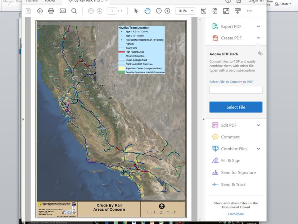
Oil by Rail Safety in California Report Interagency Rail Safety Working Group June 10, 2014 CA Oil by Rail Risk and Response Map High Hazard Areas, Known Geologic Faults, Sensitive Species/Habitat Occurrences, HazMat Team Locations

5
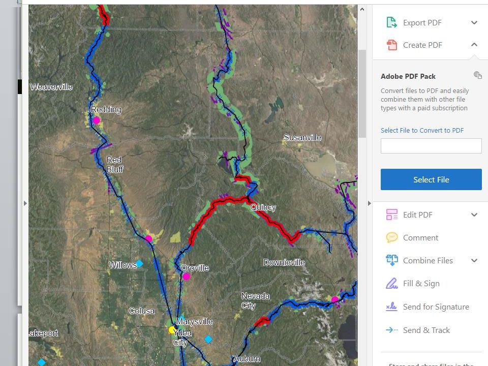
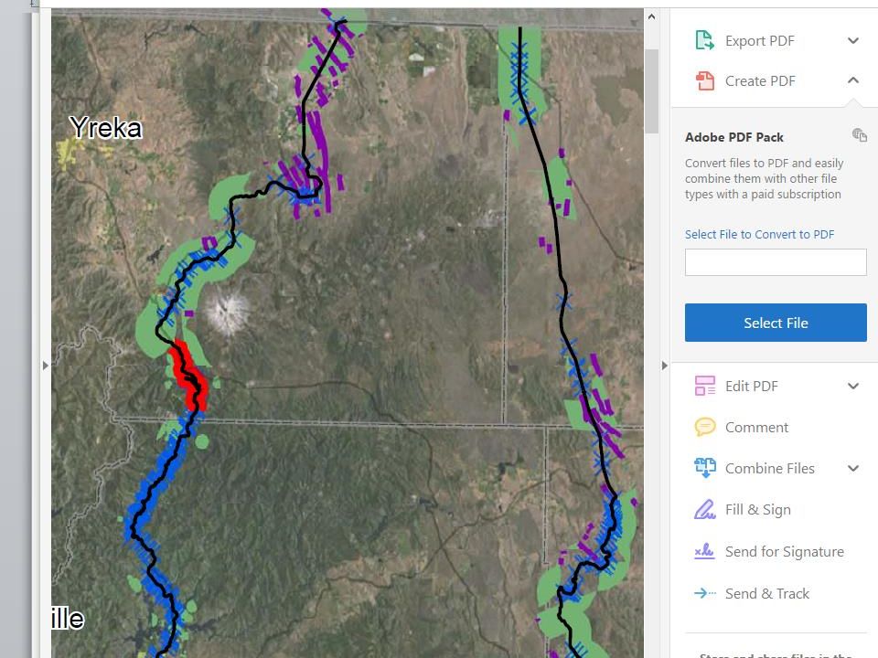
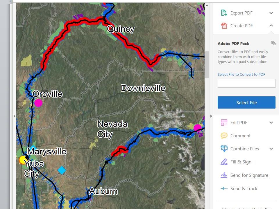
All three of the northern routes into CA have stretches of high hazard rail. Oregon through Dunsmuir and Redding to Roseville. An herbicide spill from a derailment near Dunsmuir killed everything for 20 miles of the Sacramento River; it took a decade to recover. Feather River Canyon, either from the north or from the east. A grain train derailed Nov. 2014. Cars breached as they rolled down the embankment and spilled corn into the river. Donner Pass over the Sierra Nevada Mountains requires 5 engines.

7
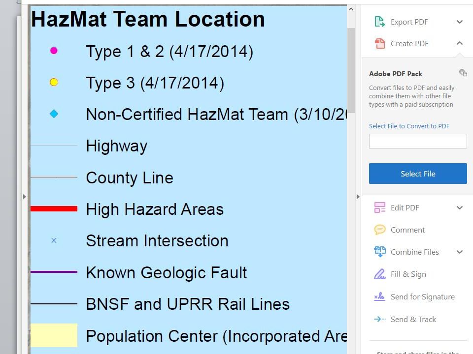
Zoom in on the Dunsmuir Area 1.Bright red = high hazard rail area 2.Purple lines = known geologic faults 3.Green = Sensitive Species or Habitat Occurrences 4.Blue = water, rivers, 5.Blue x’s = river/creek crossings

9
Zoom in on Feather River Canyon and Donner Pass Pink dot = Type 1 & 2 teams with the most training; yellow dot = Type 3 teams to lend assistance Blue squares = non-certified teams

12
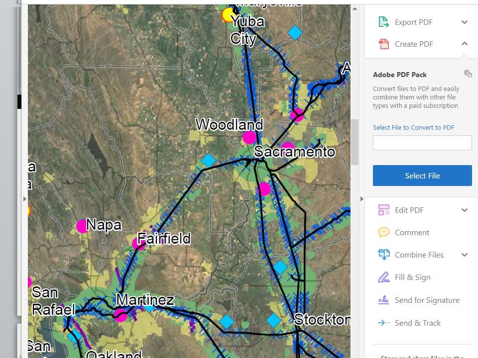
Regional Concerns for oil trains from Roseville to Benicia Trains run right through neighborhoods & downtowns, even threatening the Capitol. Tracks run beside and cross over critical water supplies. Trains run through sensitive species and habitat occurrence areas. Known geologic faults run close to Benicia and the tracks. Recent reports state that sea level is rising faster than predicted. The project is at sea level. What happens if the tracks flood?

Similar presentations


 are relatively narrow regions in the atmosphere that are responsible for most of the.>")


