Download presentation
Presentation is loading. Please wait.

1
Introduction to Geographic Information Systems Introduction

2
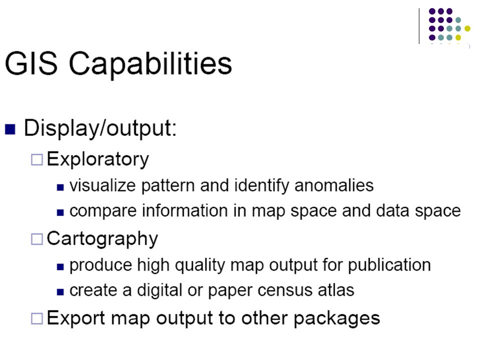
The Purpose of GIS GIS Definitions GIS Workflow The Real World Representation of GIS Maps Databases Spatial Databases Capabilities of GIS Content

3
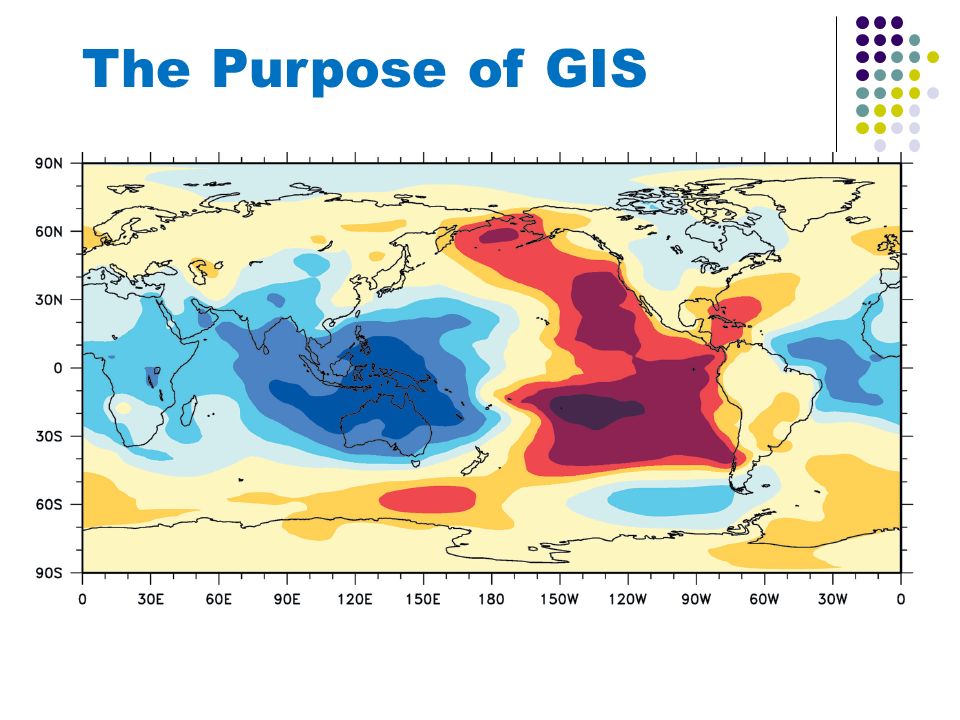
We want to understand what is going on in our world, and this is why we study the phenomena of geographic change. The Purpose of GIS

5
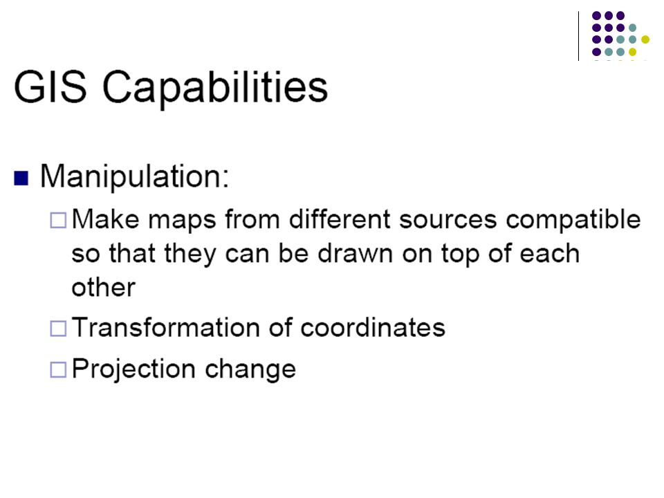
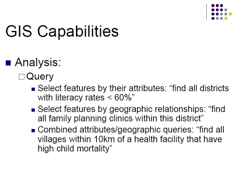
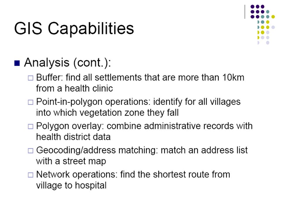
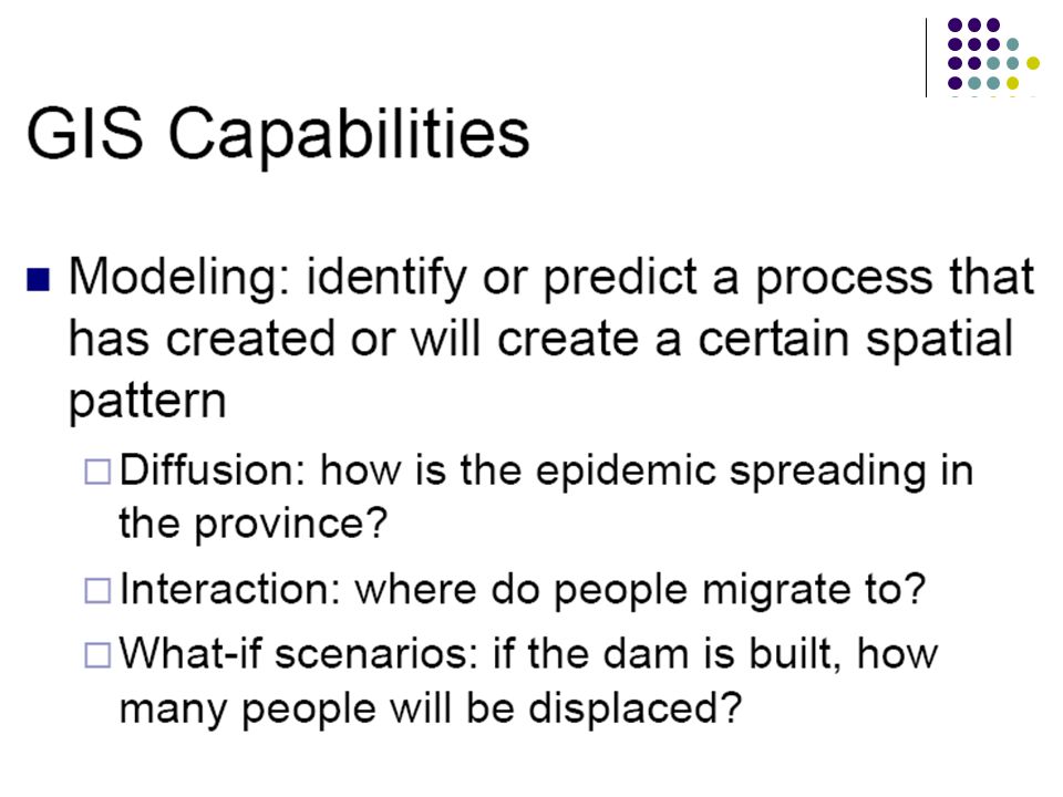
The three important stages of working with geographic data: 1.Data preparation and entry: The early stage in which data about the study phenomenon is collected and prepared to be entered into the system. 2.Data analysis: The middle stage in which collected data is carefully reviewed, and, for instance, attempts are made to discover patterns. 3.Data presentation: The final stage in which the results of earlier analysis are presented in an appropriate way.

6
GIS Definition A system of hardware, software, data, people, organizations and institutional arrangements for collecting, storing, analyzing, and disseminating information about areas of the earth. A geographic information system as a computerized system that facilitates the phases of data entry, data analysis and data presentation especially in cases when we are dealing with georeferenced data. A similar definition:

7
GIS Principle

8
GIS Workflow

9
The real world and representations of it Maps Databases Spatial databases

10
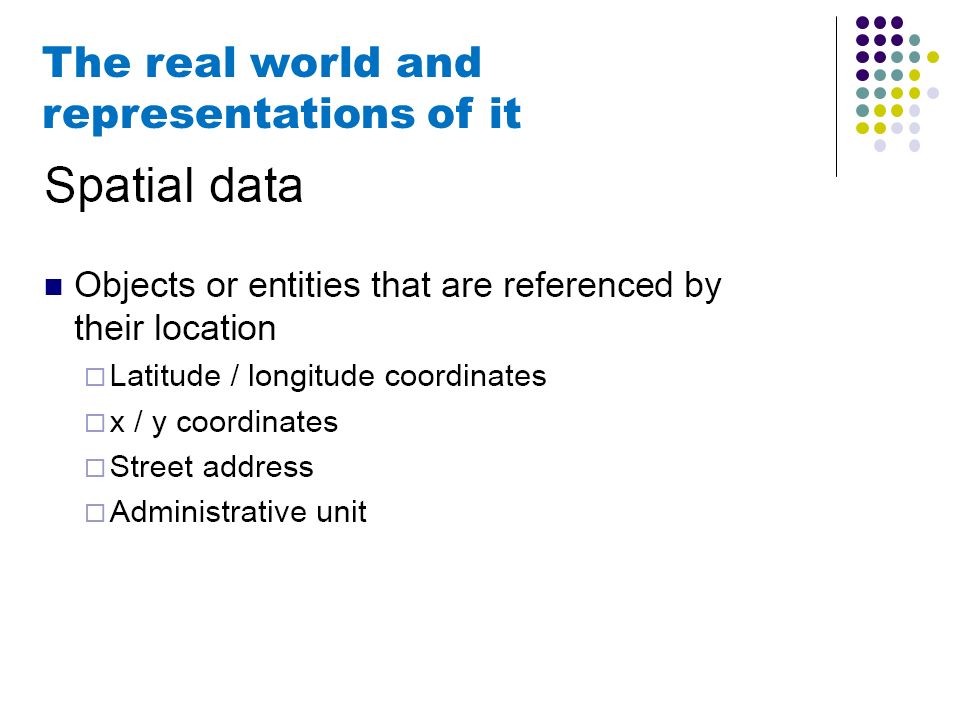
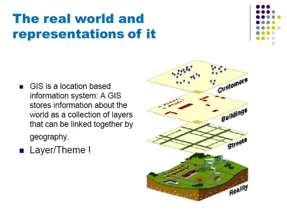
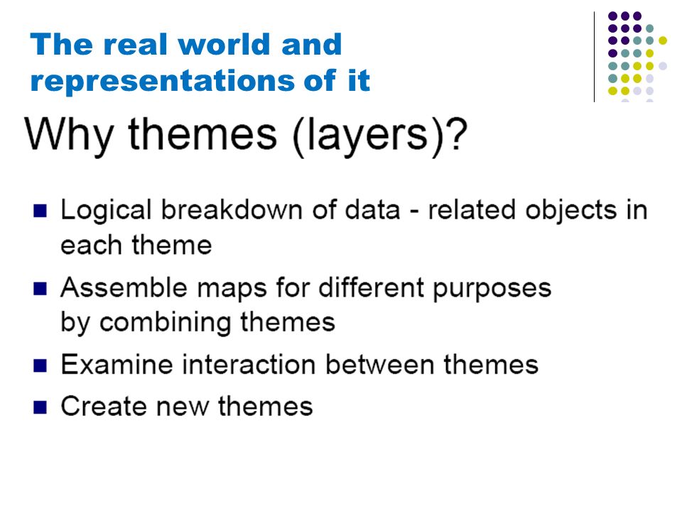
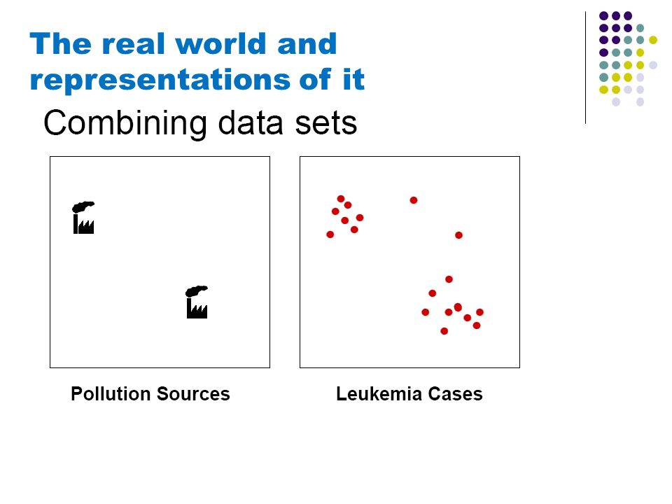
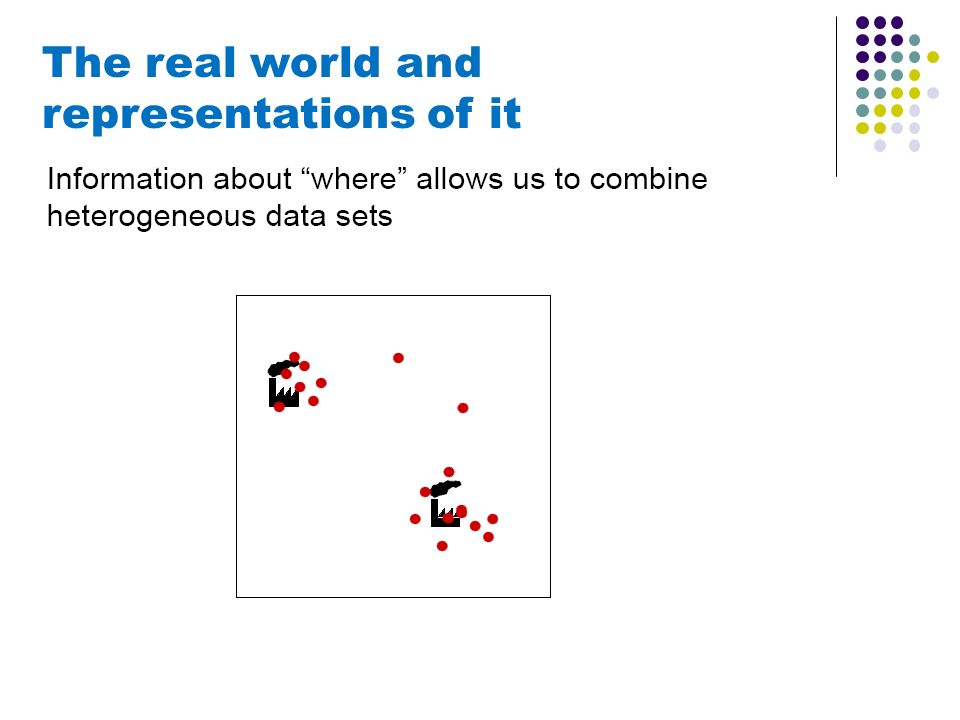
The real world and representations of it

Similar presentations


 based “Decision Support System for Transport”>")


 Lesson 1.>")

