Download presentation
Presentation is loading. Please wait.

1
Bell Ringer: What is the purpose of maps? Where have you noticed maps? WRITE ON YOUR DESK!

2
Homework World History Homework: Due Friday, September 5th Homework Slips are located next to bell papers, be sure to grab one on your way out! Look up and define 10 vocabulary words. Vocabulary Quiz on FRIDAY! Can be submitted online: www.msdumont6th.weebly.com

3
SS.6.G.6.1 Describe the 6 elements of Geography as the organizing framework for understanding the world and its people. UNIT 1/Element 1 The world in Spatial Terms

4
Table of Contents: Standard Topic Page SS.6.W.1.1 Timelines 1 SS.6.W.1.2 Vocabulary 2 SS.6.W.1.3 Primary/Secondary Sources 3 SS.6.G.6.1 6 Elements of Geography 4 New !

5
4 Page Number SS.6.G.6.1- Describe the 6 elements of geography. 9-2-14 Date Notes

6
Location Place Region Movement Human-Environment Interaction Front 5 Themes of Geography

7
Where something is Using maps and other tools Organization of people, places, and environments Element 1: The world in Spatial Terms

8
SS.6.G.1.2 Analyze the purposes of map projections (political, physical, special purpose) and explain the applications of various types of maps.
 and explain the applications of various types of maps.")
9
Table of Contents: Standard Topic Page SS.6.W.1.1 Timelines 1 SS.6.W.1.2 Vocabulary 2 SS.6.W.1.3 Primary/Secondary Sources 3 SS.6.G.6.1 5 Themes of Geography 4 SS.6.G.1.2Map Projections 5 New !

10
5 Page Number SS.6.G.1.2-Analyze the purposes of map projections and explain the applications of various types of maps. 9-2-14 Date Notes

13
CLASSIFYING: Map Projections Map Projections Cylindrical Cylinder touches the globe only at the equator Landmasses near poles appear larger

15
CLASSIFYING: Map Projections Map Projections Cylindrical Conic Cylinder touches the globe only at the equator Landmasses near poles appear larger Cone placed over the globe Most accurate along latitude lines

17
CLASSIFYING: Map Projections Map Projections Cylindrical Conic Cylinder touches the globe only at the equator Landmasses near poles appear larger Cone placed over the globe Most accurate along latitude lines Flat-plane A plane touching the globe at 1 point Distorts land

19
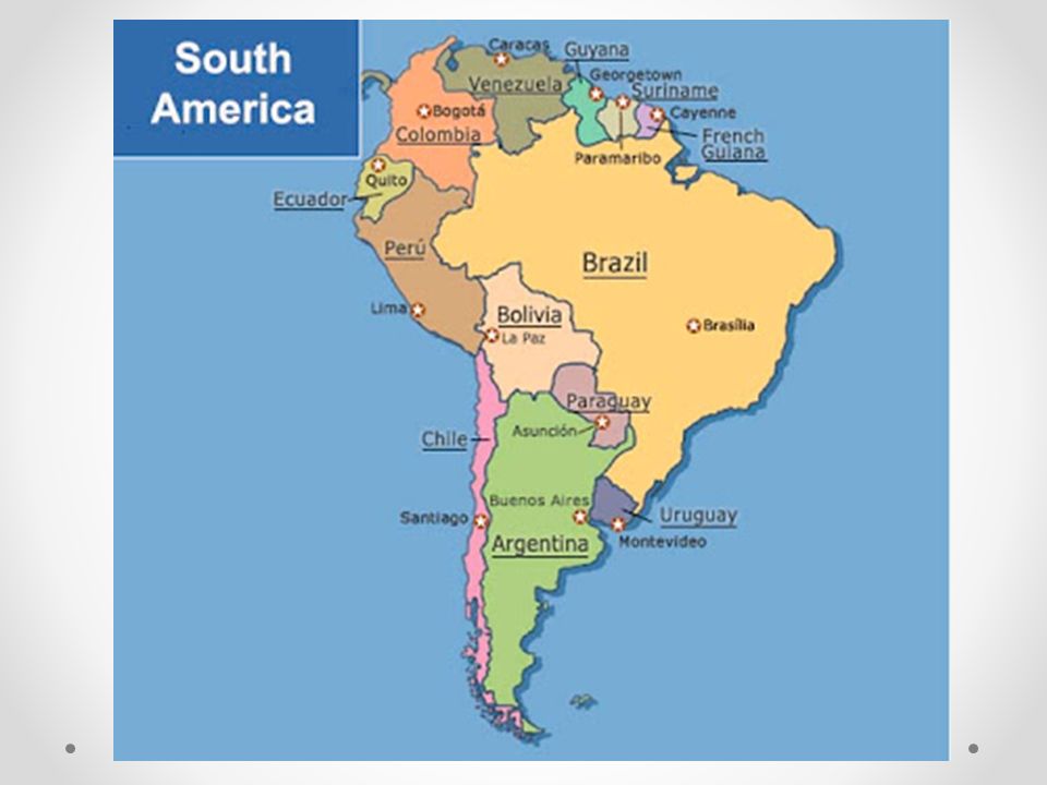
CLASSIFYING: Types of Maps Maps Political Physical Special Purpose

21
CLASSIFYING: Types of Maps Maps Political Physical Special Purpose Country borders Capital cites- special symbol Other important places

26
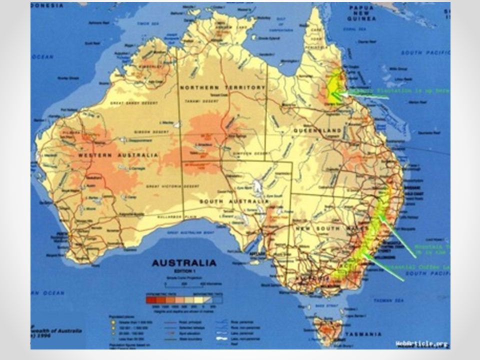
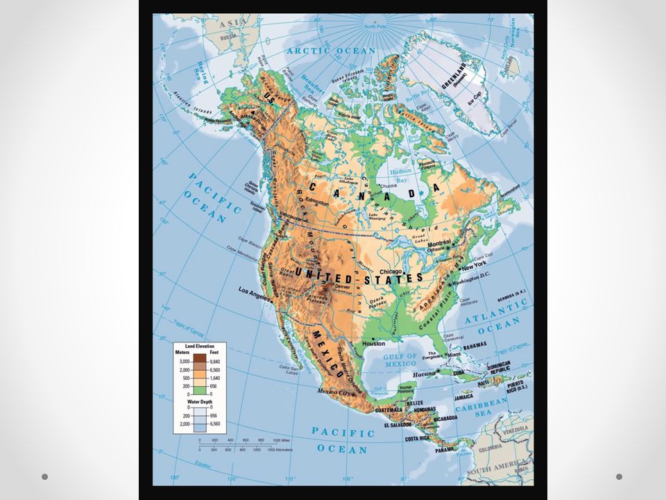
CLASSIFYING: Types of Maps Maps Political Physical Special Purpose Country borders Capital cites- special symbol Other important places Mountain ranges Rivers Oceans Islands Deserts Plains Land elevation

31
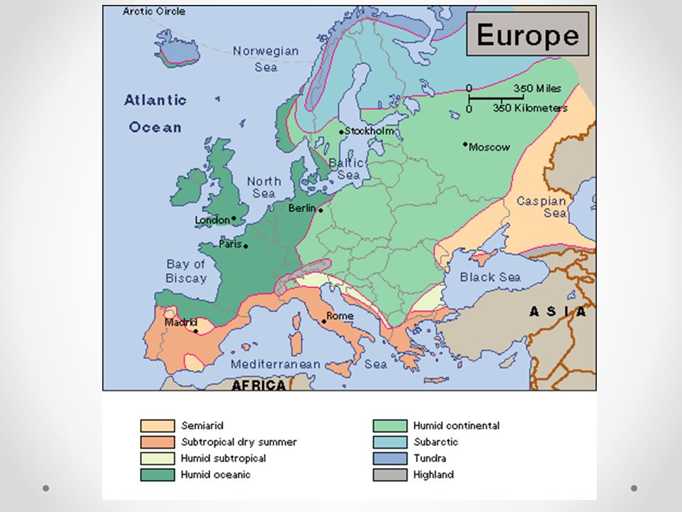
CLASSIFYING: Types of Maps Maps Political Physical Special Purpose Country borders Capital cites- special symbol Other important places Mountain ranges Rivers Oceans Islands Deserts Plains Land elevation Climate Resources Population Dot density

35
Map Sort Map Number Type of Map What information can you get from this map? Student name(s) Class Period :
 Class Period :.")
36
Exit Question: Choose 1 map and answer questions 1-2

Similar presentations