Download presentation
Presentation is loading. Please wait.

1
France Lamy, Google Program manager Geo Crisis Response at Google UNGIWG- 2011

2
Google Crisis Response Team Respond in times of crisis Support response/relief organizations Coordinate with other platforms, organizations and teams Build tools to surface timely, relevant crisis-related data Strengthening capacity of response organizations

3
Crisis Response Geo Workflow Crisis response landing page Collecting and publishing fresh, high-resolution imagery Access to Map Maker data Optimizing and hosting of crisis-related datasets Broad surfacing of crisis-related data Technology outreach

4
Why Google Earth for Crisis Response Demand for geospatial data increasing Large, diverse user base Presentation matters - ability to visualize complex geo data Ability to ingest variety of formats Access to multi-temporal, high-resolution imagery

5
Why Google Map Maker for Crisis Response Providing rich and accurate maps of a country, region, and world that reflect local expert's knowledge Allowing every Internet user to have access to an up-to-the-minute national map - Google Maps, Google Earth, Google Maps for Mobile, etc.; Providing localized information Maintaining aggregated and high quality geospatial data Disaster preparedness - supporting and strengthening a mapping community Long-term -- more accurate local information reconstruction, recovery, development

6
A few examples of our response activities…

8
Haiti Haiti pre-earthquake imagery - DigitialGlobe 2010

9
Haiti Haiti post-earthquake imagery - Geoeye 2010

10
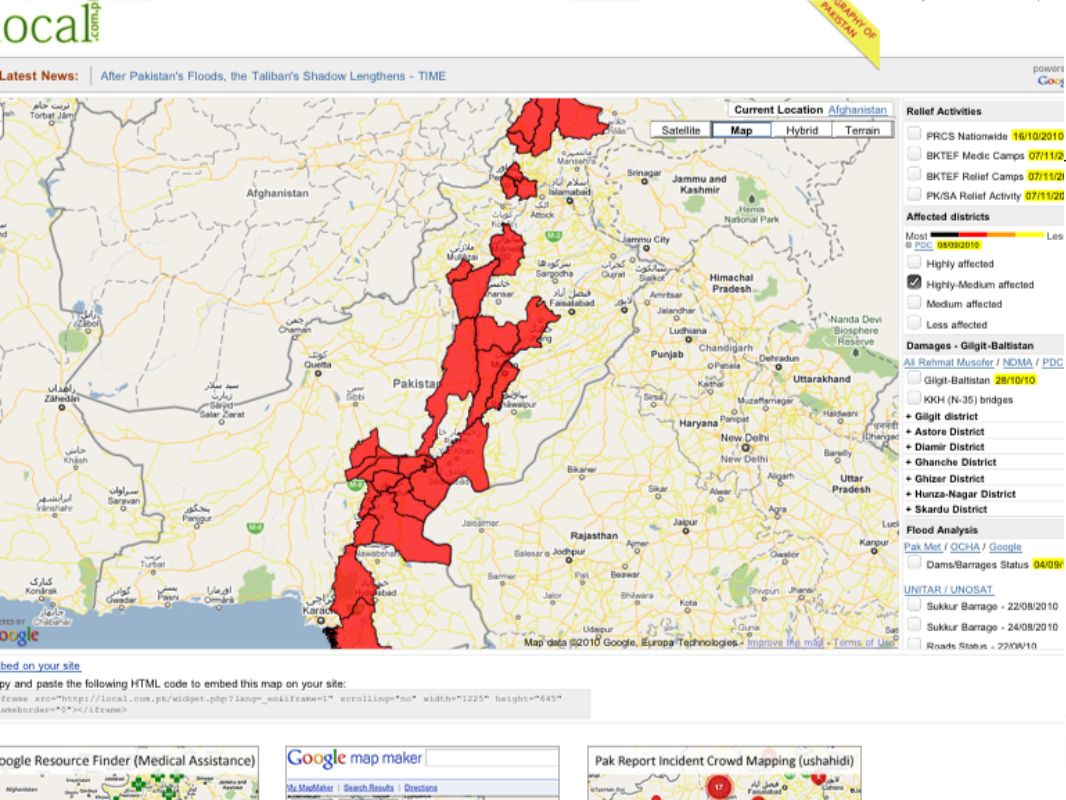
Map Makers respond to Disaster Jabran, Omer, Faraz ‘…unable to locate data relevant to the affected areas, we appealed to the Map Maker community & Google team…created http://www.local.com.pk/’ Landslides hit Atta Abad, January 2010 Floods in Pakistan, July 2010

12
UNOSAT’s use of Google Map Maker Data for Pakistan Floods 2010 UNOSAT Analysis of satellite imagery over flood-affected areas was improved by detailed geographic data about population, transportation and infrastructure from Google Map Maker 20 mapping products 40,000 downloads for Pakistan 800,000 people received assistance due to the availability of Map Maker data

13
Pakistan Army Incorporates Map Maker data into Flood Response Efforts

14
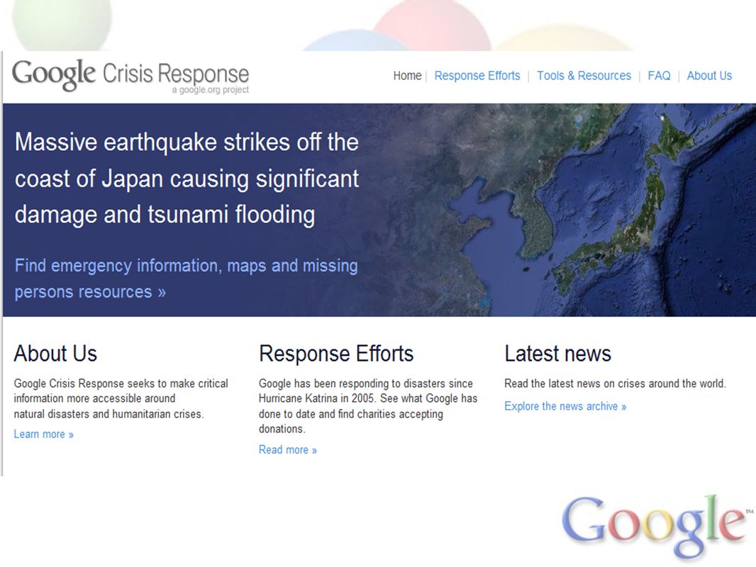
Japanese Earthquake and Tsunami March 11, 2010

15
Crisis prevention -- Clooney, Google, UN team up Monitoring Human Security During the Southern Sudan Referendum

16
Crisis prevention -- Let’s build a better map of Sudan –Acquire historical & fresh imagery to update the conflict zones –Empowering a mapping community that will remain engaged in Sudan over time and become self-sufficient –Support on-going monitoring efforts –Support the creation of independent tools and communities (Maps API, Youtube) for on-going monitoring efforts Impact -- Improved and more widely available geo data –Objective visual evidence of human rights concerns to generate better, faster responses, as a means to help prevent a return to war –And ultimately support the building of Sudan geospatial foundation to achieve long-term socio-economic objectives.
 for on-going monitoring efforts Impact -- Improved and more widely available geo data –Objective visual evidence of human rights concerns to generate better, faster responses, as a means to help prevent a return to war –And ultimately support the building of Sudan geospatial foundation to achieve long-term socio-economic objectives.")
17
Sudan Crisis prevention -- what we have done so far Imagery acquisition – We have acquired historical and fresh imagery –120 000+ sqkm GeoEye over Southern Sudan –This new imagery is covering about 40% of the crisis areas –Imagery made available to mappers in Map Maker, upon reception (select Sudan imagery option)
")
18
Sudan Crisis prevention -- upcoming activities Map Maker –A series of Mapping Parties with Sudanese and individuals/Orgs having connections in Sudan; –Mapping Party in Washington DC, end of February. A mapping event to be likely hosted at the World Bank; 100 participants (from Sudanese diaspora, UN, NGOs, etc.) having local knowledge & connections with Sudan. And expand to other locations. –Mapping parties in Sudan with universities – still exploration stage University of Khartoum, University of Juba, Ahfad University, and Rumbek University. –We are monitoring ongoing acts of violence, so that we reprioritize mapping efforts, as needs evolved.
 having local knowledge & connections with Sudan. And expand to other locations. –Mapping parties in Sudan with universities – still exploration stage University of Khartoum, University of Juba, Ahfad University, and Rumbek University. –We are monitoring ongoing acts of violence, so that we reprioritize mapping efforts, as needs evolved..")
19
Map Maker Community team, a holistic approach… 1 2 3 We are helping to strengthen the geospatial community, and empowering the next generation of mappers We are working and partnering with mappers (local/diaspora), UN, NGOs, start-ups, data providers, and more – to create and enable more content online We are helping to develop Google Map Maker as a product that is locally meaningful We are working with universities: raising the level of curriculum for geospatial technologies -- encouraging innovation and entrepreneurship 4
, UN, NGOs, start-ups, data providers, and more – to create and enable more content online We are helping to develop Google Map Maker as a product that is locally meaningful We are working with universities: raising the level of curriculum for geospatial technologies -- encouraging innovation and entrepreneurship 4")
20
Africa Mappers Summit …I’m used to seeing maps and thinking of them as a collection of edits or points of interests. They’re alive, they’re personal, and they tell the stories of the people who create them...

21
Google Map Maker 180+ countries, 60 languages....more to come

22
What’s next… High-level meeting between UN-CIO and Google’s executives Another Google // UNGIWG meeting, Geneva? Please contact me for questions, requests, and suggestions France Lamy flamy@google.com

23
Questions: France Lamy flamy@google.com

Similar presentations


 2015 Work Plan Symposium Barbara J. Ryan Director, GEO Secretariat Geneva, Switzerland 5 May 2015.>")

 Conference.>")


