Download presentation
Presentation is loading. Please wait.

1
Cooperative Efforts and Practices of the Invasive Species Coordinator and Mapping Department

2
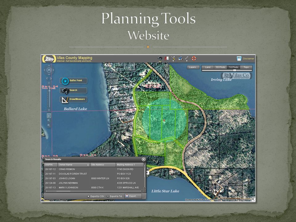
Partnerships Departments Resource Conservation and Development (RC&D) Regional Groups Equipment Pen/Paper Handheld GPS ArcPad ArcGIS Personal Mobile Devices?
 Regional Groups Equipment Pen/Paper Handheld GPS ArcPad ArcGIS Personal Mobile Devices")
3
Find a usable coordinate format Create a feature class from the XY table Play connect-the-dots using point attributes

4
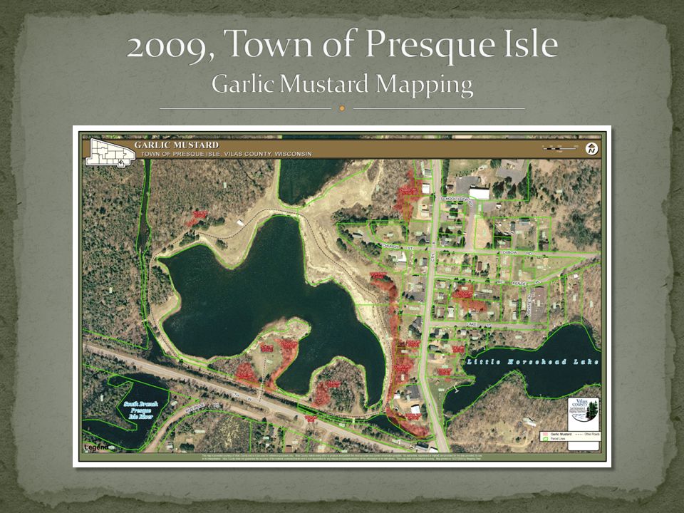
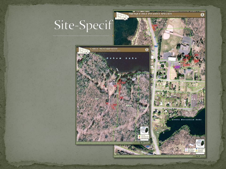
Objective: To quantify the extent of garlic mustard growing in the heart of town and identify on whose lands it was growing. Field mapping equipment: Handheld basic GPS receiver Paper & pen to record starting and ending waypoint for each polygon Method: Collected polygon points around each patch Requested map showing patch sizes and parcel lines

7
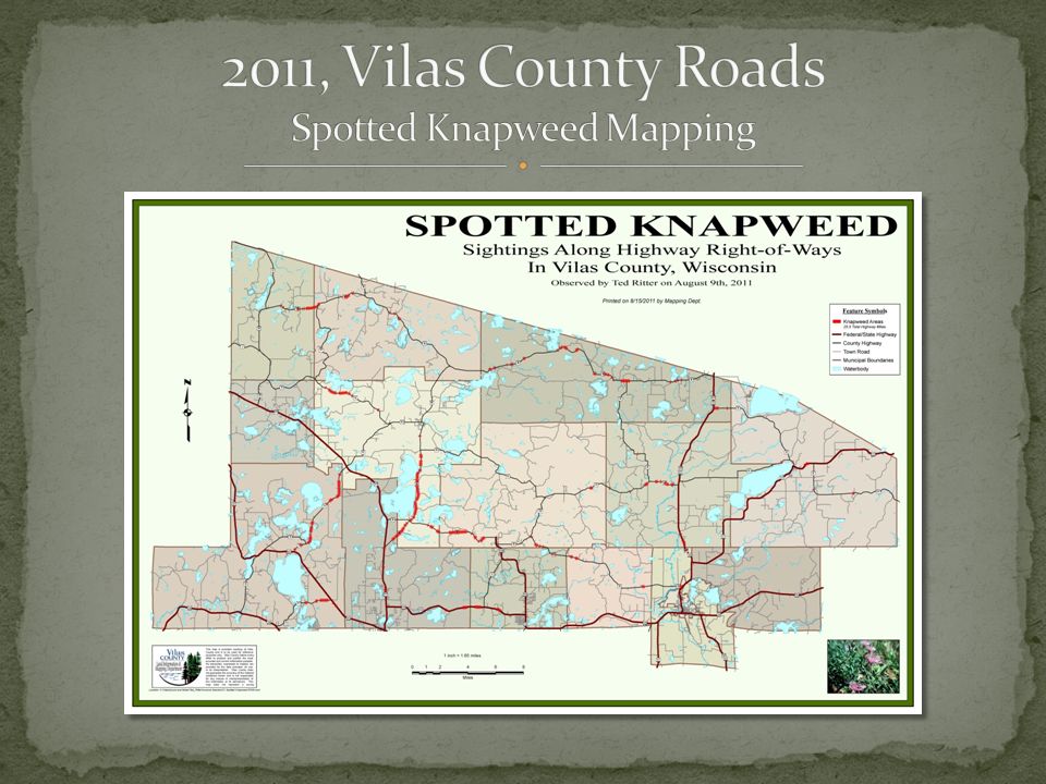
Objective: To determine total miles of SK along county roadway ROW and evaluate potential for bio-control implementation Field mapping equipment: Handheld basic GPS receiver Paper & pen to record stop and start waypoint numbers for each Method: Collected via “windshield” survey Requested map highlighting ROW infestations

9
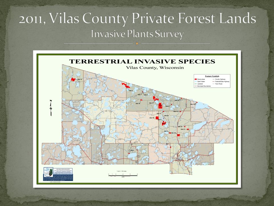
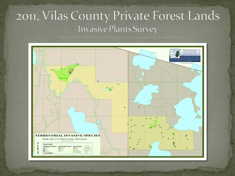
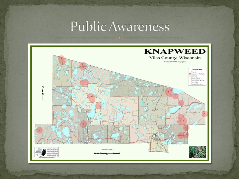
Objective: Evaluate selected private forest lands for presence of invasive plants To increase invasives awareness by landowners Project partners: Local RC&D provided funding Vilas County provided employment services for field technician Conserve School provided housing for technician WHIP (weed co-op) provided Trimble unit Mapping Dept. programmed Trimble

12
Objective: Survey all county roads ROW for presence of invasive plants in advance of developing ROW invasive species management plans for Highway Commissioners Project partners: Local RC&D provided funding and employment services to hire two LTEs WHIP providing use of two Trimble units and oversight of LTEs Mapping Depts. programmed Trimble units

13
Species [name list], Notes [text] Count [ 50], Area [ 500]
![Species [name list], Notes [text] Count [ 50], Area [ 500]](http://images.slideplayer.com/34/10225542/slides/slide_13.jpg "Species [name list], Notes [text] Count [ 50], Area [ 500]")
14
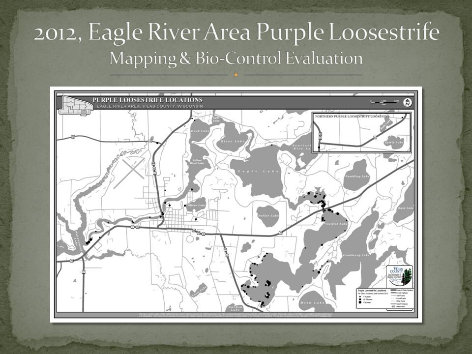
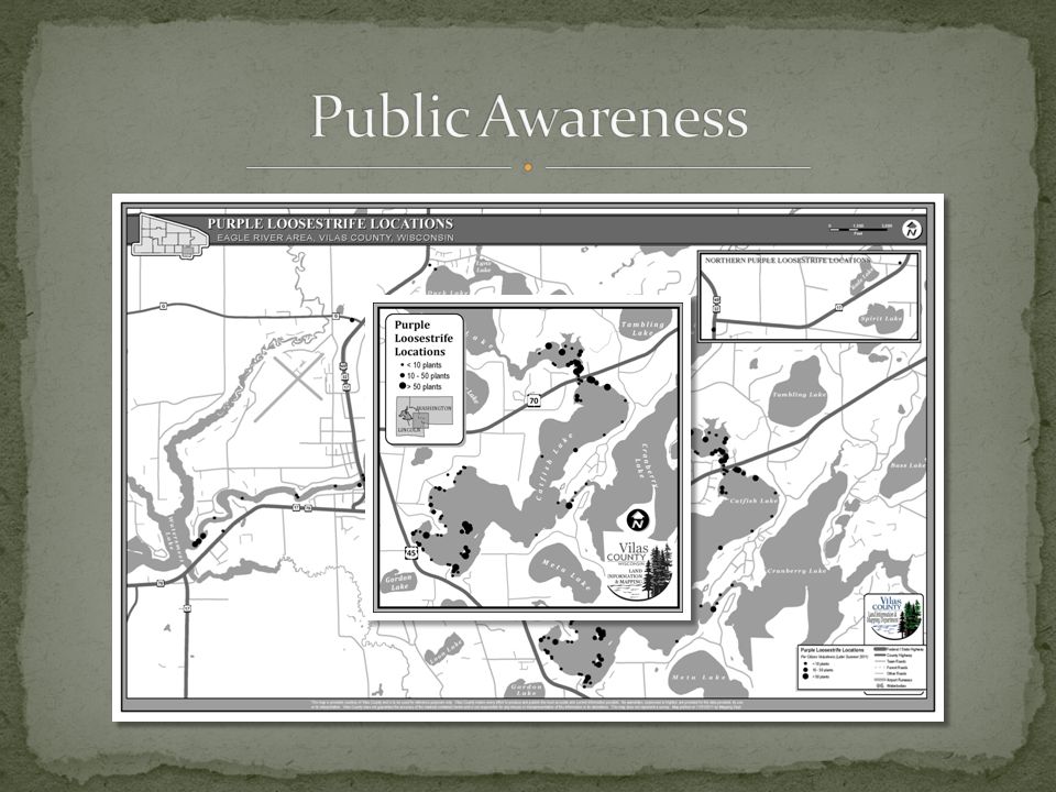
Objective: Survey 70 shoreline miles of Eagle river chained lakes for presence of PL plants to evaluate need for bio- control project Project partners: Chain of Lakes Association volunteers Vilas Mapping Dept. Method: Volunteer spotters collected GPS coordinates and plant counts during 2011 PL bloom season Mapping Dept produced map Bio-control program now underway

21
Department visibility Consistent collection procedures One-stop data storage Local data sharing Regional data sharing Enhanced products Public Awareness/Engagement

Similar presentations


 Cathy McGlynn, Coordinator, Northeast Illinois Invasive Plant Partnership.>")


