Download presentation
Presentation is loading. Please wait.

1
Complex terrain study using TODWL data Emmitt (SWA) de Wekker and Godwin (SWA/UVa) DWL WG Meeting 24 – 26 August 2010 Bar Harbor, Me
 de Wekker and Godwin (SWA/UVa) DWL WG Meeting 24 – 26 August 2010 Bar Harbor, Me")
2
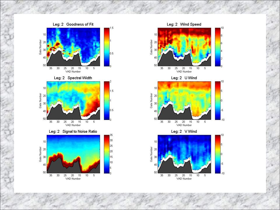
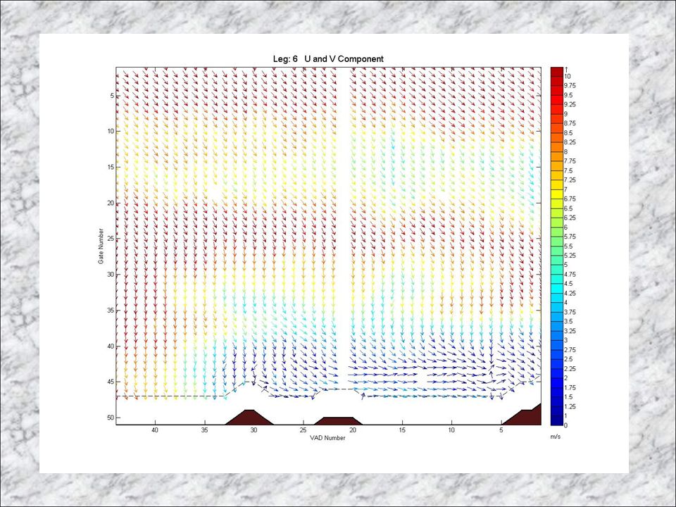
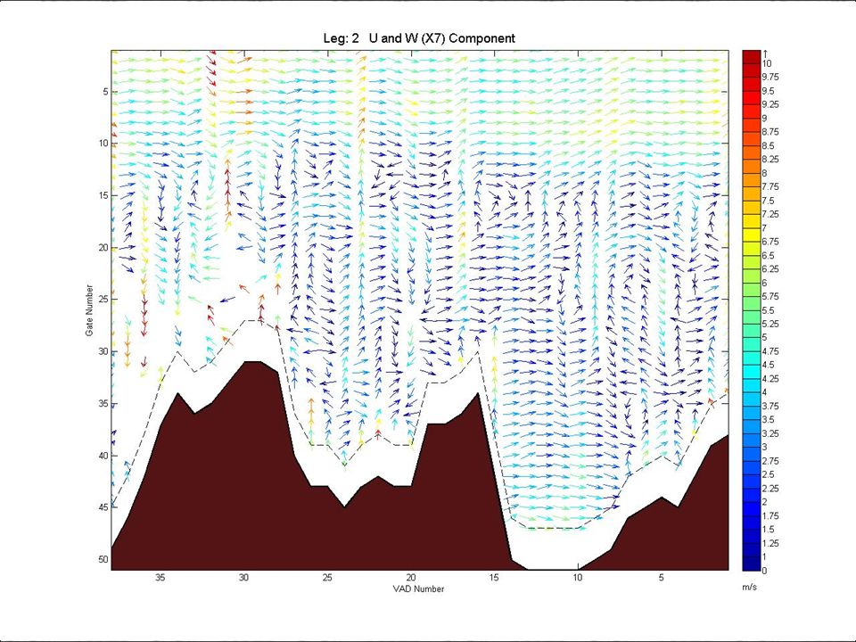
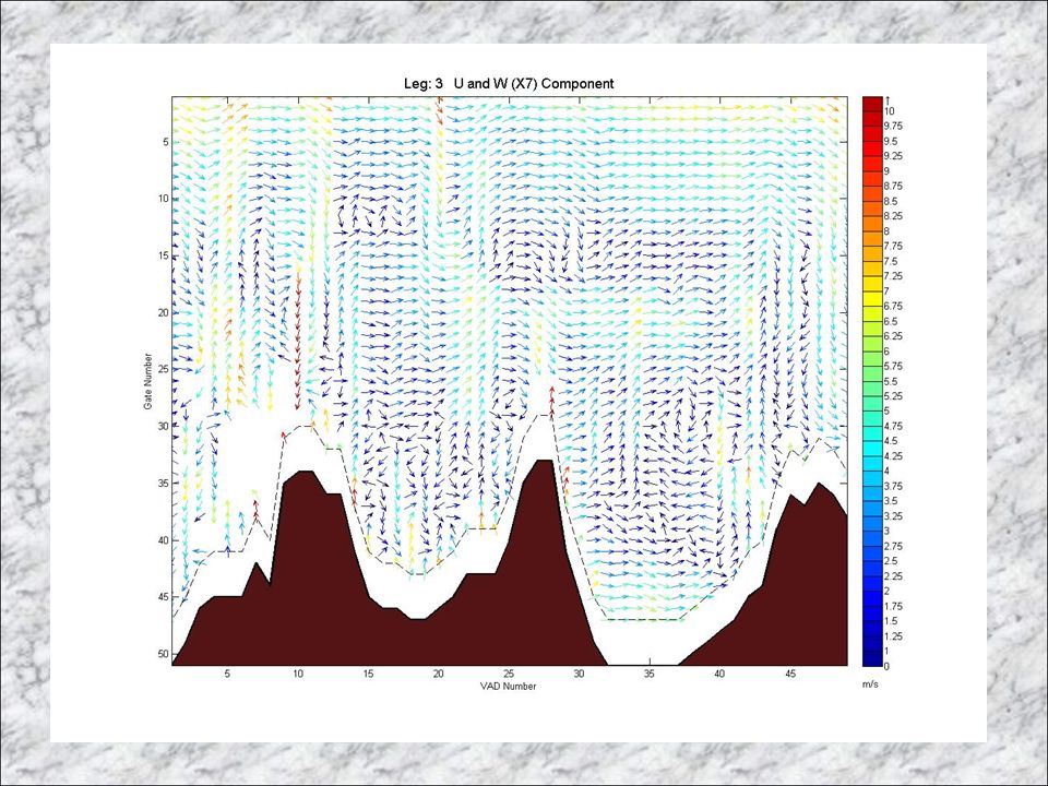
Outline Objectives of ARL funded research – Demonstrate the utility of airborne DWL to investigate complex terrain circulations with conical scanning – Develope code to extract winds down to the surface (lowest 50 meters) in complex terrain – Study valley circulations and their interactions with the large scale flow – Study flushing and venting of aerosols and gases within a ridge and valley system Background on TODWL flights Examples of results
 in complex terrain – Study valley circulations and their interactions with the large scale flow – Study flushing and venting of aerosols and gases within a ridge and valley system Background on TODWL flights Examples of results")
3
Twin Otter Doppler Wind Lidar (TODWL) Series of flights between 2002 and 2007 Focused upon developing understanding of PBL wind and aerosol variability impact on space-based DWL data products. In five cases, we collected data along long flight legs across the ridge and valley complex south of Monterey, CA. Used LADSA (developed by SWA for NPOESS) to fine tune laser beam pointing knowledge precision
 to fine tune laser beam pointing knowledge precision.")
4
LADSA Scans near Salinas Valley on 12 November 2007 PitchYaw Average (degrees) 0.039924-0.07377 Standard deviation 0.1087630.279544 Average (m/s) HLOS 0.0724150.013415 Standard deviation 0.197274-0.05083
 Standard deviation Average (m/s) HLOS Standard deviation")
5
Leg 1 Leg 2 Leg 3 Leg 4 Leg 5 Monterey Bay November 12, 2007

13
Summary The use of LADSA (Lidar Attitude Determination and Solution Adjustment) algorithm improves precision of DWL LOS measurement to <.1 m/s on average (.2 stdev) Once corrected with LADSA detailed circulations within the complex terrain of the Monterey Peninsula are resolved. The use of land LADSA scans appear to be useful for over water observations where surface motions can not be assumed tom be 0,0,0.

Similar presentations


>")
 Products and Measurements Presented by Patrick Selmer Goddard advisor: Dr. Matthew McGill Assisted.>")


