Download presentation
Presentation is loading. Please wait.

1
Jordan Gerth Cooperative Institute for Meteorological Satellite Studies University of Wisconsin at Madison 27 January 2011 91 st American Meteorological Society Annual Meeting First Conference on Transition of Research to Operations: Successes, Plans and Challenges Satellite research to operations (R2O) plans and challenges
 plans and challenges")
2
Talk Overview Introduction Today’s Data Delivery Early Evolution of CIMSS R2O Effort Expanse of CIMSS R2O Effort Today GOES-R Proving Ground Lessons Learned CIMSS Model for R2O Field Demonstrations Case Study POES Imagery Hurdles Future Directions Steve Hentz

3
Introduction This talk discusses advantageous methods of scientists engaging the operational community in a research to operations and technology transfer exercise where the needs of both partners are met as a result of science sharing and problem solving, particularly involving satellite imagery and derived products.

4
Introduction The Cooperative Institute for Meteorological Satellite Studies (CIMSS) has developed a growing program in which new satellite imagery and products are developed for, collaborated in conjunction with, and delivered to National Weather Service (NWS) field weather forecast offices (WFOs) without invoking a formalized process or an operational provider, such as the Office of Satellite Data Processing and Distribution (OSDPD) within the National Environmental Satellite, Data, and Information Service (NESDIS). This program started with 5 WFOs in 2006 and expanded to over 50 WFOs in 2010.

5
Today’s Data Delivery is via NOAAPort : Satellite-based system used as the primary delivery mechanism for hydrometeorological data and model output to the field, as well as NOAA’s partners Strengths: Reliable and operationally supported, transmits broad range of data, bandwidth increase expected in 2011 Weaknesses: Approval process for transmission lengthy, not all data within geographic area important to the user

6
Today’s Data Delivery is via Local Data Manager (LDM) : Event- driven data sharing network that utilizes the Internet to mass move various data between NOAA agencies and universities Strengths: Easy delivery method to NWS field offices, widespread use throughout NWS enterprise and universities, user configurable to only ingest certain products Weaknesses: Not operational, strains bandwidth available to the field, limited connectivity to NOAA partners Web : Displaying text data or images on a web page Widespread access, but outside of AWIPS, so data interrogation limited
 : Event- driven data sharing network that utilizes the Internet to mass move various data between NOAA agencies and universities Strengths: Easy delivery method to NWS field offices, widespread use throughout NWS enterprise and universities, user configurable to only ingest certain products Weaknesses: Not operational, strains bandwidth available to the field, limited connectivity to NOAA partners Web : Displaying text data or images on a web page Widespread access, but outside of AWIPS, so data interrogation limited")
7
Early Evolution A joint effort, initiated in 1998, between NWS, NESDIS, and NOAA Cooperative Institutes, such as CIMSS, known as the Virtual Institute for Satellite Integration Training (VISIT), accelerates the transition of the latest in remote sensing science, conducted under the GOES Improved Measurements and Products Activities Plan (GIMPAP) and other research grants, to NWS operations via distance education. In order to provide effective training, examples drawn from the meteorological data visualization software deployed to NWS WFOs, the Advanced Weather Interactive Processing System (AWIPS), were required.
, were required..")
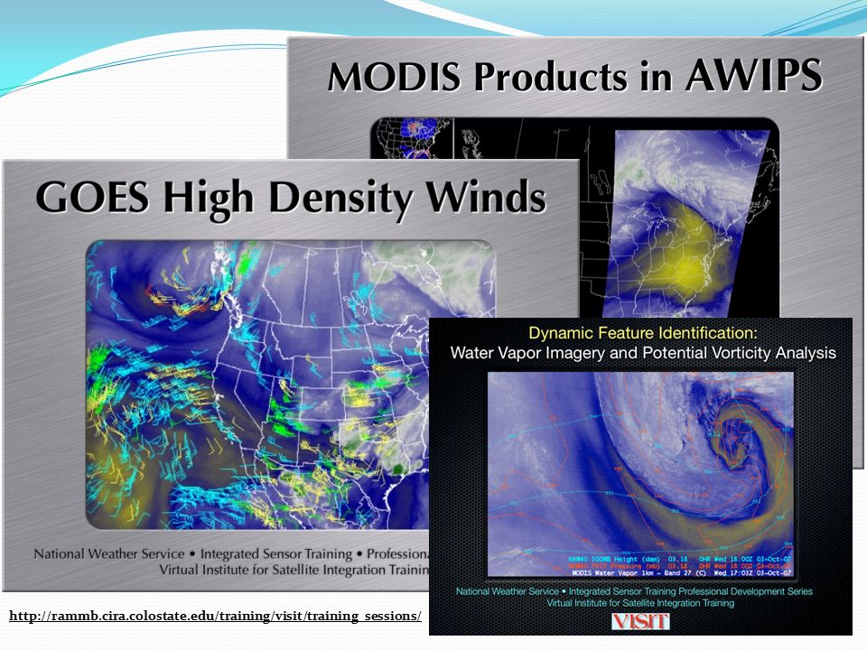
8
http://rammb.cira.colostate.edu/training/visit/training_sessions/
9
Early Evolution In 2005, CIMSS worked to retrofit the AWIPS software for use in a non-operational environment. This required a reconfiguration of the traditional operational data ingest (models, observations, satellite, radar) and, consequently, an understanding of the raw and storage formats. Workstations and servers to run AWIPS were procured as part of ground systems funding from NOAA. With this new knowledge, CIMSS started broadcasting new and experimental satellite imagery to NWS field offices in 2006 via the LDM. Early success was built on a low-cost, limited-bureaucracy, innovative grassroots culture at local NWS field offices.
 and, consequently, an understanding of the raw and storage formats. Workstations and servers to run AWIPS were procured as part of ground systems funding from NOAA. With this new knowledge, CIMSS started broadcasting new and experimental satellite imagery to NWS field offices in 2006 via the LDM. Early success was built on a low-cost, limited-bureaucracy, innovative grassroots culture at local NWS field offices..")
10
AWIPS D-2D Panes

11
R2O Activities Today By the end of 2010, CIMSS transitioned over 60 different types of geostationary and polar-orbiting satellite image and product developments to the field for assisting in the analysis and forecast of a variety of atmospheric properties and phenomena, including: low cloud/fog, volcanic ash, convective initiation, cloud phase, stability, precipitable water, and skin temperature. At least one CIMSS product was delivered in an experimental fashion (via LDM) to more than 50 WFOs across the country in 2010. Since 2006, CIMSS products delivered to the field have influenced over 300 documented forecast decisions. Funding for some of the continued growth of this work comes from the GOES-R Proving Ground.
 to more than 50 WFOs across the country in Since 2006, CIMSS products delivered to the field have influenced over 300 documented forecast decisions. Funding for some of the continued growth of this work comes from the GOES-R Proving Ground..")
12
GOES-R Proving Ground A proving ground is designed to showcase future capabilities and identify possible gaps as a forward-thinking exercise to prepare the end user for upcoming science and technology. The GOES-R Proving Ground connects research and operations to assure widespread day-one readiness through: Applying current earth observing systems and numerical weather prediction models to demonstrate GOES-R capabilities today Transitioning new algorithms and techniques to the field early to assure forecaster familiarity with GOES-R products Making operational meteorologists part of the discussion when it comes to designing and implementing effective GOES-R decision support products and visualization tools The GOES-R Proving Ground is a collective effort between many NOAA and NOAA-supported agencies and universities.

14
Lessons Learned Involve operations thoroughly and frequently in transitioning a research product. First impressions are important. Do not expect a second chance. Make sure training is available and questions are resolved in due time. Forecasters talk. A good tip from a fellow forecaster is one way to guarantee the use of the experimental product will expand to other forecasters and offices. “Consistency. Reliability.” Ken Rizzo, Former Meteorologist-In-Charge, MKX It must be there at the same time, every day, with as little disruption as possible.

15
Lessons Learned Some forecasters will not care. “I have been using the [Nested Grid Model] for the past 15 years with no problems.” Listen to those who do! R2O activities can be interrupted and delayed by the research sector usurping the role of the evaluator in demonstration exercises. Check back later. Keep a continuing dialogue with the forecasters. If they see and talk to you frequently, they are likely to at least give your products a chance. Offices sometimes do not report outages unless you call them. Create quick surveys, but nothing that takes a lot of time. Do lunch with the forecasters. Break down the stereotypes.

16
Types of R2O Exercises Expanded delivery Research-guided observations introduced to operations Research-originated implementation A research product intended to improve the analyses or forecasts developed by operations is brought to the field for evaluation Operations-requested development The field approaches the research community with a problem where further understanding or additional products are required to support operations Hybrid or ad hoc

17
Research to Operations: Our Model Tailor experimental satellite imagery and products to meet the users’ needs Show operations how satellite data can bring a resolution Evaluate possible satellite solutions that may remedy the identified problem Determine the problems confronting operational users on multiple levels AskAssess Determine and Develop Deliver and Demonstrate Original presentation: Transitioning Satellite Products to National Weather Service Operations, and Future Directions for the GOES-R Era Talk, American Meteorological Society Annual Meeting—16th SATMET Conference (Phoenix, Arizona) January 14, 2009
 January 14, 2009")
18
Field Demonstrations A necessary component of any research- originated implementation, such a proving ground, is to assure a sufficient amount of time has been spent with forecasters to explain the intended benefit of the new product(s). The GOES-R Proving Ground has recently began participating in the Norman Hazardous Weather Testbed, a R2O interface platform currently in use to connect science and service.

19
Case Study: POES Imagery In response to NWS AWIPS OB7 requirements, NESDIS planned to add NOAA polar-orbiter visible (0.63 µm), shortwave IR (3.7 µm), and longwave IR (10.8 µm) imagery to NOAAPort on June 7, 2006. After testing, it was determined that there was an insufficient amount of bandwidth between NESDIS and the Network Control Facility (NCF). Thus, this imagery could not be broadcast and delivered to the field. In 2009, CIMSS worked with NESDIS to obtain the code for adequately formatting the POES imagery into the standard distributable GINI format (AWIPS I/II decoder compliant), and adapting it to run in real- time at the University of Wisconsin. Field sites can now obtain this imagery from CIMSS via LDM. Additional products also available.
. Thus, this imagery could not be broadcast and delivered to the field. In 2009, CIMSS worked with NESDIS to obtain the code for adequately formatting the POES imagery into the standard distributable GINI format (AWIPS I/II decoder compliant), and adapting it to run in real- time at the University of Wisconsin. Field sites can now obtain this imagery from CIMSS via LDM. Additional products also available..")
21
Case Study: POES Imagery GINI SectorFrequency Alaska National12 to 14 per day East CONUS10 per day Hawai`i National2 per day Puerto Rico Nat’l10 per day West CONUS4 to 6 per day Additional AVHRR imagery available includes: Band 2 (0.86 µm), for distinguishing land and water Band 5 (12.0 µm), for detecting volcanic ash Additional AVHRR products available include: Sea Surface Temperature Cloud Type Cloud Top Temperature Cloud Top Height Cloud Optical Depth Cloud Particle Effective Radius All NOAA Polar Operational Environmental Satellites (POES) are equipped with an Advanced Very High Resolution Radiometer (AVHRR) which has a resolution of 1.09 km at nadir.
, for distinguishing land and water Band 5 (12.0 µm), for detecting volcanic ash Additional AVHRR products available include: Sea Surface Temperature Cloud Type Cloud Top Temperature Cloud Top Height Cloud Optical Depth Cloud Particle Effective Radius All NOAA Polar Operational Environmental Satellites (POES) are equipped with an Advanced Very High Resolution Radiometer (AVHRR) which has a resolution of 1.09 km at nadir.")
22
Example courtesy of Scott Bachmeier, CIMSS

24
Case Study Value to the Forecaster Near-term (less than 12 hours) forecasts Precipitation potential Cloud optical depth product Cloud particle effective radius product Precipitation type: Snow or drizzle? Cloud type product Short-term (12 to 36 hours) forecasts Areas of fog formation (10.8–3.7 µm) Air temperatures in nearshore areas based on water temperatures Post-event analysis Flooding rivers and tributaries Rain-cooled ground on IR Window Cloud top temperature and cloud height products Just in Time Satellite Training from CIMSS: http://cimss.ssec.wisc.edu/goes/blog Obtain POES Imagery and Products for your AWIPS: http://cimss.ssec.wisc.edu/~jordang/awips-avhrr
 forecasts Areas of fog formation (10.8–3.7 µm) Air temperatures in nearshore areas based on water temperatures Post-event analysis Flooding rivers and tributaries Rain-cooled ground on IR Window Cloud top temperature and cloud height products Just in Time Satellite Training from CIMSS: Obtain POES Imagery and Products for your AWIPS:")
25
Hurdles R2O activities are bridged between partners with a common interest but not a shared funding source. Limited funding on the NWS side suggests a preponderance of research-originated implementations, which are higher risk than an operations-request development. As R2O activities continued to expand in popularity and success, additional funding likely requires more extensive planning and reporting, which hampers the agility of the efforts. NWS forecasters are facing an overload of information with an increasing amount of new, high-resolution data sets and model output. The added benefit of newly introduced products must be adequately explained through day-one training.

26
Hurdles The NWS data delivery network (both NOAAPort and LDM) continues to struggle with the data load. An adequate, time-effective avenue does not exist to support experimental satellite products in the long-term by alternative means (Satellite Broadcast Network). Technical support is dependent on the internal knowledge of NWS systems by a provider (Cooperative Institutes, etc.) which are predominantly research centric (academic environments). While strong cooperation is readily available at local levels of the NWS, higher management can constrain efforts by not fully embracing all aspects of the activity (security restrictions are a common hassle).
. Technical support is dependent on the internal knowledge of NWS systems by a provider (Cooperative Institutes, etc.) which are predominantly research centric (academic environments). While strong cooperation is readily available at local levels of the NWS, higher management can constrain efforts by not fully embracing all aspects of the activity (security restrictions are a common hassle)..")
27
Future Directions CIMSS will continue to work with the NWS and Raytheon to prepare for the fielding of the next-generation of AWIPS software in 2012. Reformatting will be required of many products delivered to the field today for ingest and display on AWIPS “II”. The GOES-R Proving Ground and similar efforts are necessary steps forward in perfecting the R2O concept, but attention is required to assure the two-way dialogue is maximized and technical implications of additional data sets (bandwidth) are met to support operationally. Continue to advocate a well-traveled, two-way street! Questions? Contact me: Jordan.Gerth@noaa.gov
 are met to support operationally. Continue to advocate a well-traveled, two-way street. Questions. Contact me:")
Similar presentations


 Review 09 – 11 March 2010 Image: MODIS Land Group, NASA GSFC March 2000 A Cloud Object Based Volcanic.>")


 J. Kelly, Jr. National Weather Service Infusion of Satellite.>")


 Regional And Mesoscale Meteorology Branch (RAMMB)>")


