Download presentation
Presentation is loading. Please wait.

1
Chapter 4 Continental Margins and Basins

2
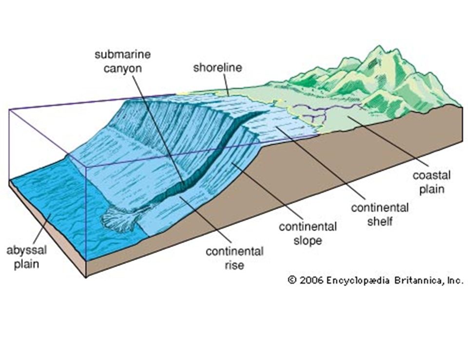
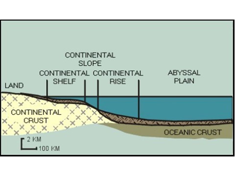
Continental Margins These are the areas of the edges of the continents that are under water – Passive margins face edges of diverging plates and have little earthquake/volcanic activity. Ex: East Coast of USA – Active margins face edges of converging plates and have lots of activity. Ex: West Coast of USA 2 subdivisions: Continental Shelf and Slope

4
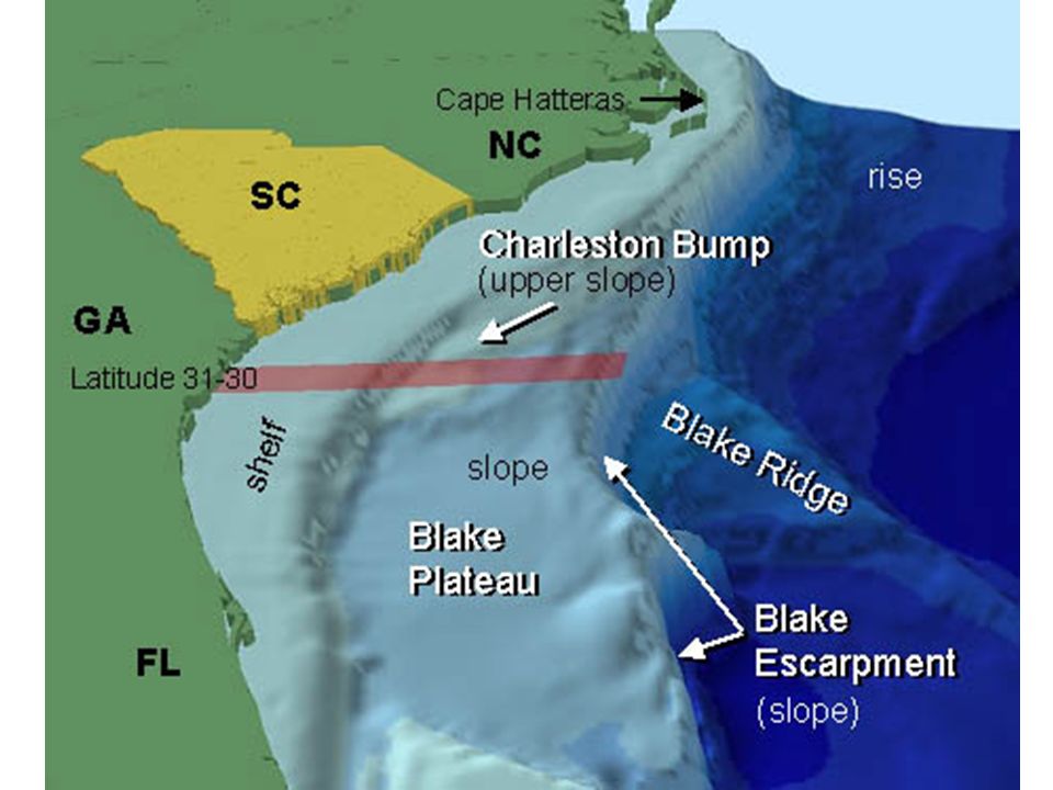
Continental Shelf Shallow extension of the continent – Can be narrow, quickly becoming steep – Or can be broad, gently sloping downward They look much like the continent from which they extend: hills and depressions The sediment on the shelf is eroded dirt and debris from the dry land above it – Sediment is rich in minerals, oil and gas

5
Continental Slope The transition between the shelf and the deep-ocean floor – The shelf break marks the transition – Very steep Continental rise is past the slope – It is oceanic crust covered with sediment from the land

7
Activity Draw, label, and color figure 4.8 on pg 93 Draw, label, and color figure 4.10 on pg 94

8
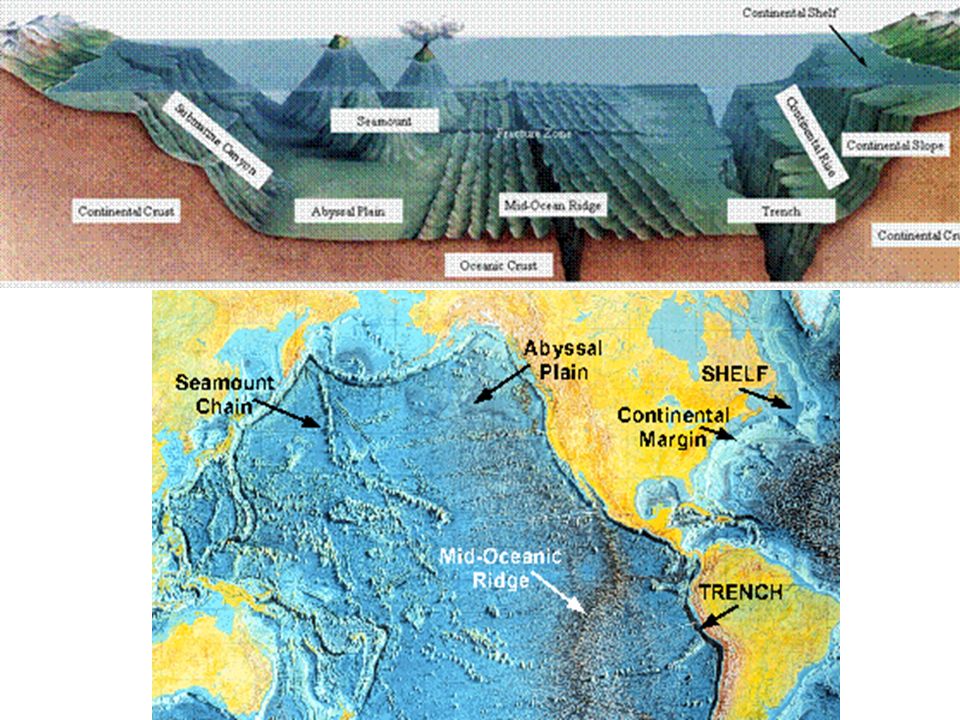
Submarine Canyons These canyons cut into the continental shelf and slope, ending in a deep-sea fan Sometimes they extend from the mouth of a river that drains sediment and fast flowing water out to sea – Created by erosion like canyons on land Sometimes they are created by earthquakes that cause an “avalanche” of sediments

9
Deep-Ocean Basins The seafloor is a blanket of sediment covering the basalt rock Consists of oceanic ridge systems and plains The plains are scattered with islands, hills, trenches, active and extinct volcanoes, and seafloor spreading

10
Oceanic Ridges A chain of mountains formed during seafloor spreading – Composed of “new” basaltic rock with no sediment – If they extend above the water, they are called islands

11
Seamounts and Guyots Seamounts are volcanoes that are below ocean surface – From hot spots or spreading centers – Found alone or in groups Guyots are flat-topped seamounts that once went above the ocean surface – flattened by waves and erosion

12
Atlantic Ocean Depth (m) Distance from North America (Km) 0 4,600 4,800 5,000 5,200 5,400 5,600 5,800 6000 0 150 300 450 600 750 900 1,050 1,200 1,350 5,700
 Distance from North America (Km) 0 4,600 4,800 5,000 5,200 5,400 5,600 5, ,050 1,200 1,350 5,700")
13
39 o N

14
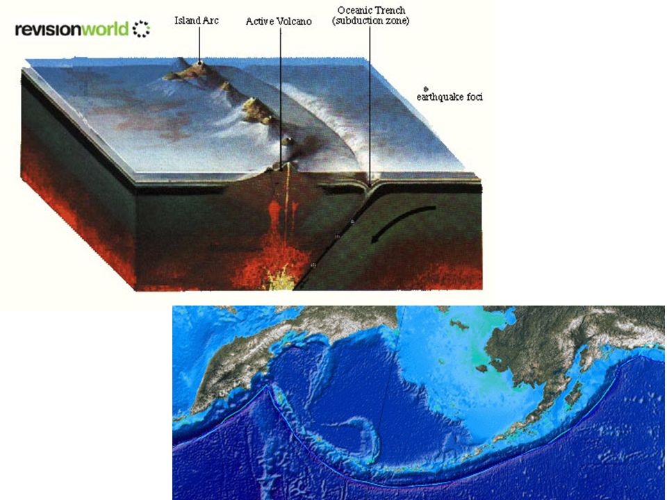
Trenches and Island Arcs Trenches are deep pits in the ocean where the converging plate is subducted – Recall the cold ocean crust is sinking into the upper mantle of the continental plate – V-shaped due to spherical shape of Earth Parallel to the side of the trench, the molten rock from the subducted plate is coming back up through volcanoes called an island arc. – Example is Caribbean islands

20
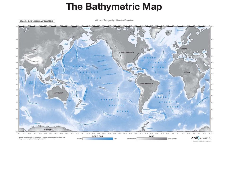
Cartography – the science of making maps – Dry land forms are mapped using topography. – Underwater landforms are maps using bathymetry. Mapping the Oceans

24
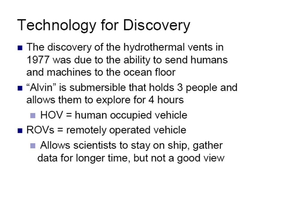
Alvin explored the Titanic (HOV) The Trieste explored the Mariana’s Trench in 1960 (HOV) Hercules ROV
 The Trieste explored the Mariana’s Trench in 1960 (HOV) Hercules ROV")
25
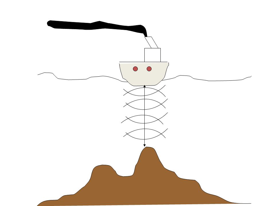
SONAR Sound Navigation and Ranging provided a rapid method of looking through water to identify features in the water beneath a vessel and on the sea floor.

Similar presentations


 What is topography of the ocean?>")


 Depth = (time x 1500 m/sec)/2 (round trip) At 25 degrees.>")


