Download presentation
Presentation is loading. Please wait.

1
Geology & Groundwater Origins
TAMBORINE MOUNTAIN Geology & Groundwater Origins

2
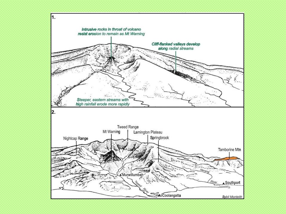
Tamborine Plateau Formed on horizontal basalt lavas
Erupted from the Tweed Volcano over Mt Warning in NSW ~23 million years ago One of several volcanoes active at that time

4
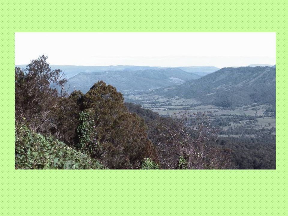
Erosion Plateau is remnant of the final surface of the northern flank of volcano Isolated by erosion from the radial streams of Canungra Creek and Coomera River Same surface still visible to south on Beechmont

7
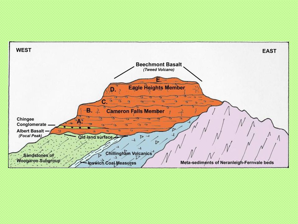
The basalts cap four groups of older rocks-
Meta-sediments’ of Neranleigh-Fernvale beds on east Rhyolite lavas of Chillingham Volcanics in centre Thin band of soft shales of Ipswich Coal Measures Sandstones of Woogaroo Subgroup on west

8
The basalts Lowermost flows are of the Albert Basalt from Focal Peak Volcano –limited in extent Remainder are of the Beechmont Basalt from Tweed Volcano Several sub-units recognised

10
Beechmont Basalt Unit A – 10 thin flows with inter-bedded sediments
Unit B, Cameron Falls Member – Single massive flow 20m thick Unit C – 4 or 5 thin flows Unit D, Eagle Heights Member – Single massive flow 25m thick forming upper scarp of mountain Unit E – Weathered flows on plateau surface (Lower units absent on eastern side)
")
11
Beechmont Basalt (contd.)
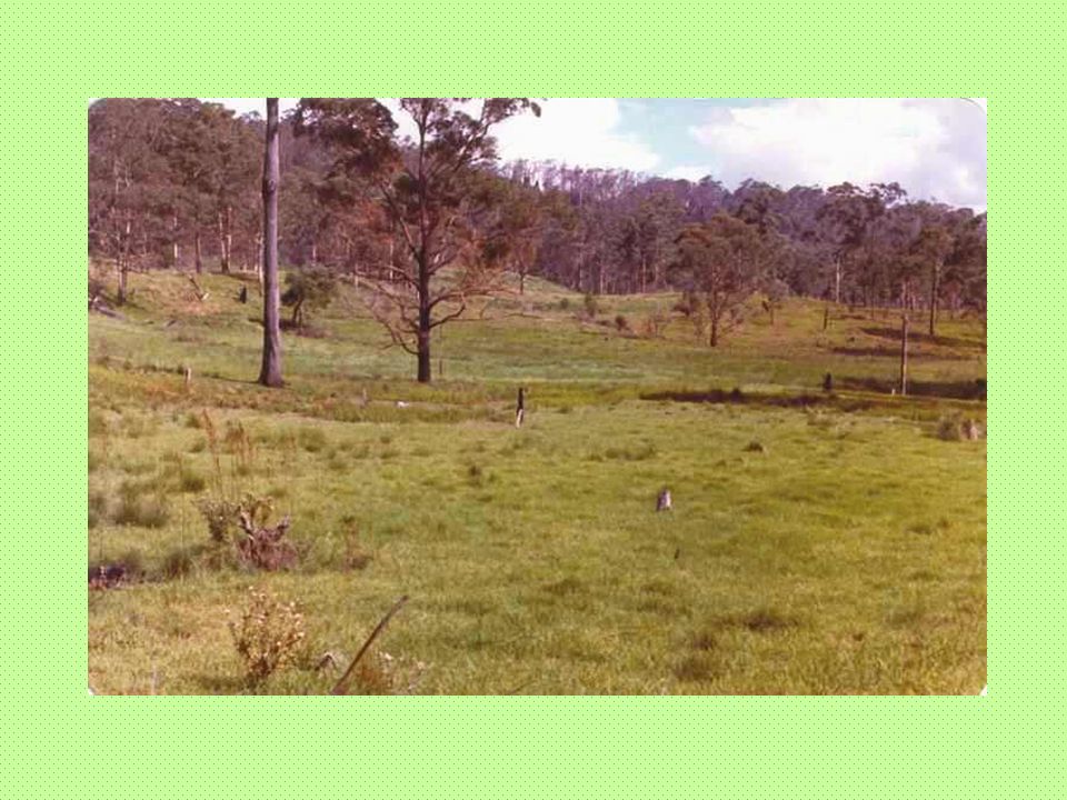
Thin flows of Units A and C are strongly fractured and contain zones of gas bubbles These less resistant to weathering and form benches on sides of mountain

13
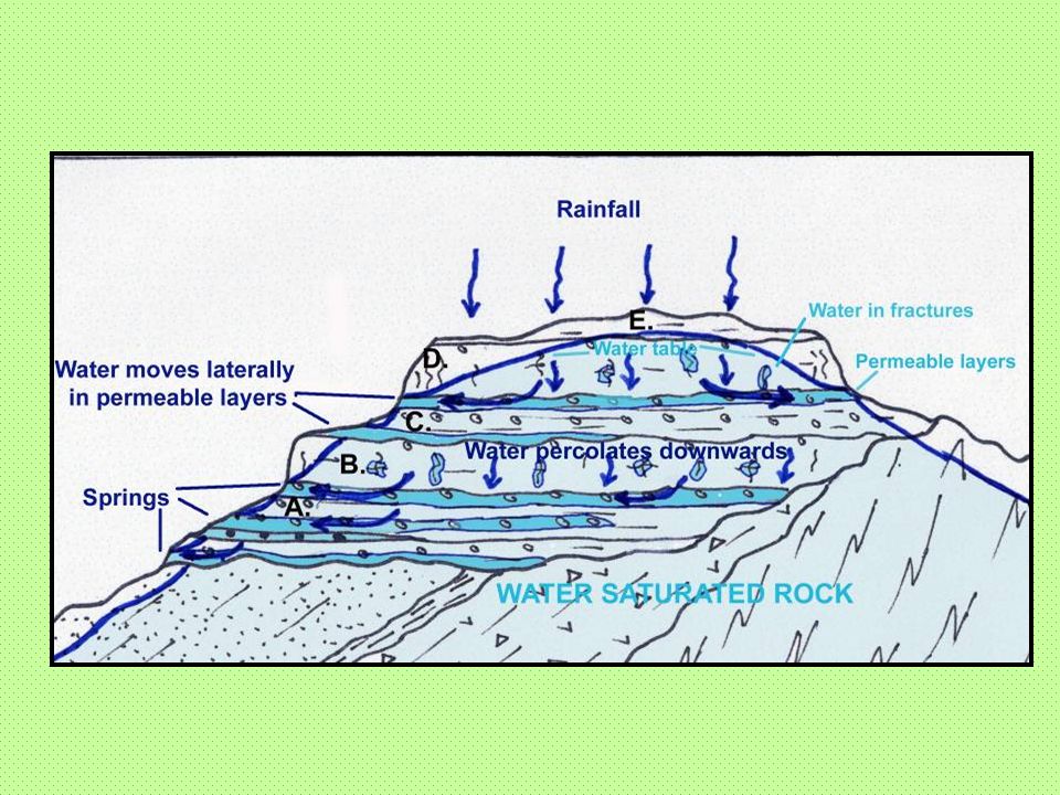
Water movement Rainfall seeps into ground to saturate rock
Level of saturation is the water table Just because rock is saturated does not mean water can be extracted – often held only in tiny pores and fractures Water can only be pumped where there are permeable zones which allow it to flow and be replenished relatively quickly

14
Controls on groundwater at Tamborine Mountain
Horizontal basalt flows Fractures and gas bubbles in Units A & C which create permeable layers that feed groundwater laterally on to the sides of the mountain to form springs Springs wax and wane depending on pressure head of water table, which is seasonally variable Other permeable layers at base of basalt

16
Likely water sources Best flows are likely from bores in Units A & C, and in deeper permeable layers at base of basalt sequence Units B and D unfavourable, but small flows may be possible from localised fracture zones Older rocks beneath basalt not of significance

Similar presentations