Download presentation
Presentation is loading. Please wait.

1
You need COLORED PENCILS or CRAYONS – go to your locker if needed Get out your Asia maps and something to write with for notes!

2
South and East Asia Notes SS7G9

3
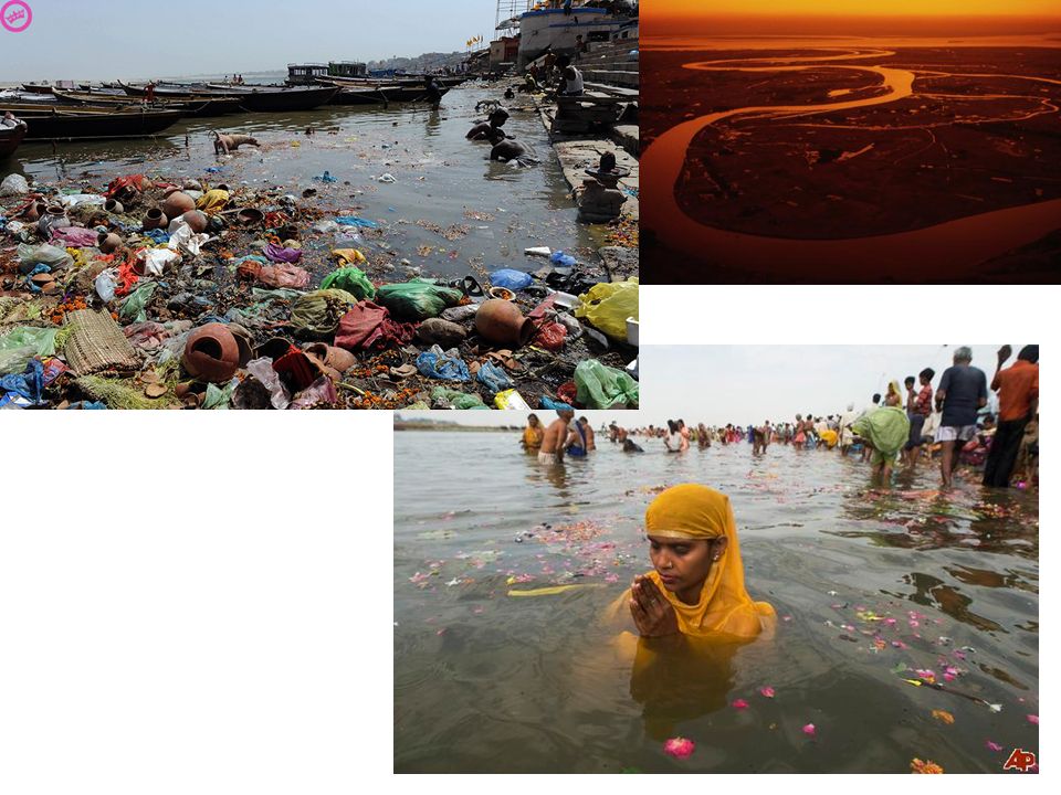
Ganges River The Ganges River is the most important river in India, and religiously significant to Hindus. The Ganges River is 1,557 miles long. The Ganges is one of the most polluted river systems in the world.

4
Ganges River

6
Huang He River (Yellow River) The Huang He River is the major river of the northern regions of China and the second longest river in China. The river has been nicknamed “China’s Sorrow” because of the extensive and dangerous floods.

7
Huang He River (Yellow River)
")
8
Indus River The Indus River is one of the world’s longest rivers at over 1,800 miles. The Indus River flows through the valleys of Tibet in the Himalayas and continues through disputed land areas between Pakistan and India.

9
Indus River

10
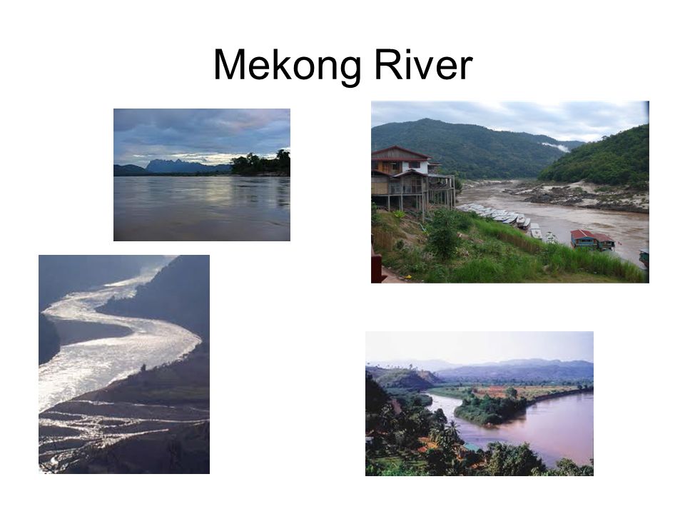
Mekong River The Mekong River originates in the southern Qinghai province of China It flows southward through Tibet and serves as a part of the Laos and Myanmar border, and Laos and Thailand. The Mekong River enters the sea in Vietnam near Ho Chi Minh City. The Mekong River flows through major countries like China, Tibet, Cambodia, Laos, Thailand, Myanmar, and Vietnam.

11
Mekong River

13
Yangtze (Chang Jiang)River As does the Indus River, the Yangtze begins on the Tibetan Plateau. The Yangtze (Chang Jiang) flows eastward into the East China Sea. The Yangtze is over 3400 miles long and is China’s longest river. The Yangtze flows through fertile farmlands and is a major transportation route.
 flows eastward into the East China Sea. The Yangtze is over 3400 miles long and is China’s longest river. The Yangtze flows through fertile farmlands and is a major transportation route..")
14
Yangtze River

15
Yangtzee River

16
Bay of Bengal The Bay of Bengal is a major bay that occupies over 800,000 square miles. It is part of the Indian Ocean that is bordered to the west by India, and to the east by Myanmar, Sri Lanka, and Bangladesh.

17
Bay of Bengal

18
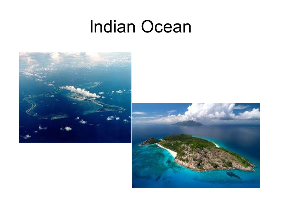
Indian Ocean The Indian Ocean is the world’s third largest ocean. Located in the Eastern Hemisphere, it stretches from India to the Southern Ocean, and from Africa to Australia. The Indian Ocean has thousands of shipping routes for oil and other resources. The Indian Ocean has been plagued by deadly tsunamis because of the fault boundary beneath it. Indian Ocean

19
Indian Ocean

21
Sea of Japan The Sea of Japan separates western Japan from China. The sea is relatively warm and helps create a mild climate for Japan. The increase in Chinese and Japanese productivity has made the Sea of Japan increasingly vital economically.

22
Sea of Japan

23
South China Sea The South China Sea is part of the Pacific Ocean. It is located south of mainland China and the island of Taiwan and west of the Philippines. The South China Sea is a vital shipping area for the Eastern Asian economies.

24
South China Sea

25
Yellow Sea The Yellow Sea is a large inlet of the western North Pacific Ocean. It is located between northeastern China and the Korean Peninsula. The sand from the Gobi Desert sandstorms turn the surface of the water yellow. A Gobi Desert sandstorm as seen from a NASA satellite image.

26
Yellow Sea

27
Gobi Desert One of the great deserts of the world; the Gobi Desert covers an area across Central Asia, especially Northern China and Mongolia. Much of the Gobi Desert is barren rock and some parts sandy.

28
Gobi Desert

29
Taklimakan Desert The Taklimakan Desert is the most extreme desert climate in Asia. On a clear day, tornadoes and sandstorms may occur and sandstorms can turn day into night. The region is largely uninhabitable because of the climate.

31
Himalaya Mountains The “roof top of the world,” the Himalaya Mountains are the highest in the world. –Over 110 mountains reach an elevation of 24,000 ft. or more. –Mount Everest at 29,000 ft. is the highest point on Earth. The most extreme mountain climates on Earth are found in the Himalayas. The Himalayas as viewed from the International Space Station.

32
Himalaya Mountains

33
Himalayan Mountains

34
Korean Peninsula The Korean Peninsula is in East Asia and has been split between North and South Korea since the rise of Communism in the 1950s. South Koreans enjoy a higher standard of living. North Korea has suffered from poor government and natural disasters.

35
Korean Peninsula – North and South Korea

36
Countries to know in Asia: China India Indonesia South Korea North Korea Japan Vietnam

37
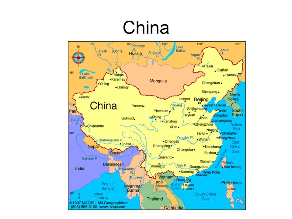
China

39
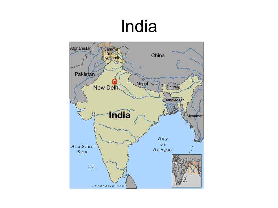
India

41
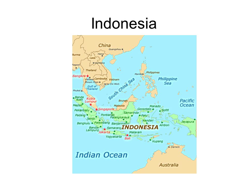
Indonesia

43
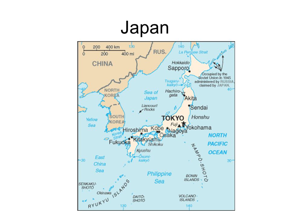
Japan

45
North Korea

47
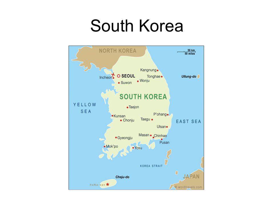
South Korea

49
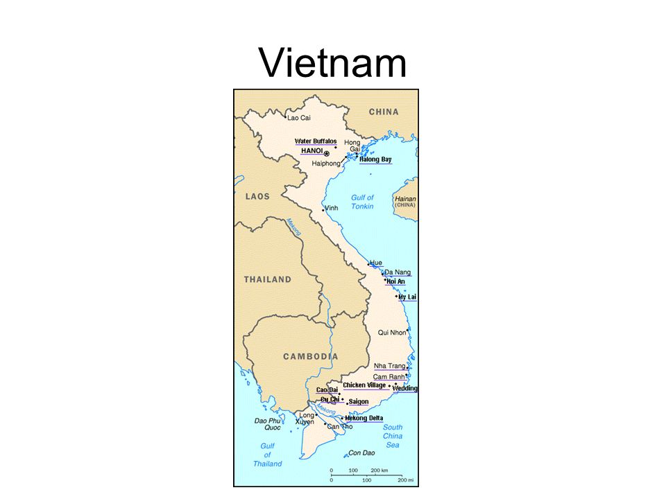
Vietnam

51
STUDY YOUR MAPS FOR YOUR MAP QUIZ!!!

Similar presentations


 FSMS Standard SS7G9.a Standard SS7G9.a Days 1-3 Days 1-3.>")

 FSMS Standard SS7G9.a>")

 Largest Mountain chain in the world.>")
 FSMS Standard SS7G9.a>")
