Download presentation
Presentation is loading. Please wait.

1
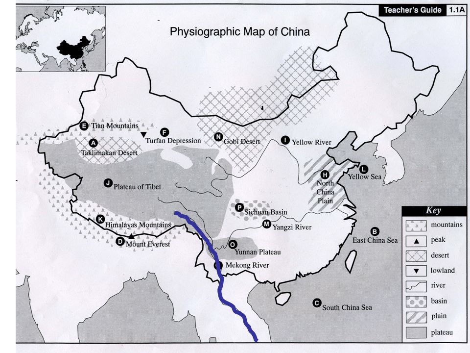
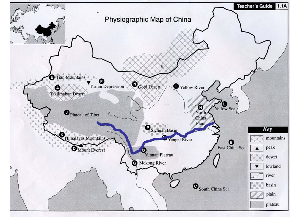
Physiographic Map Study of China
“China’s geography is an assemblage of pieces.”

2
Map Study Directions Be prepared to discuss the 5 guiding questions. Take Cornell Notes to assist you in the class discussion. You need a black line map of China. You need pen/pencil/colored pencils. Read through the slide show. Complete the map as you read through the slide show. Answer 1 question at the end of the slide show on a separate sheet of paper.

3
Guiding Questions How would you describe China’s physical borders?
How would you characterize the western part of China? The eastern? The southern? The northern? The central? Given these physical attributes, why might it be difficult for a government to rule China? How might a government unify such a vast and diverse country?

4
Question to be answered at the completion of the slide show.
Answer the following question in complete sentences: What does the following quote mean to you? “China’s geography is an assemblage of pieces.” Provide examples to illustrate your point of view.

5
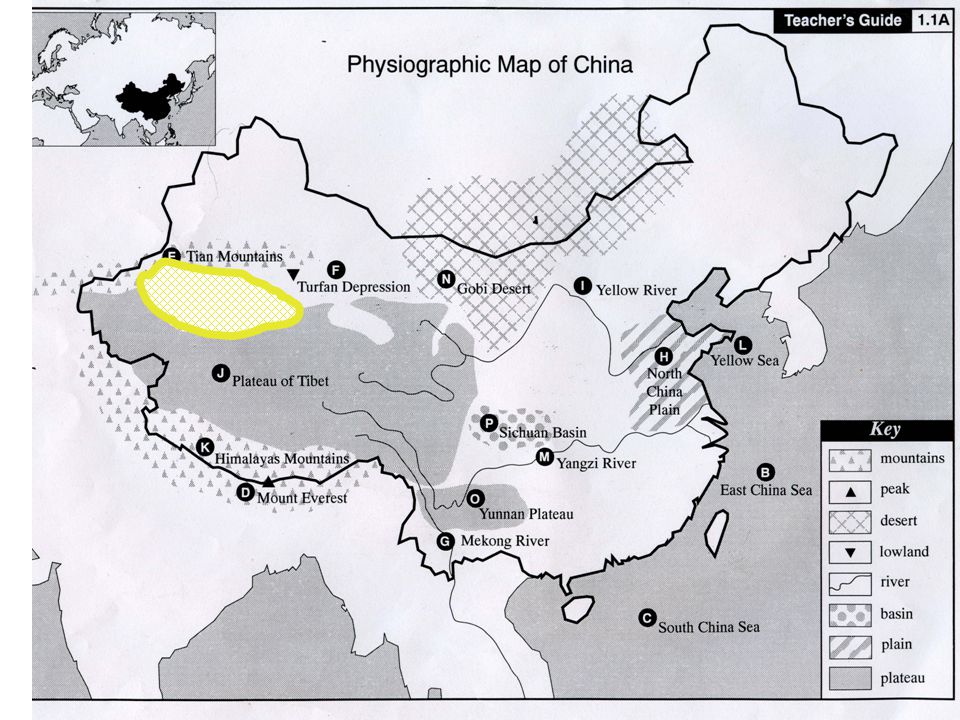
Sample Taklimakan Desert 1.1A
Because of Copyright issues, I could not include the content which was provided by TCI History Alive unit on Ancient China. See Resources at conclusion.

6
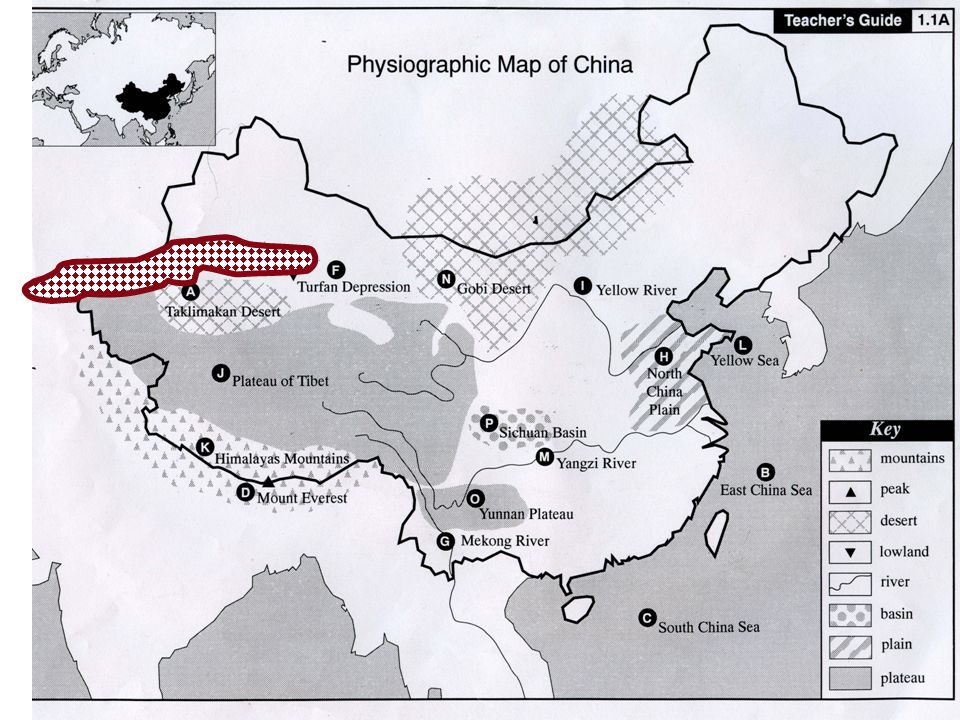
Taklimakan Desert 1.1A

8
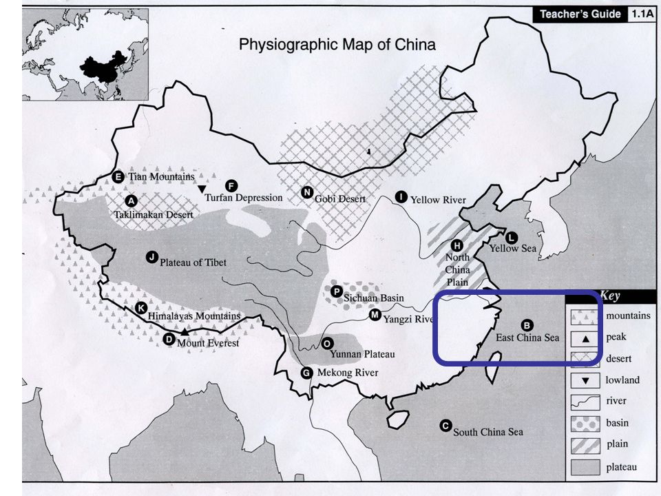
East China Sea 1.1B

9
East China Sea 1.1B

11
South China Sea 1.1C

12
South China Sea 1.1C

14
Mount Everest 1.1D

15
Mount Everest 1.1D

17
Tian Mountains 1.1E

18
Tian Mountains 1.1E

20
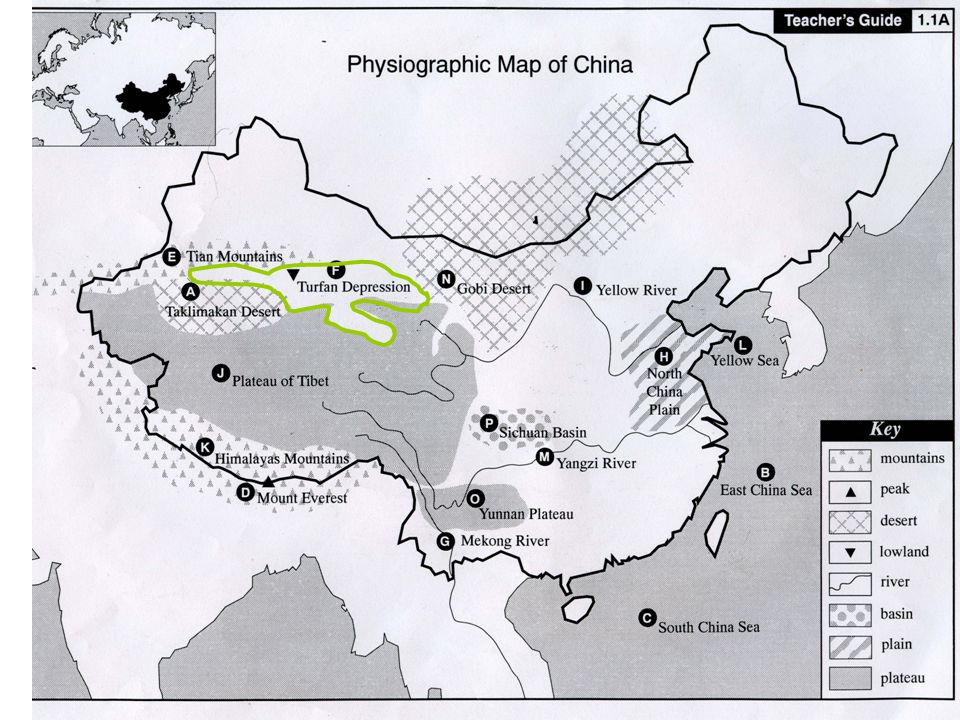
Turfan Depression 1.1F

21
Turfan Depression 1.1F

23
Mekong River 1.1G

24
Mekong River 1.1G Mother of All the Waters the 9 Dragons River
the River of Rocks the Great River

26
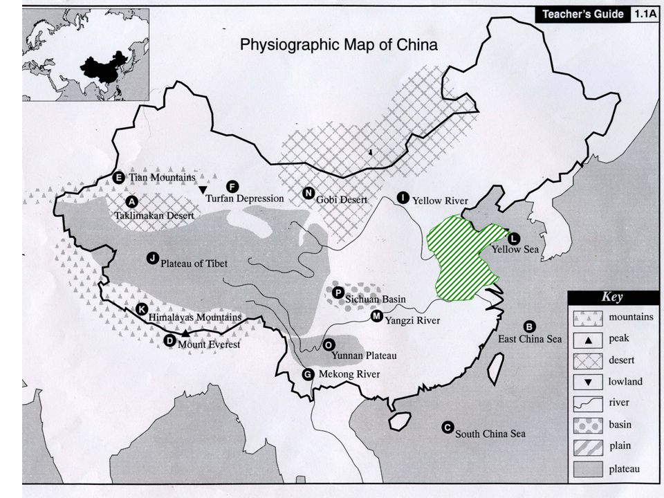
North China Plain 1.1H

27
North China Plain 1.1H

29
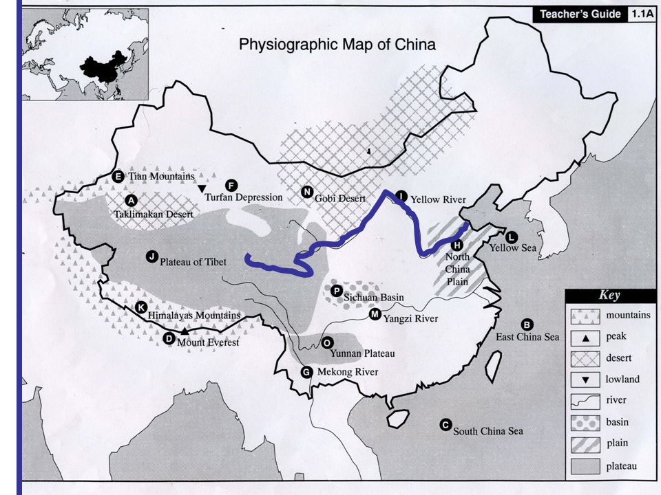
Yellow River 1.1I

30
Yellow River 1.1I

32
Plateau of Tibet 1.1J

33
Plateau of Tibet 1.1J

35
Himalayas Mountains 1.1K

36
Himalayas Mountains 1.1K

38
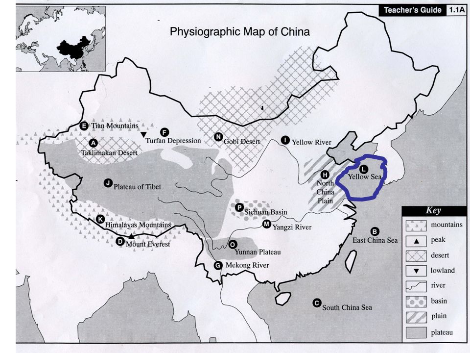
Yellow Sea 1.1L

39
Yellow Sea 1.1L

41
Yangzi River 1.1M

42
Yangzi River 1.1M

44
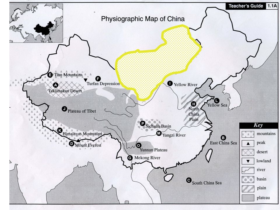
Gobi Desert 1.1N

45
Gobi Desert 1.1N

47
Yunnan Plateau 1.1O

48
Yunnan Plateau 1.1O

50
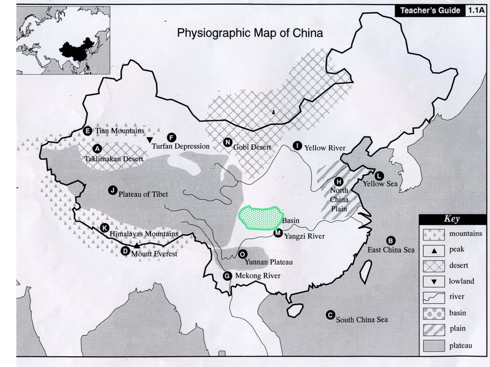
Sichuan Basin 1.1P

51
Sichuan Basin 1.1P

53
Question to be answered at the completion of the slide show.
On a separate piece of paper answer the following question in complete sentences: What does the following quote mean to you? “China’s geography is an assemblage of pieces.” Provide examples to illustrate your point of view.

54
Resources Photographs were taken from the Internet.
Content material comes from TCI History Alive unit on China. TCI provides slides, but I found it easier to utilize the Internet

Similar presentations