Download presentation
Presentation is loading. Please wait.

2
Remember “normal” ocean circulation?

3
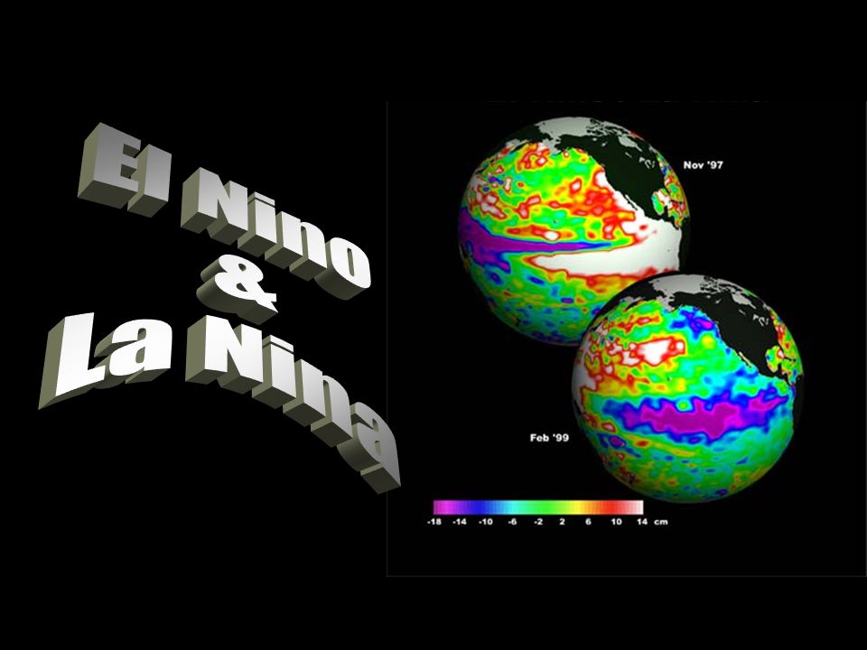
El Nino? (warm) Trade winds weaken Thermocline drops Upwelling is cut off SST rises in E.Pacific High & Low pressure areas in Pacific reverse Disrupts fish/bird populations in E.Pacific Occur every 2-7 years Lasts 12-18 months
 Trade winds weaken Thermocline drops Upwelling is cut off SST rises in E.Pacific High & Low pressure areas in Pacific reverse Disrupts fish/bird populations in E.Pacific Occur every 2-7 years Lasts months.")
4
La Nina? (cold) Trade winds strengthen SST decrease in E.Pacific Upwelling increases Occurs every 3-5 years Lasts 9-12 months
 Trade winds strengthen SST decrease in E.Pacific Upwelling increases Occurs every 3-5 years Lasts 9-12 months.")
5
Prentice Hall Textbook animation linkTextbook animation link

6
Prentice Hall Textbook animation linkTextbook animation link

7
Prentice Hall Textbook animation linkTextbook animation link

8
Normal El nino – strong counter-current

9
Sea surface anomalies associated with El Nino

10
SST differences between El Nino and La Nina

11
A B C QUIZ! Which is which… Normal, El Nino, La Nina?

12
Were you’re predictions correct?

13
What are the effects of El Nino?

14
Brush fires caused by drought

15
Increased Tropical Storms

16
Devastating floods

17
Peruvian anchovy populations decline

18
Winter NH El Nino La Nina

19
Summer NH El Nino La Nina

20
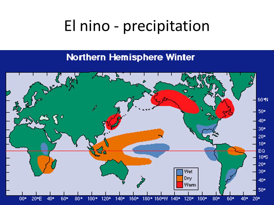
El nino - precipitation

22
Hurricanes El Niño contributes to more eastern Pacific hurricanes and fewer Atlantic hurricanes. La Niña contributes to fewer eastern Pacific hurricanes and more Atlantic hurricanes. US hurricane damage

23
US Tornados Tornado activity Depends on the location of the polar jet stream El Nino: More to the south La Nina: more to the north

24
Measurements! How can we predict an El Nino or La Nina event?

25
Buoys Measure... temperature currents winds

26
Radiosonde Weather balloon Monitors global weather and climate patterns

27
Satellites Provide data on: Rainfall Wind Ocean temp. Sea surface height Ocean color Surface currents

28
TOPEX/Poseidon (T/P)
")
30
Click here to find out what the current sea surface temperatures are. Are we in an El Nino, La Nina, or neither?

Similar presentations


>")
 Physical Oceanography>")


