Download presentation
Presentation is loading. Please wait.

1
Water in our Local System Objectives: Locate the main stem, tributaries, headwaters, mouth and boundaries of watersheds on simple maps. Characterize movement of water in a watershed based on elevation changes.

2
Watersheds definition A watershed, also called a catchment, basin or drainage, is an area of land drained by a river and its tributaries to a common outlet, which may be a closed basin (Salt Lake, UT), a larger stream, a lake, wetland, estuary or an ocean. Within its boundaries, a watershed includes ALL the land, air, surface and ground water, plants and animals, mountains and deserts, cities and farms, and people including their stories and traditions.

3
Features of Watersheds Watersheds are separated from each other by areas of higher elevation called ridge lines or divides. Near the divide the water channels are narrow and can contain fast-moving water. At lower elevations where the slope of the land decreases the water flows more slowly. As smaller streams merge, the width of the channel increases.

4
Features cont. Eventually, water collects in a wide river that empties into a body of water such as a lake or ocean. From an aerial view drainage patterns of watersheds resemble a network similar to the branching pattern of a tree. Tributaries, similar to twigs and small branches flow into streams, the main branches of the tree.

5
Features cont. Streams large river, comparable to trunk of tree.

6
Features cont. Unlike the tree analogy, where water goes from the roots to the tips of the branches and leaves; the tips of a watershed are called headwaters. Headwaters are the source of a stream. Streams are any body of running water moving under gravity’s influence through clearly defined natural channels to progressively lower levels. Tributary: A stream that contributes its water to another stream or body of water. Mouth: the end of the river where it flows into an ocean or sea.

7
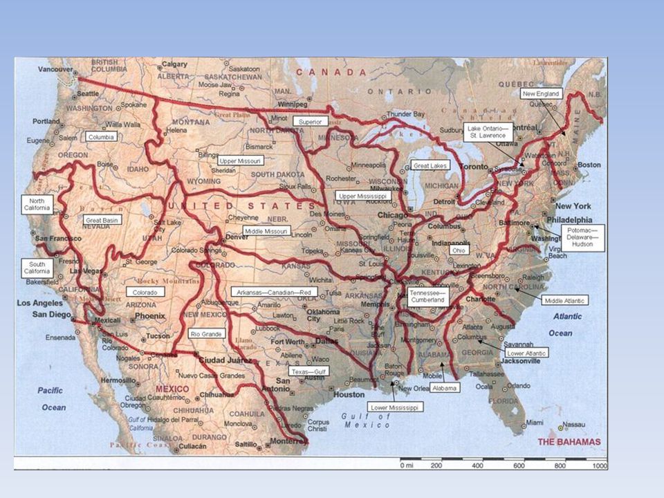
Seeing Watersheds No matter where you are in the world you are in a watershed. The ability to see watersheds begins with the main river (main stem) in the watershed. Part I To outline the watershed boundary, the branching pattern of the main stem and its tributaries ( streams that drain into it) are traced first.
 in the watershed. Part I To outline the watershed boundary, the branching pattern of the main stem and its tributaries ( streams that drain into it) are traced first..")
8
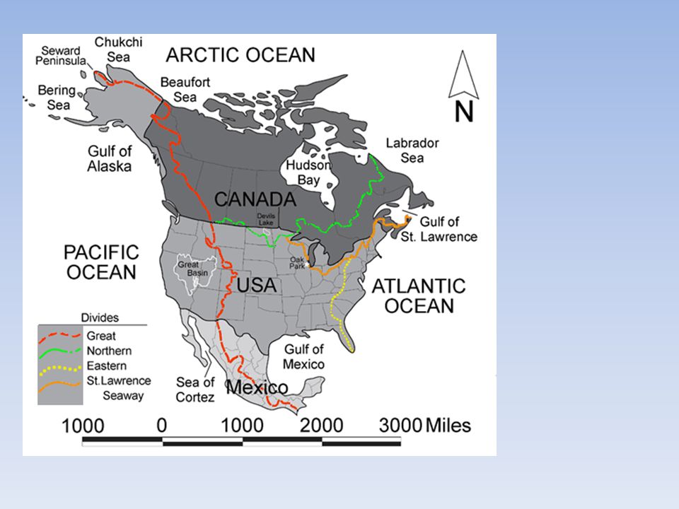
Seeing watersheds Follow the main stem to its tributary and the tributary to its source. Sources of tributaries are on ridgelines that separate watersheds. Part II The largest in North America is the Great Continental Divide which divides the flowing water into either the Atlantic or Pacific Ocean (or Arctic to the North)
.")
11
Seeing Watersheds Outline watershed boundaries color each one a different color; red, purple, orange, green. Identify the source tributaries and mouth of the Verde River. – Color the main stem purple, the tributaries orange, and the tertiary tributaries red, quaternary tributaries green, quinary brown

13
Verde River

Similar presentations