Download presentation
Presentation is loading. Please wait.

1
Southwest Asia, Central Asia, North Africa
Chapter 17 Southwest Asia, Central Asia, North Africa

2
Chapter 17: 1 Objectives Identify which land and water features dominate the region. Discuss how the region’s major rivers are important to its people. Explain why much of the world is economically dependent on the region.

3
Drawing from Experience
Have you ever put together a jigsaw puzzle? Imagine a region in which the seas and land resembles pieces of a jigsaw puzzle. This section focuses on the natural features and resources of North Africa, Southwest Asia and Central Asia.

4
Terms to Know alluvial soil wadi kum phosphate

5
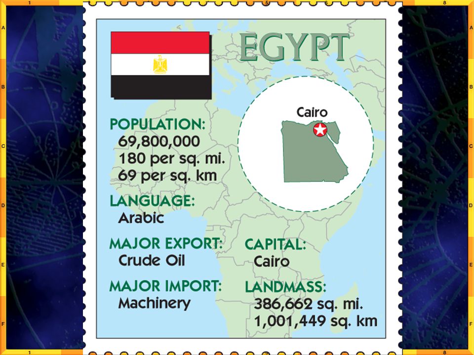
North African countries
Egypt – (Cairo) The Cradle of Civilization Morocco (Rabat) Algeria (Algiers) Tunisia (Tunis) Libya (Tripoli)
 The Cradle of Civilization. Morocco (Rabat) Algeria (Algiers) Tunisia (Tunis) Libya (Tripoli)")
7
Southwest Asia (Middle East)
Bahrain Iran Iraq Israel Jordan Kuwait Lebanon Oman Qatar Saudi Arabia Syria United Arab Emirates (UAE) Yemen
 Yemen.")
9
Central Asia & the “Stans”
Afghanistan Kazakhstan Kyrgyzstan Tajikistan Turkmenistan Uzbekistan (Pakistan – later) Armenia Azerbaijan Georgia Turkey
 Armenia. Azerbaijan. Georgia. Turkey.")
11
Introduction People, goods, and ideas have come together for centuries in North Africa, Southwest Asia and Central Asia. The region’s location near the Mediterranean Sea draws travelers from all directions. This region is where the continents of Europe, Africa and Asia meet. The region’s landscape is varied and rich in natural resources.

13
Why do people, goods and ideas come together in North Africa, Southwest Asia and Central Asia?
Answer: the region’s location near the Mediterranean Sea and this is where the continents of Europe, Asia and Africa meet.

14
Seas and Peninsulas a. the Mediterranean Sea lies between Africa and Europe. b. the Red Sea and the Gulf of Aden separate Southwest Asia’s Arabian Peninsula from Africa c. the Persian Gulf borders the Arabian Peninsula on the east and the Arabian Sea borders it on the south.

15
d. the Gulf of Suez and the Gulf of Aqaba border the Sinai Peninsula.
e. the Black, Mediterranean Sea and Aegean Seas border the peninsula of Anatolia (Turkey).
.")
16
Three Landlocked bodies of saltwater lie east of the Mediterranean Sea
a. the Dead Sea – saltiest body of water in the world. forms part of the Israel-Jordan border. b. the Caspian Sea is the largest inland body of water on earth c. the Aral Sea in Central Asia, used to be the 4th largest inland sea but it’s shrinking.

17
Question What land and water features make up much of this region?
Answer: seas; Mediterranean, Red, Black, Arabian, Caspian and Aral gulfs; Aden, Persian, Suez, Aqaba peninsulas; Arabian, Sinai, Anatolia

18
Rivers the Nile River – in Egypt (Misr), longest in the world.
fertile soil river was the site of one of the world’s earliest civilization, 90% of Egyptians live on the river. Aswan Dam 7 others now control flooding of the Nile.

19
The dams have reduced flooding and deposits of alluvial soil.
This rich soil is made up of sand and mud deposited by moving water.

24
Nile Delta A delta is where a river and a larger body of water, in this case the Mediterranean Sea, meet and push at each other, in other words an estuary, where freshwater (Nile) meets saltwater (Mediterranean); it pushes the river and makes it fan out like the fingers of a hand… in the shape of a triangle or the Greek letter “delta” -- .
 meets saltwater (Mediterranean); it pushes the river and makes it fan out like the fingers of a hand… in the shape of a triangle or the Greek letter delta -- .")
25
Nile Delta

29
Dam the Nile – Why? pros: dams make lakes and thus store more water,
can irrigate feed more people stop destructive flooding cons: flooding makes the soil more fertile, slower water causes more disease soil is less fertile and now must add chemicals to restore rich soil.

30
Aswan High Dam

31
Aswan High Dam

32
Effects of Aswan High Dam

34
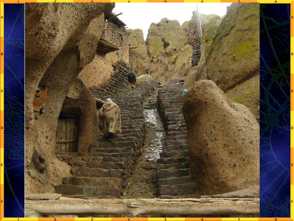
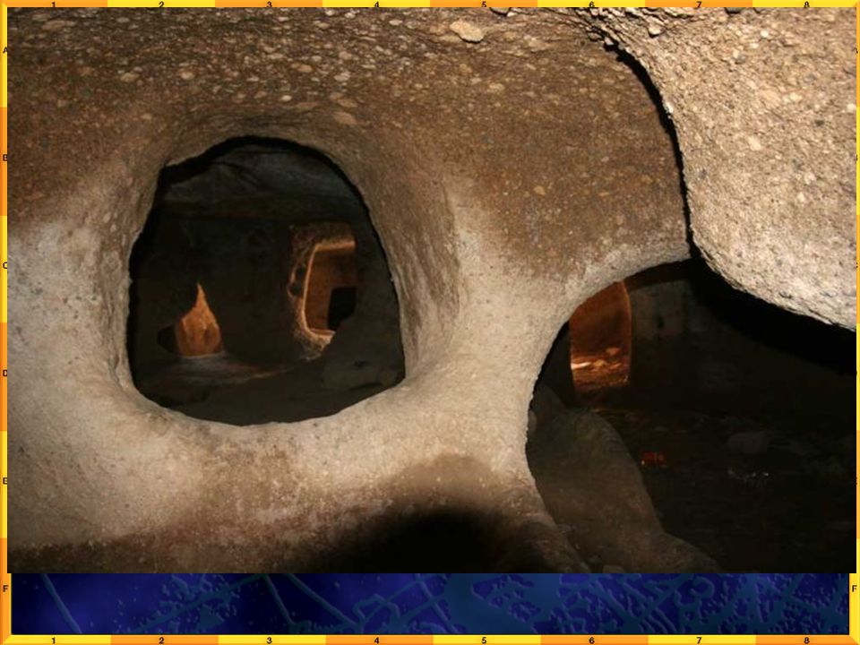
Creates Nasser Lake

35
Abu Simbel – Would have been flooded

36
Temple of Ramses II

37
Temple of favorite wife -- Nefertari

38
The Tigris and Euphrates Rivers
located mostly in Iraq river valley is a fertile farming valley the birthplace of Mesopotamia, an early civilization Mesopotamia means “land between two rivers” both rivers have been damed.

39
Tigris & Euphrates River

40
Tigris River

41
Euphrates River

42
Where the two rivers meet: Shat al-Arab river delta – empties into the Gulf of Persia.

44
Irrigation Today the Tigris and Euphrates Rivers irrigate farms throughout Syria, Turkey and Iraq. Dams control the flow of both rivers.

45
Wadis Many streams appear and disappear suddenly.
This occurs because of runoff of infrequent rainstorms. These streambeds are dry until a heavy rain. called wadis.

46
Wadi

48
Plains, Plateaus, Mountains
A. Atlas Mountains – Africa’s longest mountain range, Morocco and Algeria in North Africa. Enough rain falls on the northern side to allow farming and settlement. B. Hejaz and Asir mountains – Asir gets the most rain – east gets little rain because of the rain shadow effect.

49
C. Pontic and Taurus Mountains in Turkey.
D. Caucasus Mountains – between the Black and the Caspian Seas. E. Turan Lowlands – irrigated farmlands close to China. kums are deserts: Kara Kum (Garagum) – Turkmenistan Kyzl Kum (Qizilqum) – Uzbekistan.
 – Turkmenistan. Kyzl Kum (Qizilqum) – Uzbekistan.")
50
Earthquakes Three tectonic plates come together in North Africa, Southwest and Central Asia. Movement of these plates has built mountains, moved landmasses and caused frequent earthquakes in the region. is causing the Red Sea to grow wider. In 1999 a violent earthquake killed 20K.

51
Resources Petroleum and natural gas are the region’s most abundant and important. 70% of the earth’s known oil reserves are here and 30 % of all natural gas are in this region. Other minerals: sulfate, sulfur, phosphate, chromium, gold, lead, manganese, zinc, iron and copper.

52
sulfates – Turkmenistan has the world’s largest deposits.
phosphates – a chemical compound used in fertilizers.

53
Sec. 1 – Key Points North Africa, Southwest Asia and Central Asia are located at the crossroads of Asia, Africa and Europe. The region is a jigsaw puzzle of peninsulas and seas. The movement of tectonic plates forms mountains, moves landforms and causes earthquakes in the region.

54
Rivers feed the inland seas and supply irrigation to parched lands.
Their alluvial soil deposits enrich the land, especially in the Nile River Valley and delta. The region contains much of the world’s oil and natural gas reserves.

56
Chapter 17 Sec. 2 Objectives
Explain how the climates of the region differ. Describe how the needs of a growing population have affected the natural vegetation of the region.

57
Terms to Know oasis pastoralism cereal

58
Drawing from Experience
When you think of a desert, what comes to mind? What is the climate like? What kinds of animals live there? What would it be like to live in a region in which half the land was desert? In the last section, you read about the natural features and resources of North Africa, Southwest Asia and Central Asia. This section focuses on climate & vegetation of the region.

59
Introduction Ancient cave paintings tell us the North Africa was once wet and green. Differences in climate across the region affect vegetation and human activities.

60
Water: A Precious Resource
Rainfall is plentiful in some areas of the region. In most, however, water is scarce because evaporation exceeds rainfall. Two dry climates cover most of the region.

61
A. A Desert Climate 50% of the region is desert
less than 10 inches of rain per year The Sahara is the largest desert in the world. Covers most of North Africa, The Rub’al Khali (Empty Quarter) desert covers 1/4th (quarter) of the Arabian Peninsula.
 desert covers 1/4th (quarter) of the Arabian Peninsula.")
62
Nomadic peoples raise herds of sheep, goats and camels in the Garayum desert of Central Asia.
Oasis = a place in the desert where underground water comes to the surface. Villages, towns or small-scale farms can exist in some oases (plural).
.")
63
Afghan Village

73
Sahara Desert & Rub’al Khali

75
B. Steppe Climate 2nd largest climate in the region.
annual rainfall: 10 to 20 inches enough to grow short grasses, shrubs and a few trees supports pastoralism – the raising and grazing of livestock.

76
Climatic Variations There are two climates in the region with more rainfall than the desert and steppe climates. A. Mediterranean and B. Highland

77
A. Mediterranean Climate
has cool rainy winters and hot, dry summers found in the Tigris-Euphrates valley, in upland areas and the coastal plains of the Mediterranean, Black and Caspian Seas. Farmers can grow citrus fruits, olives and grapes. Tourists enjoy this climate.

78
B. Highlands found in higher areas of the region
in the Caucasus Mountains. highland climate varies with elevation, wind and sun generally is wetter and colder than other climates in the region.

79
Others Coastal and highlands areas near mountain ranges receive the most rainfall North African coast can get 30” of rain, enough to grow forests. Georgia can get more than 100 inches of rain. Areas that get more than 14” of rain a year can grow cereals – food grains such as barley, oats and wheat.

80
Section 2: Key Points Rainfall in North Africa, Southwest Asia and Central Asia varies widely. Most of the region contains arid areas. The four (4) climate regions in North Africa, Southwest Asia and Central Asia are: desert, steppe, Mediterranean and highlands. Natural vegetation in the region varies widely and is closely related to rainfall and irrigation patterns.
 climate regions in North Africa, Southwest Asia and Central Asia are: desert, steppe, Mediterranean and highlands. Natural vegetation in the region varies widely and is closely related to rainfall and irrigation patterns.")
81
Olives

82
End of Slide Show

Similar presentations