Download presentation
Presentation is loading. Please wait.

1
Using high resolution satellite imagery to improve sweet potato crop statistics in Uganda L. Claessens, P. Zorogastúa, R. Quiroz, M. Potts & S. Namanda

2
Introduction Study area : characteristics Physical bases of remote sensing Imagery Digital image processing Results Conclusions

3
AFRICA

4
UGANDA

6
Introduction Study area : characteristics Physical bases of remote sensing Imagery Digital image processing Results Conclusions

9
Source: FAO

10
Introduction Study area : characteristics Physical bases of remote sensing Imagery Digital image processing Results Conclusions

13
B RGNEAR IRMID INFRARED 5001000150020002500 0 10 20 30 40 50 Wavelength in nanometers % Reflectance water Green vegetation Dry vegetation Soil Generic spectral signatures

14
Introduction Study area : characteristics Physical bases of remote sensing Imagery Digital image processing Results Conclusions

15
SPOT Satellite Source: www.spotimage.comwww.spotimage.com

16
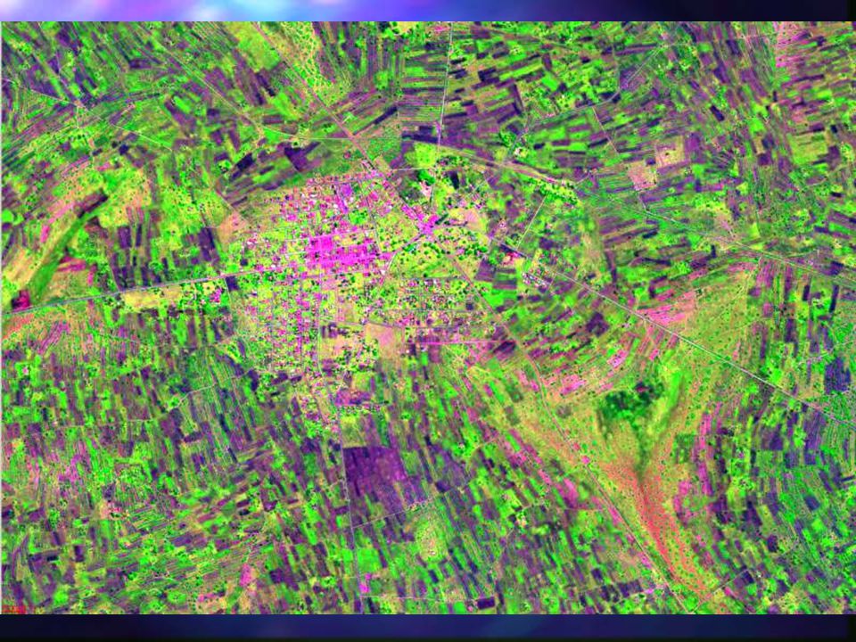
SOURCE: SPOTIMAGE-CNESS Kumi Spot Image 06-May-06

17
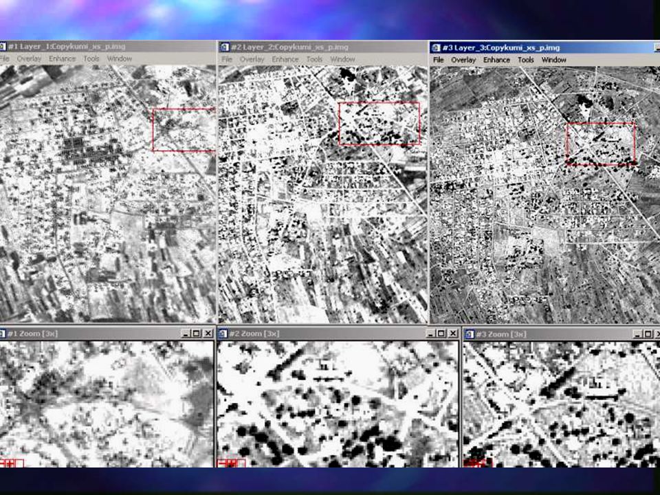
Introduction Study area : characteristics Physical bases of remote sensing Imagery Digital processing Results Conclusions

20
Introduction Study area : characteristics Physical bases of remote sensing Imagery Digital image processing Results Conclusions

23
Sweet potato plot Distribution of Sweet potato fields around Kumi town

24
Introduction Study area : characteristics Physical bases of remote sensing Imagery Digital image processing Results Conclusions

25
Kumi Land cover - land use

27
THANKS THANKS

Similar presentations


: The range of energy which contains parts or bands: visible light, infrared,>")

