Download presentation
Presentation is loading. Please wait.

1
Locating Plate Boundaries of the Pacific Rim
Around the Ring of Fire Locating Plate Boundaries of the Pacific Rim

2
Pacific Northwest Seismic Data
This is a map of seismic activity of the Pacific Northwest Each yellow (35-70 km deep) and orange (less than 35 km deep) dot represents an earthquake What pattern do you see? What does this pattern mean? Map generated using the U.S. Geological Survey. “Earthquake Hazards Program :Earthquake Center”
 and orange (less than 35 km deep) dot represents an earthquake. What pattern do you see What does this pattern mean Map generated using the U.S. Geological Survey. Earthquake Hazards Program :Earthquake Center")
3
Southeast Asia Seismic Data
This is a map of seismic activity of Southeast Asia Each yellow (35-70 km deep) and orange (less than 35 km deep) dot represents an earthquake What pattern do you see? What does this pattern mean? Map generated using the U.S. Geological Survey. “Earthquake Hazards Program :Earthquake Center”
 and orange (less than 35 km deep) dot represents an earthquake. What pattern do you see What does this pattern mean Map generated using the U.S. Geological Survey. Earthquake Hazards Program :Earthquake Center")
4
Pacific Rim Seismic Data
This is a map of seismic activity of the Pacific Rim Each yellow (35-70 km deep) and orange (less than 35 km deep) dot represents an earthquake Do you see any patterns? What do these patterns tell you? Map generated using the U.S. Geological Survey. “Earthquake Hazards Program :Earthquake Center”
 and orange (less than 35 km deep) dot represents an earthquake. Do you see any patterns What do these patterns tell you Map generated using the U.S. Geological Survey. Earthquake Hazards Program :Earthquake Center")
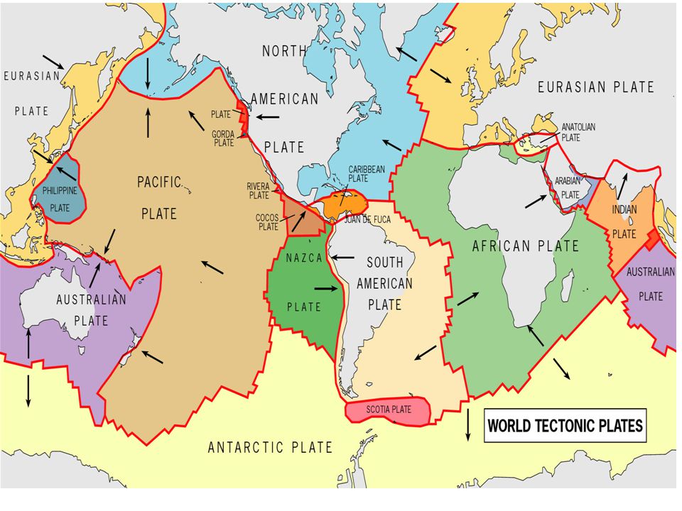
6
Plates of the Pacific Rim

Similar presentations


 MODIS 1km 3/4~3/11/01 PSN (gC m -2 d -1 ) LAI (m 2 m -2 ) 0-0.7 0.8-1.5.>")


 2. ___plate boundary that plates slide past one another (plate boundaries) 3.___layer.>")


