Download presentation
Presentation is loading. Please wait.

1
LOUISIANA COASTAL ZONE EROSION 100+ YEARS OF LANDUSE AND LAND LOSS USING GIS AND REMOTE SENSING DATA Dr. Lionel D. Lyles and Dr. Fulbert Namwamba Southern University

2
GOALS To establish a link between oil and gas well production and Louisiana wetlands land loss. To establish a link between freshwater deprivation and increasing land loss south of the Intracoastal Canal.

3
OBJECTIVES To show the high concentration of oil and gas wells located throughout the Louisiana wetlands. To establish a connection between the oil and gas infrastructure-service and distribution-and freshwater deprivation and saltwater intrusion. To examine 100+ years of land loss in the Louisiana coastal wetlands.

4
STATUS OF OIL AND GAS PRODUCTION 160,000+ oil and gas wells located in the Louisiana wetlands. Account for 18% U.S. oil production with an annual value of $6.3 billion. Account for 24% of U.S. natural gas production with an annual value of $10.3 billion.

6
OIL/GAS INFRASTRUCTURE Channeling: over the past 100 years, numerous channels and canals have been cut through the wetlands for transportation and oil exploration. Result: Creation of the movement of unnatural water patterns, ultimately increasing erosion and wetland demise. Result: Freshwater deprivation, vegetation decay, and increasing land loss.

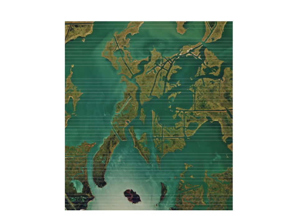
7
Channeling Diagram

16
100+ YEARS OF WETLANDS’ LAND LOSS Past 50 years: Coastal LA has lost and average of 34 square miles of marsh, roughly 1,700 square miles. 1932 to 2000: Coastal LA has lost 1,900 square miles of land-roughly the size of Delaware. Next 50 years: Coastal LA could lose another 700 square miles of land-area the size of Washington, D.C./Baltimore.

18
CON’TD Coastal LA loses 1acre of land every 24 minutes, or roughly 70 acres per day; 490 acres per week; 25,400 acres per year.

19
PROPOSED SOLUTION Develop an aqueduct system along the Intracoastal Canal to channel a steady flow of freshwater across the LA wetlands- annually- to stimulate the natural growth of freshwater vegetation landcover.

20
TEACHER REQUIREMENTS Working knowledge of GIS 3.2a. Go to www.atlas.lsu.edu to obtain oil and gas well shapefile and Digital Orthorectified Quarter Quadrangle ( DOQQ ) data.www.atlas.lsu
 data.")
Similar presentations


 Key.>")
 D. Phil Turnipseed, P.E., D.WRE Director USGS National Wetlands Research.>")


: Environmental and Economic Implications Coastal Wetland Planning, Preservation, and Restoration Act.>")

 agricultural / industrial water 1.8.>")
