Download presentation
Presentation is loading. Please wait.

1
MODIS Web Fire Mapper an example of internet GIS technology to support decision making Diane Davies and Suresh Kumar Department of Geography University of Maryland, USA

2
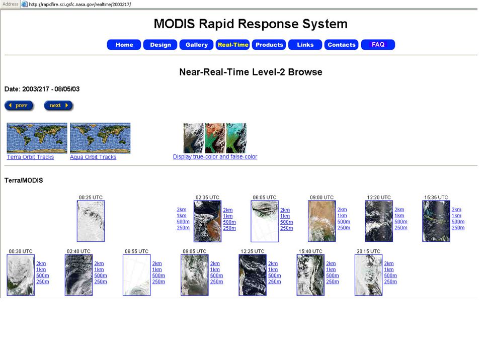
MODIS Web Fire Mapper MODIS Rapid Response real time images gallery Web Fire Mapper Active Fire Text Files (ftp site)
")
8
MODIS Terra 18 th August 2003

9
Bands 1-4-3

10
NDVI

11
Bands 7-2-1

12
MODIS Terra 18 th August 2003

13
MODIS Terra Active Fire and 250m Corrected Reflectance July 4 2002

15
MODIS image 13 th August 2003

16
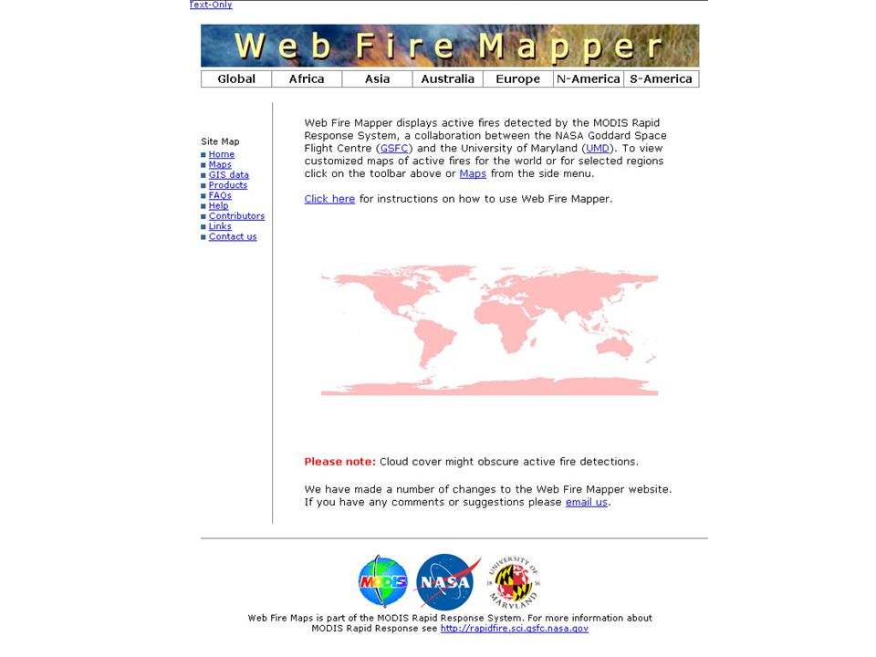
An internet mapping tool that displays near-real time active fires using data from the MODIS Rapid Response System - developed to serve active fire data to the broader natural resource management community for whom accessing and processing satellite data is costly and time consuming - displays active fire data approx 4 hours after the satellite over pass. Four daily fire observations. - customized interactive maps can be viewed and queried for selected regions and countries - by combining active fire data with local information (such as protected areas and settlements) you can get an overview of fire activity in your area
 you can get an overview of fire activity in your area.")
17
What is new? New Interface More maps Checkbox list of available layers Fires displayed as polygons 48 hour and 7 day fire files Data base of active fires from 2000 Aqua and Terra color coded Missing data pop up FAQ and Help files on line Products Executable files for importing active fire text files (from ftp site) in to ESRI GIS products
 in to ESRI GIS products.")
21
What next? Granule outlines Percentage cloud cover New satellite products (NDVI, 8 day reflectance image) Burned area product Email alert system – in conjunction with Conservation International
 Burned area product alert system – in conjunction with Conservation International.")
22
http://maps.geog.umd.edu ftp://maps.geog.umd.edu

Similar presentations


 CSET is a Software Framework + Suite of Tools (Apps) that leverages a Common Architecture, Unified Data Model, Common.>")


 – Air Quality.>")


, Ruth DeFries (1), Sandy Andelman (2), Rasolohery.>")