Download presentation
Presentation is loading. Please wait.

1
What is GIS? A technology An information handling strategy
hardware & software tools An information handling strategy The objective: to improve overall decision making What is GIS? Firstly and most importantly a GIS is an information system. A system is a group of connected entities and activities which interact for a common purpose. In GIS the common purpose is decision making for managing any spatially distributed activity. Remember that: An information system is a set of processes, executed on raw data to produce information which will be useful in decision making A chain of steps leads from observation and collection of data through to analysis An information system must have a full range of tools to handle observation, measurement, description, explanation, forecasting and decision making Finally it is important to remember that GIS can also help to achieve the overall objective of improving the decision making process, whether in an organisation, or within a project.

2
GIS: a formal definition
“A system for capturing, storing, checking, integrating, manipulating, analysing and displaying data which are spatially referenced to the Earth. This is normally considered to involve a spatially referenced computer database and appropriate applications software” GIS: a formal definition The most commonly quoted definition in the UK comes from the Chorley Report “Handling Geographic Information” HMSO, 1987 which is described above. Not everyone agrees with this definition. There are those who believe GIS forms part of more established disciplines but these definitions tend to ignore the cross disciplinary nature of spatial data.

3
GIS definition “… a special case of information system where the database consists of observation son spatially distributed features, activities or events, which are definable in space as points, lines or area. A geographic information systems manipulates data about these points, lines and areas to retrieve data for ad hoc queries and analyses”

4
Why is GIS unique? GIS handles SPATIAL information
Information referenced by its location in space GIS makes connections between activities based on spatial proximity Why is GIS unique? What distinguishes GIS from other information systems? GIS integrates spatial* and other kinds of information within one system: it offers a consistent framework for analysing space GIS makes connections between activities based on spatial proximity GIS provides the mechanisms for undertaking the manipulation and display of geographic knowledge *Spatial data will be described in much greater detail in the next lecture.

5
GIS concepts are not new!
London cholera epidemic 1854 Cholera death Water pump Soho + GIS concepts are not new! The concepts used in GIS are not new to Geographers. In the purest sense Geographers have made use of such systems for many years, but these have been manually operated - card indexes with paper map overlays, atlases and similar systems. The following is one example: In the London Cholera epidemic of 1854 Dr. John Snow was able to locate the source of the the outbreak by plotting the locations of fatal cases.

6
GIS: historical background
This technology has developed from: Digital cartography and CAD Data Base Management Systems 1 2 3 ATTRIB ID X,Y CAD System Data Base Management System GIS: historical background GIS has developed from two independent areas: digital cartography and databases. These developments are closely related to the enormous growth in power, and the corresponding reduction in the cost of computer technology, since the late 1960’s. Digital cartography The desire to use computers to replace manual cartographic processes, particularly for the more tedious tasks, was a focus in the 1970’s. Developments in digital cartography often resulted from developments in the larger Computer Aided Design (CAD) field. At the same time the 1960’s quantitative revolution in Geography encouraged the development of computer programs that could undertake map analysis operations that would be difficult or too time-consuming to undertake by hand. Database links The use of Data Base Management Systems (DBMS) is very important to the current concept of GIS which involves the integrating of spatial and non-spatial data. The development of relational DBMS was particularly significant with examples such as Oracle being widely used today.
 field. At the same time the 1960’s quantitative revolution in Geography encouraged the development of computer programs that could undertake map analysis operations that would be difficult or too time-consuming to undertake by hand. Database links. The use of Data Base Management Systems (DBMS) is very important to the current concept of GIS which involves the integrating of spatial and non-spatial data. The development of relational DBMS was particularly significant with examples such as Oracle being widely used today.")
7
Cross-disciplinary nature of GIS
Digital Mapping Computer Aided Design Photo- grammetry GIS Databases Surveying Remote Sensing Cross-disciplinary nature of GIS

8
? G I S GIS components Spatial data Computer hardware / software tools
The key to establishing this type of technology within an information framework for the purposes of decision making is INTEGRATION: the linking together of technology, data and a decision making strategy. What GIS is all about today is the bringing together of spatial analysis techniques and digital spatial data combined with computer technology. But for many, GIS is much more than a computer database and a set of tools: it is also a philosophy for information management. Often GIS can form the core of the information management within an organisation. There are of course other definitions too. GIS is sometimes referred to as the tool whilst the user may be the Spatial Information Scientist! In recent times the whole subject area has also been referred to as Geographic Information Management (GIM) or even Geomatics Each of these components will now be examined in further details. 1. Data 2. Software & hardware tools 3. GIS data manipulation & analysis Computer hardware / software tools Specific applications / decision making objectives
 or even Geomatics. Each of these components will now be examined in further details. 1. Data. 2. Software & hardware tools. 3. GIS data manipulation & analysis. Computer hardware / software tools. Specific applications / decision making objectives.")
9
What makes data spatial?
Grid co-ordinate Placename Latitude / Longitude Postcode What makes data spatial? Spatial data has particular characteristics. These can be described in terms of: shape, place and relationship to other spatial data (or geometry, location, and topology - these terms will be explored in lecture 2). It is also necessary to model real world data (such as a road or building) in terms of a geographical representation. For example, a road could be represented as a line and the building perhaps as a small box on a map. These features (line, box) are in fact models of the actual real world features. Sometimes these models are described as objects or entities too. Again this will be discussed in lecture 2. Another important aspect of spatial data is that it often contains attribute information. That implies that a description of the feature (the road) is held in some form. The description might be the name or the type of road (A, B, Motorway). This information might be held in a database record or simply written or depicted on a map. Finally spatial data by its very nature implies that relationships are also recorded. When we look at map data, we automatically interpret the relative locations of the spatial data. Computers require more explicit descriptions. Spatial data thus refers to information that is associated with a location or place. It may be recorded on a map, held as records in a database or even be represented as a photograph. Remember that Geography is, in fact, the study of spatial information and that we are surrounded by geography. You will also discover that most information is either spatial or has a spatial component. Description Distance & bearing
. It is also necessary to model real world data (such as a road or building) in terms of a geographical representation. For example, a road could be represented as a line and the building perhaps as a small box on a map. These features (line, box) are in fact models of the actual real world features. Sometimes these models are described as objects or entities too. Again this will be discussed in lecture 2. Another important aspect of spatial data is that it often contains attribute information. That implies that a description of the feature (the road) is held in some form. The description might be the name or the type of road (A, B, Motorway). This information might be held in a database record or simply written or depicted on a map. Finally spatial data by its very nature implies that relationships are also recorded. When we look at map data, we automatically interpret the relative locations of the spatial data. Computers require more explicit descriptions. Spatial data thus refers to information that is associated with a location or place. It may be recorded on a map, held as records in a database or even be represented as a photograph. Remember that Geography is, in fact, the study of spatial information and that we are surrounded by geography. You will also discover that most information is either spatial or has a spatial component. Description. Distance & bearing.")
10
Characteristics of spatial data
Location Description: Kingston University,PenrhynRoad Centre Post Code: KT1 2EE Grid Reference: Latitude/Longitude: 0° 21’ 55.38”W, 49° 36’ 17.62”N Characteristics of spatial data This can be expressed in many ways. It may, however, differ in terms of: Method e.g. co-ordinate, place name, Post Code Precision e.g. <1.0m, City name, Post Code sector Accuracy e.g. centre of building, front door position Examine the spatial data descriptions in the slide, then attempt to answer the following question: Question Could you describe your current location in these terms? Name of building: Post Code: Grid reference: Latitude/Longitude: Other spatial reference:

11
Characteristics of spatial data
Geometry The shape of a building or county The course of a river, the route of a road The shape of the landscape, relief Characteristics of spatial data: Geometry It is also important to remember that geographical information often has shape associated with it. The forms might be: the shape of a building; the course of a river or even the relief of the landscape. Using the example of Kingston University again, have a look at Figure above and examine the geometry or shape of the University buildings.

12
Characteristics of spatial data
Topology Connected to Within Adjacent to North of . . . Within the Royal Borough of Kingston-upon-Thames Opposite the Surrey County Council building North of Surbiton station Adjacent to Penrhyn Road Characteristics of spatial data: Topology This term expresses how geographical data about one location relates to data about another. These concepts often include descriptions such as: Connected to Within Adjacent to North of . . . Describing the topology of Kingston University one can say that it is: Within the Royal Borough of Kingston-upon-Thames Opposite the Surrey County Council building North of Surbiton station Adjacent to Penrhyn Road Question Could you describe your current location in these terms? Jot down the answers.

13
Spatial Data: examples
Socio-economic data Regional health data Consumer / lifestyle profiles Geodemographics Environmental data Topographic data Thematic data, soils, geology Spatial data examples Socio-economic data is widely available, often from national and local government, and is usually the product of population surveys and censuses. This data is also used by a number of commercial vendors who combine census information with other datasets to produce neighbourhood profiles classifying particular areas for marketing purposes. This ability to recognise particular markets based on geographical datasets is known as Geodemographics and is one of the fastest growth areas within GIS. Environmental Data The collection and analysis of information about the environment was one of the driving forces behind the development of GIS and continues to be an important application area. Environmental data sets often tend to be large and require considerable management. Environmental data often includes boundaries between vegetation types, for example, which are fuzzy i.e. they are not defined by a simple line. Conversely, socio-economic data is usually related to administrative boundaries, which are sharp if artificial.

14
Data Modelling - step 1 Features Buildings Road centrelines
Lamp columns Gas pipes CTV Access covers Road surfaces Data modelling - Step 1 It is important to identify the features that one can see. Look at the photograph of the marketplace in Kingston-upon-Thames and see if you can identify any of the features listed above. Question Perhaps you can identify other features? Jot them down here.

15
Data Modelling - step 2 Point Line Polygon Feature Category Buildings
It is now important to identify these features into three categories: point, line or polygon Question Identify the following features using one of these categories for each Feature Category Buildings Road centrelines Lamp columns Gas pipes CTV Access covers Road surfaces Remember that as you continue to model the spatial data, you will move further away from the physical representation of the feature (Heywood et al 1998)
")
16
Data Modelling - step 3 Feature : Building Object: Polygon
Entity: Tourist Information Bureau Data Modelling - Step 3 Finally you can identify your features in terms of geometry. Look at the large building in the centre of the photograph. Then examine the geometrical representation of the marketplace buildings in Kingston-upon-Thames.

17
Attributes Name : Next Address: 5 Market Place Town: Kingston
Owner: Ms J Shore Tel. No: Floor space 1300 sq m Attributes Finally consider the type of description or attributes of the chosen feature. What sort of information could be recorded about the feature? An example is given in the slide. Question See if you can complete a similar description for the building that you are currently located in at the moment. Name Address: Town: Post Code: Owner: Tel. No: Floor space:

18
Spatial data storage Vector model Raster model as geometric objects:
points, lines, polygons Spatial data storage It is easy for us to recognise by eye the shape and form of objects or features such as those you have just examined (Burrough 1998). Computers require much more information and precision and, in fact, instructions on how to store such information. Spatial features or entities and their attributes are stored in computers using a number of spatial data models. It is important to understand the characteristics of them since the data model employed has considerable influence on the functionality of the GIS. The basic approaches are : • The Raster model • The Vector model The Raster data model is the simpler of the two and is based on the division of reality into a regular grid of identically shaped cells. The Vector data model is similar in its operation to the ‘join the dot’ books we all used as children. An object’s shape is represented by dots which are located where the shape of the object changes. The dots are joined by straight lines. In the vector data model the dots are known as vertices as image files composed of grid-cells (pixels)
. Computers require much more information and precision and, in fact, instructions on how to store such information. Spatial features or entities and their attributes are stored in computers using a number of spatial data models. It is important to understand the characteristics of them since the data model employed has considerable influence on the functionality of the GIS. The basic approaches are : • The Raster model. • The Vector model. The Raster data model is the simpler of the two and is based on the division of reality into a regular grid of identically shaped cells. The Vector data model is similar in its operation to the ‘join the dot’ books we all used as children. An object’s shape is represented by dots which are located where the shape of the object changes. The dots are joined by straight lines. In the vector data model the dots are known as vertices. as image files. composed of grid-cells. (pixels)")
19
Spatial data storage model
important in determining the potential applications of the system model may also affect the type of analysis work that can be achieved hybrid approach to storing graphical and attribute information Attribute information often stored within standard relational database Graphical information is stored in a proprietary file system optimised tools for data handling although non-standard proprietary system will be difficult to integrate with other systems, it will tend to be very efficient at handling large graphics files.

20
Vector data model advantage of the vector data format: allows precise representation of points, boundaries, and linear features. useful for analysis tasks that require accurate positioning, for defining spatial relationship (ie the connectivity and adjacency) between coverage features (topology), important for such purposes as network analysis (for example to find an optimal path between two nodes in a complex transport network) main disadvantage of vector data is that the boundaries of the resulting map polygons are discrete (enclosed by well-defined boundary lines), whereas in reality the map polygons may represent continuous gradation or gradual change, as in soil maps.
 between coverage features (topology), important for such purposes as network analysis (for example to find an optimal path between two nodes in a complex transport network) main disadvantage of vector data is that the boundaries of the resulting map polygons are discrete (enclosed by well-defined boundary lines), whereas in reality the map polygons may represent continuous gradation or gradual change, as in soil maps.")
21
Raster data model good for representing indistinct boundaries
thematic information on soil types, soil moisture, vegetation, ground temperatures as reconnaissance satellites and aerial surveys use raster-based scanners, the information (ie scanned images) can be directly incorporated into GIS the higher the grid resolution, the larger the data file is going to be
 can be directly incorporated into GIS. the higher the grid resolution, the larger the data file is going to be.")
22
Modelling the real world
... x y Modelling the real world Thus all features can be coded in a digital form that the computer (and GIS) can understand. The slide shows the real world features as we see them, followed by a map representation. The map is then coded into two data models. Firstly (above) the Vector representation. Secondly (below) the Raster data model. Finally these two models when applied will be translated into a series of numbers or codes that the computer can understand. Further examples of these two data models can be found in both Burroughs & McDonnell and also Heywood et al.
 can understand. The slide shows the real world features as we see them, followed by a map representation. The map is then coded into two data models. Firstly (above) the Vector representation. Secondly (below) the Raster data model. Finally these two models when applied will be translated into a series of numbers or codes that the computer can understand. Further examples of these two data models can be found in both Burroughs & McDonnell and also Heywood et al")
23
Vector data Land use parcels Vector data
This slide shows a typical example of some Vector data. It represents land use parcels from an American dataset. Notice how it is possible to colour code different types of land use. Question Can you think how this is possible? Jot down your ideas.

24
Raster data Raster Data
This slide shows a typical example of some raster data. It represents an aerial photo/satellite image? Of a river valley. Question What do you think the different colours represent here?

25
Manipulation and analysis
What would happen if . . . A chemical leaked into a river? Where does . . . The Green Belt exist in relation to the City? Has . . . Population changed over the last ten years? Is there a spatial pattern related to . . . Car ownership in our area? Manipulation and analysis To be of any value a GIS must perform a wide range of data manipulation and analysis functions. Thus all good GIS systems should be able to answer the types of questions listed above. The only limitations would be the availability of data and the functions of the specific software package. In addition how each GIS is used to carry out such analysis will vary. In this course you will be using MapInfo - a Desk top GIS. You will carry out many of these type of questions in terms of MapInfo’s functionality. At the end of the day, however, it will be your interpretation of how the software functions which will determine the type of analysis that can be achieved. Project planning will be an important issue to consider if you decide to carry out further analysis of your own data after completion of this course.

26
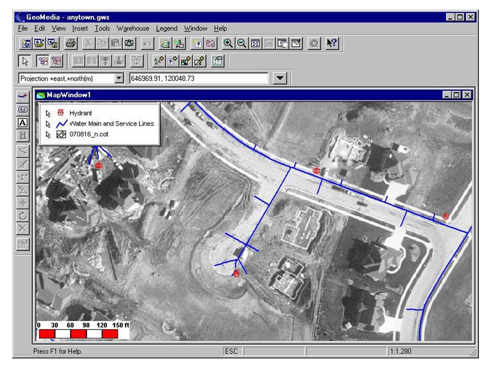
Databases & GIS Spatial data At a simple level a GIS may just form the graphical interface to a database The majority of GIS applications follow this example MapInfo Linked database table SQL Query Manager

27
Geo-relational Data Models
Linked tables based on the relational model, but storing geographical information such as: Geometry Topology Attributes

28
GIS & Analysis In the context of GIS, analysis is... “Deriving new information from existing data” It is also the manipulation of data to solve a problem e.g. identify all areas within 500m of a lake Increasing use is made of the analytical capabilities of GIS, BUT many GIS projects only use the software to store and manage geographical data Yet analysis often relies on many simple basic GIS techniques

29
Simple Query The identification of objects and their attributes either by location or attribute query. MapInfo

30
Buffering Creation of an area of interest around an object
proximity analysis and environmental impact assessment. MapInfo

31
Cookie Cutting Overlay of datasets using one dataset as a sieve or cookie cutter to select a subset of the other dataset. MapInfo

32
Overlays Layer: A thematic plane of GIS features containing geographically and logically related data Overlaying involves superimposing two or more map layers to produce a new map layer. Example: a new genetically engineered variety of wheat grows well in dry environments, with long growing seasons and alkaline soils. Given the availability of data on the length of the growing season, moisture regime and soil alkalinity, where is the best place to plant the wheat? overlaying (superimposing) several maps showing (separately) water-budget, growing season length, soil pH, sodium content, and so on. The GIS analysis can establish the locations where all the favorable soil conditions coincide, as the places where the wheat will grow best.
 several maps showing (separately) water-budget, growing season length, soil pH, sodium content, and so on. The GIS analysis can establish the locations where all the favorable soil conditions coincide, as the places where the wheat will grow best.")
35
The benefits of GIS include:
Better information management Higher quality analysis Ability to carry out “what if?” scenarios Improve project efficiency The benefits of GIS include: Use of GIS software and spatial data should lead to better information management; higher quality analysis; the ability to carry out ‘what if . . ?’ scenarios and improve project efficiency. Remember, however, that many of these achievements are dependent on: data availability the ease of use of the GIS software the understanding of the problem to be solved the time available the amount of funding for the project in hand A project may take longer than you first anticipate

36
GIS Applications Facilities management Marketing and retailing
Environmental Transport/vehicle routing Health Insurance and many more . . . GIS Applications Facilities management: Utilities such as electricity, gas, water and cable communication companies all use GIS systems to store, retrieve and analyse their plant and materials. Areas such as customer responses, demand forecasting, fault analysis, network assessment analysis, site planning, strategic planning and market analysis can be generated by the GIS. Marketing and retailing: these applications tend towards targeting customers and identifying potential markets for customers. The extensive datasets generated from the use of loyalty cards can also be used in conjunction with GIS. Other applications may include: media planning, territory allocation and prospect analysis. Environmental: Forestry management, impact analysis, resource management, coastal zone mapping, geophysical & geotechnical surveys. Transport/vehicle routing: this is an example of ‘real-time’ GIS and is used particularly by vehicle routing companies and the emergency services who need to know where there vehicles are located at any given time. Vehicle routing can also be assessed in terms of least cost or efficiency. In addition GIS may also be used for; dispatch, scheduling, franchise planning as well as route planning. Health: Disease mapping as well as epidemiology, facility planning, provider & purchaser planning, expenditure monitoring and patient analysis can all be carried out using GIS. Insurance: risk distribution analysis, catastrophe planning, customer service analysis, hazard & prediction analysis and underwriting

Similar presentations


 & ArcView GIS software? What is a Geographical Information System (GIS)? Introduction to ESRI ArcView 3.x.>")


? A GIS is a particular form of Information System applied to geographical.>")
