Download presentation
Presentation is loading. Please wait.

1
If we knew then what we know now….Adapting to meet challenges Gulf Coast

2
U.S. Fish & Wildlife Service 2 A surrogate species approach, why is it something we need to do? 1.Only a fraction of the landscape is devoted to species conservation (prioritize conservations lands) 2.Finite resources are allocated to conservation as it competes with other socioeconomic objectives ($$ = best conservation value) 3.The vast majority of species habitat requirements remain unknown (utilize data rich areas) Noon et al. 2009
 2.Finite resources are allocated to conservation as it competes with other socioeconomic objectives ($$ = best conservation value) 3.The vast majority of species habitat requirements remain unknown (utilize data rich areas) Noon et al")
3
U.S. Fish & Wildlife Service 3 Dimension I Dimension II

4
U.S. Fish & Wildlife Service 4 PARTNERSHIPS & COLLABORATION

5
U.S. Fish & Wildlife Service 5 USFWS strategic growth initiative for prioritizing sustainable habitat in the Gulf Coastal Prairies Conservation Region

6
U.S. Fish & Wildlife Service 6 Human footprint Sea-level rise Intense drought Key threats to multiple species

7
U.S. Fish & Wildlife Service 7 1.Mottled Duck (irregularly flooded marsh) 2.Redhead Duck (estuaries) 3.Whooping cranes (saltwater marsh) A starting point:
 2.Redhead Duck (estuaries) 3.Whooping cranes (saltwater marsh) A starting point:.")
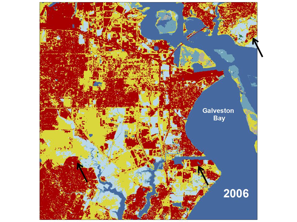
8
Land use land cover change (LULCC) U.S. Fish & Wildlife Service Past LC/LU Present & Future LC/LU 8 Wetlands Contemporary trends Future (?)
.")
9
U.S. Fish & Wildlife Service 9 Mexico? Housing boom? Energy development? NOAA C-CAP Landcover Baseline?

11
U.S. Fish & Wildlife Service Conservation Planning Aransas NWR - Potential acquisition boundary Where to expand and how much? Need to understand the impact of sea level rise 11

12
U.S. Fish & Wildlife Service What do cranes like now?

13
U.S. Fish & Wildlife Service What does sea-level rise mean for cranes? Initial conditions2100 at 2m sea level rise scenario 13

14
U.S. Fish & Wildlife Service Initial conditions 2100 at 2m sea level rise scenario 14 Potential habitat for whoopers with sea level rise

15
U.S. Fish & Wildlife Service Coastal LiDAR to greatly enhance sea level predictions Points in space = 3D vegetation and terrain Work by Luke Beasley SCA intern

16
U.S. Fish & Wildlife Service Baseline information to determine habitats vulnerable to change, and areas less vulnerable Prioritize areas for sustainable conservation ID candidate sites for refuge expansion, mitigation banking, and other conservation approaches WetlandsUrbanization 16 Complementary data and tools needed for a surrogate species approach for:

Similar presentations