Download presentation
Presentation is loading. Please wait.

1
Water that is constantly moving among the oceans, the atmosphere, the ground, and the biosphere There are six parts to the Water Cycle

2
1. Transpiration Water vapor is released by plants during natural processes (plant sweat) 2. Evaporation Water to water vapor (liquid to gas) 3. Condensation Water vapor to water (gas to liquid) 4. Precipitation A downing of a water form from clouds (rain, snow, sleet, and hail) 5. Infiltration Water moving through /into the ground 6. Runoff Water flowing on the ground
 3. Condensation Water vapor to water (gas to liquid) 4. Precipitation A downing of a water form from clouds (rain, snow, sleet, and hail) 5. Infiltration Water moving through /into the ground 6. Runoff Water flowing on the ground.")
3
All water must be balanced in the hydrosphere, with precipitation equaling the amount of water that is evaporated from the oceans and LRS (lakes, rivers, and streams)
")
4
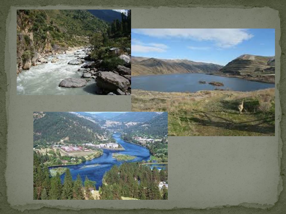
*** All water flows naturally downhill, caused by gravity, into one of the four oceans All rivers begin with a source and end at the delta The beginning of a river will be called a young river This is where the water is moving the fastest, cutting down into the rocks and creating a deep V shaped valley around the river that is also deeper and straighter than the rest of the river The young river is trying to cut down to a baseline, the lowest point a stream or river can cut down to

6
As you continue down the river, it begins to meander (moving back and forth) across a landscape, flattening it out This is called the mature part of the river The water is moving slower, and the valley that the river will cut will be wide and very curvy
 across a landscape, flattening it out This is called the mature part of the river The water is moving slower, and the valley that the river will cut will be wide and very curvy")
7
Every river system has a drainage basin Land area that contributes water to a main stream or river What does this mean? Every stream, creek, and pond will drain in one direction towards a large river, that will lead out to the oceans eventually

8
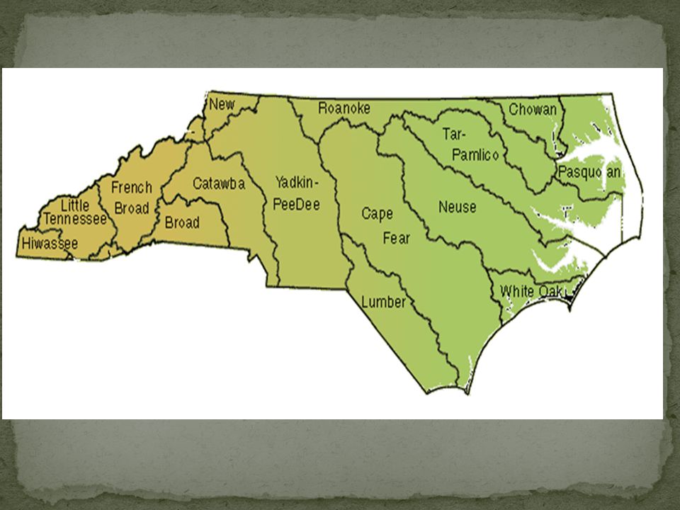
Each drainage basin is separated by a watershed which is a higher elevation divide between 2 basins Examples of watersheds Mountain Ranges Highlands Plateaus Watershed for North Carolina Appalachian Mountains/ Blue Ridge

9
Source Beginning of a river system (lake, pond, or waterfall) (Higher elevations for flowing down hill) Tributaries Small streams and creeks that add water and drain into the main system Young River Shorter beginning of a river, faster, deeper, and straighter than the rest Mature River Middle of river that is longer, shallow, slower, and curvy Floodplain Flattened area surrounding a mature river, forms when a river floods and leaves behind nutrients in the soil Delta End of the river that opens to another river or an ocean, forms when sediments will slow and drop to the river bed
 (Higher elevations for flowing down hill) Tributaries Small streams and creeks that add water and drain into the main system Young River Shorter beginning of a river, faster, deeper, and straighter than the rest Mature River Middle of river that is longer, shallow, slower, and curvy Floodplain Flattened area surrounding a mature river, forms when a river floods and leaves behind nutrients in the soil Delta End of the river that opens to another river or an ocean, forms when sediments will slow and drop to the river bed")
11
A River Basin is the land that water flows across or under on its way to a river Same thing as a drainage basin Sends all the water falling on the surrounding land into: 1. Ocean 2. Another river basin 3. Larger body of water Five of the river basins flow into the Mississippi River: French Broad, Hiwassee, Little Tennessee, Savannah, Watauga The other 12 flow into the Atlantic Ocean

12
Each river basin has its own characteristics Geography Shape of the land Wetlands Areas where groundwater is very close to the surface and allows for specialized plants to grow and act as filters for the land Groundwater water in the ground within the zone of saturation Biodiversity the total amount of species (plant or animal) that make up the area of the river basin Climate How much precipitation and temperature changes occur over a long period of time
 that make up the area of the river basin Climate How much precipitation and temperature changes occur over a long period of time")
13
Human Population How much pollution is being added to the river basin We have a way of destroying the natural buffers that clean out the river system 1.Point Source Pollution Where the source of pollution is a specific place, like a pipe or barrel of trash 2.Nonpoint Source Pollution Pollution that is coming from of a general area Runoff from landfills or farms with fertilizers and other sources

14
CategoriesWestern North CarolinaEastern North Carolina Geography Mountains Beaches and Flat Lands Wetlands None PresentLocated inland from the beaches Groundwater Much runoff means the groundwater is low Runoff from river basins and increased ocean water Biodiversity Mountain lions, bears, bobcats, pine trees, larger birds of prey, wolves Smaller marine birds, palm trees, marine life, large reptiles, swamp plants Climate Colder temperatures and larger amounts of precipitation in the winter Warm temperatures and larger amounts of precipitation in the summer Human Population Smaller towns means smaller amounts of people and pollution created Larger towns and cities means larger amounts of people and pollution creates

15
1. Change Government Policies 2. Protect river banks from erosion This will allow the natural filters and boundaries of the rivers to maintain their balance 3. Land Conservation Use only the land needed or land previously used to minimize the human impact on the land

16
4. Try to reduce the impact of nonpoint and point source pollution 5. Environmental Education What we are doing right now 6. Urban Stream Renewal Cities have either polluted or moved streams and creeks to make way for development, so cities are trying to find ways to revive/renew and make the streams useful and pretty again A. Here in Charlotte Greenways

17
Water in the ground Groundwater moves through the pore spaces in the ground by soaking and seeping through the crack through the process of infiltration There are 3 places that groundwater will go when it gets into the ground 1. When water falls to the ground, a lot of it will seep into the ground and be absorbed by the roots of plants 2. Much of the water will runoff of the land into the LRS system (This is considered one place, not three!)
.")
18
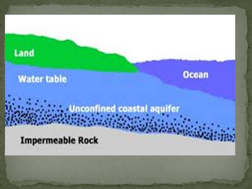
3. Most of it will reach the zone of saturation where water fills all the open spaces in the sediment and rocks below us The top limit of this zone is called the watertable line

19
Sometimes, there is a rock layer in the ground that is above the zone of saturation that can hold water and allow groundwater to be drilled out and delivered to our homes This is known as an aquifer Underneath, holding the water above the zone of saturation, is a rock layer that will not allow the water to flow downward, and this layer is known as an aquitard

21
Everyone receives their water from the ground in some way People who live in the city receive their water from a filtration plant, where the water is cleaned and then the water from their homes returns through the sewer and is cleaned at the same filtration plant

22
If you live in the countryside, you probably have a well, which is a hole that is drilled in your backyard and the groundwater is pumped up into your house This well needs to be drilled into the zone of saturation in order for you to receive a continuous flow of water into your home Wells are naturally cleaned by the filtration of water by the rocks and soils in the ground.

24
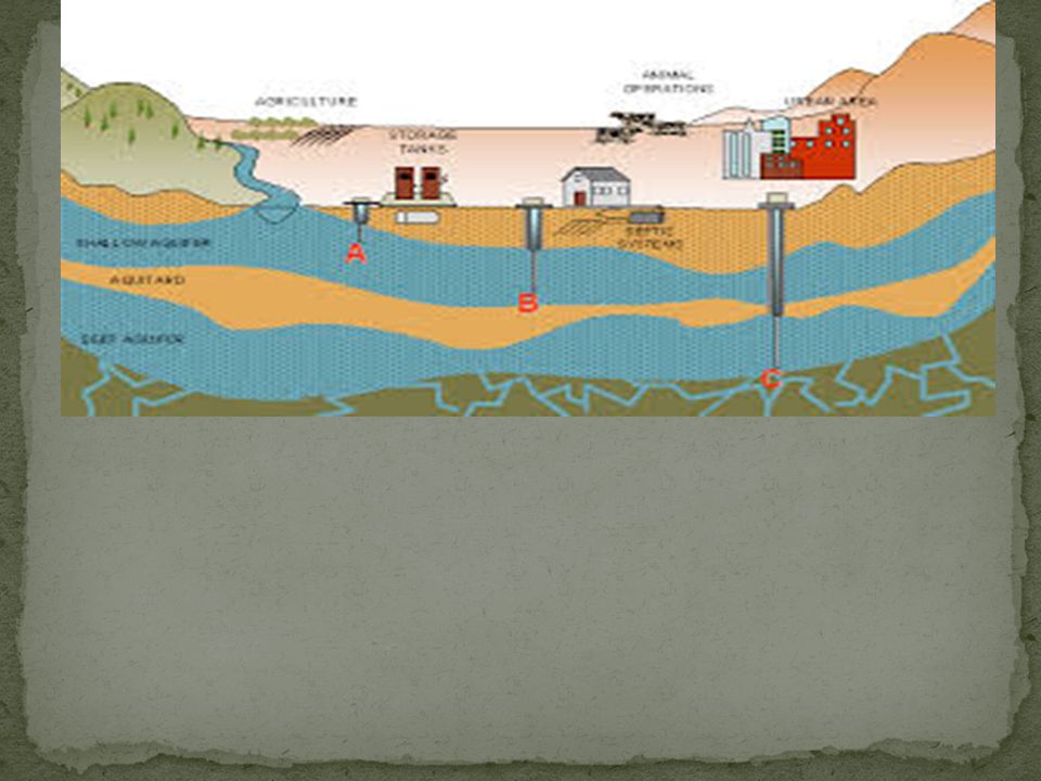
When too much water has been drawn out of the ground by multiple homes, a cone of depression will form because there is not enough groundwater refilling the supply (recharging) the water in the zone of saturation. This usually happens when 3 or more homes are close together.

25
Porosity is the amount of pore spaces (openings) within the dirt and rocks beneath the surface of the Earth Larger sediments will have a higher porosity because the rocks do not fit together well Smaller sediments will have a lower porosity because the rocks pieces are touching each other closely and can fit together well.
 within the dirt and rocks beneath the surface of the Earth Larger sediments will have a higher porosity because the rocks do not fit together well Smaller sediments will have a lower porosity because the rocks pieces are touching each other closely and can fit together well.")
26
Permeability is the interconnectedness of the pore spaces in rocks If there is a high permeability, then that means that water can flow freely through the pore spaces If there is a low permeability, then water cannot flow easily through the rocks, and it is said to be impermeable

27
RESOURCE DEGRADATION = pollution! Controlling Water Pollution - 1898 Rivers and Harbors Act - First legislation to address water pollution - Individual states were responsible for enforcing laws on water pollution - Studies not accurate - People not held accountable for pollution Rachel Carson- wrote the book Silent Spring - Brought water pollution problems to the common man in terms they could understand - Helped lead to water pollution control act

28
"Clean Water Act" - Set water-quality standards for all 50 states - Provides a vision of water quality standards and a means of measuring improvement -Does not set laws for enforcement - Many states have improved their water quality, but there are still problems Sewage treatment, soil erosion, removal of toxic chemicals, and heavy metals Cancer causing agents identified in drinking water

Similar presentations


>")


>")
