Download presentation
Presentation is loading. Please wait.

1
Natural Disaster Week HURRICANES!

2
Pick up the two pieces of paper in the front of the room and begin reading. –We will start notes shortly thereafter. –Some of you may need to share your paper with people beside you. Beginning of Class

3
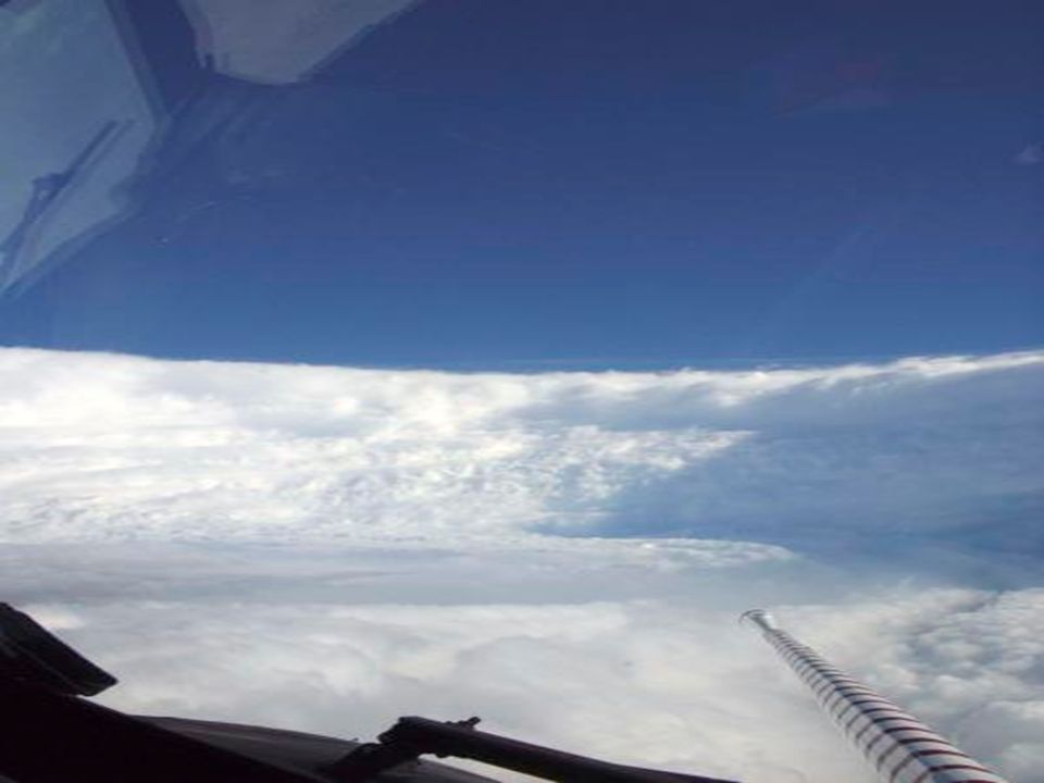
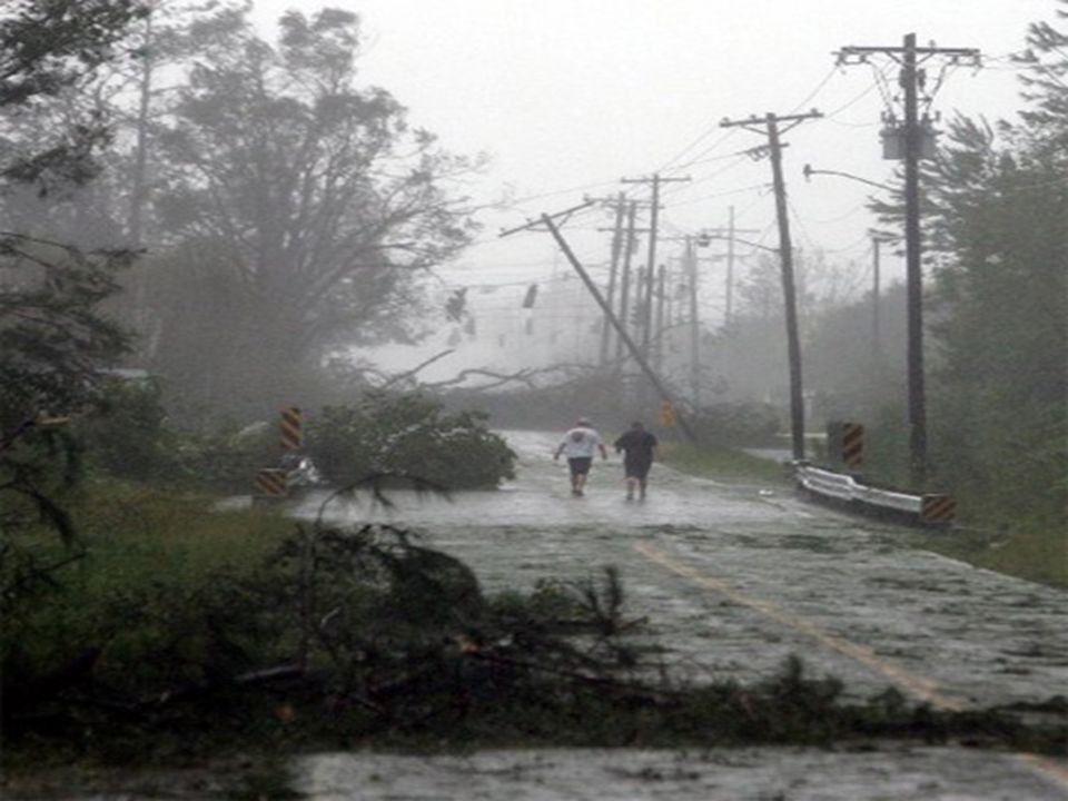
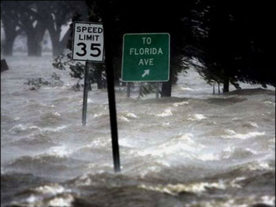
Check these out… You’d probably want to evacuate at this point…

4
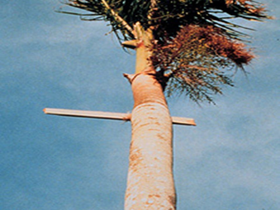
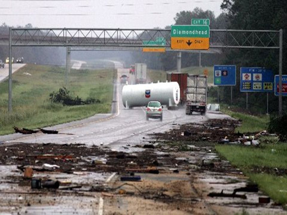
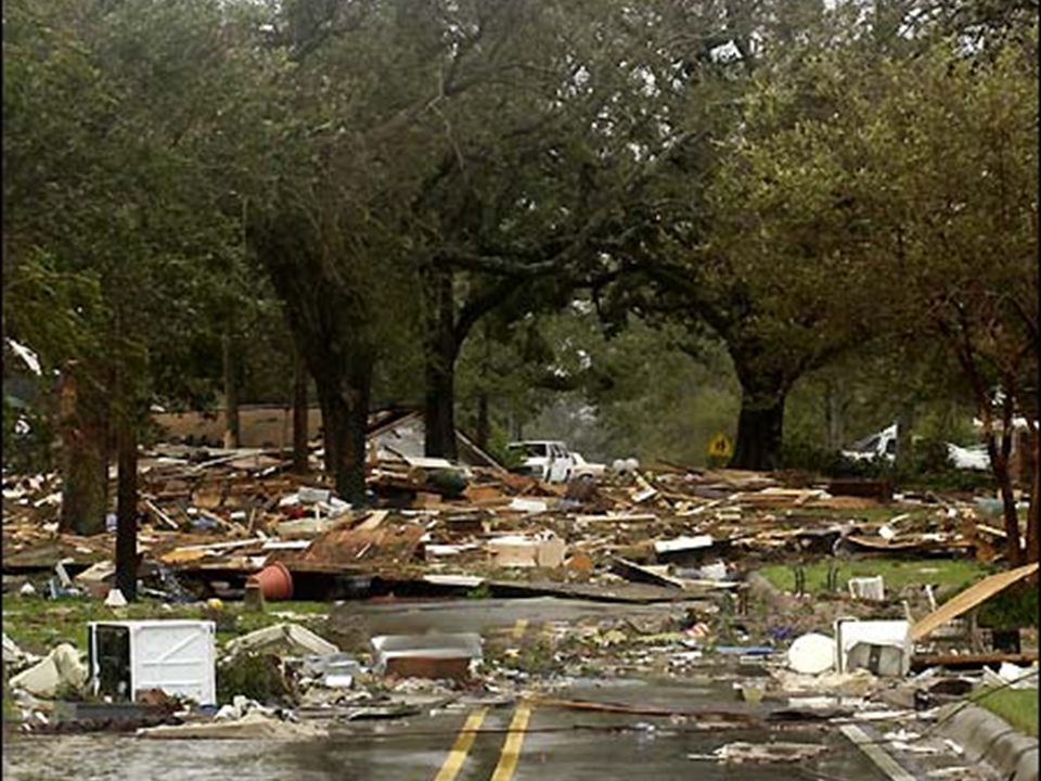
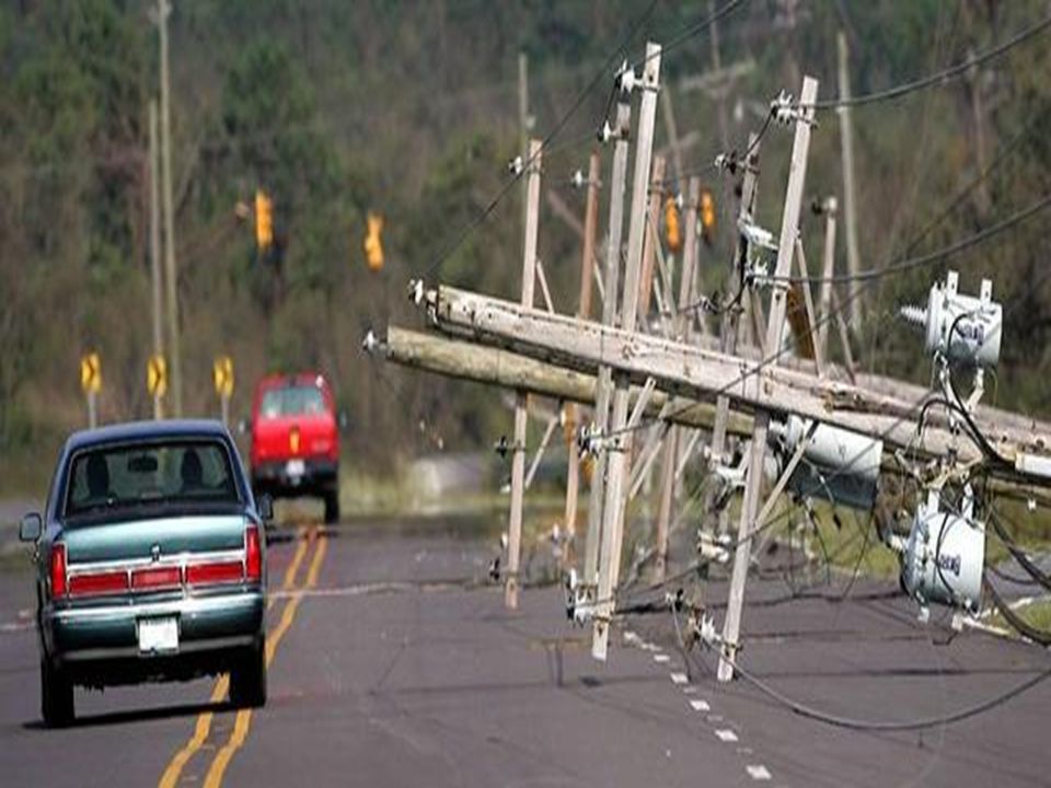
What kind of damage are we talkin’ about here? Might want to take the detour…

5
Ok, So What Exactly Is a Hurricane? A hurricane can best be described as a huge tropical storm (up to 600 miles in diameter)! Winds can be up to 200 mph! Storm usually doesn’t last for more than 7-10 days. It moves across the ocean at around 10-20 mph…not too fast really! The winds are the strongest around the eye wall. They eye of the storm is usually about 20 miles in diameter. Within the eye, winds are calm and the weather is great. Strongest winds are on the right side, heaviest rain is usually on the left side. Arrows indicate “feeder bands” or “rain bands”
. Winds can be up to 200 mph. Storm usually doesn’t last for more than 7-10 days. It moves across the ocean at around mph…not too fast really. The winds are the strongest around the eye wall. They eye of the storm is usually about 20 miles in diameter. Within the eye, winds are calm and the weather is great. Strongest winds are on the right side, heaviest rain is usually on the left side. Arrows indicate feeder bands or rain bands .")
6
Scary…so when do I need to watch out for these things?? Since we’re in the USA, we’ll focus on what meteorologists call the “Atlantic Basin”. The Atlantic basin includes the Atlantic Ocean, Caribbean Sea, and the Gulf of Mexico. The “hurricane season” is just a name for the time period when we expect to see tropical systems develop. The hurricane season for the Atlantic runs from June 1 st – November 30 th. Peak season is the middle part of September…why do you think this is?

7
So where are these “Atlantic Basin” Hurricanes forming??? Storms of the Atlantic basin will begin forming in one of three places: Off the coast of Africa In the Caribbean Sea In the Gulf of Mexico What is the ITCZ????

8
Intertropical Convergence Zone The ITCZ is an area of low pressure located roughly 5 degrees North and South of the Equator. It is a place where air converges, rises, and condenses (forming clouds). It is the rainiest place on Earth!
. It is the rainiest place on Earth!.")
9
So What Does a Hurricane Need in Order to Develop? So a hurricane needs warm water, time to grow, and favorable upper level winds in the troposphere. If the winds are too strong, they will blow the hurricane apart – we call that wind shear!

11
Evolution of Hurricane Development -- Stages Stage 1 – Tropical Wave (Depression) Usually has begun its life off of the west coast of Africa in the ITCZ. Tropical depressions have winds of less than 39mph, and are not given a name. Lacks structure – no well developed feeder bands or eye

12
Evolution of Hurricane Development -- Stages Stage 2 – Tropical Storm At this point, the tropical storm is beginning to develop some serious structure. Winds range from 40-73 mph. In the Atlantic, storms are given a name when they reach this stage. Feeder bands are beginning to develop – you can see the center of the low pressure system more easily. Eye and eye wall still not well formed.

13
Evolution of Hurricane Development -- Stages Stage 3 – Category 1 Hurricane Winds range from 75-94 mph. Well developed feeder bands. An eye begins to form (although it is covered in clouds). Storm is tightening around center.
. Storm is tightening around center..")
14
Evolution of Hurricane Development -- Stages Stage 4 – Category 2 Hurricane Winds range from 95-110 mph. Well developed feeder bands. An eye and eye wall are usually very well formed. Storm continues to tighten around center.

15
Evolution of Hurricane Development -- Stages Stage 5 – Category 3 Hurricane Winds range from 111-130 mph. Now considered a “Major Storm”. Intense flooding and building damage will occur to most areas on the coast. Further inland, the damage will still be substantial.

16
Evolution of Hurricane Development -- Stages Stage 6 – Category 4 Hurricane Winds range from 131-155 mph. All shrubs, signs and trees blown down. COMPLETE DESTRUCTION of mobile homes. Extensive damage to doors and windows. Major damage to lower floors of structures near the coast.

17
Evolution of Hurricane Development -- Stages Stage 7 – Category 5 Hurricane Winds greater than 156 mph! Complete roof failure on many residential and industrial buildings. Some complete building failures with small utility buildings blown over or away. Massive evacuation of residential areas on low ground within 5-10 miles of the coastline maybe required.

18
Saffir-Simpson Scale of Hurricane Intensity

19
Rest of Class Finish up your Hurricane Pamphlet. When done; you can pick up a Natural Disasters word-search. Both of these are due on Monday @ the beginning of class.

20
Hurricane Naming System – Why do they have names anyway? In 1953 the National Weather Service began naming storms after women. In 1979, men’s names were added to the list of hurricane names. In the Atlantic, there are 6 lists of names that are recycled. In the case of storms so devastating that reusing the name is inappropriate, the name is taken off the list and another name is used to replace it. The name “Katrina” is one that will be removed from the list. Andrea Barry Chantal Dean Erin Felix Gabrielle Humberto Ingrid Jerry Karen Lorenzo Melissa Noel Olga Pablo Rebekah Sebastien Tanya Van Wendy This year’s list

21
Storm Names for 1994- 1999 199419951996199719981999 AlbertoAllisonArthurAnaAlexArlene BerylBarryBerthaBillBonnieBret ChrisChantalCesarClaudetteCharleyCindy DebbyDeanDollyDannyDanielleDennis ErnestoErinEdouardErikaEarlEmily FlorenceFelixFranFabianFrancesFloyd GordonGabielleGustavGraceGeorgesGert HeleneHumbertoHortenseHenriHermineHarvey IsaacIrisIsidoreIsabelIvanIrene JoyceJerryJosephineJuanJeanneJose KeithKarenKyleKateKarlKatrina LeslieLuisLiliLarryLisaLenny MichaelMarilynMarcoMindyMitchMaria NadineNoelNanaNicholasNicoleNate OscarOpalOmarOdetteOttoOphelia PattyPabloPalomaPeterPaulaPhilippe RafaelRoxanneReneRoseRichardRita SandySebastienSallySamSharyStan TonyTanyaTeddyTeresaTomasTammy ValerieVanVickyVictorVirginieVince WilliamWendyWilfredWandaWalterWilma

22
Atlantic Names 200520062007200820092010 Arlene Bret Cindy Dennis Emily Franklin Gert Harvey Irene Jose Katrina Lee Maria Nate Ophelia Philippe Rita Stan Tammy Vince Wilma Alberto Beryl Chris Debby Ernesto Florence Gordon Helene Isaac Joyce Kirk Leslie Michael Nadine Oscar Patty Rafael Sandy Tony Valerie William Andrea Barry Chantal Dean Erin Felix Gabrielle Humberto Ingrid Jerry Karen Lorenzo Melissa Noel Olga Pablo Rebekah Sebastien Tanya Van Wendy Arthur Bertha Cristobal Dolly Edouard Fay Gustav Hanna Ike Josephine Kyle Laura Marco Nana Omar Paloma Rene Sally Teddy Vicky Wilfred Ana Bill Claudette Danny Erika Fred Grace Henri Ida Joaquin Kate Larry Mindy Nicholas Odette Peter Rose Sam Teresa Victor Wanda Alex Bonnie Colin Danielle Earl Fiona Gaston Hermine Igor Julia Karl Lisa Matthew Nicole Otto Paula Richard Shary Tomas Virginie Walter

23
Bell-Ringer #19 What do you know about Hurricane Katrina? –Do you think we, as a nation, did enough for those affected by such a horrific event?

24
Katrina’s Wrath Largest in size; third strongest in U.S. history. –Great Labor Day storm (1935) –Hurricane Camille (1969) New Orleans was plenty prepared for a Category 3 hurricane; Katrina touched down as a Category 5 (175 mph winds) 1,836 people died as a result of Katrina.
 –Hurricane Camille (1969) New Orleans was plenty prepared for a Category 3 hurricane; Katrina touched down as a Category 5 (175 mph winds) 1,836 people died as a result of Katrina..")
25
$Costliest Hurricanes$ Katrina, 2005: $81 Billion Andrew, 1992: $27 Billion Wilma, 2005: $21 Billion Charley, 2004: $15 Billion Ivan, 2004: $14 Billion Rita, 2005: $10 Billion Frances, 2004: $9 Billion Hugo, 1989: $ 7 Billion

26
Deadliest Hurricanes Mitch, 1998: 11,000 Dead Galveston, 1900: 6,000-12,000 Dead Fifi, 1974: 8,000-10,000 Dead Dominican Republic, 1930: 8,000 Dead Cuba, 1932: 3,000 Dead David, 1979: 2,000 Dead Katrina, 2005: 1,700+ Dead

27
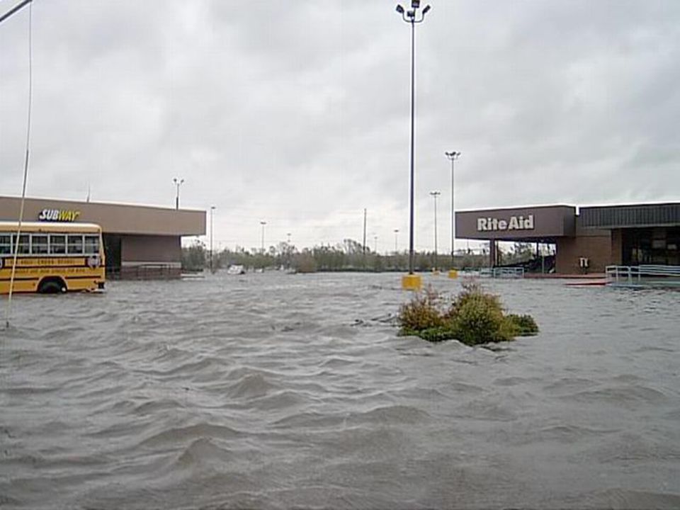
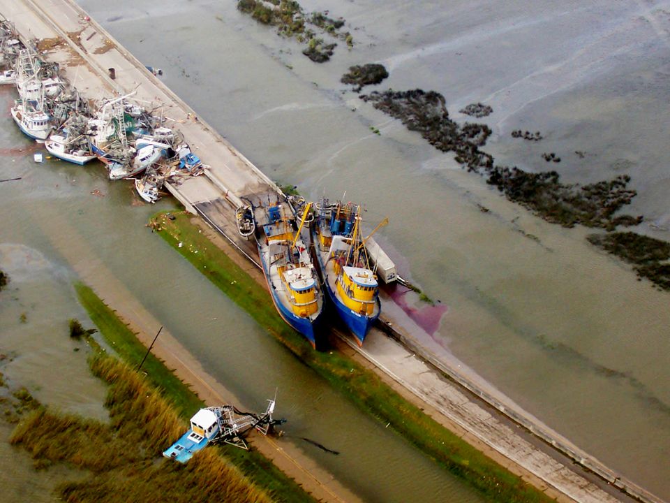
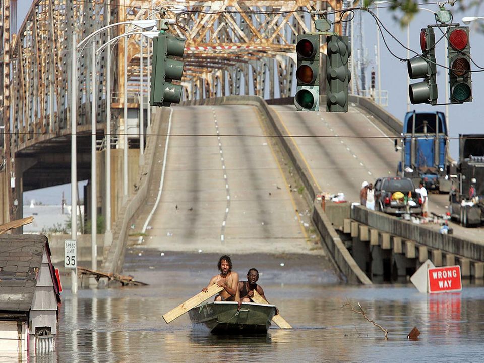
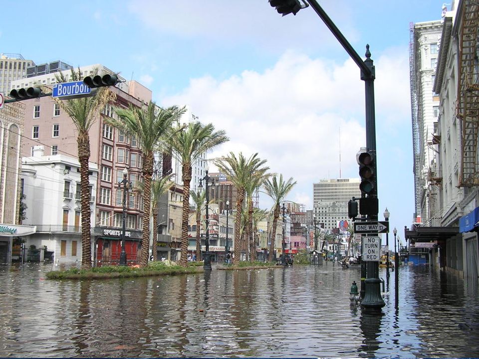
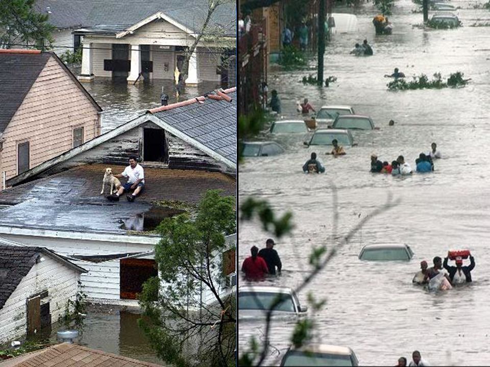
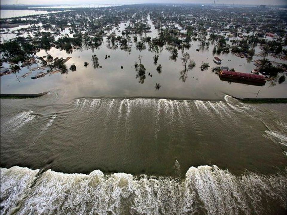
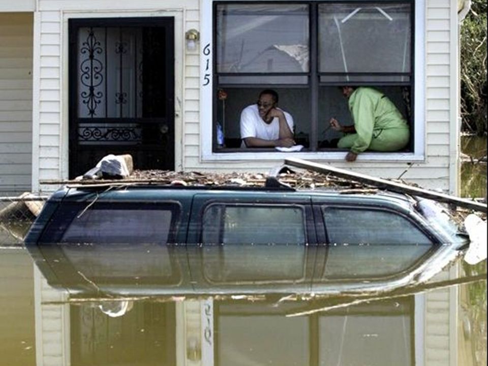
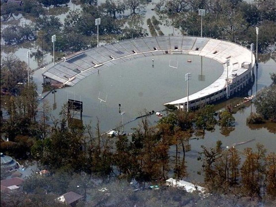
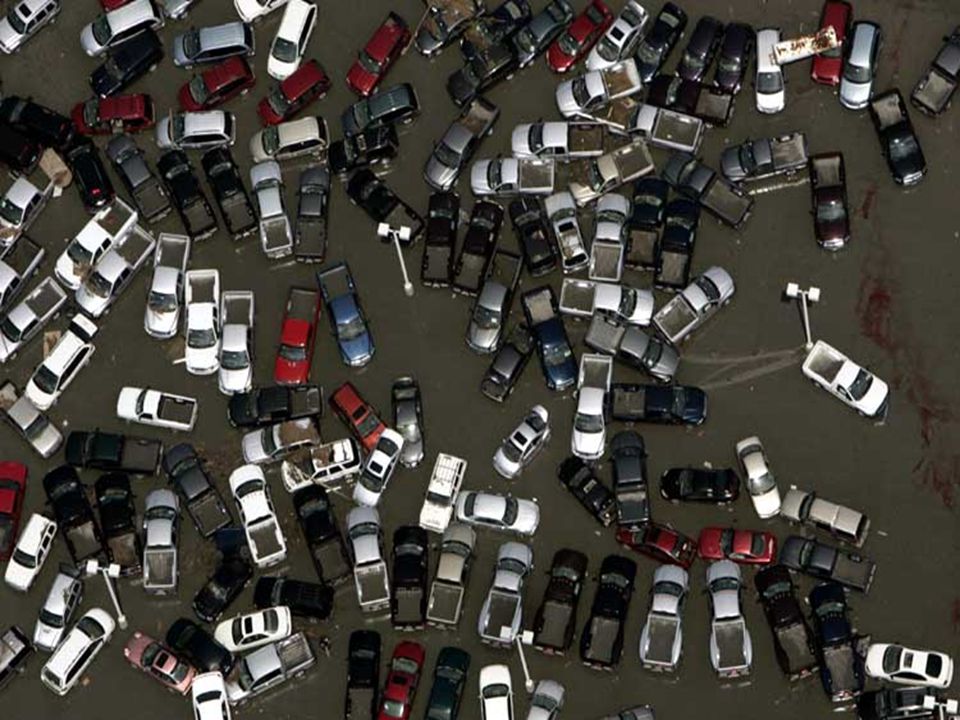
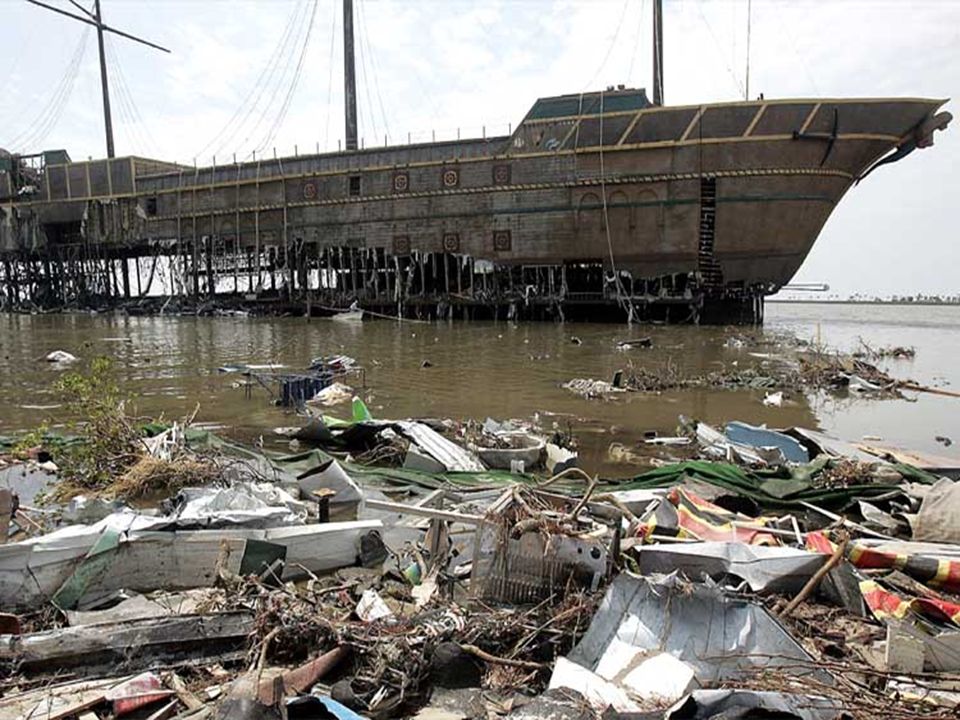
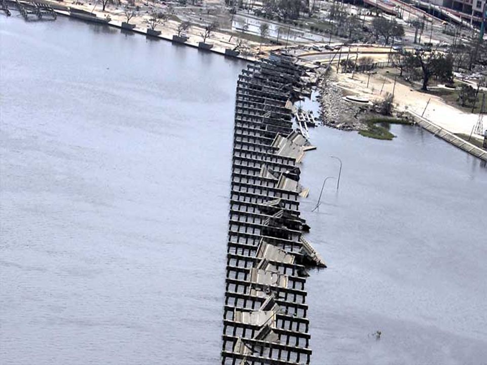
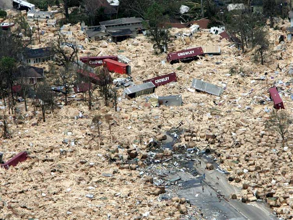
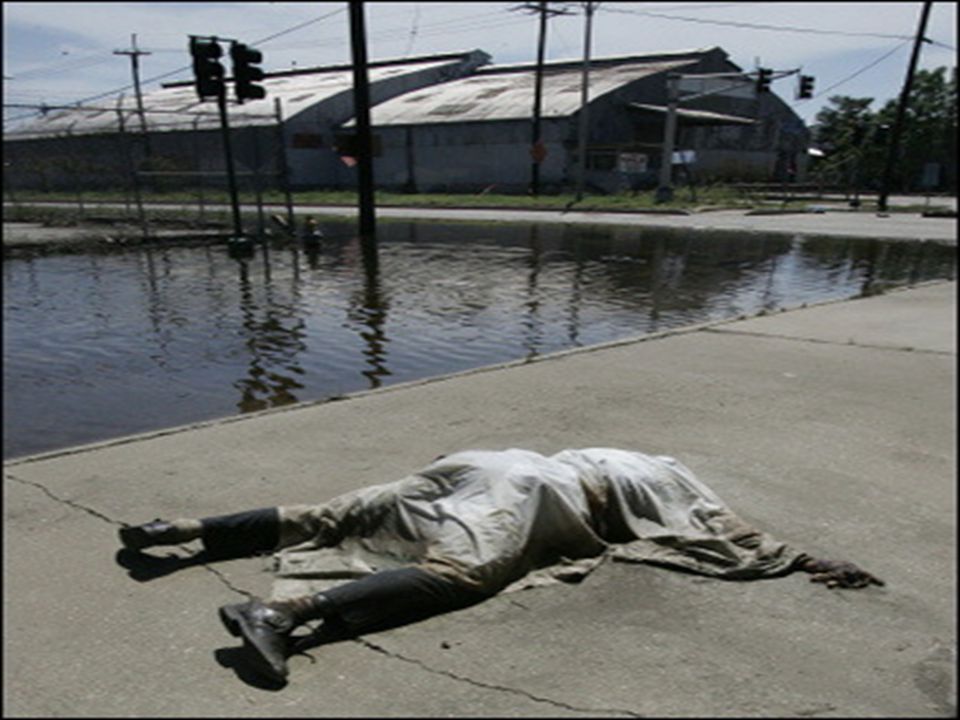
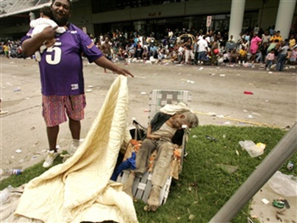
Cool Stuff to Check-out…

29
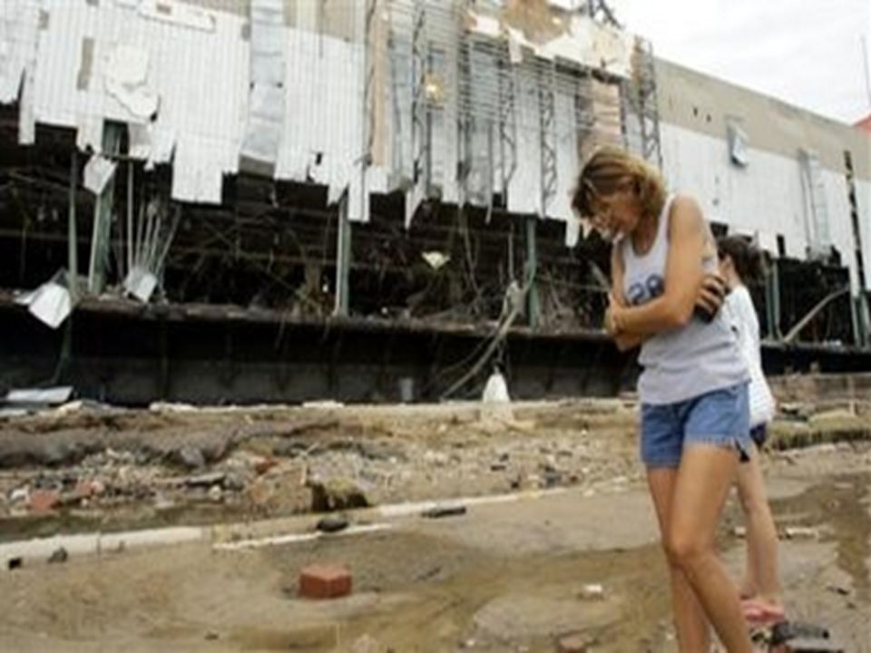
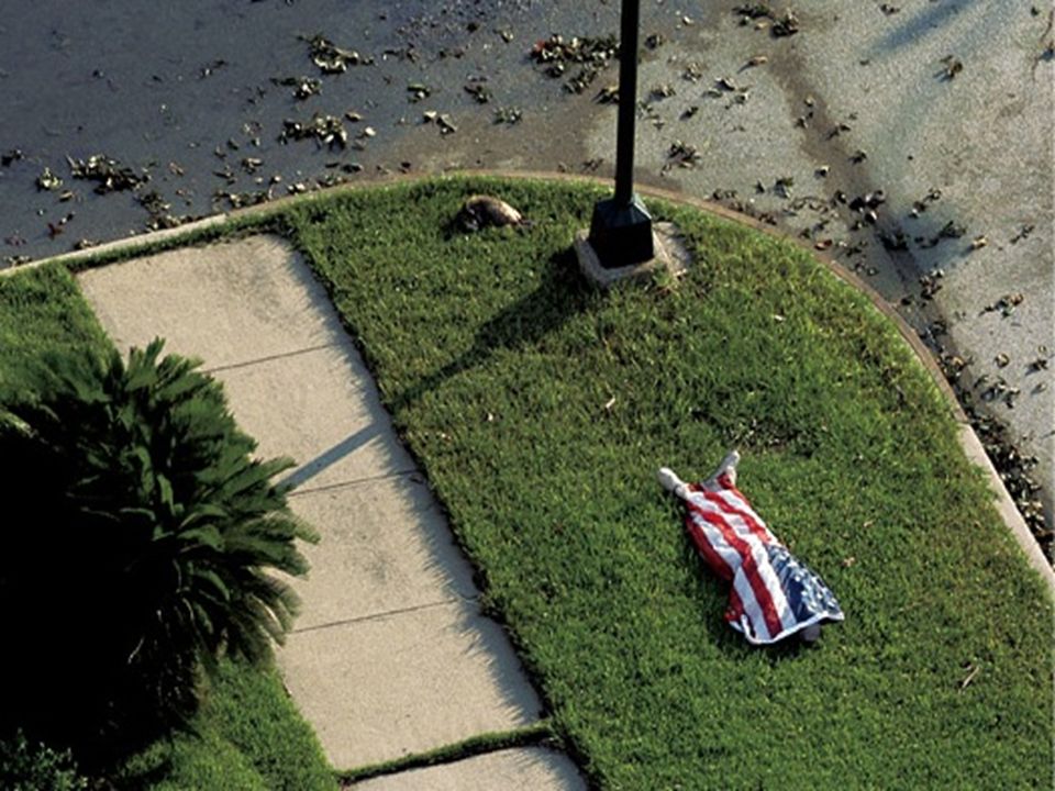
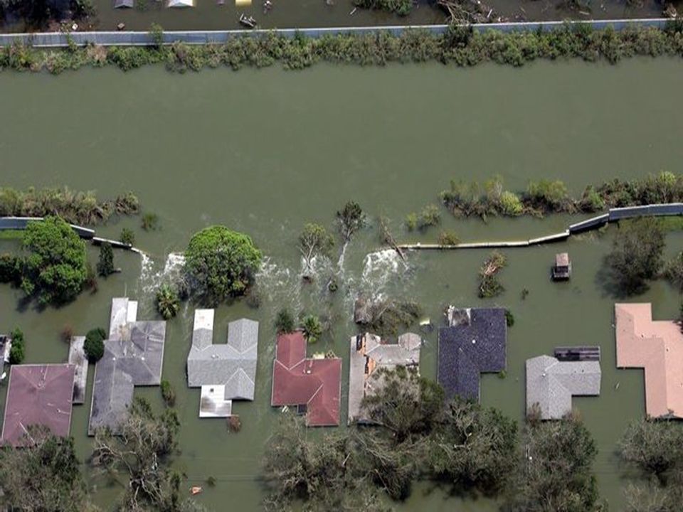
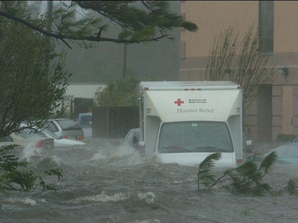
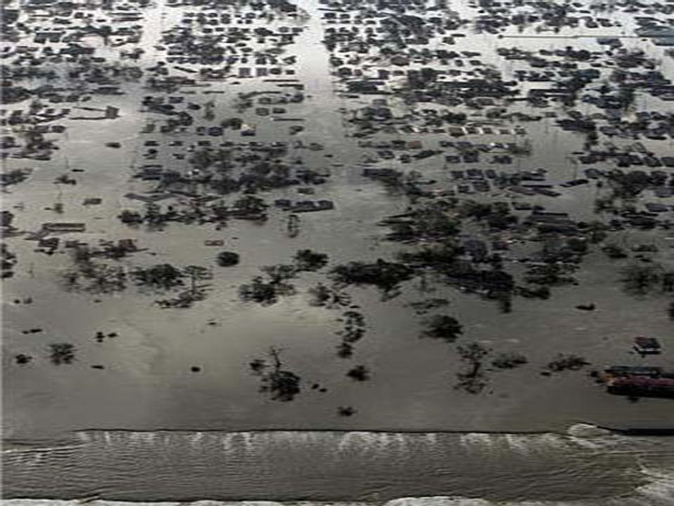
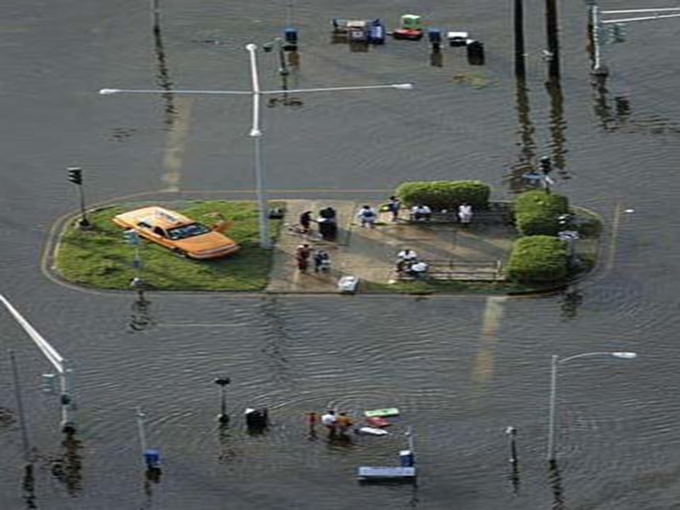
Aftermath…

33
Hurricane Katrina

34
Hurricane Katrina Eye

35
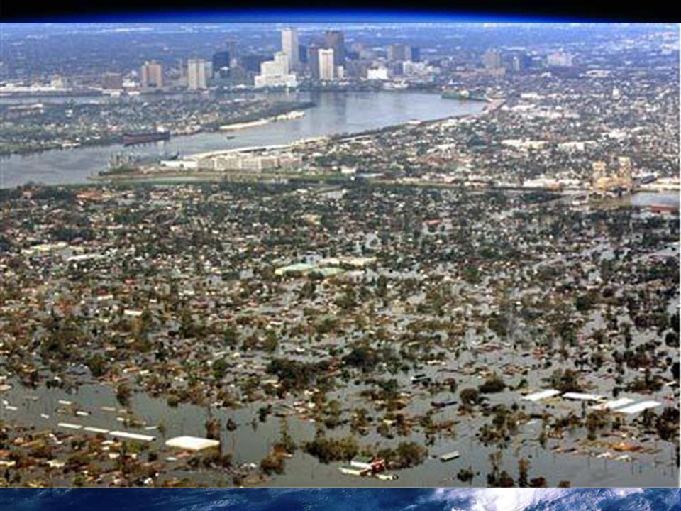
Hurricane Katrina –It was the first Category 5 hurricane of the 2005 Atlantic Hurricane Season –It was the sixth-strongest Atlantic Hurricane ever recorded. –The storm weakened to a Category 3 when it made landfall along the Central Gulf Coast on August 29, 2005 –The storm surge from Katrina caused catastrophic damage along the coastlines –Leeves in New Orleans were breached by the surge, ultimately flooding about 80% of the city. –Wind damage was reported well inland, impeding relief efforts. –Katrina is estimated to be responsible for $75 billion in damages, making it the costliest hurricane in United States history –The storm has killed 1,417 people, becoming the deadliest U.S. hurricane since the 1928 Okeechobee Hurricane.

36
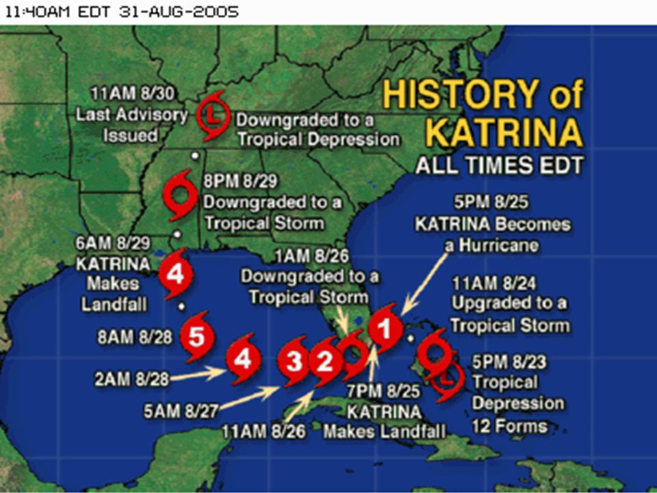
The Path of Hurricane Katrina

43
Cool Video

44
What Not to do During a Hurricane

76
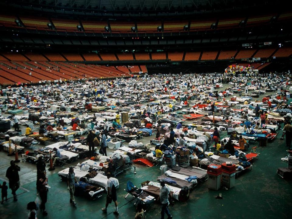
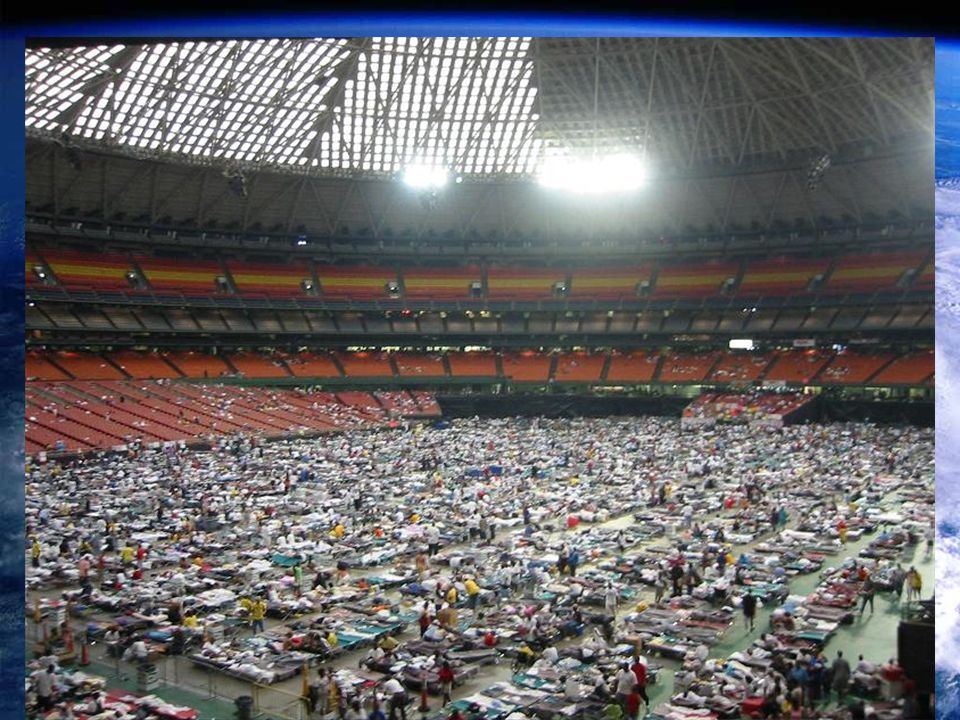
Safety? After the Hurricane the Superdome was opened for those seeking refuge It was supposed to be a safe place…It wasn’t

81
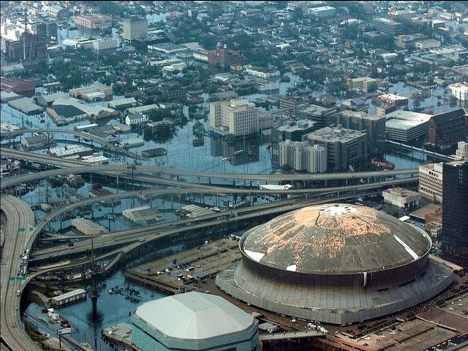
Not Just New Orleans? Though most attention was paid to New Orleans…well a major US city was essentially get destroyed…The Destruction was wide spread along the Gulf Coast

83
Who’s to Blame? Extended neglect of the levees –Which allowed deterioration Governor of LA –Slow action though warned of potential trouble Mayor of New Orleans –Slow action, did not utilize services at hand The US Government –Slow Response contributed to looting, death, and displacement The people –Warnings were given, but many decided to stay in the city City in a Bowl –Location of New Orleans was a disaster waiting to happen

84
Notes At the bottom of your Hurricane notes; write a 3-sentence summary on how the Katrina images made you feel and why it made you feel that way.

85
Hurricane Katrina

Similar presentations