Download presentation
Presentation is loading. Please wait.

1
CalNex Forecast Prepared Tuesday 8 June 2010

2
Anticipated Platform Activities NOAA P3 Note: Deployed to Gulf of Mexico, return to Ontario Thursday night, at earliest NOAA Twin Otter Tue: No Flight Wed: transit to Sacramento, sampling Central Valley Thu - Mon: No Flights - maintenance R/V Atlantis Tue: SF DOE G-1 & NASA B-200 (CARES - http://campaign.arm.gov/cares)http://campaign.arm.gov/cares Tue: morning and afternoon flights Wed: No Flights

3
Local Features Tue: Sac: Sac plume forecast to skirt north of receptor site although surface flow currently from SW; cirrus clouds today; mixing to 3000-5000' in afternoon; good to moderate air quality Wed: Sac: Sac plume forecast to north (misses receptor site); altocumulus and cirrus anticipated; afternoon PBL ~4000'; good air quality SJV: mixing to 3000-5000'; good air quality Thu: Sac: Sac plume to SSE into SJV
; altocumulus and cirrus anticipated; afternoon PBL ~4000 ; good air quality SJV: mixing to ; good air quality Thu: Sac: Sac plume to SSE into SJV")
4
Synoptic Overview for California Tuesday June 8 Mainly zonal flow across CA Onshore flow at the surface, deep marine layer in the south Strong onshore flow through the Delta Wednesday June 9 PacNW trough deepens, digs southward into far N CA Onshore flow increases, marine layer deepens Transport flow remains W Thursday June 10 Trough digs farther south, transport flow shifts W/NW Onshore flow continues for all areas Friday-Weekend Fri/Sat: Trough axis over NV, northerly transport along the coast Major model differences – GFS builds strong ridge, Euro keeps trough on Sunday

5
Analysis GFS – 00 Z Tuesday – Mon 17 PDT

6
12 hour GFS – 12 Z Tuesday – 05 PDT

7
24 hour GFS – 00 Z Wednesday – Tue 17 PDT

8
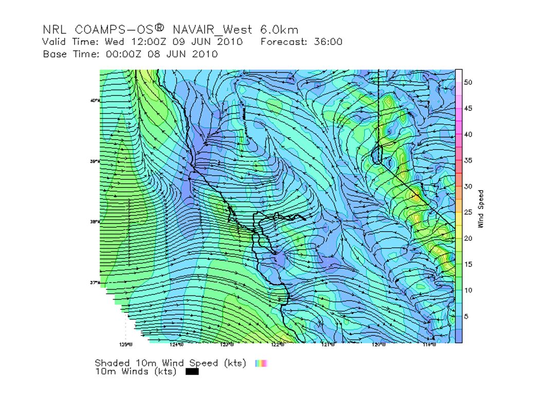
36 hour GFS – 12 Z Wednesday – 05 PDT

9
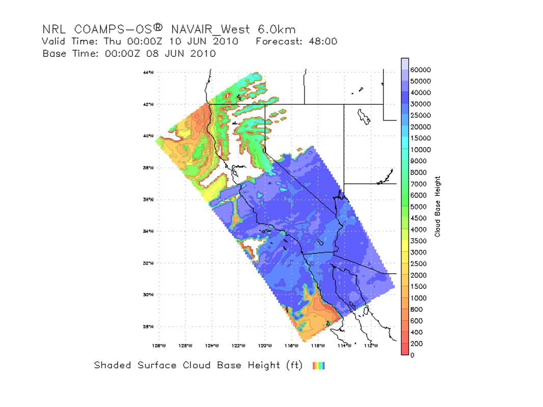
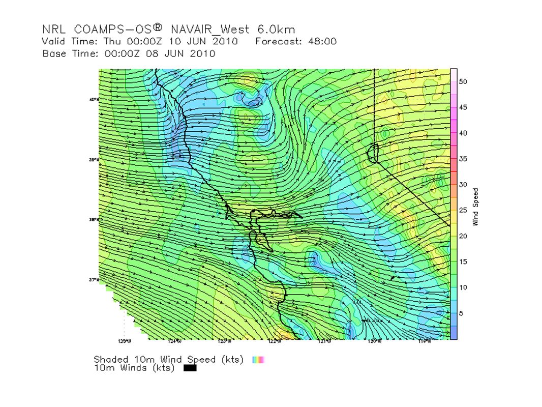
48 hour GFS – 00 Z Thursday – Wed 17 PDT

10
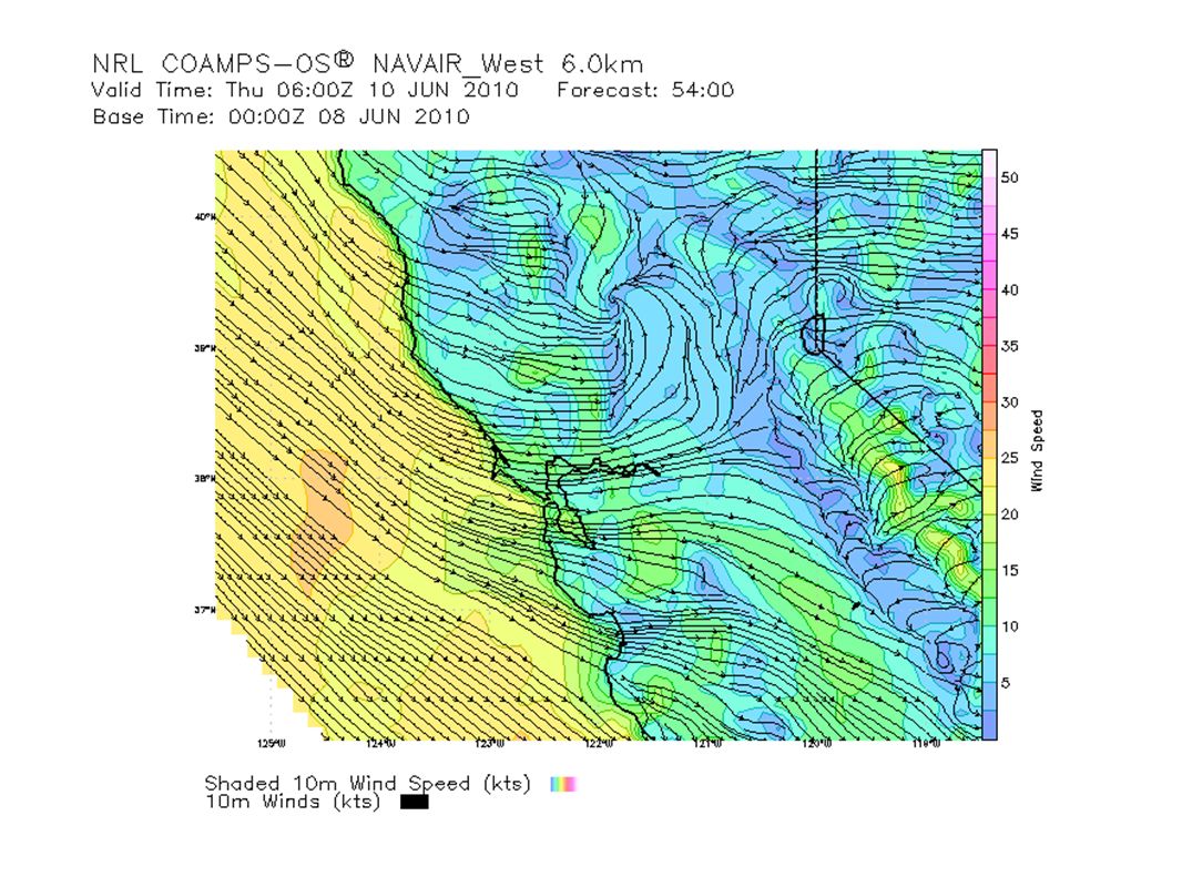
60 hour GFS – 12 Z Thursday – 05 PDT

11
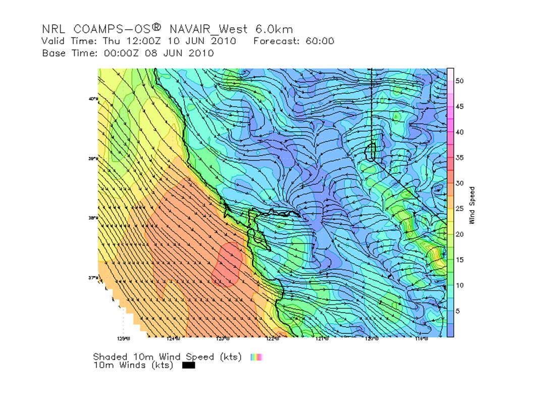
GFS 3 day – 00 Z Friday – Thu 17 PDT

12
ECMWF 3 day – 00 Z Friday – Thu 17 PDT

13
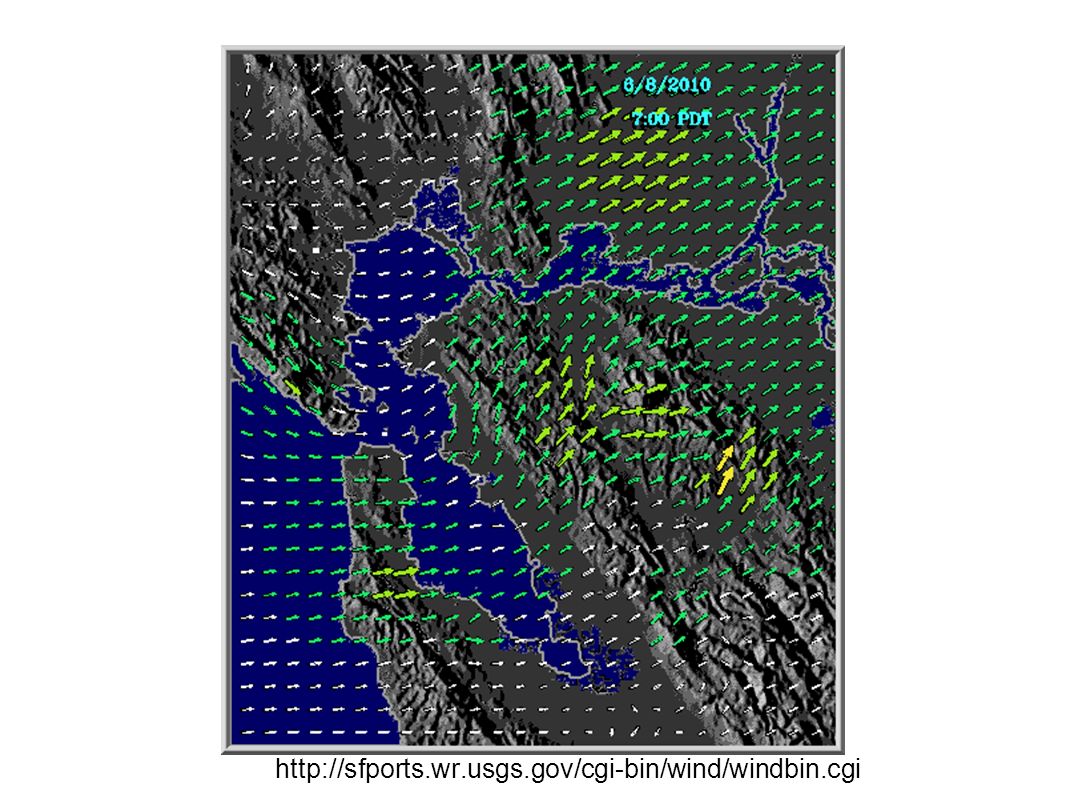
3.5 day GFS – 12 Z Friday – 05 PDT

14
4 day GFS – 00 Z Saturday – Fri 17 PDT

15
4 day ECMWF – 00 Z Saturday – Fri 17 PDT

16
5 day GFS – 00 Z Sunday – Sat 17 PDT

17
5 day ECMWF – 00 Z Sunday – Sat 17 PDT

19
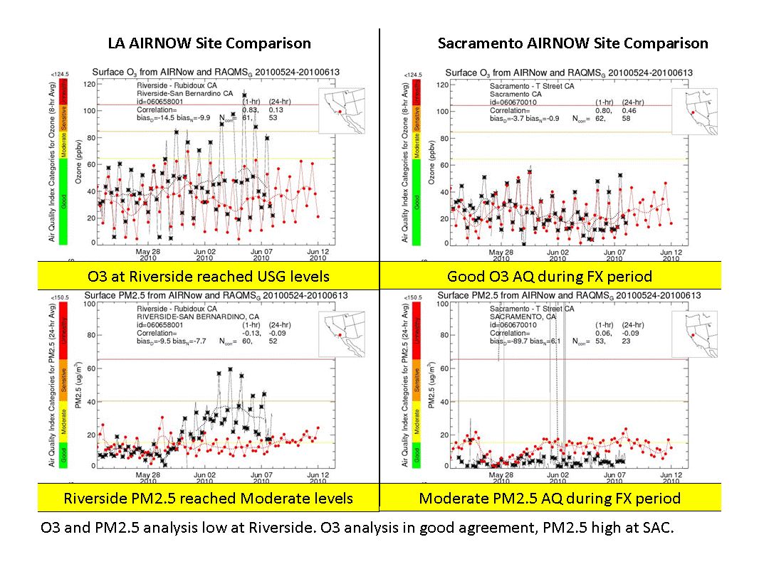
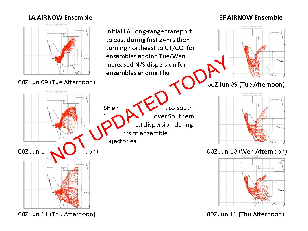
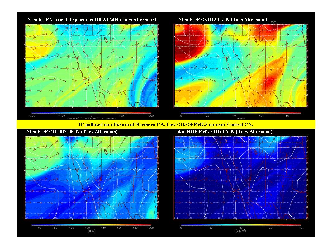
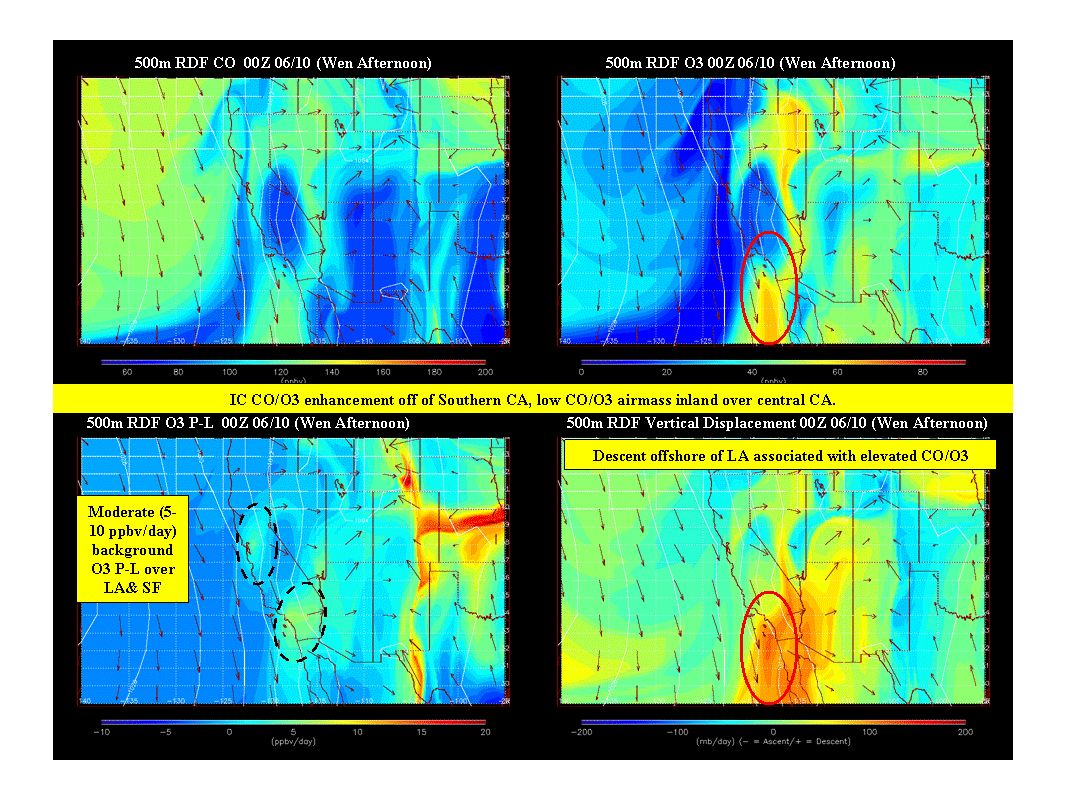
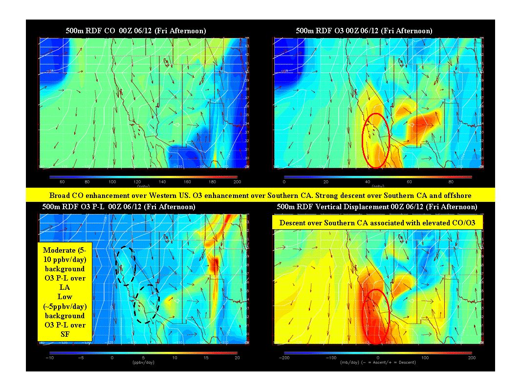
Large Scale Transport RAQMS FX updated Tues, Jun 08th

27
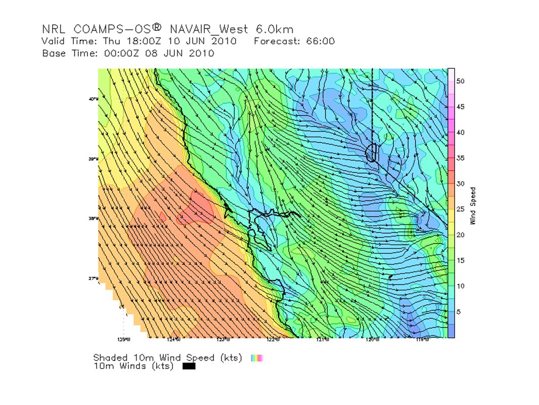
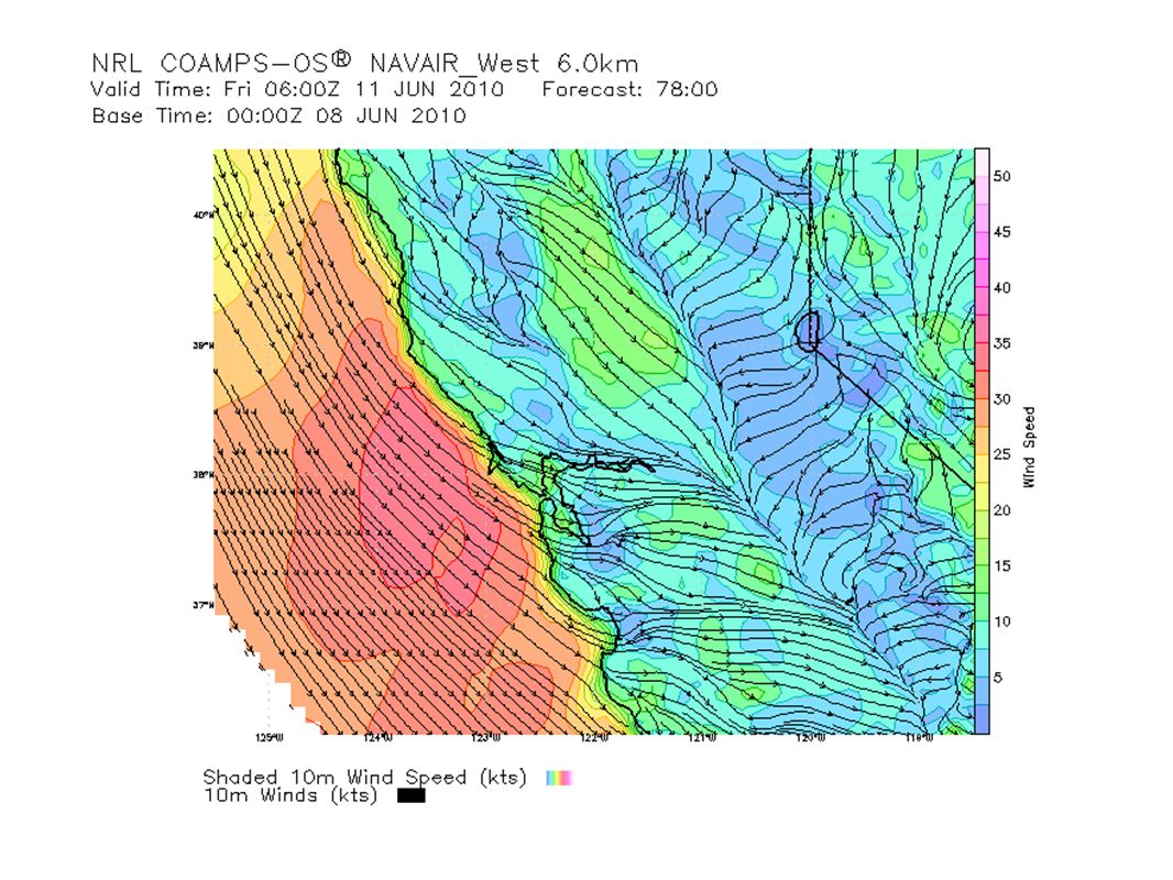
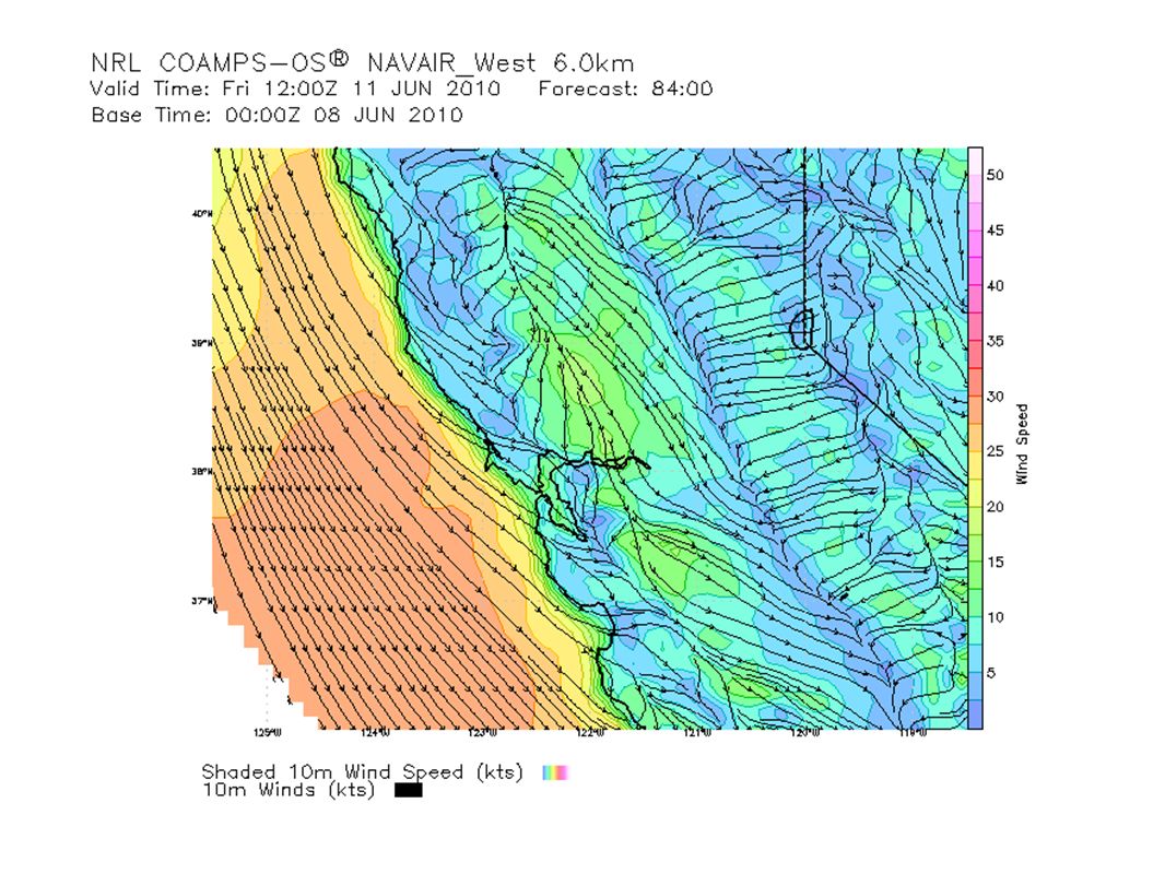
SF Bay Area Tuesday NW 20kt; lightens into 15kt late aftn and shift W at late night MBL 1,000ft increase to 1,500 ft Friday NW continues, around 25 to 30kt Extended Gradient relaxes future in the weekend, returning into moderate wind on Saturday and light on Sunday

28
http://sfports.wr.usgs.gov/cgi-bin/wind/windbin.cgi
29
Sacramento Valley Tuesday Northern SV - to SE 5 to 10kt early AM, shifts S by mid-mrng; becomes 10kt in aftn through the evening Southern SV - SW 5kt to 10kt, strengthen to 10kt in late aftn, lightens slightly in the evening AM PBL around 1,000ft; PM PBL 3,000 to 5,000ft Cirrostratus all day Max aftn temp: 28C; moderate air quality, max-8hr mean O3 in 0.06 ppm range Wednesday Northern SV - SE 10kt early AM, shift S around late AM and strengthen to 15kt in late aftn; lightens to SE 5kt to 10kt at late night Southern SV - S to SW 5kt to 10; dies down a bit in late AM before picking up again into 10 to 15kt in the aftn; SW 5kt at late night AM PBL between 500ft; PM PBL around 4,000ft Partly cloudy, altocumulus in AM, with a bit of stratus in AM for northern SV; becomes mostly clear in the aftn; cirrus later at night; 10% chance of rain Max aftn temp: 27C; good air quality, max-8hr mean O3 in 0.05 ppm range

30
Sacramento Valley (cont'd) Thursday Southern SV - NW 5kt and below; becomes 10kt around mid-late mrng and slightly above 10kt in late aftn Northern SV will experience stronger N wind and earlier than southern SV AM PBL around 1,500ft; PM PBL 4,000 to 8,000ft Some cirrus moves through in the AM, otherwise clear Max aftn temp: 27C; good air quality max-8hr mean O3 in 0.05 ppm range Friday NW wind, around 10kt and above Blue sky Max aftn temp 30C; good air quality Extended Gradient moves further south compared to Friday and then relaxes later in the day; N to NE on Sunday and relaxes further into light wind No clouds Max aftn temp warms to low 30C; expects air quality to worsen a bit on Sunday
 Thursday Southern SV - NW 5kt and below; becomes 10kt around mid-late mrng and slightly above 10kt in late aftn Northern SV will experience stronger N wind and earlier than southern SV AM PBL around 1,500ft; PM PBL 4,000 to 8,000ft Some cirrus moves through in the AM, otherwise clear Max aftn temp: 27C; good air quality max-8hr mean O3 in 0.05 ppm range Friday NW wind, around 10kt and above Blue sky Max aftn temp 30C; good air quality Extended Gradient moves further south compared to Friday and then relaxes later in the day; N to NE on Sunday and relaxes further into light wind No clouds Max aftn temp warms to low 30C; expects air quality to worsen a bit on Sunday")
31
Sacramento Trajectories (Tue)
")
32
Sacramento Trajectories (Wed)
")
33
Sacramento Trajectories (Thu)
")
34
San Joaquin Valley (prepared on June 8 at 9:00 PDT) Tuesday June 8 Surface Winds: Surface obs this morning: Light to moderate NW flow Fresno/Kings counties northward, with calm winds in Kern and Tulare Counties. The wind profiler at Chowchilla shows a light to moderate N to NW flow from the surface up to 3,000 feet, shifting from the south to southeast above. The lower air profiler at Lost Hills depicts light and variable wind flow up to 6,000, slightly stregthening from the west to northwest above. CANSAC shows light to moderate flow over the Delta, Altamont and Pacheco Passes this morning continuing into this evening. By this afternoon, a general northwesterly flow pattern will be established over the SJV. Outflow is present toward the Deserts and SLO. Local terrain driven flow will continue over the Sierra's (upslope during day, downslope at night). Boundary Layer Mixing: The morning aircraft sounding from Fresno depicts a moderate inversion of 9 degrees Fahrenheit from the surface up to 2,500 feet. CANSAC shows that maximum boundary layer mixing depths will range from 3,500 to 5,000 feet from Merced County southward, with maximum mixing depths between 1,000 and 2,500 feet over San Joaquin and Stanislaus counties. Air Quality: Good air quality (from Madera County northward) due to ozone and Moderate air quality (from Fresno County southward). Wednesday June 9 Surface Winds: CANSAC shows similar onshore flow conditions on Wednesday as compared to Tuesday through the Delta, Pacheco and Altamont passes. Outflow will continue out toward the Deserts and SLO. Boundary Layer Mixing: CANSAC shows that maximum mixing depths will range from 3,000 to 5,000 feet District-wide. Air Quality: Air quality is predicted to be in the good range.
. Boundary Layer Mixing: The morning aircraft sounding from Fresno depicts a moderate inversion of 9 degrees Fahrenheit from the surface up to 2,500 feet. CANSAC shows that maximum boundary layer mixing depths will range from 3,500 to 5,000 feet from Merced County southward, with maximum mixing depths between 1,000 and 2,500 feet over San Joaquin and Stanislaus counties. Air Quality: Good air quality (from Madera County northward) due to ozone and Moderate air quality (from Fresno County southward). Wednesday June 9 Surface Winds: CANSAC shows similar onshore flow conditions on Wednesday as compared to Tuesday through the Delta, Pacheco and Altamont passes. Outflow will continue out toward the Deserts and SLO. Boundary Layer Mixing: CANSAC shows that maximum mixing depths will range from 3,000 to 5,000 feet District-wide. Air Quality: Air quality is predicted to be in the good range..")
35
San Joaquin Valley (cont'd) Thursday June 10 through Saturday June 12 Surface Winds: Onshore flow conditions will continue over the SJV air basin from Thursday into mid-day Friday as a trough remains over the West Coast. The northwesterly flow will slowly weaken by late Friday as offshore flow develops over the region as the trough departs to the east. Boundary Layer Mixing: Boundary layer mixing depths will begin to lower on Friday as high pressure noses toward the region. Air Quality: AIr quality will be good District-wide on Friday, deteriorating slightly into the upcoming weekend. *Potential Targets for next Flight Day* Analyze northwesterly wind flow patterns over the SJV, especially flow coming into the air basin through the Delta, Altamont, and Pacheco passes. LLNL Site 300, located near Altamont pass in southwestern San Joaquin County, may be conducting their prescribed burn project today (winds permitting). (74 acres). Their next project day will be roughly 530 and 630 acres respectively.
. (74 acres). Their next project day will be roughly 530 and 630 acres respectively..")
56
Central Coast NO FORECAST UNTIL OPERATIONS RESUME IN SoCal OR SJV

57
Southern Coastal Waters NO FORECAST UNTIL OPERATIONS RESUME IN SoCal

59
South Coast NO FORECAST UNTIL OPERATIONS RESUME IN SoCal

60
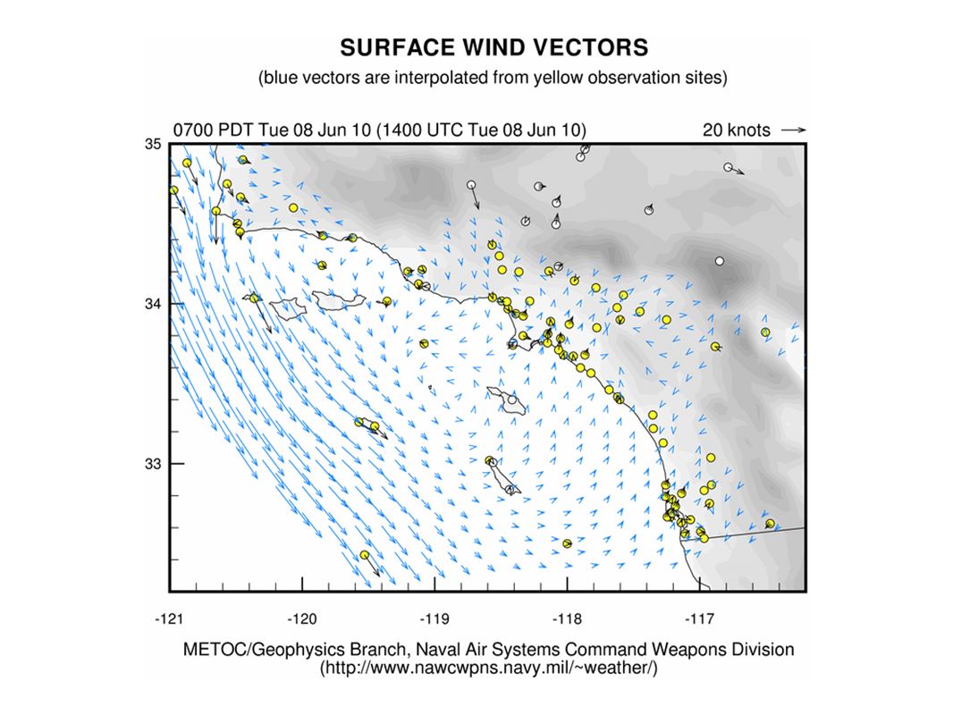
Northern California Observed, Model-Interpolated Winds for SF Bay http://sfports.wr.usgs.gov/cgi-bin/wind/windbin.cgi and COAMPS Wind Plots http://www.sccoos.org/data/coamps/coamps.html

Similar presentations


 Prepared by Jennie Moody (UVA) and Mike Porter (FSU)>")


 …what development was forecast? Lecture 26: Map discussion 12Z Wed (analysis)>")


 CONFERENCE CALL Wednesday 2:30 PM February 6, 2013.>")


;>")

