Download presentation
Presentation is loading. Please wait.

1
ATOC 6700 Weather Forecasting Discussion

2
THIS CLASS IS NOT ABOUT WEATHER FORECASTING

3
OK… So what is this class about? It is a critical thinking class Understand the “black box” of scientific data – What types of data do you use in your research? – What types of data will we use this semester? Determine if the data you are working with makes sense based on physical principles – Build on the knowledge you’ve gained in taking the ATOC core classes

4
OK… So what is this class about? Draw conclusions from the available data – What do you use your data for in your research? – In this class we’ll use the available data to make short duration weather forecasts Defend your conclusions – As a scientist you need to be able to explain and defend the conclusions you’ve drawn from your data and analysis – We’ll do the same thing in ATOC 6700 Analyze additional data as it becomes available and reassess your conclusions – What were you right or wrong about in your initial analysis?

5
Student Introductions Tell us: – Your name and where you are from – Your year in ATOC graduate program – The topic of your research and your advisor

6
ATOC 6700 Goals Apply theoretical concepts from ATOC core classes (esp. ATOC 5050 and 5060) to real-world mid-latitude weather Develop a physically based conceptual model, or “story”, to relate atmospheric processes to the weather observed at specific locations You will have incomplete data as you develop your model/story – this is the same challenge you will face in your research
 to real-world mid-latitude weather Develop a physically based conceptual model, or story , to relate atmospheric processes to the weather observed at specific locations You will have incomplete data as you develop your model/story – this is the same challenge you will face in your research.")
7
How will we achieve these goals? Introduction to forecasting – During the first 3 weeks of the semester Professor Cassano will review the key factors to consider when making a weather forecast – Professor Cassano will lead the weekly forecast discussion during this period Weekly weather discussion (Forecast Discussion Handout) – Review previous week’s forecast and identify aspects of forecast that were or were not well forecast – Identify the key weather elements that will impact the upcoming forecast Forecasting contest – Forecast daily high and low temperature – Forecast daily precipitation category – Forecasts for 6 to 54 hours in the future (day 1 and 2) – Forecast for Denver, CO and Chicago, IL – Forecasting contest entry page Forecasting contest entry page Written forecast analysis (Forecast Discussion Handout) – Five times during the semester you will submit a written analysis of your forecast for one forecast city Key weather elements you expected to impact the city Impact of these weather elements on the sensible weather in the forecast city Class schedule
 – Review previous week’s forecast and identify aspects of forecast that were or were not well forecast – Identify the key weather elements that will impact the upcoming forecast Forecasting contest – Forecast daily high and low temperature – Forecast daily precipitation category – Forecasts for 6 to 54 hours in the future (day 1 and 2) – Forecast for Denver, CO and Chicago, IL – Forecasting contest entry page Forecasting contest entry page Written forecast analysis (Forecast Discussion Handout) – Five times during the semester you will submit a written analysis of your forecast for one forecast city Key weather elements you expected to impact the city Impact of these weather elements on the sensible weather in the forecast city Class schedule.")
8
ATOC 6700 Expectations You should plan on: – Spending at least 1 hour the morning before class reviewing the current weather and model forecasts – Spending at least 1 hour per week preparing your forecasts – Spending 1 hour per week assessing your forecast for the following week’s in-class discussion – Actively contributing to the weekly weather discussions – Preparing 5 written forecast discussions

9
Weather Forecasting Review ATOC 6700 28 August 2013

10
Numerical Forecasts Model output statistics (MOS) and other gridded numerical forecast products are the basis for modern weather forecasts
 and other gridded numerical forecast products are the basis for modern weather forecasts")
11
Numerical Forecasts Model output statistics (MOS) and other gridded numerical forecast products are the basis for modern weather forecasts We want to use these to make our weekly forecasts, but… We also want to understand why the MOS numbers change in time as they do. – We don’t want to use MOS as a black box What are the processes that lead to changes in temperature and drive precipitation?

12
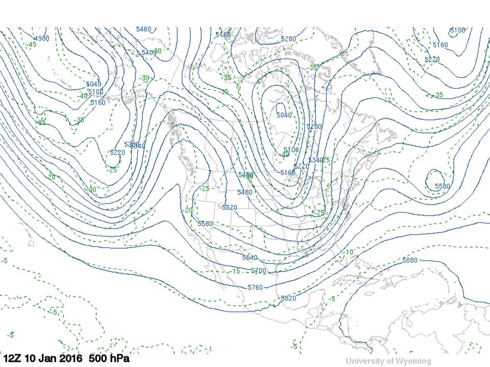
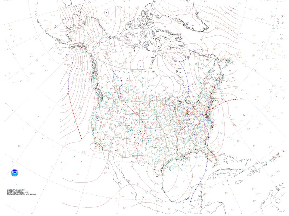
Key Weather Elements Upper level features – Troughs / ridges PVA / NVA – Jet stream Air mass characteristics – Temperature and moisture Surface features – Surface low and high pressure centers – Fronts Local effects

22
Key Weather Elements Upper level features – Troughs / ridges PVA / NVA – Jet stream Air mass characteristics – Temperature and moisture Surface features – Surface low and high pressure centers – Fronts Local effects

23
Why are these important for forecasting the weather? Rising / sinking motion – Cloud and precipitation development Divergence / convergence – Forces vertical motion – Surface pressure Temperature advection / air mass change Wind shift (frontal) Rising motion (frontal)
 Rising motion (frontal).")
24
Forecasting Local Weather Temperature – Air mass temperature / CAA / WAA – Clouds – day vs. night – Winds – day vs. night – Time of year – Recent precipitation / soil moisture / snow cover – Local effects on temperature (topography) – Humidity / fog impacts on temperature
 – Humidity / fog impacts on temperature.")
25
Forecasting Local Weather Cloud cover – Moisture – Rising or sinking motion – Frontal clouds – Convective clouds – Other types of clouds

26
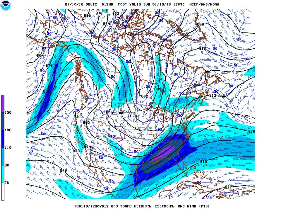
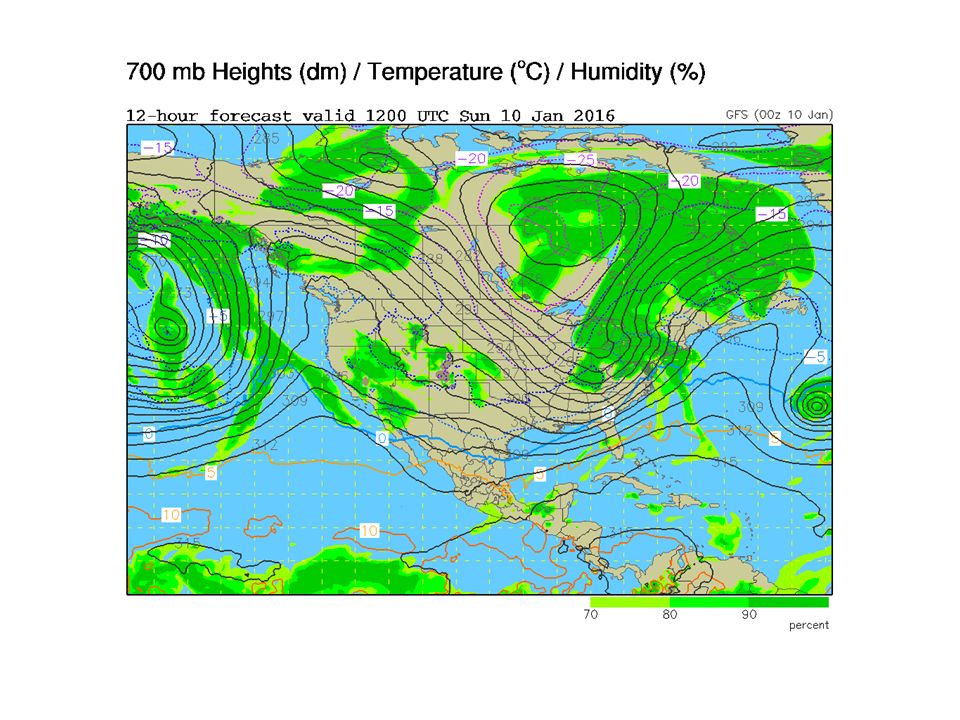
Forecasting Local Weather Wind – Near surface wind and SLP Or look at 850 or 700 mb maps for indication of surface winds at DEN – Upslope vs. downslope winds – Topographic effects on winds (wind storms)
.")
27
Forecasting Local Weather Precipitation – Moisture availability – Dynamic forcing Troughs / ridges / PVA / NVA Jet stream Fronts Low pressure center – Local forcing Topography

28
Weather Products Available Online ATOC 6700 web page – Week in Review – Observations Week in Review – Observations – Week in Review – Guidance Review Week in Review – Guidance Review NCAR Real-time Weather Data NCEP Models Forecast Model Animator National Weather Service web pages University of Wyoming Weather Web Plymouth State Weather Center

29
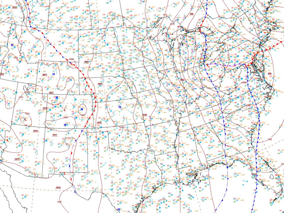
Observational Weather Products Surface data – Maps (NCAR Real-time Weather Data, NWS North American Surface Analysis )NCAR Real-time Weather Data NWS North American Surface Analysis – Text list of time series (Plymouth State)Plymouth State – Meteograms (Plymouth State)Plymouth State Upper air maps (University of Wyoming)University of Wyoming – What levels are of interest for forecasting? – What can we learn from each upper air map? Soundings (University of Wyoming)University of Wyoming
University of Wyoming.")
30
Observational Weather Products Satellite images (NCAR Real-time Weather Data)NCAR Real-time Weather Data Radar (NCAR Real-time Weather Data)NCAR Real-time Weather Data Severe weather – Thunderstorms (Storm Prediction Center)Storm Prediction Center – Hurricanes (National Hurricane Center)National Hurricane Center
NCAR Real-time Weather Data Radar (NCAR Real-time Weather Data)NCAR Real-time Weather Data Severe weather – Thunderstorms (Storm Prediction Center)Storm Prediction Center – Hurricanes (National Hurricane Center)National Hurricane Center")
31
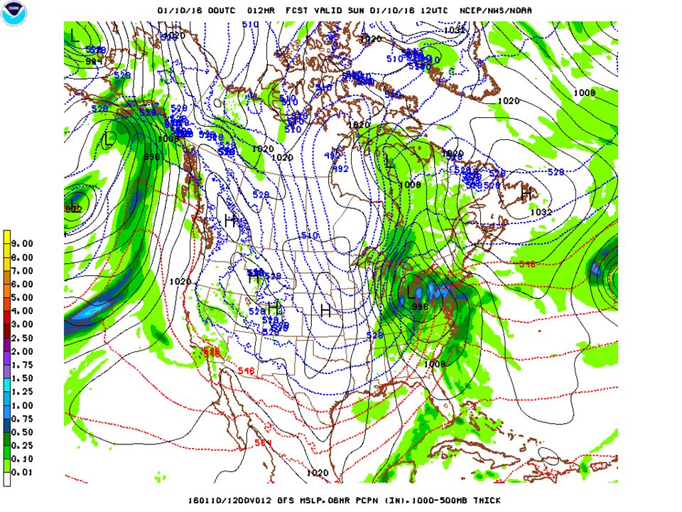
NWP Products Model forecast maps – Which maps are of interest for forecasting? – NCEP Models NCEP Models – Forecast Model Animator Forecast Model Animator – NCAR Real-time Weather Data NCAR Real-time Weather Data – University of Wyoming University of Wyoming Model output statistics (MOS) – Ex. DEN NAM MOSDEN NAM MOS
 – Ex. DEN NAM MOSDEN NAM MOS.")
32
NWS Products Zone Forecast – DEN DEN – ORD ORD Grid Forecast – DEN DEN – ORD ORD Forecast Discussion – DEN DEN – ORD ORD

Similar presentations


 MSC 243 Lecture #8, 10/22/09.>")


… Bad GEMPAK analysis.>")

>")


 is responsible for forecasts several times.>")
