Download presentation
Presentation is loading. Please wait.

1
Using Sonar and GIS To Investigate Aquatic Communities in Lk. St. Clair and Inland Lakes Robert HaasRobert Haas Michigan Department of Natural ResourcesMichigan Department of Natural Resources Lake St. Clair Fisheries Research StationLake St. Clair Fisheries Research Station Mt. Clemens, MIMt. Clemens, MI

2
Plant hydroacoustic data collected with BioSonics DE-6000 digital echosounder equipped with a 430 kHz 60 split-beam transducer Lake sturgeon abundance information collected with Marine Sonic 600 kHz Sidescan Sonar Vector-type data Raster-type data

3
GPS Report Latitude Longitude GPS time Mid Ping Number Bottom depth (m) Plant height (m) Percent plant cover Bare pings Plant pings 142.64262-82.7815014.31977-2.470.54100014 242.64262-82.7814114.320819-2.470.42100010 342.64262-82.7813714.321429-2.450.47100010 442.64261-82.7813314.321939-2.470.41100010 542.64261-82.7812714.322549-2.450.36100010 GIS software used most often are ESRI’s ArcView® 3.2 with spatial analyst extension, Golden Software’s 3D mapping software called SURFER®, BioSonics software for submerged plant analysis called EcoSAV® and hydroacoustic integration software by SonarData called EchoView®. Example EcoSAV® output Percent plant biovolume = Plant Height / Water Depth X Plant Cover

8
Hydroacoustic estimates of plant (relative) density (dry g/m 2 ) within cells 10 m wide by 1 m deep. [Nichols Lake Transect T450; 7/24/02] 15 foot depth

12
Nichols Lake Percent of water column within Submerged plant canopy (biovolume)
")
19
Clifford Lake – transect T_2700M

23
August 28, 2002August 28, 2004

25
StationLongitudeLatitude Nw9-2ln-86.120510044.6983900 T2grid-86.066760044.6808400 T3grid-86.063700044.6838500 T5grid-86.065610044.6769500 T6grid-86.068550044.6776600

30
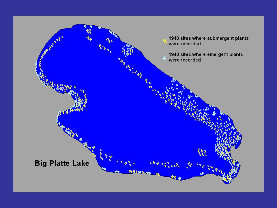
Comparison of Nichols, Clifford, and Big Platte lakes Percent of Platte Laketotal vol.Clifford Laketotal vol.Nichols Laketotal vol. Surface acres2,481 197 158 Total volume (m 3 )79,993,664 3,638,849 14,619,562 Volume of littoral (4.7m extent)7,237,3559.05821,92222.59545,6333.73 Volume of littoral (8m extent)13,620,72717.032,182,71259.981,194,8248.17 Surface acres in 8m littoral zone1,281 159 100 Within 8m littoral zone Relative acoustic density dry wt. g/m 2 237.35 335.33 552.08 Plant biomass (relative) lbs/acre26.60 37.59 61.88 Mean bottom coverage by plants (%)5.91 50.18 47.54 Mean bio-volume (%)1.92 7.07 9.57 Est. biomass (lbs) dry wt. of plants2,014 3,003 2,944
79,993,664 3,638,849 14,619,562 Volume of littoral (4.7m extent)7,237, , , Volume of littoral (8m extent)13,620, ,182, ,194, Surface acres in 8m littoral zone1, Within 8m littoral zone Relative acoustic density dry wt. g/m Plant biomass (relative) lbs/acre Mean bottom coverage by plants (%) Mean bio-volume (%) Est. biomass (lbs) dry wt. of plants2,014 3,003 2,944.")
31
Wild Celery Aquatic plants have increased Plant increase associated with increases in smallmouth bass, muskellunge, yellow perch Plants provide nutrients, habitat, stabilize sediment, improve water transparency Critical food source for fall migratory waterfowl Occasional die-offs cause nuisance conditions, public demand for control Issue: Aquatic Plants

32
This stinks!

33
1893 Aquatic Plant Study of Michigan waters “The bottom of the lake wherever examined, was found to be covered by plants (much Chara). It is probable that it also covers the bottom of the whole lake.”

34
1978 1. Many assumed 1978 was good. 2. Compared 1990 and 1994. 3. Reasoned that changes were bad because of floating vegetation and bacteria problems in 1994. 4. Actually, 1994 was much closer to original, natural condition. Rooted Aquatic Plants What happened in 1994?

Similar presentations


 Survey: Progress Report DCL Policy Review Board Meeting 7/23/12.>")


 By: Melissa Negron.>")


 developed during WW II –Sound pulses emitted reflected off metal objects with characteristic.>")
