Download presentation
Presentation is loading. Please wait.

1
Chapter 4: Marine Provinces

2
Seismic profiling Fig. 4-4

3
Hypsographic curve Average depth of ocean 3729 m Average height of continents 840 m Fig. 4-5

4
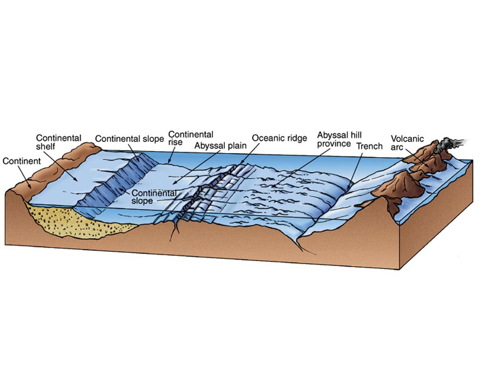
Continental margins Shallow ocean close to land Underlain by continental crust Classified as passive or active

6
Passive margins Not a plate boundary Not tectonically active Continental shelf Continental slope Continental rise

7
Active margins At plate boundaries Tectonically active Classified by type of plate boundary

8
Continental shelf Coast to shelf break (average depth 135m) Generally flat May be narrow or wide Average width 70 km Active margin narrower Passive margin wider
 Generally flat May be narrow or wide Average width 70 km Active margin narrower Passive margin wider")
9
Continental slope Extends from shelf break to deep ocean Gradient ranges from 1-25 o Average gradient 4 o Relief greater at active margin Submarine canyons Turbidity currents

10
Fig. 4-9a

11
Continental rise Transition between continental margin and deep ocean Sediments deposited by waning turbidity currents Not common convergent active margins Rise only exists where sediments can accumulate

12
Deep ocean basin Underlain by oceanic crust Seaward of continental margin Abyssal plains very flat Fine-grained sediments deposited Volcanic seamounts, tablemounts, abyssal hills

14
Mid-ocean ridge 75,000 km long Covers 23% of Earth’s surface Rift valley at crest Site of magma (pillow basalts) Hydrothermal vents Warm water White smokers Black smokers
 Hydrothermal vents Warm water White smokers Black smokers")
15
Fig. 4-17a

16
Hot vent communities Chemosynthetic autotrophs Metal sulfide deposits

17
Ocean ridge Steeper, rugged, prominent rift valley Ocean rise Gentler, less rugged, less well-defined rift valley Fracture zones Aseismic scars, extensions of transform faults

18
End of Chapter 4: Marine Provinces

Similar presentations