Download presentation
Presentation is loading. Please wait.

1
Fire Weather Customer Meeting 2004 Sponsored by NWS-ABQ

2
Outline Statistics Fire Weather Zones Summer Precipitation Across NM: Regimes and Variability El Nino is back Open Forum

3
Statistics

4
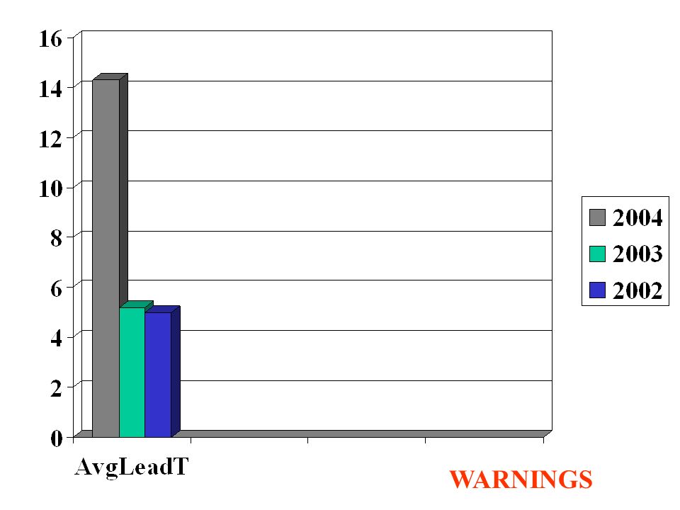
Red Flag Verification 2004 –Zones Warned: 104 –Total Zones Occurred: 70 –Warned Zones Verified: 69 –Warned Zones didn’t Verify: 35 –No warning issued/Zones Missed: 1 –POD (Prob of Detection): 0.99 –FAR (False Alarm Rate): 0.34 –CSI (Critical Success Index): 0.66 –Average Lead Time: 14.3 hours
: 0.99 –FAR (False Alarm Rate): 0.34 –CSI (Critical Success Index): 0.66 –Average Lead Time: 14.3 hours")
5
WARNINGS ZnsOcrd

6
WARNINGS

8
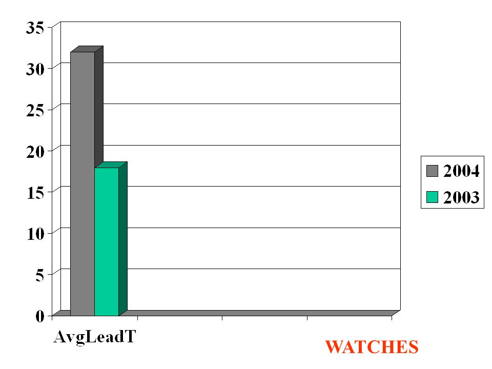
Statistics Fire Weather Watch Verification 2004 –Zones Watch: 84 –Total Zones Occurred: 70 –Watch Zones Verified: 53 –Watch Zones didn’t Verify: 30 –No watch issued/Zones Missed: 17 –POD (Prob of Detection): 0.76 –FAR (False Alarm Rate): 0.37 –CSI (Critical Success Index): 0.52 –Average Lead Time: 31.6 hours
: 0.76 –FAR (False Alarm Rate): 0.37 –CSI (Critical Success Index): 0.52 –Average Lead Time: 31.6 hours")
9
WATCH Zones Ocrd

10
WATCHES

12
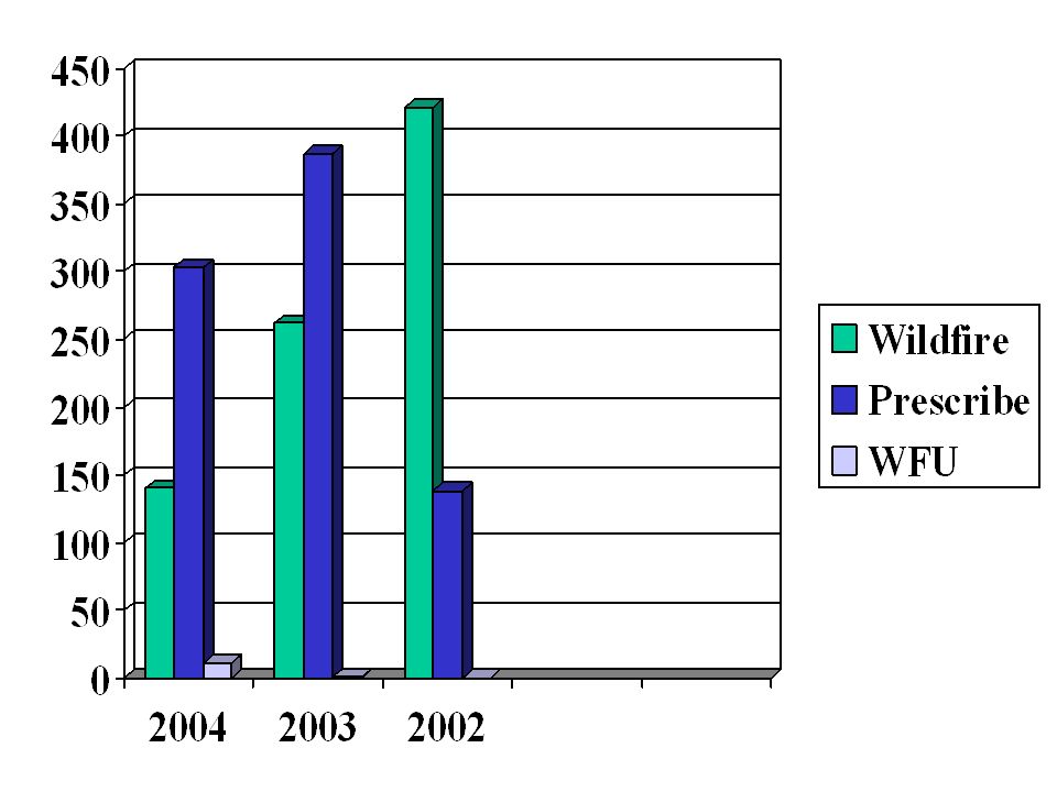
Statistics Spot Forecasts

14
Statistics Turn Around Time for Spot Forecasts –Calculated by subtracting Requested time from Forecast Complete time

15
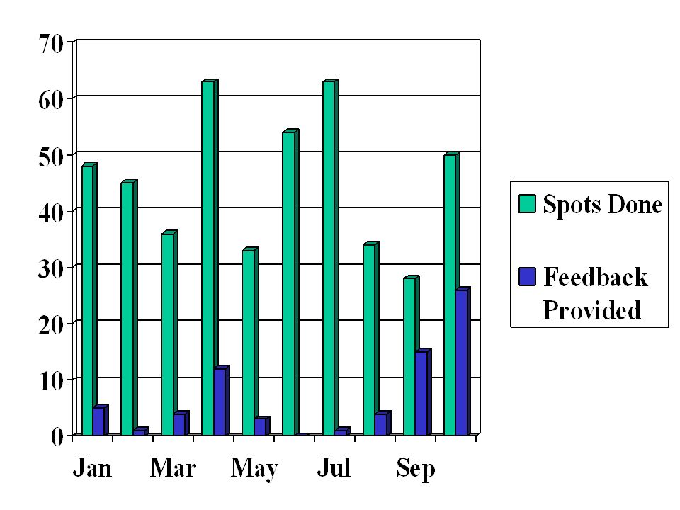
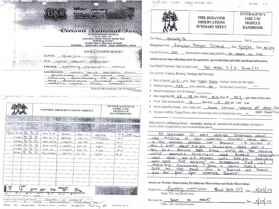
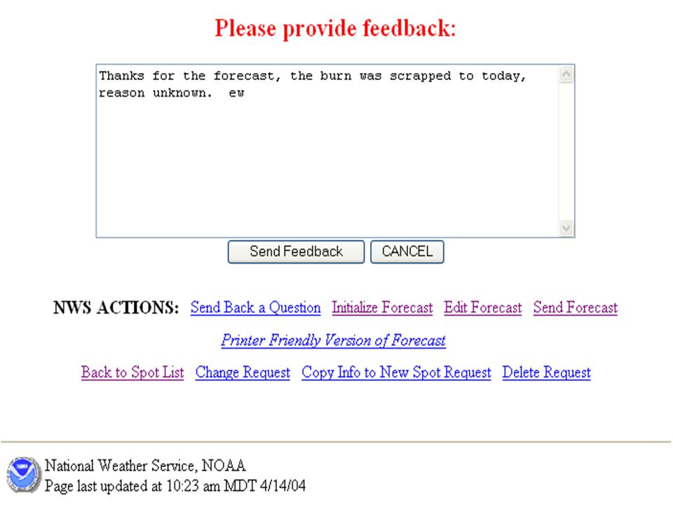
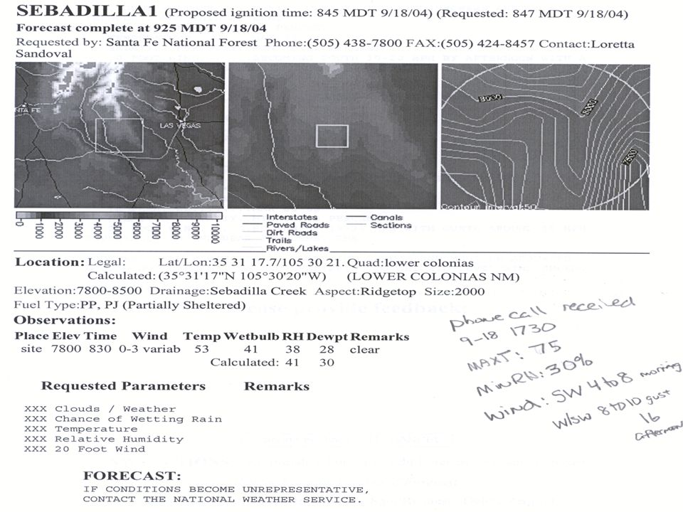
Statistics Spot Forecast Feedback –Faxed observation sheet –NWS-Spot Web Page Feedback Button Remarks Section –Initial Spot Request –Portable RAWS (hourly GOES) Remarks Section –Initial Spot Request –Phone Call Looked at January through October
 Remarks Section –Initial Spot Request –Phone Call Looked at January through October")
17
Faxed

20
NWS-Spot

21
Feedback↓Button

22
Initial Request ↑ Remarks Box

24
Remarks Section Initial Request

26
Statistics Feedback –Hourly afternoon or burn period T,RH and wind (Max T, Min RH, General Wind) If needs are critical for overnight hours (Min T, Max RH and General Wind) –Critical weather such as precipitation duration and accumulation (estimate), Start of upslope or downslope winds and afternoon mixing –Misc such as snow on the ground and sky cover –Pertinent information for the burn site Slope (ridgetop-mid-valley bottom) “Unusual” topography (saddle, chute etc) Rule of Thumb Wx Burn area defined Topo Maps
 If needs are critical for overnight hours (Min T, Max RH and General Wind) –Critical weather such as precipitation duration and accumulation (estimate), Start of upslope or downslope winds and afternoon mixing –Misc such as snow on the ground and sky cover –Pertinent information for the burn site Slope (ridgetop-mid-valley bottom) Unusual topography (saddle, chute etc) Rule of Thumb Wx Burn area defined Topo Maps")
27
Statistics Why? –Efficiency Get Forecast Out Quicker as Forecaster’s use Trends –Customers wait for forecasts are less –Forecasters don’t have to guess on what happened thus less busy time spent Correct trends applied to good ground truthing provides more accurate forecasts.

28
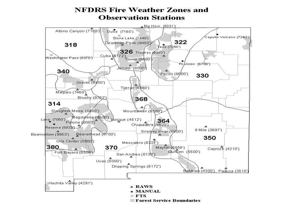
Fire Weather Zones

29
Old Zone Map

30
New Zone Map

31
New Zone Names 101: Northwest Plateau 102: North Central Mountains 103: Northeast Highlands 104: Northeast Plains 105: Northwest Highlands 106: Middle Rio Grande Valley 107: Sandia-Manzano and Gallinas Mountains 108: East Central Plains 109: West Central Highlands

32
New Zone Map: Elevation

33
Old Zone over New Zone Map

35
NFDRS and New Zones 11 to 15

36
Ventilation Forecast Points: New Zones

Similar presentations


>")


