Download presentation
Presentation is loading. Please wait.

1
What is a climagraph? A graph of the monthly mean temperature, temperature range and precipitation of a particular city. Always includes as its title the name of the city, latitude and elevation (in ft and m).
..")
2
M.E.L.L.O.W. Controls of Temperature Mountains Elevation Latitude #1-Most influential Land vs. Water Ocean Currents Wind and Pressure Belts

3
Mountains

4
Mountains continued Windward SideLeeward Side

5
Elevation The air is rare up there! Decrease pressure, decrease temperature. The RANGE stays the same!

6
Latitude Rays and days! Strength of the sun’s rays and the length of the days are the number 1 factor in heating the Earth. Closer to equator, there are stronger rays and more consistent day length. So, in general… increase latitude, decrease average temperature.

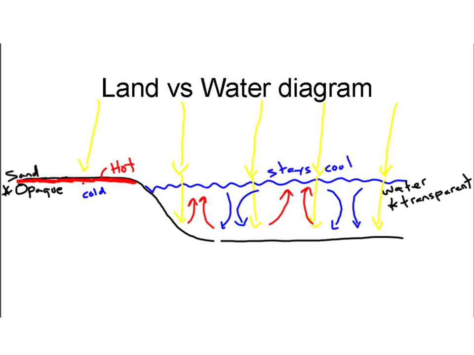
7
Land vs. Water Land heats up and cools down FASTER than water. –Water has a HIGH specific heat- takes more energy to heat one gram one degree celsius. –Water is transparent-light can travel through it. Land is opaque. –Water can convect heat throughout. Land CANNOT convect and it does NOT conduct very well.

9
Ocean Currents Recall: The Sun heats the Earth and the Earth heats the air. Warm ocean currents will heat the air above. Wind belts can then move that warm air

10
Climagraph- Ocean Current New York London

11
Wind & Pressure Belts

Similar presentations


 Small geographic area Can change rapidly.>")


